


Why visit Wolnzach
Townapedia lists 21 museums and landmarks, 12 parks and trails, 55 places to eat, 6 places to stay and 14 attractions in and around town.
Highlights include Amper Lichtspiele, Biohof Amberger, Deutsches Hopfenmuseum and Artesische Quelle Fahlenbach.
Weather in Wolnzach
Forecast from MET Norway (CC BY 4.0). Full forecast
About Wolnzach
Wolnzach (German pronunciation: [ˈvɔlntsax], locally [ˈvɔɪntsɔ(x)]) is a municipality in the district of Pfaffenhofen in Bavaria, Germany. It is also a "seal district" ("Siegelbezirk") of the hop-planting area Hallertau, and home of important hops-related institutions such as the German Hops Museum ("Deutsches Hopfenmuseum") and the Hop Research Center Hüll.
From the Wikipedia article Wolnzach (this version), under CC BY-SA 4.0.
Things to do14

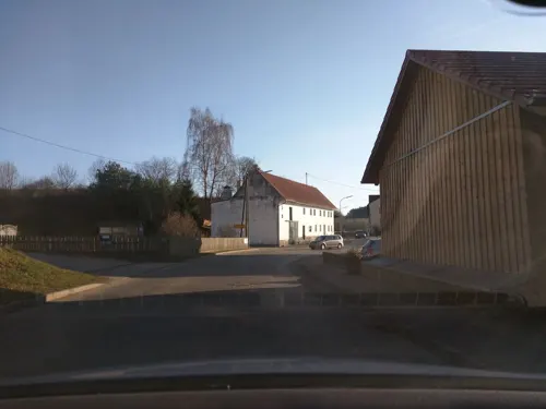
Biohof Amberger
Farm and orchard · 1.6 km
Hauptsortiment: Kartoffeln, Eier, Mehl, Nudeln, Honig Saisonal: Gemüse, Suppenhühner
19 Auerbergstraße, Wolnzach
Mo-Su 06:00-20:00


2 more on the map.
Museums and landmarks21


Artesische Quelle Fahlenbach
Monument and historic site · 4.9 km
Der ca. 1,4 m hohe Block aus Malm-Riffdolomit stammt aus dem Eichstätter Raum. Dieser wurde durchbohrt und auf die artesische Quelle zu...

Cultural heritage D-1-7335-0115 in Wolnzach
Monument and historic site · 3.1 km
Cultural heritage monument in Wolnzach, Pfaffenhofen, Upper Bavaria, Bavaria, Germany


Kapellenlinde
Monument and historic site · 6.4 km
400 Years Old Singe 1939/09/19 Saved As Special Natural Sign

9 more on the map.
Parks, trails and playgrounds12


Restaurants and cafes55

Gasthaus Breitnerhof
Restaurant · Bavarian · 2.5 km
5 Hofmarkstraße, Wolnzach
Tu-Su 11:00-14:00, 17:00-22:00
Grantlerwirt
Restaurant · Bavarian · 0.6 km
Mo,We,Sa 15:00-23:00; Th,Fr 11:00-23:00; Su,PH 11:00-23:00; Tu off
Landgasthof Siebler
Restaurant · Regional, German · 4.8 km
9 Egg, Wolnzach
Mo-Tu 08:00-22:00, Th-Su 08:00-22:00 || "nach Vereinbarung"
Ristorante Pizzeria Sapori d'Italia
Restaurant · Italian · 4.8 km
2 Amtmannweg, Rohrbach an der Ilm
Tu-Th 11:30-14:00,17:45-22:00; Fr 11:30-14:00,17:45-22:30; Sa...
i’fratelli
Restaurant · Italian
3 Marktplatz
Mo closed; Tu 17:00-22:30; We 17:00-22:30; Th 11:30-14:30,...
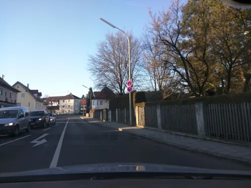
Backhaus Hackner
Bakery
16-20 Schloßhof, Wolnzach
Mo-Fr 06:00-18:00; Sa 06:00-13:00; Su,PH 07:30-17:00



43 more on the map.
History
Wolnzach was first mentioned in the foundation document of Wessobrunn Abbey in 756, by the name of Wolamotesaha. In 1150 there occurs the first documentary reference to Wolnzach as the site of a market.
In 1926, the German Hop Research Society established a research site in Hüll near Wolnzach, which would develop into the Hop Research Center Hüll in 1962.
Alois Dallmayr, former owner of the famous Dallmayr food store in Munich originated from Wolnzach.
From the History section of Wolnzach on Wikipedia, under CC BY-SA 4.0.
Where to stay6
Churches and places of worship57
Kapelle zur schmerzhaften Mutter Gottes
Church · Roman Catholic · 6.4 km
Kapellenweg, Schweitenkirchen
Maria Himmelfahrt
Church · Roman Catholic · 6.0 km
30 Waal, Rohrbach an der Ilm
Mariä Himmelfahrt
Church · Roman Catholic · 6.2 km
2 Kirchgassl, Au in der Hallertau
Mariä Himmelfahrt
Church · Roman Catholic · 7.3 km
7 Obermettenbach, Geisenfeld
St. Andreas
Church · Roman Catholic · 3.5 km
4 Dekan-Hofmeier-Straße, Wolnzach
St. Bartholomäus
Church · Roman Catholic · 7.5 km
2 Am Kirchplatz, Au in der Hallertau
Shopping11
Gas and EV charging8
Schools, colleges and libraries7
Healthcare4
Hofmarkapotheke
Clinic and pharmacy · 4.3 km
8 Bahnhofstraße, Rohrbach an der Ilm
Map of Wolnzach
195 places. The map loads OpenStreetMap tiles when you open it.
Getting there and nearby towns
Ingolstadt Manching Airport (IGS) is the nearest airport with scheduled flights listed in OpenStreetMap, 14 km away.
- Rohrbach 5 km west, about 5 min by car
- Geisenfeld 9 km north, about 9 min by car
- Au in der Hallertau 10 km southeast, about 10 min by car
- Rudelzhausen 10 km east, about 10 min by car
- Pfaffenhofen an der Ilm 12 km southwest, about 12 min by car
- Schweitenkirchen 11 km south, about 11 min by car
- Ingolstadt 23 km northwest, about 23 min by car
- Munich 52 km south, about 52 min by car
- Regensburg 58 km northeast, about 58 min by car
- Augsburg 59 km southwest, about 59 min by car
Drive times are estimates from straight-line distance, not routes.
Local news
Headlines from INDB.
Reviews, tips and questions
Loading what members have shared...
Sources and licences
- GeoNames (CC BY 4.0): population, coordinates, regions and time zone
- Mapillary (see each image): photos
- OpenStreetMap contributors (ODbL 1.0): places, airports, map data
- Wikidata (CC0 1.0): elevation, founding date, time zone, website, landmarks and historic places
- Wikimedia Commons (see each image): photos
- Wikipedia (CC BY-SA 4.0): overview and history text
Photo credits
- Wolnzach Ortszentrum, H.Helmlechner, CC BY-SA 4.0
- Wolnzach Marktplatz 01, H.Helmlechner, CC BY-SA 4.0
- Mariensäule Wolnzach 2018, H.Helmlechner, CC BY-SA 4.0
- Mariensäule Wolnzach, H.Helmlechner, CC BY-SA 4.0
- Wolnzach Marktplatz 07, H.Helmlechner, CC BY-SA 4.0
- Wolnzach Marktplatz 04, H.Helmlechner, CC BY-SA 4.0
- Rathaus Wolnzach 02, H.Helmlechner, CC BY-SA 4.0
- Wolnzach Marktplatz 3, H.Helmlechner, CC BY-SA 4.0
- Wolnzach Marktplatz 05, H.Helmlechner, CC BY-SA 4.0
- Wolnzach Marktplatz 4, H.Helmlechner, CC BY-SA 4.0
- Wolnzach St. Laurentius 1, H.Helmlechner, CC BY-SA 4.0
- Marktplatz 7, Wolnzach, H.Helmlechner, CC BY-SA 4.0
- Rathaus Wolnzach 01, H.Helmlechner, CC BY-SA 4.0
- Rathaus Wolnzach 06, H.Helmlechner, CC BY-SA 4.0
- Wolnzach Marktplatz 03, H.Helmlechner, CC BY-SA 4.0
- Rathaus Wolnzach 07, H.Helmlechner, CC BY-SA 4.0
- Wolnzach Marktplatz 02, H.Helmlechner, CC BY-SA 4.0
- Rathaus Wolnzach 03, H.Helmlechner, CC BY-SA 4.0
- Rathaus Wolnzach 04, H.Helmlechner, CC BY-SA 4.0
- Auferstehungskirche Wolnzach, H.Helmlechner, CC BY-SA 4.0
- Wolnzach St. Laurentius 3, H.Helmlechner, CC BY-SA 4.0
- Wolnzach St. Laurentius 2, H.Helmlechner, CC BY-SA 4.0
- Wolnzach St. Laurentius 01, H. Helmlechner, CC BY-SA 3.0
- Wolnzach Preysingstraße 7, H. Helmlechner, Mainburg, CC BY-SA 3.0
- Preysingstraße 4, Wolnzach, H.Helmlechner, CC BY-SA 4.0
- Preysingstraße 6, Wolnzach, H.Helmlechner, CC BY-SA 4.0
- Wolnzach Preysing Str. 4 und 6, H.Helmlechner, CC BY-SA 4.0
- Wolnzach Preysing Str. 8, H.Helmlechner, CC BY-SA 4.0
- Am Starzenbach 10, Wolnzach, H.Helmlechner, CC BY-SA 4.0
- Preysingstraße 14, Wolnzach, H.Helmlechner, CC BY-SA 4.0
- Preysingstraße 23, Wolnzach, H.Helmlechner, CC BY-SA 4.0
- Wolnzach - Preysingstr Nr 27, H.Helmlechner, CC BY-SA 4.0
- Wolnzach Ortsansicht 3, H.Helmlechner, CC BY-SA 4.0
- Wolnzach Preysingstrasse 17, H.Helmlechner, CC BY-SA 4.0
- Wolnzach Friedhofskapelle, H. Helmlechner, Mainburg, CC BY-SA 3.0
- Deutsches Hopfenmuseum, Eppasandas at German Wikipedia ( Original text: de:Benutzer:Eppasandas ), Public domain
- Ossenzhausen Pfarrkirche St. Nikolaus, Philipp Hayer, CC BY-SA 3.0
- Kapelle zur schmerzhaften Mutter Gottes (Geisenhausen) 030, Kd6=dra, CC0
- Wolnzach Mariensaeule Detailbild, Philipp Hayer, CC BY-SA 3.0
- Geroldshausen-Hallertau Sankt Martin, Philipp Hayer, CC BY-SA 3.0
- Geroldshausen St. Andreas, H. Helmlechner, CC BY-SA 3.0
- Haushausen Kath. Filialkirche St. Georg, H. Helmlechner, CC BY-SA 3.0
- Larsbach Hl. Kreuz, Philipp Hayer, CC BY-SA 3.0
- Artesische quelle fahlenbach pfaffenhofen ilm, Mibeer, CC BY-SA 4.0
- Osseltshausen Mariä Himmelfahrt 02, H.Helmlechner, CC BY-SA 4.0
- Kirche St. Bartholomäus in Osterwaal, H. Helmlechner, Public domain
- Geisenfeld-Obermettenbach-7-Kirche-Mariä-Himmelfahrt, Elcom.stadler, CC BY-SA 3.0
- Waal Pfarrkirche St. Maria, Philipp Hayer, CC BY-SA 3.0
- Oberlauterbach Pfarrkirche St. Andreas, Philipp Hayer, CC BY-SA 3.0
- Burgstall 21.3.04 098a, E.mil.mil ( talk ), CC BY-SA 3.0 at
- Street-level photo, soulcover, CC BY-SA 4.0
- Street-level photo, peda, CC BY-SA 4.0
- Street-level photo, peda, CC BY-SA 4.0
- Street-level photo, schnitzelwagen, CC BY-SA 4.0
- Street-level photo, thetornado76, CC BY-SA 4.0
- Street-level photo, DanielWallas, CC BY-SA 4.0
- Street-level photo, santon, CC BY-SA 4.0
- Street-level photo, thetornado76, CC BY-SA 4.0
- Street-level photo, dsmm, CC BY-SA 4.0


Page built November 8, 2026. Spotted a mistake? Tell us or suggest a place.