


Decatur, Alabama
Decatur is a city of 57,361 people in Limestone County, Alabama, founded in 1821.
Why visit Decatur
Townapedia lists 23 museums and landmarks, 45 parks and trails, 86 places to eat, 18 places to stay and 14 attractions in and around town.
Highlights include AMC CLASSIC Decatur 12, Princess Theater, Bank Street–Old Decatur Historic District and Southern Railway Depot.
July is the warmest month, with average highs of 89°F; January lows average 31°F.
Weather in Decatur
Forecast from the National Weather Service. Full forecast
About Decatur
Decatur () is the largest city in and the county seat of Morgan County (with a portion also in Limestone County) in the U.S. state of Alabama. Nicknamed "The River City," it is located in northern Alabama on the banks of Wheeler Lake along the Tennessee River. The population was 57,938 at the 2020 census.
From the Wikipedia article Decatur, Alabama (this version), under CC BY-SA 4.0.
Things to do14

Princess Theatre
Cinema and theater · 2.2 mi
Theater in Decatur, Alabama, United States


2 more on the map.
Museums and landmarks23

Bank Street–Old Decatur Historic District
Monument and historic site · National Register of Historic Places · 2.6 mi
Historic district in Alabama, United States

Southern Railway Depot
Museum · National Register of Historic Places · 2.8 mi
Railway station in Decatur, the United States of America
Cotaco Opera House
Cinema and theater · National Register of Historic Places · 2.1 mi
Theater in Decatur, Alabama

Dr. William E. Murphey House
Monument and historic site · National Register of Historic Places · 7.8 mi
Building in United States of America

East Old Town Historic District
Monument and historic site · National Register of Historic Places · 3.0 mi
Historic district in Decatur, Alabama

Forest Home
Monument and historic site · National Register of Historic Places · 5.1 mi
Listed on the NRHP in Alabama
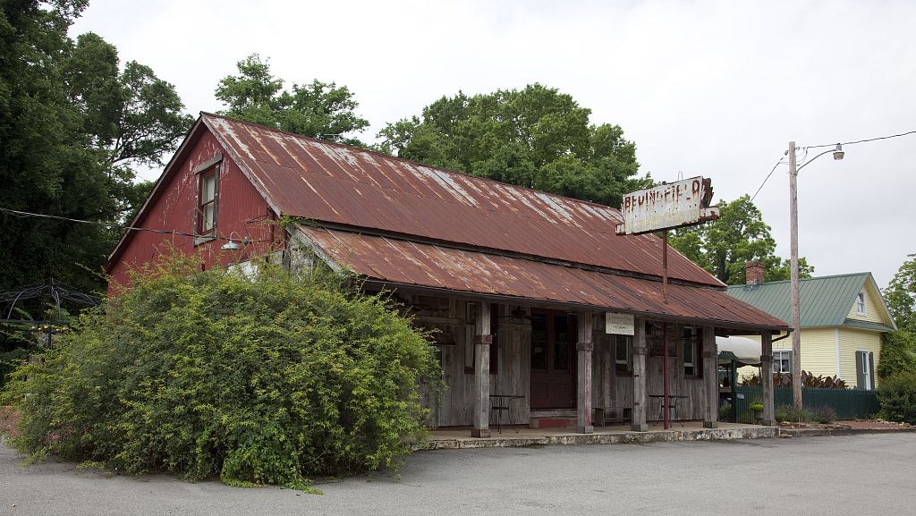
Mooresville
Monument and historic site · National Register of Historic Places · 7.2 mi
Town in Limestone County, Alabama, United States
New Decatur–Albany Historic District
Monument and historic site · National Register of Historic Places · 2.1 mi
Historic district in Decatur, Alabama
Pillow-Bethel House
Monument and historic site · National Register of Historic Places · 7.2 mi
Historic house in Tennessee, United States
Rhea-McEntire House
Monument and historic site · National Register of Historic Places · 3.1 mi
Historic house in Alabama, United States

State Bank Building Decatur Branch
Monument and historic site · National Register of Historic Places · 2.9 mi
925 Bank Street Northeast, Decatur


West Old Town Historic District
Monument and historic site · National Register of Historic Places · 3.1 mi
Historic district in Decatur, Alabama
11 more on the map.
Parks, trails and playgrounds45

Delano Park
Park · 1.9 mi
Park in Alabama, United States of America, United States of America

Point Mallard Golf Course
Golf course · 3.3 mi
2600 Point Mallard Dr., Decatur, Alabama
Mo-Su 07:30-19:00

Ogle Stadium - Decatur High School
Sports field and stadium · 1.6 mi
1101 Prospect Dr, Decatur
33 more on the map.
Restaurants and cafes86

Applebee's
Diner · American · 1.8 mi
2401-A Beltline Road Southwest, Decatur
Mo-Th 11:00-23:00; Fr-Sa 11:00-24:00; Su 11:00-22:00

Big Bob Gibson's Bar-B-Q
Restaurant · Barbecue · 0.8 mi
1715 6th Avenue Southeast, Decatur
09:30-20:15

Two Fish & A Toad
Cafe · American, Regional, Coffee Shop · 1.5 mi
1123 Sommerville Road Southeast
Mo-Fr 09:00-14:00

Buffalo Wild Wings
Restaurant · Wings · 1.2 mi
945 Wimberly Drive Southwest, Decatur
Mo-Th 11:00-21:40; Fr-Sa 11:00-23:40; Su 11:00-21:40
Candela Bakery Restaurant
Restaurant · Cuban · 1.0 mi
725 Beltline Road Southwest, Decatur
Mo-Su 10:00-20:00
Let's Do Lunch
Restaurant · Sandwich · 2.2 mi
435 Holly Street Northeast, Decatur
Mo-Fr 10:00-15:00
74 more on the map.
History
Initially, the area was known as "Rhodes Ferry Landing", named for Dr. Henry W. Rhodes, an early landowner who operated a ferry that crossed the Tennessee River in the 1810s at the present-day location of Rhodes Ferry Park. The city was incorporated as Decatur in 1821. It was named in honor of Stephen Decatur; after he was killed in a duel in 1820, President Monroe directed that the Alabama town be named for him.
In the early 1830s, Decatur was the eastern terminus of the Tuscumbia, Courtland and Decatur Railroad, the first railway built west of the Appalachian Mountains. In 1850, the Tuscumbia, Courtland and Decatur was incorporated into the Memphis & Charleston Railroad.
From the History section of Decatur, Alabama on Wikipedia, under CC BY-SA 4.0.
Where to stay18
Churches and places of worship84
Central United Methodist Church
Church · United Methodist · 2.0 mi
616 Jackson Street Southeast, Decatur
First Church of Christ, Scientist
Church · Christ Scientist · 2.2 mi
120 6th Avenue Southeast, Decatur
Cornerstone Baptist Church & Christian School
Church · Baptist · 1.8 mi
3211 Spring Avenue Southwest, Decatur
Annunciation of the Lord Catholic Church
Church · Roman Catholic · 2.8 mi
3910 Spring Avenue Southwest, Decatur
First Bible Church
Church · Nondenominational · 1.7 mi
3202 Spring Avenue Southwest, Decatur
Shopping21
Gas and EV charging25
Schools, colleges and libraries40
Healthcare7
Map of Decatur
250 places. The map loads OpenStreetMap tiles when you open it.
Climate by month
Monthly table
| Month | High | Low | Rain |
|---|---|---|---|
| Jan | 52°F | 31°F | 5.4 in |
| Feb | 57°F | 34°F | 5.6 in |
| Mar | 65°F | 41°F | 5.4 in |
| Apr | 74°F | 49°F | 5.2 in |
| May | 80°F | 58°F | 4.9 in |
| Jun | 87°F | 66°F | 4.5 in |
| Jul | 89°F | 69°F | 4.8 in |
| Aug | 89°F | 68°F | 3.9 in |
| Sep | 84°F | 62°F | 3.9 in |
| Oct | 74°F | 50°F | 3.9 in |
| Nov | 63°F | 40°F | 4.4 in |
| Dec | 55°F | 34°F | 6.0 in |
U.S. Climate Normals 1991-2020 for Decatur 4Se (3 mi away), NOAA NCEI.
People and cost of living
American Community Survey 5-year estimates, 2020-2024, U.S. Census Bureau. Estimates have margins of error, larger for small towns.
Disaster history
Limestone County has had 14 federal disaster declarations since 2000, most often for hurricanes.
- 2024-09-26: Hurricane Helene (Hurricane)
- 2020-09-14: Hurricane Sally (Hurricane)
- 2020-05-21: Severe Storms And Flooding (Severe Storm)
- 2020-03-29: Covid-19 Pandemic (Biological)
- 2020-03-13: Covid-19 (Biological)
- 2017-09-11: Hurricane Irma (Hurricane)
OpenFEMA disaster declarations summaries.
Getting there and nearby towns
Pryor Field Regional Airport (DCU) is the nearest airport with scheduled flights listed in OpenStreetMap, 6 miles away.
- Hartselle 10 mi south, about 15 min by car
- Athens 15 mi north, about 24 min by car
- Madison 16 mi northeast, about 26 min by car
- Huntsville 20 mi northeast, about 32 min by car
- Cullman 29 mi south, about 46 min by car
- Meridianville 31 mi northeast, about 50 min by car
- Muscle Shoals 38 mi west, about 1 h by car
- Florence 42 mi northwest, about 1 h 15 min by car
- Russellville 42 mi west, about 1 h 15 min by car
- Albertville 49 mi southeast, about 1 h 15 min by car
Drive times are estimates from straight-line distance, not routes.
Local news
Headlines from INDB, the NEMICO news database.
Reviews, tips and questions
Loading what members have shared...
Sources and licences
- NCES EDGE (Public domain): public schools
- NOAA NCEI U.S. Climate Normals 1991-2020 (Public domain): climate by month
- OpenFEMA (Public domain): disaster declarations
- OpenStreetMap contributors (ODbL 1.0): places, airports, map data
- U.S. Census Bureau (Public domain): population, income, housing, education, commute
- Wikidata (CC0 1.0): elevation, founding date, time zone, website, landmarks and historic places
- Wikimedia Commons (see each image): photos
- Wikipedia (CC BY-SA 4.0): overview and history text
Photo credits
- Tug and Boat at Bridge, MPearsallArt, CC BY-SA 4.0
- Lynne Federal Building Decatur July 2010 02, Chris Pruitt, CC BY-SA 3.0
- Lynne Federal Building Decatur July 2010 01, Chris Pruitt, CC BY-SA 3.0
- Greetings from Decatur, Alabama - Large Letter Postcard (4237322464), Steve Shook from Moscow, Idaho, USA, CC BY 2.0
- Decatur Heritage sunset image cropped, Willis Orr, CC0
- Front of Decatur Heritage sunset, Willis Orr, CC0
- JUDGE SEYBOURN H LYNNE HOMEPLACE at 503 FERRY ST NE, DECATUR, AL, G LLOYD PHILPOTT, CC BY-SA 3.0
- First Baptist Decatur July 2010, Chris Pruitt, CC BY-SA 3.0
- Bank Street Decatur July 2010 01, Chris Pruitt, CC BY-SA 3.0
- Southern Railway Depot Decatur July 2010 01, Chris Pruitt, CC BY-SA 3.0
- Bank Street Decatur July 2010 02, Chris Pruitt, CC BY-SA 3.0
- Store in Mooresville, Alabama Highsmith, Carol M. Highsmith, Public domain
- Dr. William E. Murphey House, Robert Gamble, Public domain
- Sterrs Street Decatur June 2013, Chris Pruitt, CC BY-SA 3.0
- Westview, the Burleson Home, Ejh7999, CC BY-SA 4.0
- Church Street NW Decatur June 2013, Chris Pruitt, CC BY-SA 3.0
- Old State Bank Decatur July 2010 02, Chris Pruitt, CC BY-SA 3.0
- ISS009-E-25359 - View of Alabama, Earth Science and Remote Sensing Unit , Lyndon B. Johnson Space Center, Public domain
- Cotaco Opera House July 2010 03, Chris Pruitt, CC BY-SA 3.0
- Cotaco Opera House July 2010 01, Chris Pruitt, CC BY-SA 3.0
- Cotaco Opera House July 2010 02, Chris Pruitt, CC BY-SA 3.0
- Princess Theatre July 2010 02, Chris Pruitt, CC BY-SA 3.0
- Princess Theatre July 2010 01, Chris Pruitt, CC BY-SA 3.0
- Steamboat Bill Bridge 2025c, Antony-22, CC BY-SA 4.0


Page built October 30, 2026. Spotted a mistake? Tell us or suggest a place.