
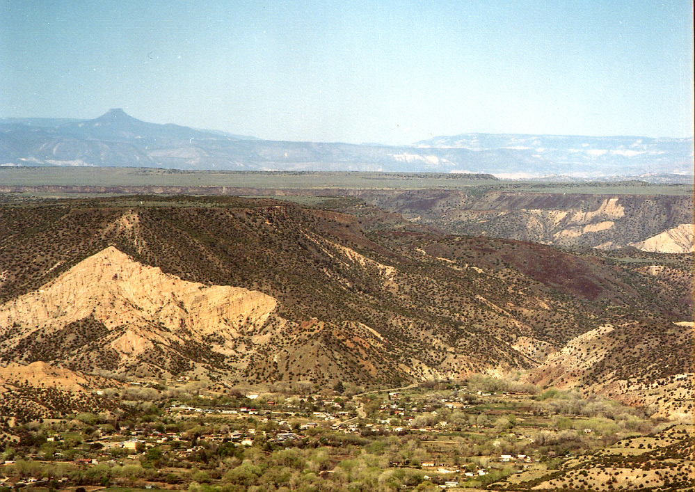
Dixon, New Mexico
Dixon is a community of 1,623 people in Rio Arriba County, New Mexico.
Why visit Dixon
Townapedia lists 1 place to eat and 4 attractions in and around town.
Highlights include Cerro Abajo and Cerro de Arriba.
July is the warmest month, with average highs of 88°F; December lows average 15°F.
Weather in Dixon
Forecast from the National Weather Service. Full forecast
About Dixon
Dixon is an unincorporated community located in Rio Arriba County, New Mexico, United States, on New Mexico State Road 75, just east of New Mexico State Road 68, in the north-central part of the state, and is approximately 20 miles (32 km) southwest of Taos. The elevation of Dixon is 6,028 feet (1,837 m) above sea level. It is on the banks of the Embudo Creek, a tributary of the Rio Grande. Embudo Creek flows into the Rio Grande two miles (3.2 km) downstream from Dixon.
From the Wikipedia article Dixon, New Mexico (this version), under CC BY-SA 4.0.
Things to do4


Restaurants and cafes1

Churches and places of worship3


Schools, colleges and libraries5


History
The area was inhabited by Tiwa peoples from nearby Picuris Pueblo, then settled by Spanish colonists under the 1725 Embudo Land Grant. The original name was El Puerto del Embudo de Nuestro Señor San Antonio and the grant was made in 1725, to Francisco Martín, Lázaro Córdova and Juan Márquez. The acequias (irrigation canals) were the first public works project of any land grant, so they were started immediately after settlement, on September 20, 1725, and there are 10 Historic Acequias with senior water rights on the Embudo River and one with junior water rights. On the Rio Grande there are two with senior rights and two with junior water rights. The aldea was known as San Antonio del Embudo until around 1900 when a post office was established and the name was changed to Dixon, reputedly to honor Collins Dixon, a school teacher who taught here in the late 19th century; one tradition has him being a Civil War army deserter; his descendants live around nearby Española.
From the History section of Dixon, New Mexico on Wikipedia, under CC BY-SA 4.0.
Map of Dixon
13 places. The map loads OpenStreetMap tiles when you open it.
Climate by month
Monthly table
| Month | High | Low | Rain | Snow |
|---|---|---|---|---|
| Jan | 45°F | 15°F | 0.5 in | 2.2 in |
| Feb | 51°F | 20°F | 0.4 in | 1.5 in |
| Mar | 60°F | 25°F | 0.7 in | 1.4 in |
| Apr | 67°F | 32°F | 0.7 in | 0.3 in |
| May | 76°F | 40°F | 0.8 in | 0.0 in |
| Jun | 86°F | 48°F | 0.8 in | 0.0 in |
| Jul | 88°F | 55°F | 1.6 in | 0.0 in |
| Aug | 86°F | 54°F | 1.8 in | 0.0 in |
| Sep | 80°F | 45°F | 1.2 in | 0.0 in |
| Oct | 69°F | 32°F | 1.1 in | 0.6 in |
| Nov | 55°F | 22°F | 0.7 in | 1.4 in |
| Dec | 44°F | 15°F | 0.7 in | 3.3 in |
U.S. Climate Normals 1991-2020 for Alcalde (11 mi away), NOAA NCEI.
People and cost of living
American Community Survey 5-year estimates, 2020-2024, U.S. Census Bureau. Estimates have margins of error, larger for small towns.
Disaster history
Rio Arriba County has had 13 federal disaster declarations since 2000, most often for fires.
- 2026-10-26: Severe Storms And Flooding (Flood)
- 2024-06-20: South Fork Fire, Salt Fire, And Flooding (Fire)
- 2020-04-05: Covid-19 Pandemic (Biological)
- 2020-03-13: Covid-19 (Biological)
- 2014-10-06: Severe Storms And Flooding (Severe Storm)
- 2013-10-29: Severe Storms, Flooding, And Mudslides (Flood)
OpenFEMA disaster declarations summaries.
Getting there and nearby towns
Ohkay Owingeh Airport (ESO) is the nearest airport with scheduled flights listed in OpenStreetMap, 14 miles away.
- Canova 6 mi west, about 9 min by car
- Chamisal 8 mi east, about 13 min by car
- Chimayo 13 mi south, about 21 min by car
- Española 16 mi southwest, about 25 min by car
- Arroyo Seco 29 mi northeast, about 47 min by car
- Los Alamos 30 mi southwest, about 48 min by car
- Santa Fe 36 mi south, about 58 min by car
- Angel Fire 38 mi east, about 1 h by car
- Cañoncito 45 mi south, about 1 h 15 min by car
- Las Vegas 55 mi southeast, about 1 h 30 min by car
Drive times are estimates from straight-line distance, not routes.
Local news
Headlines from INDB, the NEMICO news database.
Reviews, tips and questions
Loading what members have shared...
Sources and licences
- NCES EDGE (Public domain): public schools
- NOAA NCEI U.S. Climate Normals 1991-2020 (Public domain): climate by month
- OpenFEMA (Public domain): disaster declarations
- OpenStreetMap contributors (ODbL 1.0): places, airports, map data
- U.S. Census Bureau (Public domain): population, income, housing, education, commute
- Wikidata (CC0 1.0): elevation, founding date, time zone, website
- Wikimedia Commons (see each image): photos
- Wikipedia (CC BY-SA 4.0): overview and history text
Photo credits
- Dixon, NM, Originally uploaded by Carptrash (Transferred by Cloudbound ), CC BY-SA 3.0
Page built October 30, 2026. Spotted a mistake? Tell us or suggest a place.