
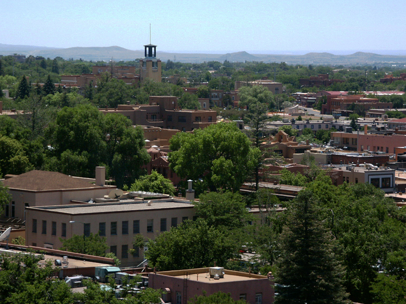

Santa Fe, New Mexico
Santa Fe is a city of 89,019 people in Santa Fe County, New Mexico, founded in 1610.
Why visit Santa Fe
Townapedia lists 105 museums and landmarks, 60 parks and trails, 235 places to eat, 34 places to stay and 16 attractions in and around town.
Highlights include Jean Cocteau Cinema, James A. Little Theater, Ralph T. Coe Center and House of Eternal Return - Meow Wolf.
July is the warmest month, with average highs of 86°F; December lows average 18°F, and about 20 inches of snow fall in a normal year.
Weather in Santa Fe
Forecast from the National Weather Service. Full forecast
About Santa Fe
Santa Fe ( SAN-tə FAY, - fay; Spanish: [santa ˈfe]; Spanish for 'Holy Faith') is the capital city of the U.S. state of New Mexico. It is the fourth-most populous city in the state with a population of 87,505 as of the 2020 census, while the Santa Fe metropolitan area has an estimated 158,000 people. The greater Albuquerque–Santa Fe–Los Alamos combined statistical area includes eight counties in north-central New Mexico with 1.16 million residents. The county seat of Santa Fe County, Santa Fe is situated at the foothills of the Sangre de Cristo Mountains at the highest altitude of any U.S. state capital, with an elevation of 6,998 feet (2,133 m).
From the Wikipedia article Santa Fe, New Mexico (this version), under CC BY-SA 4.0.
Things to do16


Don Gaspar Bridge
Bridge · National Register of Historic Places · 2.8 mi
Bridge in Santa Fe, New Maxico, United States
Paolo Soleri Amphitheater
Cinema and theater · 1.1 mi
Former outdoor theater in Santa Fe, New Mexico
1501 Cerrillos Road, Santa Fe

Institute of American Indian Arts
School · 5.4 mi
College focused on Native American art, in Santa Fe, New Mexico
Lensic Theater
Cinema and theater · 2.9 mi
Theater and former movie theater in Santa Fe, New Mexico, United States
Santa Fe Playhouse
Cinema and theater · 2.8 mi
Non-profit professional theater based in Santa Fe, New Mexico

Ski Santa Fe
Ski area · 1.8 mi
Ski resort in New Mexico, United States
Regal Cinemas Santa Fe Place
Cinema and theater · 2.6 mi
4250 Cerrillos Road, Santa Fe
4 more on the map.
Museums and landmarks105

Ralph T. Coe Center
Museum · 1.2 mi
Mission: increase public awareness, education, and appreciation of Indigenous art through programs, exhibitions, and individual study
1590 South Pacheco Street, Santa Fe
closed
House of Eternal Return - Meow Wolf
Museum · 1.0 mi
1352 Rufina Circle, Santa Fe
Su-Mo 10:00-20:00; Tu off; We-Th 10:00-20:00; Fr-Sa 10:00-22:00

Ricardo Alarid House
Monument and historic site · National Register of Historic Places · 2.2 mi
1902 building in Santa Fe, New Mexico; National Register of Historic Places 1984; used for elementary, middle, and high schools at...
534 Alarid Street, Santa Fe
Alfred M. Bergere House
Monument and historic site · National Register of Historic Places · 3.0 mi
Single-family detached home in Santa Fe, United States of America
Allison Dormitory
Monument and historic site · National Register of Historic Places · 3.3 mi
Dormitory in Santa Fe, New Mexico
Barrio De Analco Historic District
Monument and historic site · National Register of Historic Places · 2.9 mi
Historic district in Santa Fe, New Mexico
Camino del Monte Sol Historic District
Monument and historic site · National Register of Historic Places · 3.2 mi
Historic district in Santa Fe, New Mexico
Connor Hall
Monument and historic site · National Register of Historic Places · 1.7 mi
Historic building
Delgado Street Bridge
Bridge · National Register of Historic Places · 3.2 mi
Road bridge in Santa Fe, New Mexico
Digneo-Valdes House
Monument and historic site · National Register of Historic Places · 2.7 mi
House in Santa Fe, New Mexico
Dodge-Bailey House
Monument and historic site · National Register of Historic Places · 3.5 mi
Single-family detached home in Santa Fe, United States of America
Don Gaspar Historic District
Monument and historic site · National Register of Historic Places · 2.5 mi
Historic district in New Mexico, United States
93 more on the map.
Parks, trails and playgrounds60

Santa Fe Plaza
Park · National Register of Historic Places · 3.0 mi
Plaza in Santa Fe, New Mexico
Harvey Cornell Rose Park
Park · 2.1 mi
1315 Galisteo Parkway, Santa Fe
48 more on the map.
Restaurants and cafes235


Dr. Field Goods Kitchen
Restaurant · New Mexican · 0.6 mi
Local, organic, wood oven
2860 Cerrillos Road, Santa Fe
Mo-Su 11:00-21:00
Pyramid Cafe
Restaurant · Greek, Mediterranean, Tunisian · 2.0 mi
Mediterranean, Greek, Tunisian
505 West Cordova Road, Santa Fe
Mo-Sa 11:00-14:30, 16:00-20:30

Bruno’s Pizzeria
Restaurant · Pizza · 2.4 mi
1512 Paseo de Peralta, Santa Fe
Mo-Tu 11:00-16:00; We-Fr 11:00-15:00
Capital City Nutrition
Cafe · Smoothie, Juice, Tea, Coffee
1302 Osage Avenue, Santa Fe
Tu-Fr 08:00-14:00; Sa-Su 09:00-12:00
Chocolate Maven
Cafe · Bakery, Chocolate · 1.1 mi
An independent, homestyle bakery in Santa Fe, NM serving homemade pastries, cookies, cakes and more.
821 West San Mateo Road, Santa Fe
Mo-Sa 08:00-16:00; Su 08:00-14:00
Counter Culture Cafe
Restaurant · American, New Mexican, Mexican · 1.3 mi
930 Baca Street, Santa Fe
Mo-Su 08:00-15:00
223 more on the map.
Where to stay34
Churches and places of worship28
Archbishop Lamy's Chapel
Church · National Register of Historic Places · 6.3 mi
St. Juliana of Lazarevo
Church · Russian Orthodox · 1.4 mi
3877 West Alameda Street, Santa Fe
Unitarian Universalist Congregation of Santa Fe
Place of worship · 2.2 mi
107 West Barcelona Road, Santa Fe
Shopping60
Gas and EV charging23
Schools, colleges and libraries63
New Mexico School for the Arts
School · 2.5 mi
500 Montezuma Avenue, Santa Fe
Healthcare37
Christus Saint Vincent Regional Cancer Center
Clinic and pharmacy · 1.9 mi
490 West Zia Road, Santa Fe
Presbyterian Saint Michaels Urgent Care
Clinic and pharmacy · 2.0 mi
454 Saint Michaels Drive, Santa Fe
Santa Fe Public Health Office
Clinic and pharmacy · 1.9 mi
605 Letrado Street, Santa Fe
Santa Fe Health Services
Clinic and pharmacy · 1.5 mi
1549 South Saint Francis Drive, Santa Fe
Adelante Student Wellness Annex
Clinic and pharmacy · 1.7 mi
1300 Camino Sierra Vista, Santa Fe
Map of Santa Fe
250 places. The map loads OpenStreetMap tiles when you open it.
Climate by month
Monthly table
| Month | High | Low | Rain | Snow |
|---|---|---|---|---|
| Jan | 43°F | 18°F | 0.6 in | 3.7 in |
| Feb | 48°F | 21°F | 0.5 in | 2.4 in |
| Mar | 57°F | 26°F | 0.7 in | 3.9 in |
| Apr | 64°F | 32°F | 0.6 in | 0.4 in |
| May | 74°F | 41°F | 0.9 in | 0.0 in |
| Jun | 84°F | 50°F | 0.9 in | 0.0 in |
| Jul | 86°F | 55°F | 2.3 in | 0.0 in |
| Aug | 83°F | 54°F | 2.0 in | 0.0 in |
| Sep | 78°F | 47°F | 1.4 in | 0.0 in |
| Oct | 66°F | 35°F | 1.3 in | 1.3 in |
| Nov | 53°F | 24°F | 0.8 in | 1.7 in |
| Dec | 43°F | 18°F | 0.8 in | 6.8 in |
U.S. Climate Normals 1991-2020 for Santa Fe 2 (3 mi away), NOAA NCEI.
People and cost of living
American Community Survey 5-year estimates, 2020-2024, U.S. Census Bureau. Estimates have margins of error, larger for small towns.
Disaster history
Santa Fe County has had 8 federal disaster declarations since 2000, most often for fires.
- 2020-04-05: Covid-19 Pandemic (Biological)
- 2020-03-13: Covid-19 (Biological)
- 2014-10-29: Severe Storms And Flooding (Severe Storm)
- 2013-10-29: Severe Storms, Flooding, And Mudslides (Flood)
- 2005-09-07: Hurricane Katrina Evacuation (Hurricane)
- 2002-05-23: Nm - Borrego Fire - 5-23-02 (Fire)
OpenFEMA disaster declarations summaries.
Getting there and nearby towns
Santa Fe Readiness Center AASF (SAF) is the nearest airport with scheduled flights listed in OpenStreetMap, 6 miles away.
- Agua Fria 2 mi west, about 3 min by car
- Tres Arroyos 3 mi west, about 6 min by car
- Conejo 3 mi southeast, about 5 min by car
- Tano Road 5 mi north, about 8 min by car
- Los Alamos 24 mi northwest, about 38 min by car
- Española 24 mi north, about 39 min by car
- Las Vegas 43 mi east, about 1 h 15 min by car
- Rio Rancho 48 mi southwest, about 1 h 15 min by car
- North Valley 49 mi southwest, about 1 h 15 min by car
- Albuquerque 54 mi southwest, about 1 h 30 min by car
Drive times are estimates from straight-line distance, not routes.
Local news
Headlines from INDB, the NEMICO news database.
Reviews, tips and questions
Loading what members have shared...
Sources and licences
- NCES EDGE (Public domain): public schools
- NOAA NCEI U.S. Climate Normals 1991-2020 (Public domain): climate by month
- OpenFEMA (Public domain): disaster declarations
- OpenStreetMap contributors (ODbL 1.0): places, airports, map data
- U.S. Census Bureau (Public domain): population, income, housing, education, commute
- Wikidata (CC0 1.0): elevation, founding date, time zone, website, landmarks and historic places
- Wikimedia Commons (see each image): photos
- Wikipedia (CC BY-SA 4.0): overview and history text
Photo credits
- Santa Fe NM, Unknown author, CC BY-SA 3.0
Page built October 30, 2026. Spotted a mistake? Tell us or suggest a place.