


Dorneyville, Pennsylvania
Dorneyville is a community of 5,211 people in Lehigh County, Pennsylvania.
Why visit Dorneyville
Townapedia lists 82 museums and landmarks, 37 parks and trails, 56 places to eat, 5 places to stay and 11 attractions in and around town.
Highlights include Albertus L. Meyers Bridge, Bogert Covered Bridge, Zephyr Railroad and Allentown Masonic Temple.
July is the warmest month, with average highs of 86°F; January lows average 22°F, and about 33 inches of snow fall in a normal year.
Weather in Dorneyville
Forecast from the National Weather Service. Full forecast
About Dorneyville
Dorneyville is a census-designated place in Lehigh County, Pennsylvania. As of the 2020 census the population was 4,850. Dorneyville is located just west of Allentown in South Whitehall Township and Salisbury Township.
From the Wikipedia article Dorneyville, Pennsylvania (this version), under CC BY-SA 4.0.
Things to do11

Albertus L. Meyers Bridge
Bridge · National Register of Historic Places · 2.9 mi
Bridge in United States of America

Bogert Covered Bridge
Bridge · National Register of Historic Places · 1.2 mi

Civic Theatre of Allentown
Cinema and theater · 2.1 mi
Theater company and theater in Allentown, Pennsylvania, United States
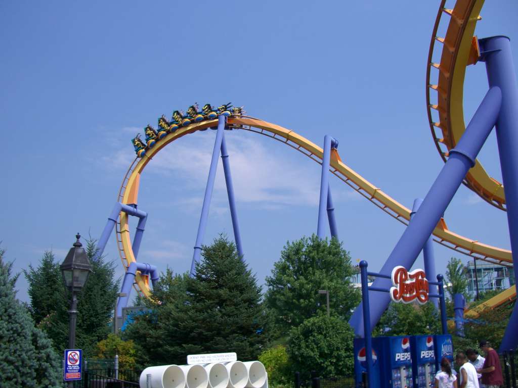
Dorney Park & Wildwater Kingdom
Monument and historic site · 0.7 mi
Amusement park in Pennsylvania
Pines Dinner Theatre
Cinema and theater · 0.5 mi
315 South Cedar Crest Boulevard, Allentown
Museums and landmarks82


Allentown Masonic Temple
Monument and historic site · National Register of Historic Places · 2.2 mi
Masonic temple in Allentown, Pennsylvania

Allentown National Bank
Monument and historic site · National Register of Historic Places · 3.2 mi
Bank building in Allentown, Pennsylvania

Americus Hotel
Monument and historic site · National Register of Historic Places · 3.2 mi
Hotel building in Allentown, Pennsylvania

Dime Savings and Trust Company
Monument and historic site · National Register of Historic Places · 3.0 mi
Building in Pennsylvania, United States

Gauff-Roth House
Monument and historic site · National Register of Historic Places · 3.2 mi
Historic house in Pennsylvania, United States

Haines Mill
Museum · National Register of Historic Places · 0.9 mi
Museum

Jacob Jr. Ehrenhardt House
Monument and historic site · National Register of Historic Places · 3.1 mi
Historic house in Pennsylvania, United States

Kemmerer House
Monument and historic site · National Register of Historic Places · 2.2 mi
Historic house in Pennsylvania, United States

Old Lehigh County Courthouse
Monument and historic site · National Register of Historic Places · 3.3 mi
United States historic place in Allentown, Pennsylvania

Rodale Organic Gardening Experimental Farm
Monument and historic site · National Register of Historic Places · 1.5 mi
Farm in Pennsylvania, United States of America

Trout Hall
Monument and historic site · National Register of Historic Places · 3.4 mi
Building in Pennsylvania, United States
70 more on the map.
Parks, trails and playgrounds37





25 more on the map.
Restaurants and cafes56


Mario's Pizza Cafe
Restaurant · Pizza
3335 Hamilton Boulevard, Allentown
Mo off; Tu-Th 10:00-21:00; Fr,Sa 10:00-22:00; Su 11:00-21:00
Pizza Hut
Restaurant · Pizza
3315 Hamilton Boulevard, Allentown
Mo-Th,Su 10:30-23:00; Fr,Sa 10:30-24:00

44 more on the map.
Where to stay5
Four Points by Sheraton Allentown Lehigh Valley
Motel and hotel · 0.6 mi
3712 Hamilton Boulevard, Allentown
Holiday Inn Express & Suites - Allentown Cen - Dorneyville
Motel and hotel · 0.5 mi
3620 Hamilton Boulevard, Allentown
Churches and places of worship20
Zion's Reformed United Church of Christ
Church · National Register of Historic Places · 3.1 mi
Congregation Sons of Israel
Place of worship · Orthodox · 1.7 mi
2701 West Tilghman Street, Allentown
First Presbyterian Church of Allentown
Church · Presbyterian Church Usa · 1.6 mi
3231 West Tilghman Street, Allentown
Shopping15
Gas and EV charging9
Schools, colleges and libraries46
Brigadier General Anna Mae Hays El Sch
School · 2.7 mi
1227 W Gordon St, Allentown
Healthcare9
Valley Oral Surgery - Allentown
Clinic and pharmacy · 1.0 mi
1275 South Cedar Crest Boulevard, Allentown
Allentown VA Clinic
Clinic and pharmacy · 0.5 mi
3110 Hamilton Boulevard, Allentown
Hanger Clinic: Prosthetics & Orthotics
Clinic and pharmacy · 0.4 mi
3050 Hamilton Boulevard, Allentown
Lehigh Valley Health Network
Clinic and pharmacy
3080 Hamilton Boulevard, Allentown
Patient First - Allentown
Clinic and pharmacy · 1.4 mi
3178 Tilghman Street, Allentown
Map of Dorneyville
250 places. The map loads OpenStreetMap tiles when you open it.
Climate by month
Monthly table
| Month | High | Low | Rain | Snow |
|---|---|---|---|---|
| Jan | 38°F | 22°F | 3.3 in | 9.8 in |
| Feb | 42°F | 23°F | 2.8 in | 10.8 in |
| Mar | 51°F | 30°F | 3.6 in | 6.3 in |
| Apr | 63°F | 40°F | 3.7 in | 0.5 in |
| May | 74°F | 51°F | 3.6 in | 0.0 in |
| Jun | 82°F | 60°F | 4.4 in | 0.0 in |
| Jul | 86°F | 65°F | 5.3 in | 0.0 in |
| Aug | 84°F | 63°F | 4.6 in | 0.0 in |
| Sep | 77°F | 55°F | 4.8 in | 0.0 in |
| Oct | 66°F | 44°F | 4.1 in | 0.2 in |
| Nov | 54°F | 34°F | 3.2 in | 0.9 in |
| Dec | 43°F | 27°F | 3.9 in | 4.6 in |
U.S. Climate Normals 1991-2020 for Allentown Intl Ap Hcn 72517 (6 mi away), NOAA NCEI.
People and cost of living
American Community Survey 5-year estimates, 2020-2024, U.S. Census Bureau. Estimates have margins of error, larger for small towns.
Disaster history
Lehigh County has had 11 federal disaster declarations since 2000, most often for hurricanes.
- 2020-03-30: Covid-19 Pandemic (Biological)
- 2020-03-13: Covid-19 (Biological)
- 2016-03-23: Severe Winter Storm And Snowstorm (Snowstorm)
- 2012-10-29: Hurricane Sandy (Hurricane)
- 2011-09-08: Remnants Of Tropical Storm Lee (Flood)
- 2011-09-03: Hurricane Irene (Hurricane)
OpenFEMA disaster declarations summaries.
Getting there and nearby towns
Lehigh Valley International Airport (ABE) is the nearest airport with scheduled flights listed in OpenStreetMap, 6 miles away.
- Cetronia 1 mi northwest, about 2 min by car
- Allentown 2 mi northeast, about 4 min by car
- Emmaus 3 mi south, about 5 min by car
- Fullerton 4 mi northeast, about 7 min by car
- Ancient Oaks 4 mi southwest, about 7 min by car
- Catasauqua 6 mi northeast, about 10 min by car
- Alburtis 6 mi southwest, about 10 min by car
- Stiles 6 mi north, about 10 min by car
- Breinigsville 7 mi southwest, about 11 min by car
- Coplay 7 mi north, about 11 min by car
Drive times are estimates from straight-line distance, not routes.
Local news
Headlines from INDB, the NEMICO news database.
Reviews, tips and questions
Loading what members have shared...
Sources and licences
- NCES EDGE (Public domain): public schools
- NOAA NCEI U.S. Climate Normals 1991-2020 (Public domain): climate by month
- OpenFEMA (Public domain): disaster declarations
- OpenStreetMap contributors (ODbL 1.0): places, airports, map data
- U.S. Census Bureau (Public domain): population, income, housing, education, commute
- Wikidata (CC0 1.0): elevation, founding date, time zone, website, landmarks and historic places
- Wikimedia Commons (see each image): photos
- Wikipedia (CC BY-SA 4.0): overview and history text
Photo credits
- 1960 - Dorneyville Hotel Matchcover Allentown PA, Unknown matchbook company, Public domain
- PA 222 sb at Dorneyville split, Nov. 2023, Mr. Matté (if there is an issue with this image, contact me using this image's Commons talk page , my Commons user talk page , or my English Wikipedia user talk page ; I'll know about it a lot faster), CC BY 4.0
- 2007 - South Eighth Street Viaduct, Unknown author, Public domain
- Haines Mill 01, Shuvaev, CC BY-SA 3.0
- Erenhardt House 1803 Emmaus PA, Smallbones, CC0
- 2008 - Allentown Trout Hall, Alphageekpa ( talk ), CC BY-SA 3.0
- Americus Allentown PA, Smallbones, CC0
- 2011 - Old Lehigh County Courthouse, Smallbones, CC0
- Gauff Roth Allentown PA, Smallbones, CC0
- 2011 - Allentown National Bank Building, Smallbones, CC0
- 2011 - Zion Reformed Church, Smallbones, CC0
- Kemmerer House 01, Shuvaev, CC BY-SA 3.0
- 2011 - Allentown Masonic Temple, Smallbones, CC0
- 2011 - Dime Savings Bank Building, Smallbones, CC0
- Rodale Farm Clapboard & Stone Bakeoven, Final4one, CC BY-SA 3.0
- 1945 - Zollinger-Harned Department Store, Unknown author Unknown author, Public domain
- 2013 - King George Inn (E Side), PattiParker, CC BY-SA 3.0
- Bogert Covered Bridge, Smallbones, CC0
- Da Vinci Science Center Building, Dennisze, CC BY-SA 3.0
- Allentown Art Museum, Pennsylvania, Alphageekpa ( talk ), CC BY-SA 3.0
- 1962 - Liberty Bell Shrine, Unknown author Unknown author, Public domain
- Cathedral of Saint Catharine of Siena, Allentown PA 01, Shuvaev, CC BY-SA 4.0
- Talon (Dorney Park & Wildwater Kingdom) 08, Coasterman1234 at en.wikipedia, CC BY-SA 3.0
- MuseumOfIndianCulture, BobertCockney, CC BY-SA 4.0
- Chicken And Broccoli @ Bamboo Asian Cuisine, Discover Lehigh Valley, PA, CC BY 2.0
- 2022-09-26 13 48 39 View north along Pennsylvania State Route 222 (Hamilton Boulevard) just north of Cedar Crest Boulevard in South Whitehall Township, Lehigh County, Pennsylvania, Famartin, CC BY-SA 4.0
- 2022-09-26 14 23 20 View south along Pennsylvania State Route 222 (Hamilton Boulevard) just south of 30th Street on the border of South Whitehall Township and Allentown in Lehigh County, Pennsylvania, Famartin, CC BY-SA 4.0
- Da Vinci Science Center 03, CyberXRef, CC BY-SA 3.0
- Da Vinci Science Center 02, CyberXRef, CC BY-SA 3.0
- Da Vinci Science Center 05, CyberXRef, CC BY-SA 3.0
- Da Vinci Science Center 01, CyberXRef, CC BY-SA 3.0
- Wind Turbine at the Da Vinci Science Center, CyberXRef, CC BY-SA 3.0
- Da Vinci Science Center 06, CyberXRef, CC BY-SA 3.0
- AUFC First Match, Emmannm, CC BY-SA 4.0
- 2022-09-24 13 57 13 View north along Cedar Crest Boulevard from the overpass for Interstate 78 and Pennsylvania State Route 309 in Salisbury Township, Lehigh County, Pennsylvania, Famartin, CC BY-SA 4.0
- PA 222 sb in South Whitehall Twp., Nov. 2023, Mr. Matté (if there is an issue with this image, contact me using this image's Commons talk page , my Commons user talk page , or my English Wikipedia user talk page ; I'll know about it a lot faster), CC BY 4.0
- 2022-09-24 13 51 52 View south along Pennsylvania State Route 29 (Cedar Crest Boulevard) from the overpass for Interstate 78 and Pennsylvania State Route 309 in Salisbury Township, Lehigh County..., Famartin, CC BY-SA 4.0
- PA 222 NB past Lincoln Avenue, Dough4872, CC BY-SA 4.0
- Little Laser 1, Jeremy Thompson, CC BY 2.0
- Woodstock Express (Dorney Park) 1, Jeremy Thompson, CC BY 2.0


Page built October 30, 2026. Spotted a mistake? Tell us or suggest a place.