


Dranesville, Virginia
Dranesville is a community of 11,828 people in Fairfax County, Virginia.
Why visit Dranesville
Townapedia lists 10 museums and landmarks, 23 parks and trails, 90 places to eat, 2 places to stay and 1 attraction in and around town.
Highlights include Lake Fairfax Park, Herndon Depot Museum, Herndon Historic District and NOVA Wild.
July is the warmest month, with average highs of 88°F; January lows average 25°F, and about 21 inches of snow fall in a normal year.
Weather in Dranesville
Forecast from the National Weather Service. Full forecast
About Dranesville
Dranesville is a census-designated place (CDP) in Fairfax County, Virginia, United States. Dranesville is located on the Leesburg Pike (State Route 7) at its intersection with Georgetown Pike (State Route 193). The U.S. Census Bureau defines Dranesville as a census-designated place (CDP) with a population of 11,921 as of 2010. At the 2020 Census the population was 11,785.
From the Wikipedia article Dranesville, Virginia (this version), under CC BY-SA 4.0.
Things to do1

Lake Fairfax Park
Monument and historic site · 3.6 mi
Park in Reston, Fairfax County, Virginia
Museums and landmarks10

Herndon Depot Museum
Museum · National Register of Historic Places · 2.0 mi
Railway station in Herndon, the United States of America
717 Lynn Street
Su 12:00-15:00; Dec 15-Dec 31 off; Jan-Apr off

Herndon Historic District
Monument and historic site · National Register of Historic Places · 2.1 mi
Historic district in Virginia, United States

A. Smith Bowman Distillery
Monument and historic site · National Register of Historic Places · 2.9 mi
Whisky distillery in Fairfax County, Virginia
Bloomfield
Monument and historic site · National Register of Historic Places · 1.1 mi
Historic home located in Fairfax County, Virginia, United States
Dranesville Tavern
Monument and historic site · National Register of Historic Places · 0.9 mi
Historic commercial building in Virginia, United States

Lake Anne Village Center Historic District
Monument and historic site · National Register of Historic Places · 2.5 mi
Historic district in Virginia, United States
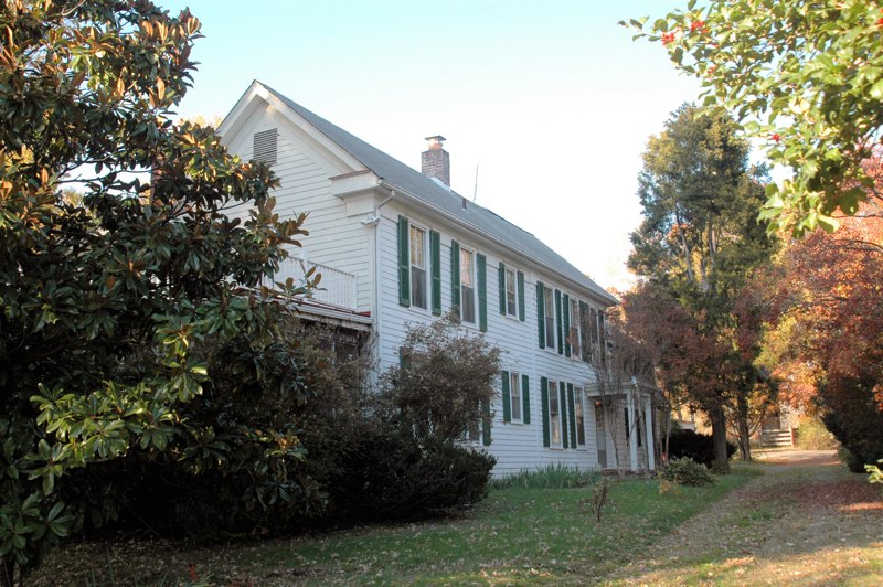
Merrybrook
Monument and historic site · National Register of Historic Places · 3.5 mi
Historic house in Virginia, United States

U.S. Geological Survey National Center
Monument and historic site · National Register of Historic Places · 3.2 mi
Government building in Fairfax County, Virginia, United States


Vestal's Gap Road and Lanesville Historic District
Monument and historic site · National Register of Historic Places · 2.3 mi
Historic district in Virginia, United States

Parks, trails and playgrounds23

Runnymede Park
Park · 1.4 mi
Herndon’s 58-acre nature park provides passive recreational opportunities, and features a native plant garden with over 100 different...

11 more on the map.
Restaurants and cafes90


Bagel Cafe
Cafe · Bagel · 2.0 mi
300 Elden Street, Herndon
Su-Sa 06:30-15:00; closed "Christmas "; closed "Thanksgiving "

Baskin-Robbins
Ice cream · Ice Cream · 1.6 mi
1446 North Point Village Center, Reston
Mo-Th 11:00-21:00; Fr 11:00-22:00; Sa 10:30-22:00; Su 11:00-21:30
Cafe Rio
Restaurant · Mexican · 2.0 mi
348;454 Elden Street, Herndon
Mo-Th 10:30-21:00; Fr,Sa 10:30-22:00; Su 11:00-21:00
California Tortilla
Restaurant · Mexican · 1.6 mi
1470 North Point Village Center, Reston
Mo-Sa 10:30-22:00; Su 11:00-21:00
Charcoal Kabob
Restaurant · Afghan · 1.9 mi
394 Elden Street, Herndon
Mo-Fr 11:00-20:00, Sa-Su 12:00-20:00
Finn Thai
Restaurant · Thai · 1.6 mi
1466 North Point Village Center, Reston
Su-Th 11:00-21:30; Fr-Sa 11:00-22:30

Glory Days Grill
Diner · American · 1.6 mi
1400 North Point Village Center, Reston
Su-Th 11:00-23:00; Fr-Sa 11:00-23:59
Gregorio's Trattoria
Restaurant · Italian · 1.6 mi
1428 North Point Village Center, Reston
Su-Th 11:00-22:00; Fr,Sa 11:00-23:00
H Pot Korean BBQ & Hot Pot
Restaurant · Hotpot, Korean, Barbecue, Korean Bbq · 1.9 mi
400 Elden Street, Herndon
Mo-Th 11:00-21:30; Fr,Sa 11:00-22:00; Su 12:00-21:30
78 more on the map.
Where to stay2
Churches and places of worship16
All Dulles Area Muslim Society Center
Place of worship · Sunni · 0.8 mi
46903 Sugarland Road, Herndon
The Church of Jesus Christ of Latter-day Saints
Church · Mormon · 1.3 mi
1515 Poplar Grove Drive, Reston
Christ the Reedemer Catholic Church
Church · Roman Catholic · 1.5 mi
46833 Harry Byrd Highway, Sterling
Saint Matthews Episcopal Church
Church · Episcopal · 1.6 mi
201 East Frederick Drive, Sterling
Sterling Park Baptist Church
Church · Baptist · 1.8 mi
501 North York Road, Sterling
Dranesville United Methodist Church
Church · Methodist · 1.1 mi
1089 Liberty Meeting Court, Herndon
The Church of Jesus Christ of Latter-day Saints
Church · Mormon · 1.6 mi
22066 Circle Drive, Sterling
Shopping15
Gas and EV charging10
Schools, colleges and libraries58
Healthcare6
Map of Dranesville
231 places. The map loads OpenStreetMap tiles when you open it.
Climate by month
Monthly table
| Month | High | Low | Rain | Snow |
|---|---|---|---|---|
| Jan | 43°F | 25°F | 2.9 in | 6.9 in |
| Feb | 46°F | 27°F | 2.6 in | 7.0 in |
| Mar | 55°F | 34°F | 3.5 in | 3.9 in |
| Apr | 67°F | 43°F | 3.5 in | 0.1 in |
| May | 75°F | 53°F | 4.7 in | 0.0 in |
| Jun | 83°F | 62°F | 4.3 in | 0.0 in |
| Jul | 88°F | 67°F | 4.2 in | 0.0 in |
| Aug | 86°F | 65°F | 3.5 in | 0.0 in |
| Sep | 79°F | 58°F | 3.9 in | 0.0 in |
| Oct | 68°F | 45°F | 3.6 in | 0.0 in |
| Nov | 56°F | 36°F | 3.1 in | 0.3 in |
| Dec | 46°F | 29°F | 3.3 in | 2.8 in |
U.S. Climate Normals 1991-2020 for Washington Dc Dulles Ap 72403 (6 mi away), NOAA NCEI.
People and cost of living
American Community Survey 5-year estimates, 2020-2024, U.S. Census Bureau. Estimates have margins of error, larger for small towns.
Disaster history
Fairfax County has had 14 federal disaster declarations since 2000, most often for hurricanes.
- 2026-01-23: Severe Winter Storm (Winter Storm)
- 2020-04-02: Covid-19 Pandemic (Biological)
- 2020-03-13: Covid-19 (Biological)
- 2018-09-11: Hurricane Florence (Hurricane)
- 2016-03-07: Severe Winter Storm And Snowstorm (Snowstorm)
- 2012-10-29: Hurricane Sandy (Hurricane)
OpenFEMA disaster declarations summaries.
Getting there and nearby towns
Washington Dulles International Airport (IAD) is the nearest airport with scheduled flights listed in OpenStreetMap, 6 miles away.
- Cascades 4 mi north, about 6 min by car
- Ashburn 6 mi west, about 9 min by car
- Travilah 8 mi northeast, about 12 min by car
- Broadlands 8 mi west, about 13 min by car
- Chantilly 8 mi southwest, about 13 min by car
- Brambleton 9 mi west, about 14 min by car
- Potomac 10 mi east, about 15 min by car
- North Potomac 10 mi northeast, about 16 min by car
- Centreville 11 mi south, about 18 min by car
- Rockville 13 mi northeast, about 21 min by car
Drive times are estimates from straight-line distance, not routes.
Local news
Headlines from INDB, the NEMICO news database.
Reviews, tips and questions
Loading what members have shared...
Sources and licences
- NCES EDGE (Public domain): public schools
- NOAA NCEI U.S. Climate Normals 1991-2020 (Public domain): climate by month
- OpenFEMA (Public domain): disaster declarations
- OpenStreetMap contributors (ODbL 1.0): places, airports, map data
- U.S. Census Bureau (Public domain): population, income, housing, education, commute
- Wikidata (CC0 1.0): elevation, founding date, time zone, website, landmarks and historic places
- Wikimedia Commons (see each image): photos
- Wikipedia (CC BY-SA 4.0): overview and history text
Photo credits
- Dranesville Auto Service, Ser Amantio di Nicolao, CC BY-SA 3.0
- 2016-10-27 13 15 49 View south along Virginia State Route 286 (Fairfax County Parkway) at Sugarland Road (Virginia State Secondary Route 604) in Dranesville, Fairfax County, Virginia, Famartin, CC BY-SA 4.0
- 2018-10-29 14 09 09 View north along Virginia State Route 286 (Fairfax County Parkway) at the exit for Virginia State Route 7 EAST-Leesburg Pike in Dranesville, Fairfax County, Virginia, Famartin, CC BY-SA 4.0
- 2016-10-27 10 36 07 View south along Virginia State Route 228 (Dranesville Road) between Bennett Street and Old Hunt Way in Herndon, Fairfax County, Virginia, Famartin, CC BY-SA 4.0
- Dranesville Tavern, David D'Agostino, CC BY-SA 3.0
- Dranesville Tavern in Autumn, Pippenjuniper, CC BY-SA 4.0
- 2016-10-27 11 18 23 View east along Virginia State Route 7 (Leesburg Pike) at Dranesville Manor Drive in Dranesville, Fairfax County, Virginia, Famartin, CC BY-SA 4.0
- 2018-10-29 14 10 40 View north along Virginia State Route 286 (Fairfax County Parkway) at the exit for Virginia State Route 7 WEST-Leesburg Pike in Dranesville, Fairfax County, Virginia, Famartin, CC BY-SA 4.0
- 2019-10-02 10 54 44 View east along Virginia State Route 7 (Leesburg Pike) from the overpass for Virginia State Route 286 (Fairfax County Parkway) on the edge of Dranesville and Great Falls in..., Famartin, CC BY-SA 4.0
- 2019-10-02 10 53 35 View west along Virginia State Route 7 (Leesburg Pike) from the overpass for Virginia State Route 286 (Fairfax County Parkway) on the edge of Dranesville and Great Falls in..., Famartin, CC BY-SA 4.0
- 2016-10-27 10 54 20 View south along Virginia State Route 228 Truck and west along Virginia State Secondary Route 606 Truck (Herndon Parkway) at Virginia State Route 228 (Dranesville Road) in..., Famartin, CC BY-SA 4.0
- Herndon Depot1, Cecouchman, CC BY-SA 3.0
- HERNDON HISTORIC DISTRICT, JERRYE & ROY KLOTZ MD, CC BY-SA 3.0
- Lanesville-8106, Cecouchman, CC BY-SA 3.0
- Oldbowmanwinedistill, Joshua Davis, CC BY-SA 2.5
- LAKE ANNE VILLAGE H.D., FAIRFAX COUNTY, VA, JERRYE & ROY KLOTZ, M.D., CC BY-SA 4.0
- Merrybrook Exterior, Shape Of Air at en.wikipedia, Public domain
- Usgs-headquarters, No machine-readable author provided. Joshuadavisphotography assumed (based on copyright claims)., CC BY-SA 2.5
- Sphecius speciosus-male hovering, peterwchen, CC BY 4.0
- Calopteryx maculata-male hovering, peterwchen, CC BY 4.0
- Euptoieta claudia-ventral, Peterwchen, CC BY-SA 4.0
- Euptoieta claudia-dorsal, Peterwchen, CC BY-SA 4.0
- Rhagovelia obesa, Peterwchen, CC BY-SA 4.0
- Micrathena gracilis-female lateral, Peterwchen, CC BY-SA 4.0
- Entypus unifasciatus, Peterwchen, CC BY-SA 4.0
- Melanolestes picipes-nymph, Peterwchen, CC BY-SA 4.0
- Occoquan Regional Park - 51410779888, markcbrennan, CC BY-SA 2.0
- Occoquan Regional Park - 51411275509, markcbrennan, CC BY-SA 2.0
- Occoquan Regional Park - 51410779473, markcbrennan, CC BY-SA 2.0
- Occoquan Regional Park - 51410516406, markcbrennan, CC BY-SA 2.0
- 110402-N-6914S-035 (5713018380), United States Navy Band from Washington, D.C., USA, Public domain
- 110429-N-VV903-013 (5712457769), United States Navy Band from Washington, D.C., USA, Public domain
- 110402-N-6914S-032 (5713018462), United States Navy Band from Washington, D.C., USA, Public domain
- 110429-N-VV903 79 (5713018014), United States Navy Band from Washington, D.C., USA, Public domain
- 110429-N-VV903-114 (5712458271), United States Navy Band from Washington, D.C., USA, Public domain
- Assistant Secretary Richard, Special Representative Zafar, UNHCR Special Envoy Jolie Pitt, and Secretary Kerry Participate in an Interfaith Iftar Reception to Mark World Refugee Day (27205501224), U.S. Department of State from United States, Public domain
- Secretary Kerry and UNHCR Special Envoy Jolie Pitt Break the Fast at an Interfaith Iftar Reception to Mark World Refugee Day (27205501254), U.S. Department of State from United States, Public domain
- A Local Girl Scout Addresses the Audience at an Interfaith Iftar Reception to Mark World Refugee Day (27205500874), U.S. Department of State from United States, Public domain
- Secretary Kerry and UNHCR Special Envoy Jolie Pitt Speak With Interfaith Leaders Before Delivering Remarks at an Interfaith Iftar Reception to Mark World Refugee Day (27205500714), U.S. Department of State from United States, Public domain
- Secretary Kerry Shakes Hands With Special Representative Zafar Before Addressing the Audience at an Interfaith Iftar to Mark World Refugee Day (27205501714), U.S. Department of State from United States, Public domain


Page built October 30, 2026. Spotted a mistake? Tell us or suggest a place.