




East Dennis, Massachusetts
East Dennis is a community of 3,062 people in Barnstable County, Massachusetts.
Why visit East Dennis
Townapedia lists 21 museums and landmarks, 54 parks and trails, 9 places to eat, 5 places to stay and 8 attractions in and around town.
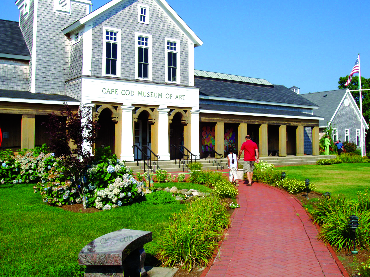
Highlights include Scargo Tower, Black Ball Hill, Cape Cod Museum of Art and Jacob Sears Memorial Library.
July is the warmest month, with average highs of 78°F; February lows average 24°F.
Weather in East Dennis
Forecast from the National Weather Service. Full forecast
About East Dennis
East Dennis is a village and census-designated place (CDP) in the town of Dennis in Barnstable County, Massachusetts, United States. It was settled in the 1630s. As of the 2020 census, East Dennis had a population of 2,585.
From the Wikipedia article East Dennis, Massachusetts (this version), under CC BY-SA 4.0.
Things to do8



Museums and landmarks21

Jacob Sears Memorial Library
Monument and historic site · National Register of Historic Places · 1.0 mi
Public library in Dennis, Massachusetts, United States
23 Center Street, Dennis

Brewster Old King's Highway Historic District
Monument and historic site · National Register of Historic Places · 4.0 mi
Historic district in Massachusetts, United States
Dennis Village Cemetery
Monument and historic site · National Register of Historic Places · 1.8 mi
Historic cemetery in Barnstable County, Massachusetts, US
Dillingham House
Monument and historic site · National Register of Historic Places · 1.9 mi
Historic house in Massachusetts, United States

Josiah Dennis House
Monument and historic site · National Register of Historic Places · 2.2 mi
Historic house in Massachusetts, United States

Stony Brook-Factory Village Historic District
Monument and historic site · National Register of Historic Places · 4.0 mi
Historic district in Massachusetts, United States

Thomas Bray Farm
Monument and historic site · National Register of Historic Places · 3.5 mi
Human settlement in Massachusetts, United States of America

West Schoolhouse
Monument and historic site · National Register of Historic Places · 2.2 mi
Listed on the National Register of Historic Places (NRHP) in Barnstable County

Old Higgins Farm Windmill
Monument and historic site · National Register of Historic Places · 2.2 mi

Taylor-Bray Farm
Monument and historic site · National Register of Historic Places · 2.6 mi


Cape Cod Museum of Natural History
Museum · 2.5 mi
Museum of natural history and archaeology in Brewster, Massachusetts, United States
9 more on the map.
Parks, trails and playgrounds54


42 more on the map.
Restaurants and cafes9


Showtime Pizza
Restaurant · Pizza, Pasta, Chicken · 1.9 mi
614 Route 6a, Dennis
11:00-22:00


Where to stay5
Churches and places of worship3
Shopping1
Schools, colleges and libraries12
Cape Cod Region Vocational Technical
School · 4.7 mi
351 Pleasant Lake Avenue, Harwich
Dennis-Yarmouth Intermediate School
School · 4.3 mi
286 Station Avenue, South Yarmouth
Dennis Memorial Library Association
Library · 1.6 mi
1020 Old Bass River Road, Dennis
Map of East Dennis
113 places. The map loads OpenStreetMap tiles when you open it.
Climate by month
Monthly table
| Month | High | Low | Rain |
|---|---|---|---|
| Jan | 38°F | 25°F | 3.8 in |
| Feb | 38°F | 24°F | 3.7 in |
| Mar | 44°F | 30°F | 4.3 in |
| Apr | 52°F | 39°F | 4.1 in |
| May | 62°F | 48°F | 3.5 in |
| Jun | 71°F | 58°F | 3.3 in |
| Jul | 78°F | 65°F | 2.8 in |
| Aug | 78°F | 64°F | 3.4 in |
| Sep | 71°F | 57°F | 3.9 in |
| Oct | 62°F | 47°F | 4.7 in |
| Nov | 52°F | 37°F | 4.0 in |
| Dec | 43°F | 30°F | 4.8 in |
U.S. Climate Normals 1991-2020 for W Harwich (5 mi away), NOAA NCEI.
People and cost of living
American Community Survey 5-year estimates, 2020-2024, U.S. Census Bureau. Estimates have margins of error, larger for small towns.
Disaster history
Barnstable County has had 16 federal disaster declarations since 2000, most often for hurricanes.
- 2023-09-15: Hurricane Lee (Hurricane)
- 2020-03-27: Covid-19 Pandemic (Biological)
- 2020-03-13: Covid-19 (Biological)
- 2018-06-25: Severe Winter Storm And Flooding (Severe Storm)
- 2015-04-13: Severe Winter Storm, Snowstorm, And Flooding (Severe Storm)
- 2013-04-19: Severe Winter Storm, Snowstorm, And Flooding (Severe Storm)
OpenFEMA disaster declarations summaries.
Getting there and nearby towns
Cape Cod Gateway Airport (HYA) is the nearest airport with scheduled flights listed in OpenStreetMap, 8 miles away.
- Dennis 2 mi west, about 3 min by car
- South Yarmouth 5 mi southwest, about 8 min by car
- Brewster 5 mi east, about 8 min by car
- Barnstable Town 11 mi southwest, about 18 min by car
- Chatham 11 mi southeast, about 18 min by car
- Buzzards Bay 24 mi west, about 38 min by car
- Bourne 24 mi west, about 38 min by car
- Nantucket 32 mi south, about 52 min by car
- Cedar Crest 35 mi northwest, about 56 min by car
- New Bedford 41 mi west, about 1 h by car
Drive times are estimates from straight-line distance, not routes.
Local news
Headlines from INDB, the NEMICO news database.
Reviews, tips and questions
Loading what members have shared...
Sources and licences
- NCES EDGE (Public domain): public schools
- NOAA NCEI U.S. Climate Normals 1991-2020 (Public domain): climate by month
- OpenFEMA (Public domain): disaster declarations
- OpenStreetMap contributors (ODbL 1.0): places, airports, map data
- U.S. Census Bureau (Public domain): population, income, housing, education, commute
- Wikidata (CC0 1.0): elevation, founding date, time zone, website, landmarks and historic places
- Wikimedia Commons (see each image): photos
- Wikipedia (CC BY-SA 4.0): overview and history text
Photo credits
- Sunset at East Dennis - Flickr - Muffet, liz west from Boxborough, MA, USA, CC BY 2.0
- Grace Church of East Dennis, Massachusetts, Kenneth C. Zirkel, CC BY-SA 4.0
- Jacob Sears Memorial Library East Dennis Massachusetts, Kenneth C. Zirkel, CC BY-SA 4.0
- Cape Cod Museum of Art, Smart Destinations, CC BY-SA 2.0
- Josiah Dennis House, Thomas Kelley from Boston, MA, CC BY-SA 2.0
- ThomasBrayFarm, DavidAFinkelstein, CC BY-SA 3.0
- Bramble Inn, Brewster MA, John Phelan, CC BY 3.0
- Old West Schoolhouse, Dennis, MA, Athanasius28, CC BY-SA 3.0
- Stony Brook Grist Mill, West Brewster MA, John Phelan, CC BY 3.0
- Taylor-Bray Farm, David A Finkelstein, CC BY-SA 3.0
- Old Windmill, Cape Cod, Mass (61282), Pub. by H. L. Moore Co., West Yarmouth, Mass. Tichnor Bros. Inc., Boston, Mass., Public domain
- Winslow Crocker House, Yarmouth Port MA, John Phelan, CC BY-SA 4.0
- 2016 05 Cape Cod Museum of Natural History Bird Alley 4, Jllm06, CC BY-SA 4.0
- Dennis Union Church, Dennis MA, John Phelan, CC BY-SA 4.0
- Massachusetts State Route 6A 050706 576, Dougtone, CC BY-SA 2.0
- Hokum Rock - panoramio, Raymond M. Coveney, …, CC BY-SA 3.0
- Massachusetts State Route 6A 050706 793, Dougtone, CC BY-SA 2.0
- Jacob Sears Memorial Library - entrance, Jerry Johnson, CC BY-SA 3.0
- Jacob Sears Memorial Library - full view, Jerry Johnson, CC BY-SA 3.0
- View of Dennis from Scargo Tower, Godsendlemiwinks, CC BY-SA 4.0
- Abigail Sears (died 1828, age 69, wife of Reuben Sears) gravestone; Red Top Cemetery; Brewster, MA, Emw, CC BY-SA 3.0
- Reuben Sears (died 1845, age 54) gravestone; Red Top Cemetery; Brewster, MA, Emw, CC BY-SA 3.0
- Red Top Cemetery; Brewster, MA, Emw, CC BY-SA 3.0
- Arthur E. Coakley (1914-1982) and Emily P. Coakley (1921-1993) gravestone; Red Top Cemetery; Brewster, MA, Emw, CC BY-SA 3.0
- James Chapman (lost at sea 1816, age 30) and Polly his wife (died 1830, age 40) gravestone; Red Top Cemetery; Brewster, MA, Emw, CC BY-SA 3.0
- Black family gravestone group; Red Top Cemetery; Brewster, MA, Emw, CC BY-SA 3.0
- Nancy Sears (died 1877, age 72, wife of Reuben Sears) gravestone; Red Top Cemetery; Brewster, MA, Emw, CC BY-SA 3.0
- Reuben Sears (died 1844, age 91) gravestone; Red Top Cemetery; Brewster, MA, Emw, CC BY-SA 3.0
- Ella B. Ellis (1876-1909) gravestone; Red Top Cemetery; Brewster, MA, Emw, CC BY-SA 3.0
- Ruth L. Ellis (died 1912, wife of J.P. Ellis) gravestone; Red Top Cemetery; Brewster, MA, Emw, CC BY-SA 3.0
- Lot Sears (1805-1829) gravestone; Red Top Cemetery; Brewster, MA, Emw, CC BY-SA 3.0
- Massachusetts State Route 6A 050706 580, Dougtone, CC BY-SA 2.0
- Eugene J. Gibbs HQ, CaptainAhab1841, CC BY-SA 4.0
- Eugene J. Gibbs, CaptainAhab1841, CC BY-SA 4.0
- Our Lady of the Cape Catholic Church; Brewster, MA; west and north (front) sides, Emw, CC BY-SA 3.0
- Our Lady of the Cape Catholic Church; Brewster, MA; north (front) and east sides, Emw, CC BY-SA 3.0
- Massachusetts State Route 6A 050706 780, Dougtone, CC BY-SA 2.0
- Massachusetts State Route 6A 050706 779, Dougtone, CC BY-SA 2.0
- Dennis Massachusetts town center, Kenneth C. Zirkel, CC BY-SA 4.0
- Dennis Village Cemetery, Jerry Johnson, CC BY-SA 3.0


Page built October 30, 2026. Spotted a mistake? Tell us or suggest a place.