


East Dubuque, Illinois
East Dubuque is a city of 1,470 people in Jo Daviess County, Illinois.
Why visit East Dubuque
Townapedia lists 69 museums and landmarks, 11 parks and trails, 10 places to eat, 3 places to stay and 6 attractions in and around town.
Highlights include Clarke University, Dubuque Rail Bridge, Dubuque Star Brewery and Andrew-Ryan House.
July is the warmest month, with average highs of 84°F; January lows average 10°F, and about 36 inches of snow fall in a normal year.
Weather in East Dubuque
Forecast from the National Weather Service. Full forecast
About East Dubuque
East Dubuque is a city in Jo Daviess County, Illinois, United States. The population was 1,505 at the 2020 census, down from 1,704 in 2010. East Dubuque is located alongside the Mississippi River. Across the river is the city of Dubuque, Iowa.
From the Wikipedia article East Dubuque, Illinois (this version), under CC BY-SA 4.0.
Things to do6

Clarke University
School · 3.7 mi
Private catholic university in Iowa, U.S.

Dubuque Rail Bridge
Bridge · 1.5 mi
Bridge in United States of America
Eagle Point Bridge
Bridge · 3.5 mi
Bridge in United States of America
University of Dubuque
School · 3.5 mi
Private Presbyterian university in Dubuque, Iowa, United States

Museums and landmarks69

Dubuque Star Brewery
Monument and historic site · National Register of Historic Places · 1.7 mi
Brewery in Dubuque, United States of America
500 Star Brewery Drive, Dubuque

Andrew-Ryan House
Monument and historic site · National Register of Historic Places · 2.7 mi
Building in Indiana, United States

Bishop's Block
Monument and historic site · National Register of Historic Places · 2.0 mi
Fixed construction in Iowa, United States of America
Carnegie-Stout Public Library
Monument and historic site · National Register of Historic Places · 2.5 mi
Public library in Iowa
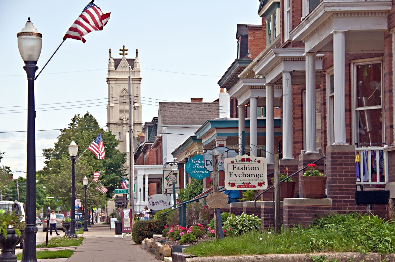
Cathedral Historic District
Monument and historic site · National Register of Historic Places · 2.3 mi
Historic district in Dubuque, Iowa

Charles T. Hancock House
Monument and historic site · National Register of Historic Places · 2.6 mi
Historic house in Iowa, United States

Diamond Jo Boat Store and Office
Monument and historic site · National Register of Historic Places · 1.8 mi
Office building in Dubuque, Iowa

Dubuque City Hall
Monument and historic site · National Register of Historic Places · 2.5 mi
Rathaus in Dubuque, United States of America
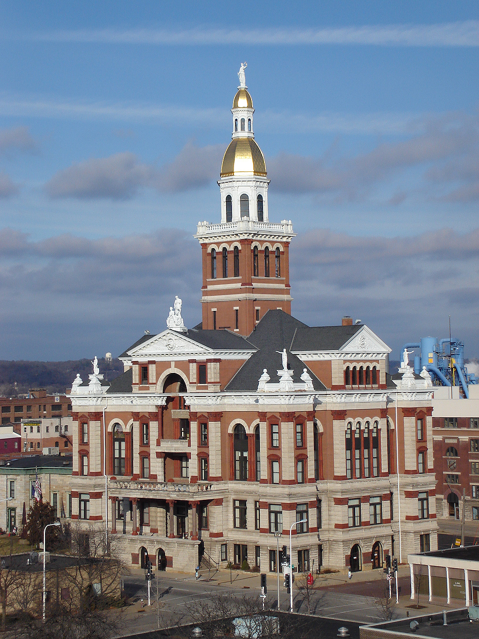
Dubuque County Courthouse
Monument and historic site · National Register of Historic Places · 2.2 mi
County courthouse in Iowa, United States of America
Dubuque County Jail
Monument and historic site · National Register of Historic Places · 2.2 mi
Prison in Iowa, United States of America

Dubuque Freight House
Monument and historic site · National Register of Historic Places · 1.9 mi
Historic building located in Dubuque, Iowa, United States
Dubuque Millworking Historic District
Monument and historic site · National Register of Historic Places · 2.2 mi
Nationally recognized historic district located in Dubuque, Iowa, United States
57 more on the map.
Parks, trails and playgrounds11





Restaurants and cafes10


Jimmy's Pub
Bar and pub · 1.2 mi
32 Sinsinawa Avenue, East Dubuque
Mulgrew's Tavern
Bar and pub · 1.0 mi
240 Sinsinawa Avenue, East Dubuque
R Place
Bar and pub · 1.0 mi
292 Sinsinawa Avenue, East Dubuque
Seldom Scene
Bar and pub · 1.2 mi
23 Sinsinawa Avenue, East Dubuque
Shorty's Saloon
Bar and pub · 1.0 mi
288 Sinsinawa Avenue, East Dubuque
The Golden Pheasant
Bar and pub · 1.0 mi
280 Sinsinawa Avenue, East Dubuque
The Other Side
Bar and pub · 1.2 mi
68 Sinsinawa Avenue, East Dubuque
History
East Dubuque was originally called Dunleith, and under the latter name was platted in 1853. The present name comes from the city's location east of Dubuque. A post office was established at Dunleith in 1854, and the post office was renamed East Dubuque in 1879.
From the History section of East Dubuque, Illinois on Wikipedia, under CC BY-SA 4.0.
Where to stay3
Grand Harbor Resort & Waterpark
Motel and hotel · 1.7 mi
350 Bell Street, Dubuque
Quality Inn East Dubuque
Motel and hotel · 0.4 mi
7787 Timmerman Drive, East Dubuque
Churches and places of worship6
Shopping1
Gas and EV charging1
Schools, colleges and libraries22
Map of East Dubuque
129 places. The map loads OpenStreetMap tiles when you open it.
Climate by month
Monthly table
| Month | High | Low | Rain | Snow |
|---|---|---|---|---|
| Jan | 28°F | 10°F | 1.3 in | 11.7 in |
| Feb | 32°F | 13°F | 1.4 in | 8.6 in |
| Mar | 45°F | 25°F | 2.1 in | 3.7 in |
| Apr | 58°F | 38°F | 3.8 in | 0.9 in |
| May | 71°F | 49°F | 4.4 in | 0.0 in |
| Jun | 81°F | 60°F | 5.6 in | 0.0 in |
| Jul | 84°F | 64°F | 5.3 in | 0.0 in |
| Aug | 82°F | 62°F | 3.8 in | 0.0 in |
| Sep | 75°F | 54°F | 3.9 in | 0.0 in |
| Oct | 61°F | 42°F | 3.1 in | 0.1 in |
| Nov | 46°F | 29°F | 2.4 in | 1.2 in |
| Dec | 33°F | 18°F | 1.7 in | 9.9 in |
U.S. Climate Normals 1991-2020 for Dubuque L&D 11 (4 mi away), NOAA NCEI.
People and cost of living
American Community Survey 5-year estimates, 2020-2024, U.S. Census Bureau. Estimates have margins of error, larger for small towns.
Disaster history
Jo Daviess County has had 7 federal disaster declarations since 2000, most often for biologicals.
- 2020-03-26: Covid-19 Pandemic (Biological)
- 2020-03-13: Covid-19 (Biological)
- 2011-03-17: Severe Winter Storm And Snowstorm (Snowstorm)
- 2010-08-19: Severe Storms And Flooding (Severe Storm)
- 2008-03-13: Record Snow And Near Record Snow (Snowstorm)
- 2005-09-07: Hurricane Katrina Evacuation (Hurricane)
OpenFEMA disaster declarations summaries.
Getting there and nearby towns
Dubuque Regional Airport (DBQ) is the nearest airport with scheduled flights listed in OpenStreetMap, 7 miles away.
- Dubuque 4 mi west, about 7 min by car
- Menominee 4 mi east, about 7 min by car
- Kieler 7 mi north, about 11 min by car
- Asbury 8 mi west, about 13 min by car
- Dickeyville 10 mi north, about 15 min by car
- Hazel Green 10 mi east, about 16 min by car
- Platteville 18 mi northeast, about 30 min by car
- Clinton 49 mi southeast, about 1 h 15 min by car
- Monroe 51 mi east, about 1 h 15 min by car
- Freeport 52 mi east, about 1 h 30 min by car
Drive times are estimates from straight-line distance, not routes.
Local news
Headlines from INDB, the NEMICO news database.
Reviews, tips and questions
Loading what members have shared...
Sources and licences
- NCES EDGE (Public domain): public schools
- NOAA NCEI U.S. Climate Normals 1991-2020 (Public domain): climate by month
- OpenFEMA (Public domain): disaster declarations
- OpenStreetMap contributors (ODbL 1.0): places, airports, map data
- U.S. Census Bureau (Public domain): population, income, housing, education, commute
- Wikidata (CC0 1.0): elevation, founding date, time zone, website, landmarks and historic places
- Wikimedia Commons (see each image): photos
- Wikipedia (CC BY-SA 4.0): overview and history text
Photo credits
- Dubuque City Hall 2016, Farragutful, CC BY-SA 4.0
- The Hancock House, Boscophotos, CC BY-SA 3.0
- Dubuque IA - Public Library, Dirk, CC BY 2.0
- Jackson Park District, Kevin Schuchmann, CC BY-SA 3.0
- The McMahon House, Boscophotos, CC BY-SA 3.0
- Bishop's Block, Clayton B. Fraser, Public domain
- The Old Chapel, Boscophotos, CC BY-SA 3.0
- William m black dredge, Billwhittaker at English Wikipedia, CC BY-SA 3.0
- The Andrew-Ryan House, Boscophotos, CC BY-SA 3.0
- Dubuque IA - 4th street shops, Dirk, CC BY 2.0
- SecurityDubuque, Teemu08 at en.wikipedia, CC BY-SA 3.0
- Interstate Power Company Building, Dubuque, Iowa, Jim Roberts, CC BY-SA 4.0
- Town Clock Building (Dubuque, Iowa), Jim Roberts, CC BY-SA 4.0
- Langworthy House, Jack Boucher, Public domain
- The Johann Christian Frederick Ratn House, Boscophotos, CC BY-SA 3.0
- 565 Fenlon Place, Boscophotos, CC BY-SA 3.0
- Julien Dubuque Bridge 066951pr, The original uploader was Cuppysfriend at English Wikipedia ., Public domain
- Diamond Jo Boat Store and Office - Dubuque Iowa, Ian Poellet, CC BY-SA 3.0
- Mathias Ham House 01, Dirk Hansen, CC BY-SA 3.0
- Red Stone, The original uploader was Kepper66 at English Wikipedia ., Public domain
- The Hollenfelz House, Boscophotos, CC BY-SA 3.0
- Schroeder-Klein-Grocery-Company-Warehouse, kevin schuchmann, CC BY-SA 3.0
- 1603 Washington, Boscophotos, CC BY-SA 3.0
- 1005 Main Street Dubuque, Iowa, Kevin Schuchmann, CC BY-SA 3.0
- Kelley House, Dubuque, Clayton B. Fraser, Public domain
- 206 Clark Drive, Boscophotos, CC BY-SA 3.0
- Grand Opera House 01 Dubuque Iowa, Dirk Hansen, CC BY-SA 3.0
- The John Bell Block, Boscophotos, CC BY-SA 3.0
- DubuqueFreight, Teemu08 at en.wikipedia, CC BY-SA 3.0
- 509 Loras, Boscophotos, CC BY-SA 3.0
- Dubuque County Courthouse, FluffyGryphon at English Wikipedia, CC BY 2.5
- Washington Park Gazebo Dubuque, Dirk Hansen, CC BY-SA 3.0
- 2162-2164 Washington Street, Boscophotos, CC BY-SA 3.0
- St Luke's United Methodist Church, Kevin Schuchmann, CC BY-SA 3.0
- 1045 W. 3rd St, Boscophotos, CC BY-SA 3.0
- The Ziepprecht Block, Boscophotos, CC BY-SA 3.0
- Dubuque IA - 4th Street Elevator, Dirk, CC BY 2.0
- The Schrup House, Boscophotos, CC BY-SA 3.0
- 1101-1103 Iowa Street, Boscophotos, CC BY-SA 3.0
- The Ora Holland House, Boscophotos, CC BY-SA 3.0


Page built October 30, 2026. Spotted a mistake? Tell us or suggest a place.