


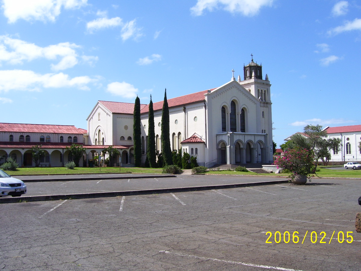
East Honolulu, Hawaii
East Honolulu is a community of 51,360 people in Honolulu County, Hawaii.
Why visit East Honolulu
Townapedia lists 24 museums and landmarks, 55 parks and trails, 63 places to eat, 3 places to stay and 17 attractions in and around town.
Highlights include Makapuu Point Light, Frankie's Nursery, Honolulu Tudor–French Norman Cottages and Jessie Eyman–Wilma Judson House.
September is the warmest month, with average highs of 85°F; January lows average 65°F.
Weather in East Honolulu
Forecast from the National Weather Service. Full forecast
About East Honolulu
East Honolulu is a census-designated place (CDP) in Honolulu County, Hawaii, United States. As of the 2020 census, the CDP had a population of 50,922, making it the 2nd most populated CDP in Hawaii, behind Honolulu.
From the Wikipedia article East Honolulu, Hawaii (this version), under CC BY-SA 4.0.
Things to do17

Makapuu Point Light
Lighthouse · National Register of Historic Places · 4.5 mi
Lighthouse in Hawaii, United States



Chaminade University of Honolulu
School · 5.7 mi
Marianist university in Hawaii, U.S.

Otsuji Farm
Farm and orchard · 1.5 mi
Small produce stand selling vegetables
We 08:00-11:00
5 more on the map.
Museums and landmarks24

Honolulu Tudor–French Norman Cottages
Monument and historic site · National Register of Historic Places · 5.9 mi
Historic houses in Hawaii, United States

Jessie Eyman–Wilma Judson House
Monument and historic site · National Register of Historic Places · 5.8 mi
Historic house in Hawaii, United States

Lemon Wond Holt House
Monument and historic site · National Register of Historic Places · 5.0 mi
Honolulu, Hawaii, listed on the NRHP on Oahu, Hawaii


Tantalus-Round Top Road
Monument and historic site · National Register of Historic Places · 2.6 mi
Road in Oahu, Hawaii

Shangri La Museum
Museum · 5.5 mi
Museum founded by Doris Duke, Islamic-style mansion in Hawaii
12 more on the map.
Parks, trails and playgrounds55

ʻĀina Haina Community Park
Park · 2.7 mi
827 West Hind Drive, Honolulu
00:00-23:45

Hanauma Bay Nature Preserve
Park · 1.6 mi
Nature preserve and marine life conservation district in a volcanic crater bay, southeastern Oahu, Honolulu, Hawaii, United States
Sea Life Park Hawaii
Park · 3.9 mi
Marine mammal park, bird sanctuary and aquarium located in Waimānalo on the island of Oahu, US
Haha`ione Neighborhood Park
Park · 0.7 mi
663 Pepeʻekeo Street, Honolulu
00:00-23:45
Koko Head Neigborhood Park
Park · 1.3 mi
435 Po‘ipū Drive, Honolulu
00:00-23:45
43 more on the map.
Restaurants and cafes63

Hawaiian Island Cafe
Cafe · Hawaiian · 4.1 mi
Honest local Hawaiian food
41-1537 Kalaniana’ole Highway, Waimanalo
Mo-Sa 08:30-16:00

Jack's
Restaurant · American, Hawaiian, Breakfast, Lunch · 2.4 mi
The premier neighborhood breakfast & lunch spot serving the East Honolulu community since 1964.
820 West Hind Drive, Honolulu
Mo-Su 06:00-14:00
TEX 808
Restaurant · Barbecue · 0.8 mi
377 Keahole Street, Honolulu
Mo-Th 11:00-22:00; Fr 11:00-12:00; Sa 10:00-00:00; Su 08:00-21:00
Zippy's
Restaurant · Hawaiian, Japanese, Chinese, American · 1.1 mi
7192 Kalaniana'ole Highway, Honolulu
06:00-22:00

51 more on the map.
Where to stay3
Churches and places of worship11
The Church of Jesus Christ of Latter-day Saints
Church · Latter-Day Saints · 3.5 mi
Shopping11
Gas and EV charging11
Schools, colleges and libraries28
Healthcare4
Liberty Dialysis
Clinic and pharmacy · 1.2 mi
7192 Kalaniana'ole Highway, Honolulu
Map of East Honolulu
227 places. The map loads OpenStreetMap tiles when you open it.
Climate by month
Monthly table
| Month | High | Low | Rain | Snow |
|---|---|---|---|---|
| Jan | 78°F | 65°F | 4.8 in | 0.0 in |
| Feb | 78°F | 65°F | 4.5 in | 0.0 in |
| Mar | 78°F | 67°F | 5.4 in | 0.0 in |
| Apr | 80°F | 69°F | 3.3 in | 0.0 in |
| May | 81°F | 70°F | 2.4 in | 0.0 in |
| Jun | 83°F | 73°F | 1.3 in | 0.0 in |
| Jul | 84°F | 74°F | 1.9 in | 0.0 in |
| Aug | 85°F | 74°F | 2.0 in | 0.0 in |
| Sep | 85°F | 74°F | 2.6 in | 0.0 in |
| Oct | 84°F | 73°F | 3.5 in | 0.0 in |
| Nov | 82°F | 70°F | 5.4 in | 0.0 in |
| Dec | 79°F | 68°F | 5.5 in | 0.0 in |
U.S. Climate Normals 1991-2020 for Waimanalo Exp F 795.1 91184 (3 mi away), NOAA NCEI.
People and cost of living
American Community Survey 5-year estimates, 2020-2024, U.S. Census Bureau. Estimates have margins of error, larger for small towns.
Disaster history
Honolulu County has had 19 federal disaster declarations since 2000, most often for hurricanes.
- 2026-10-07: Hurricane Lala (Hurricane)
- 2026-09-25: Tropical Storm Nolo (Tropical Storm)
- 2026-04-07: Severe Storms, Flooding, Landslides, And Mudslides (Flood)
- 2025-08-19: Kunia Road Fire (Fire)
- 2022-02-15: Severe Storms, Flooding, And Landslides (Severe Storm)
- 2020-07-25: Hurricane Douglas (Hurricane)
OpenFEMA disaster declarations summaries.
Getting there and nearby towns
Kaneohe Bay Marine Corp Air Station (NGF) is the nearest airport with scheduled flights listed in OpenStreetMap, 11 miles away.
- Waimanalo Beach 3 mi northeast, about 5 min by car
- Waimanalo 4 mi north, about 6 min by car
- Maunawili 6 mi northwest, about 10 min by car
- Kailua 8 mi north, about 12 min by car
- Urban Honolulu 9 mi west, about 14 min by car
- Kaneohe 10 mi northwest, about 15 min by car
- Kaneohe Base 11 mi north, about 18 min by car
- Heeia 11 mi northwest, about 18 min by car
- Ahuimanu 13 mi northwest, about 21 min by car
- Halawa 14 mi northwest, about 23 min by car
Drive times are estimates from straight-line distance, not routes.
Local news
Headlines from INDB, the NEMICO news database.
Reviews, tips and questions
Loading what members have shared...
Sources and licences
- NCES EDGE (Public domain): public schools
- NOAA NCEI U.S. Climate Normals 1991-2020 (Public domain): climate by month
- OpenFEMA (Public domain): disaster declarations
- OpenStreetMap contributors (ODbL 1.0): places, airports, map data
- U.S. Census Bureau (Public domain): population, income, housing, education, commute
- Wikidata (CC0 1.0): landmarks and historic places
- Wikimedia Commons (see each image): photos
- Wikipedia (CC BY-SA 4.0): overview and history text
Photo credits
- RoundTopDr-Watershed-Waikiki, Joel Bradshaw, Public domain
- Makapu'u Lighthouse from hiking trail, Kaleismith, CC BY-SA 3.0
- Honolulu-LemonWondHolt-House, Joel Bradshaw, Public domain
- Honolulu-PatyDr3114-frontwide, Joel Bradshaw, Public domain
- Sandybeach blowholeside, Glenn Cando, CC BY-SA 3.0
- Saint Patrick Honolulu Hawaii 001, Aloysius Patacsil at English Wikipedia, CC BY-SA 3.0
- Maunalua Facing Diamond Head, Travis.Thurston, CC BY-SA 3.0
- South Shore Oahu, Hawaii - panoramio (50), davidpinter, CC BY 3.0
- South Shore Oahu, Hawaii - panoramio (47), davidpinter, CC BY 3.0
- Maunalua Facing Koko, Travis.Thurston, CC BY-SA 3.0
- Paiko Lagoon State Wildlife Sanctuary Foot Trail Marker, Jokazoo, CC0
- Paiko Lagoon, Jokazoo, CC0
- Holy Trinity Church interior - Kuliʻouʻou, Hawaii 05, Farragutful, CC BY-SA 4.0
- Holy Trinity Church - Kuliʻouʻou, Hawaii 02, Farragutful, CC BY-SA 4.0
- Holy Trinity Church interior - Kuliʻouʻou, Hawaii 01, Farragutful, CC BY-SA 4.0
- Holy Trinity Church interior - Kuliʻouʻou, Hawaii 02, Farragutful, CC BY-SA 4.0
- Holy Trinity Church interior - Kuliʻouʻou, Hawaii 04, Farragutful, CC BY-SA 4.0
- Holy Trinity Church - Kuliʻouʻou, Hawaii 01, Farragutful, CC BY-SA 4.0
- Holy Trinity Church interior - Kuliʻouʻou, Hawaii 03, Farragutful, CC BY-SA 4.0
- Holy Trinity Church interior - Kuliʻouʻou, Hawaii 06, Farragutful, CC BY-SA 4.0
- Hawaii Kai Marina, Matt Kieffer, CC BY-SA 2.0
- Rosemary - Carole Grogloth Molokai Hawaii - panoramio, Carole Grogloth Molo…, CC BY 3.0
- Red flowers from above (Unsplash), Teo Duldulao teowithacamera, CC0
- Oahu's Southeast Shore - panoramio, Eric Tessmer, CC BY 3.0
- Opening (8700169803), Akos Kokai, CC BY 2.0
- Opened (8701282076), Akos Kokai, CC BY 2.0
- Opened (8701281424), Akos Kokai, CC BY 2.0
- ISS061-E-151404 - View of Earth, Earth Science and Remote Sensing Unit, NASA Johnson Space Center, Public domain
- ISS061-E-151405 - View of Earth, Earth Science and Remote Sensing Unit, NASA Johnson Space Center, Public domain
- ISS014-E-11326 - View of Hawaii, Earth Science and Remote Sensing Unit , Lyndon B. Johnson Space Center, Public domain
- ISS007-E-16820 - View of Hawaii, Earth Science and Remote Sensing Unit , Lyndon B. Johnson Space Center, Public domain
- Hawaii Kai (27292147003), Thomas Woodtli from Zürich, Switzerland, CC BY-SA 2.0
- Koko Crater railway motor, Atomicdragon136, CC BY 4.0
- Araucaria forest (8700169127), Akos Kokai, CC BY 2.0
- Calcinus laevimanus 449956946, Thomas Irvine, CC BY 4.0
- Hanauma Bay Koko Head, Honolulu Hawaii ≡ Eric Tessmer, Molokai, Hawaii - panoramio, Eric Tessmer, CC BY 3.0
- Grevillea robusta (8700168309), Akos Kokai, CC BY 2.0
- Monetaria caputophidii-underside, thomasirvine, CC BY 4.0
- South Shore Oahu, Hawaii - panoramio (55), davidpinter, CC BY 3.0
- South Shore Oahu, Hawaii - panoramio (54), davidpinter, CC BY 3.0


Page built October 30, 2026. Spotted a mistake? Tell us or suggest a place.