


Why visit Halawa
Townapedia lists 38 museums and landmarks, 25 parks and trails, 67 places to eat, 3 places to stay and 3 attractions in and around town.
Highlights include Admiral Clarey Bridge, Consolidated Theatres Pearlridge, Pacific Fleet Submarine Museum and USS Bowfin.
August is the warmest month, with average highs of 89°F; January lows average 67°F.
Weather in Halawa
Forecast from the National Weather Service. Full forecast
About Halawa
Hālawa (Hawaiian pronunciation: [haːˈlɐvə] , lit. 'curve') is a census-designated place (CDP) in the ‘Ewa District of Honolulu County, Hawaii, United States. Hālawa Stream branches into two valleys: North and South Hālawa; North Hālawa is the larger stream and fluvial feature. Their confluence is within the H-3/H-201 highways exchange. Most of Hālawa Valley is undeveloped.
From the Wikipedia article Hālawa, Hawaii (this version), under CC BY-SA 4.0.
Things to do3

Admiral Clarey Bridge
Bridge · 1.7 mi
Bridge connecting Ford Island to mainland Oʻahu on Pearl Harbor in the US state of Hawaii

Museums and landmarks38

Pacific Fleet Submarine Museum
Museum · 1.4 mi
11 Arizona Memorial Drive, Honolulu
Mo-Su 07:00-17:00; Nov Th[4] off; Dec 25 off; Jan 01 off

USS Bowfin
Monument and historic site · National Register of Historic Places · 1.4 mi
1942 Balao-class submarine

Commander in Chief Pacific Fleet Headquarters
Monument and historic site · National Register of Historic Places · 1.4 mi
World war two naval fleet

Naval Station Pearl Harbor
Monument and historic site · National Register of Historic Places · 2.4 mi
Naval base near Honolulu, Hawaii, USA
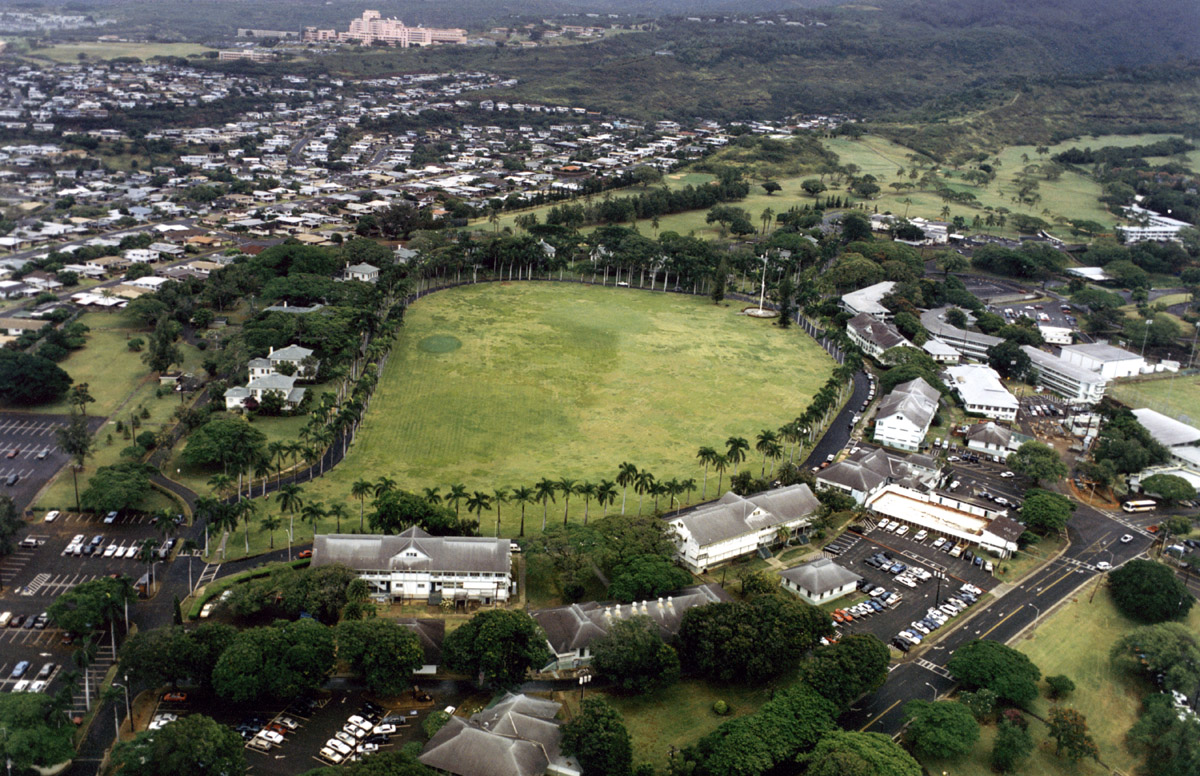
Palm Circle
Monument and historic site · National Register of Historic Places · 2.5 mi
Historic military complex at Fort Shafter, Hawaiʻi, USA
USS Arizona (BB-39)
Monument and historic site · National Register of Historic Places · 2.2 mi
1915 Pennsylvania-class battleship

USS Arizona Memorial
Monument and historic site · National Register of Historic Places · 2.2 mi
Memorial to soldiers killed on the USS Arizona during the attack on Pearl Harbor

USS Missouri
Monument and historic site · National Register of Historic Places · 2.4 mi
1944 Iowa-class battleship

USS Utah
Monument and historic site · National Register of Historic Places · 2.9 mi
1909 Florida-class battleship


Waimalu Shopping Center
Monument and historic site · National Register of Historic Places · 2.1 mi
Shopping mall in Hawaii

26 more on the map.
Parks, trails and playgrounds25

Moanalua Gardens
Park · 2.5 mi
Park in Honolulu, Honolulu County, United States of America

Aloha Stadium
Sports field and stadium · 0.8 mi
99-500 Salt Lake Boulevard, Honolulu


13 more on the map.
Restaurants and cafes67

Big City Diner
Diner · American · 1.4 mi
98-211 Pali Momi Street, Aiea
Mo-Th 10:00-20:00; Fr 10:00-21:00; Sa 08:00-21:00; Su 08:00-20:00

Da Seafood Cartel
Restaurant · Seafood, Mexican · 1.1 mi
98-380 Kamehameha Highway, Aiea
Mo-Su 11:00-19:00
Dixie Grill
Restaurant · Southern · 1.1 mi
99-016 Kamehameha Highway, Aiea
Mo-Su 11:00-21:00; Fr,Sa 11:00-22:00
El Mariachi 2
Restaurant · Mexican · 0.9 mi
99-205 Moanalua Road, Aiea
Tu-Th 11:00-19:30; Fr-Su 11:00-20:00
Gen Korean BBQ
Restaurant · Korean, Barbecue · 1.5 mi
98-1005 Moanalua Road, Aiea
Mo-Su 10:00-22:00; Fr,Sa 10:00-23:00
Pho Time
Restaurant · Vietnamese · 0.9 mi
99-080 Kauhale Street, Aiea
Mo-Sa 10:00-20:30; Su 10:00-20:00

Starbucks
Cafe · Coffee Shop · 0.8 mi
99-115 Aiea Heights Drive, Aiea
Mo-Fr 04:00-20:00; Sa,Su 05:00-20:00

55 more on the map.
Where to stay3
Churches and places of worship17
Shopping14
Gas and EV charging5
Schools, colleges and libraries45
Healthcare8
Aiea Medical Building
Clinic and pharmacy · 0.8 mi
99-128 Aiea Heights Drive, Aiea
Pali Momi Outpatient Center
Clinic and pharmacy · 1.5 mi
98-1005 Moanalua Road, Aiea
Map of Halawa
225 places. The map loads OpenStreetMap tiles when you open it.
Climate by month
Monthly table
| Month | High | Low | Rain |
|---|---|---|---|
| Jan | 80°F | 67°F | 1.8 in |
| Feb | 80°F | 67°F | 1.9 in |
| Mar | 81°F | 68°F | 2.4 in |
| Apr | 83°F | 70°F | 0.8 in |
| May | 85°F | 72°F | 0.8 in |
| Jun | 87°F | 74°F | 0.5 in |
| Jul | 88°F | 75°F | 0.5 in |
| Aug | 89°F | 76°F | 0.8 in |
| Sep | 88°F | 75°F | 0.9 in |
| Oct | 87°F | 74°F | 1.5 in |
| Nov | 84°F | 72°F | 2.2 in |
| Dec | 82°F | 69°F | 2.2 in |
U.S. Climate Normals 1991-2020 for Honolulu Intl Ap 91182 (4 mi away), NOAA NCEI.
People and cost of living
American Community Survey 5-year estimates, 2020-2024, U.S. Census Bureau. Estimates have margins of error, larger for small towns.
Disaster history
Honolulu County has had 19 federal disaster declarations since 2000, most often for hurricanes.
- 2026-10-07: Hurricane Lala (Hurricane)
- 2026-09-25: Tropical Storm Nolo (Tropical Storm)
- 2026-04-07: Severe Storms, Flooding, Landslides, And Mudslides (Flood)
- 2025-08-19: Kunia Road Fire (Fire)
- 2022-02-15: Severe Storms, Flooding, And Landslides (Severe Storm)
- 2020-07-25: Hurricane Douglas (Hurricane)
OpenFEMA disaster declarations summaries.
Getting there and nearby towns
Daniel K. Inouye International Airport (HNL) is the nearest airport with scheduled flights listed in OpenStreetMap, 4 miles away.
- Aiea 1 mi northwest, about 1 min by car
- Waimalu 1 mi northwest, about 2 min by car
- Pearl City 3 mi northwest, about 5 min by car
- Hickam Housing 4 mi southwest, about 6 min by car
- Iroquois Point 5 mi southwest, about 9 min by car
- Urban Honolulu 6 mi southeast, about 9 min by car
- Waipahu 6 mi west, about 10 min by car
- Ewa Beach 7 mi southwest, about 11 min by car
- Ewa Gentry 7 mi west, about 12 min by car
- East Honolulu 14 mi southeast, about 23 min by car
Drive times are estimates from straight-line distance, not routes.
Local news
Headlines from INDB, the NEMICO news database.
Reviews, tips and questions
Loading what members have shared...
Sources and licences
- NCES EDGE (Public domain): public schools
- NOAA NCEI U.S. Climate Normals 1991-2020 (Public domain): climate by month
- OpenFEMA (Public domain): disaster declarations
- OpenStreetMap contributors (ODbL 1.0): places, airports, map data
- U.S. Census Bureau (Public domain): population, income, housing, education, commute
- Wikidata (CC0 1.0): elevation, founding date, time zone, website, landmarks and historic places
- Wikimedia Commons (see each image): photos
- Wikipedia (CC BY-SA 4.0): overview and history text
Photo credits
- USS Bowmin submarine - full view side, Max Smith, Public domain
- Ford Island aerial photo RIMPAC 1986, PH2 Thompson, USN, Public domain
- USS Arizona Memorial (aerial view), DoD photo by: PH3(AW/SW) JAYME PASTORIC, USN, Public domain
- U.S. Naval Base, Pearl Harbor, Makalapa Support Facilities, Makalapa Administration Area, Pearl Harbor (Honolulu, Hawaii), Unknown author, Public domain
- Waimalu Shopping Center, Silverswordsweets, CC BY-SA 4.0
- USS Arizona-1, Robert Enrique Muller, Public domain
- PalmCircle AerialView, Unknown author, Public domain
- Missouri Modernized, Camera Operator: EM2 KENNETH D. MEHL (Released to Public), Public domain
- USSutah2, Unknown author Unknown author, Public domain
- Sjbchuchhnl, Chedlund808, CC BY-SA 4.0
- USSArizona Bridge Bowfin Stadium, Flightsoffancy ( talk ), CC BY-SA 3.0

Page built October 30, 2026. Spotted a mistake? Tell us or suggest a place.