


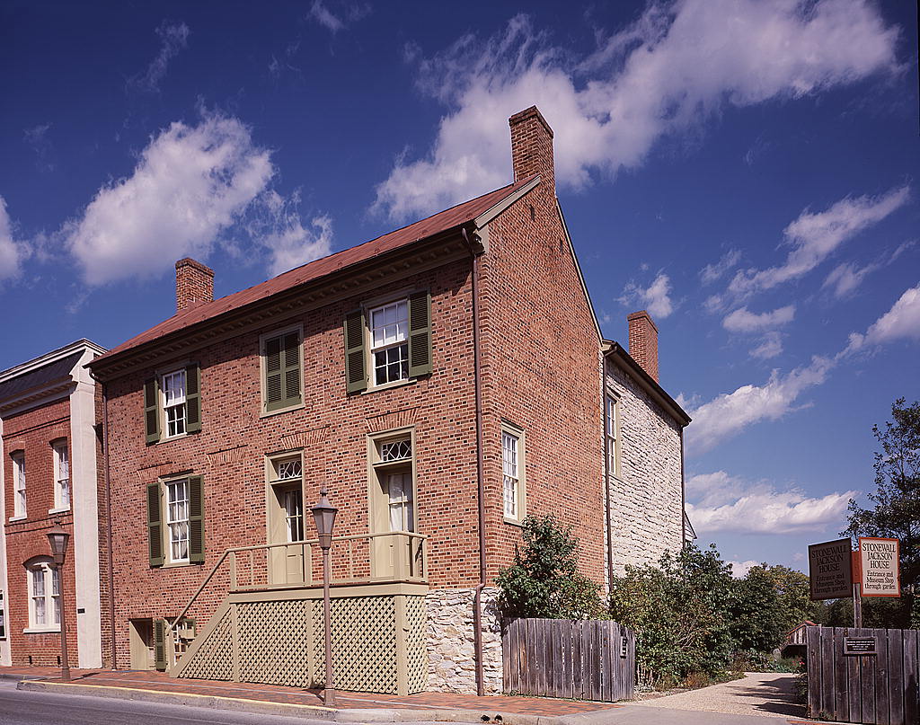


East Lexington, Virginia
East Lexington is a community of 1,652 people in Rockbridge County, Virginia.
Why visit East Lexington
Townapedia lists 43 museums and landmarks, 8 parks and trails, 20 places to eat, 12 places to stay and 3 attractions in and around town.
Highlights include Washington and Lee University, Lexington Historic District, Virginia Military Institute Historic District and Cameron Hall.
July is the warmest month, with average highs of 87°F; January lows average 23°F.
Weather in East Lexington
Forecast from the National Weather Service. Full forecast
About East Lexington
East Lexington is a census-designated place in Rockbridge County, Virginia, United States. As of the 2020 census, East Lexington had a population of 1,824.
From the Wikipedia article East Lexington, Virginia (this version), under CC BY-SA 4.0.
Things to do3

Washington and Lee University
School · 1.8 mi
Private liberal arts university in Lexington, Virginia


Museums and landmarks43

Lexington Historic District
Monument and historic site · National Register of Historic Places · 1.7 mi
Listed on the NRHP in Lexington, Virginia

Virginia Military Institute Historic District
Monument and historic site · National Register of Historic Places · 1.3 mi
Historic district in Lexington, Virginia, USA

Alexander-Withrow House
Monument and historic site · National Register of Historic Places · 1.8 mi
United States historic place

Blandome
Monument and historic site · National Register of Historic Places · 1.7 mi
Historic house in Virginia, United States

Clifton
Monument and historic site · National Register of Historic Places · 0.7 mi
Historic house near Lexington, Virginia, United States

Col Alto
Monument and historic site · National Register of Historic Places · 1.9 mi
Historic building in Lexington, Virginia

Jordan's Point Historic District
Monument and historic site · National Register of Historic Places · 1.0 mi
Historic district in Virginia, United States

Lexington and Covington Turnpike Toll House
Monument and historic site · National Register of Historic Places · 2.3 mi
House in Lexington, United States of America

Lylburn Downing School
Monument and historic site · National Register of Historic Places · 1.1 mi
School building in Lexington, United States of America

Mulberry Hill
Monument and historic site · National Register of Historic Places · 2.0 mi
Building in Virginia, United States

Reid-White-Philbin House
Monument and historic site · National Register of Historic Places · 1.9 mi
Historic house in Virginia, United States


Stone House
Monument and historic site · National Register of Historic Places · 2.9 mi
Historic house in Virginia, United States
31 more on the map.
Parks, trails and playgrounds8


Anderson Coliseum
Sports field and stadium · 0.8 mi
487 Maury River Road, Lexington
Restaurants and cafes20



Sheridan Inn & Restaurant
Restaurant · 1.7 mi
35 North Main Street


Devil's Backbone Outpost Brewery
Bar and pub · 1.3 mi
50 Northwind Lane, Lexington

8 more on the map.
Where to stay12
Churches and places of worship7
First Baptist Church
Church · Baptist · National Register of Historic Places · 1.7 mi
103 North Main Street, Lexington
Lexington Presbyterian Church
Church · National Register of Historic Places · 1.9 mi
Gospel Way Church of God in Christ
Church · Church Of God In Christ · 1.7 mi
109 East Henry Street, Lexington
Shopping5
Gas and EV charging5
Schools, colleges and libraries17
Healthcare4
Virginia Military Institute Health Center
Clinic and pharmacy · 1.1 mi
448 Institute Hill, Lexington
Rockbridge Area Health Center
Clinic and pharmacy · 0.6 mi
25 Northridge Lane, Lexington
Map of East Lexington
124 places. The map loads OpenStreetMap tiles when you open it.
Climate by month
Monthly table
| Month | High | Low | Rain | Snow |
|---|---|---|---|---|
| Jan | 45°F | 23°F | 3.1 in | 2.9 in |
| Feb | 49°F | 25°F | 2.8 in | 4.7 in |
| Mar | 57°F | 31°F | 3.5 in | 2.3 in |
| Apr | 68°F | 40°F | 3.7 in | 0.1 in |
| May | 76°F | 50°F | 4.1 in | 0.0 in |
| Jun | 83°F | 59°F | 4.8 in | 0.0 in |
| Jul | 87°F | 64°F | 4.1 in | 0.0 in |
| Aug | 85°F | 63°F | 3.3 in | 0.0 in |
| Sep | 79°F | 56°F | 3.7 in | 0.0 in |
| Oct | 69°F | 43°F | 3.1 in | 0.0 in |
| Nov | 58°F | 32°F | 3.2 in | 0.1 in |
| Dec | 48°F | 26°F | 3.5 in | 3.4 in |
U.S. Climate Normals 1991-2020 for Lexington Hcn (2 mi away), NOAA NCEI.
People and cost of living
American Community Survey 5-year estimates, 2020-2024, U.S. Census Bureau. Estimates have margins of error, larger for small towns.
Disaster history
Rockbridge County has had 11 federal disaster declarations since 2000, most often for hurricanes.
- 2026-01-23: Severe Winter Storm (Winter Storm)
- 2020-04-02: Covid-19 Pandemic (Biological)
- 2020-03-13: Covid-19 (Biological)
- 2018-09-11: Hurricane Florence (Hurricane)
- 2012-10-29: Hurricane Sandy (Hurricane)
- 2012-07-27: Severe Storms And Straight-Line Winds (Severe Storm)
OpenFEMA disaster declarations summaries.
Getting there and nearby towns
Ingalls Field (HSP) is the nearest airport with scheduled flights listed in OpenStreetMap, 25 miles away.
- Buena Vista 6 mi southeast, about 10 min by car
- Craigsville 20 mi north, about 32 min by car
- Clifton Forge 22 mi west, about 36 min by car
- Amherst 25 mi southeast, about 40 min by car
- Buchanan 25 mi southwest, about 39 min by car
- Stuarts Draft 26 mi northeast, about 41 min by car
- Lynchburg 30 mi southeast, about 49 min by car
- Madison Heights 30 mi southeast, about 48 min by car
- Forest 30 mi south, about 49 min by car
- Staunton 31 mi northeast, about 50 min by car
Drive times are estimates from straight-line distance, not routes.
Local news
Headlines from INDB, the NEMICO news database.
Reviews, tips and questions
Loading what members have shared...
Sources and licences
- NCES EDGE (Public domain): public schools
- NOAA NCEI U.S. Climate Normals 1991-2020 (Public domain): climate by month
- OpenFEMA (Public domain): disaster declarations
- OpenStreetMap contributors (ODbL 1.0): places, airports, map data
- U.S. Census Bureau (Public domain): population, income, housing, education, commute
- Wikidata (CC0 1.0): landmarks and historic places
- Wikimedia Commons (see each image): photos
- Wikipedia (CC BY-SA 4.0): overview and history text
Photo credits
- 2008-0831-VMI-ParadeGround, Bobak Ha'Eri, CC BY 3.0
- Lexington First Baptist Church, Nyttend, Public domain
- North Main Street, Lexington, VA - from Washington Street intersection, Zeete, CC BY-SA 4.0
- Stonewall Jackson House, Carol M. Highsmith, Public domain
- SUNNYSIDE, ROCKBRIDGE COUNTY, VA, Jerrye & Roy Klotz, MD, CC BY-SA 4.0
- Lexington Presbyterian Church, Lexington, VA - view from South Main Street, Zeete, CC BY-SA 4.0
- Reid-White-Philbin House Lexington VA, Unknown author Unknown author, Public domain
- Clifton, Old Buena Vista Road, Nyttend, Public domain
- Willson House, Rockbridge County, Nyttend, Public domain
- Stono House Jordan's Point Lexington Virginia, Carol M. Highsmith, Public domain
- MULBERRY HILL, LEXINGTON CITY, VA, JERRYE & ROY KLOTZ M.D., CC BY-SA 4.0
- 1 W Washington St, Lexington, VA, Cville dog, CC BY-SA 3.0
- Tankersley Tavern from west, Nyttend, Public domain
- Lylburn Downing School, Nyttend, Public domain
- 2008-0831-WashingtonandLeeUniversity, Bobak Ha'Eri, CC BY 3.0
- Lee Chapel, Carol M. Highsmith, Public domain
- Stone House, State Route 687, Lexington vicinity (Rockbridge County, Virginia), Unknown author Unknown author, Public domain
- Miller's house at Jordan Point, Nyttend, Public domain
- Col Alto, Lexington, VA - front view, Zeete, CC BY-SA 4.0
- Lexington and Covington Turnpike Toll House, Stephanie G. RiCharde, CC BY-SA 3.0
- Blandome from the north, Nyttend, Public domain


Page built October 30, 2026. Spotted a mistake? Tell us or suggest a place.