


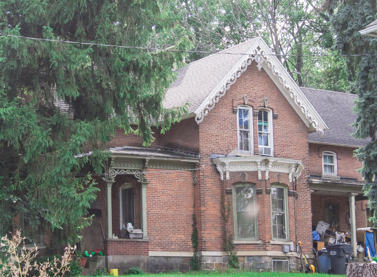

Eastwood, Michigan
Eastwood is a community of 6,669 people in Kalamazoo County, Michigan.
Why visit Eastwood
Townapedia lists 36 museums and landmarks, 14 parks and trails, 16 places to eat and 1 attraction in and around town.
Highlights include State Theatre, Alonzo T. Prentice House, Bronson Park Historic District and Bow in the Clouds Preserve.
July is the warmest month, with average highs of 83°F; January lows average 18°F.
Weather in Eastwood
Forecast from the National Weather Service. Full forecast
About Eastwood
Eastwood is an unincorporated community in Kalamazoo Charter Township, Kalamazoo County in the U.S. state of Michigan. It is a census-designated place (CDP) for statistical purposes and does not have any legal status as an incorporated municipality. As of the 2020 census, Eastwood had a population of 6,366.
From the Wikipedia article Eastwood, Michigan (this version), under CC BY-SA 4.0.
Things to do1

State Theatre
Cinema and theater · National Register of Historic Places · 2.2 mi
Theatre and movie theater in Kalamazoo, Michigan, United States
Museums and landmarks36

Alonzo T. Prentice House
Monument and historic site · National Register of Historic Places · 2.7 mi
House in Kalamazoo, Michigan

Bronson Park Historic District
Monument and historic site · National Register of Historic Places · 2.3 mi
Historic district of Kalamazoo, Michigan, USA
Charles E. Stuart House
Monument and historic site · National Register of Historic Places · 2.8 mi
Michigan's second U.S. Senator Charles Stuart home, historic

David Lilienfeld House
Monument and historic site · National Register of Historic Places · 2.4 mi
House in Kalamazoo, Michigan

Desenberg Building
Monument and historic site · National Register of Historic Places · 2.0 mi
Commercial building in Michigan

East Campus
Monument and historic site · National Register of Historic Places · 2.9 mi
Site of the original campus of Western Michigan University

Engine House No. 3
Monument and historic site · National Register of Historic Places · 1.1 mi
Historic firehouse in Kalamazoo, Michigan, USA
Enoch Shaffer House
Monument and historic site · National Register of Historic Places · 3.0 mi
Single-family home located at 1437 Douglas Avenue in Kalamazoo, Michigan

Gibson, Inc. Factory and Office Building
Monument and historic site · National Register of Historic Places · 1.9 mi
Industrial building

Haymarket Historic District
Monument and historic site · National Register of Historic Places · 1.9 mi
Historic district in Kalamazoo, Michigan, USA

Henderson Park-West Main Hill Historic District
Monument and historic site · National Register of Historic Places · 3.2 mi
Historic district in Kalamazoo, Michigan


Henry Gilbert House
Monument and historic site · National Register of Historic Places · 2.4 mi
Single-family home located at 415 West Lovell in Kalamazoo, Michigan
24 more on the map.
Parks, trails and playgrounds14



2 more on the map.
Restaurants and cafes16


Julianna's Restaurant
Restaurant · 1.6 mi
2105 Lake Street, Kalamazoo
Su 08:00-14:00; Mo-Fr 07:00-14:00; Sa 07:00-13:00
4 more on the map.
Churches and places of worship2
Shopping4
Gas and EV charging4
Schools, colleges and libraries48
Healthcare1
Map of Eastwood
126 places. The map loads OpenStreetMap tiles when you open it.
Climate by month
Monthly table
| Month | High | Low | Rain |
|---|---|---|---|
| Jan | 32°F | 18°F | 1.7 in |
| Feb | 35°F | 20°F | 1.3 in |
| Mar | 46°F | 27°F | 2.0 in |
| Apr | 59°F | 38°F | 3.1 in |
| May | 70°F | 49°F | 3.7 in |
| Jun | 80°F | 58°F | 3.2 in |
| Jul | 83°F | 62°F | 3.4 in |
| Aug | 81°F | 60°F | 3.7 in |
| Sep | 74°F | 52°F | 3.3 in |
| Oct | 61°F | 42°F | 3.7 in |
| Nov | 48°F | 32°F | 2.5 in |
| Dec | 36°F | 24°F | 1.7 in |
U.S. Climate Normals 1991-2020 for Kalamazoo Battle Ck Intl Ap (5 mi away), NOAA NCEI.
People and cost of living
American Community Survey 5-year estimates, 2020-2024, U.S. Census Bureau. Estimates have margins of error, larger for small towns.
Disaster history
Kalamazoo County has had 6 federal disaster declarations since 2000, most often for biologicals.
- 2026-06-30: Severe Storms, Tornadoes, And Flooding (Flood)
- 2020-03-27: Covid-19 Pandemic (Biological)
- 2020-03-13: Covid-19 (Biological)
- 2005-09-07: Hurricane Katrina Evacuation (Hurricane)
- 2003-09-23: Power Outage (Other)
- 2001-01-10: Snow (Snowstorm)
OpenFEMA disaster declarations summaries.
Getting there and nearby towns
Kalamazoo-Battle Creek International Airport (AZO) is the nearest airport with scheduled flights listed in OpenStreetMap, 5 miles away.
- Comstock Northwest 2 mi northeast, about 3 min by car
- Parchment 2 mi northwest, about 3 min by car
- Kalamazoo 3 mi southwest, about 5 min by car
- Galesburg 7 mi east, about 11 min by car
- Richland 7 mi northeast, about 10 min by car
- Portage 8 mi south, about 12 min by car
- South Gull Lake 9 mi northeast, about 15 min by car
- Plainwell 11 mi northwest, about 18 min by car
- Vicksburg 12 mi south, about 20 min by car
- Otsego 13 mi northwest, about 21 min by car
Drive times are estimates from straight-line distance, not routes.
Local news
Headlines from INDB, the NEMICO news database.
Reviews, tips and questions
Loading what members have shared...
Sources and licences
- NCES EDGE (Public domain): public schools
- NOAA NCEI U.S. Climate Normals 1991-2020 (Public domain): climate by month
- OpenFEMA (Public domain): disaster declarations
- OpenStreetMap contributors (ODbL 1.0): places, airports, map data
- U.S. Census Bureau (Public domain): population, income, housing, education, commute
- Wikidata (CC0 1.0): elevation, founding date, time zone, website, landmarks and historic places
- Wikimedia Commons (see each image): photos
- Wikipedia (CC BY-SA 4.0): overview and history text
Photo credits
- PeterBAppledornHouseKalamazooMI, Andrew Jameson, CC BY-SA 3.0
- Stuart House, rossograph, CC BY-SA 4.0
- MartinWRobertsHouseKalamazooMI, Andrew Jameson, CC BY-SA 3.0
- State Hospital Gatehouse, rossograph, CC BY-SA 4.0
- Enoch Shaffer House, rossograph, CC BY-SA 4.0
- State Theatre, Gpwitteveen, CC BY-SA 3.0
- Haymarket Historic District, rossograph, CC BY-SA 4.0
- Old Fire House No.4, rossograph, CC BY-SA 4.0
- The Desenberg Building, Jim Roberts, CC BY-SA 4.0
- The Henderson Castle at 100 Monroe St, Jim Roberts, CC BY-SA 4.0
- HenryGilbertHouseKalamazooMI, Andrew Jameson, CC BY-SA 3.0
- The Alonzo T. prentice House, Jim Roberts, CC BY-SA 4.0
- VineAreaHistoricDistrictBKalamazooMI, Andrew Jameson, CC BY-SA 3.0
- Masonic Temple-Kalamazoo, rossograph, CC BY-SA 4.0
- The Portage Street Fire Station, Jim Roberts, CC BY-SA 4.0
- DavidLilienfeldHouseKalamazooMI, Andrew Jameson, CC BY-SA 3.0
- Rickman Hotel, rossograph, CC BY-SA 4.0
- Michigan Central Depot-Kalamazoo, rossograph, CC BY-SA 4.0
- Henry Montague House, rossograph, CC BY-SA 4.0
- Old Kalamazoo Central Highschool (14341458587), Kalamazoo Public Library, No restrictions
- SouthStreetHistoricDistrictBKalamazooMI, Andrew Jameson, CC BY-SA 3.0
- Gibson office, Unknown author Unknown author, Public domain
- LadiesLibraryAssociationBuildingKalamazooMI, Andrew Jameson, CC BY-SA 3.0
- Kalamazoo State Hospital Water Tower, TwoBitSwivel, CC BY-SA 3.0
- Engine House No.3, rossograph, CC BY-SA 4.0
- Illinois Envelope Building, rossograph, CC BY-SA 4.0
- TheMarlboroughKalamazooMI, Andrew Jameson, CC BY-SA 3.0
- Lawrence and Chapin Buildiing, rossograph, CC BY-SA 4.0
- Western Michigan University East Hall, Fbthpg, CC0
- IsaacBrownHouseKalamazooMI, Andrew Jameson, CC BY-SA 3.0
- The Fountain of the Pioneers, Jim Roberts, CC BY-SA 4.0
- WIlliamLWelshTerraceKalamazooMI, Andrew Jameson, CC BY-SA 3.0
- RosePlaceHistoricDistrictKalamazooMI, Andrew Jameson, CC BY-SA 3.0
- US Post Office-Kalamazoo, rossograph, CC BY-SA 4.0
- KIArts-Aug-2012, 72elyod, CC BY-SA 3.0
- St. Augustine Cathedral-Kalamazoo (cropped), rossograph, CC BY-SA 4.0
- Kalamazoo Valley Museum, Cody Hough, CC BY-SA 3.0
- Ascension Borgess Hospital, Kalamazoo, United States, Imzadi1979, CC BY-SA 4.0
- Borgess Hospital entrance, MSwierenga, CC0
- Borgess Hospital, MSwierenga, CC0


Page built October 30, 2026. Spotted a mistake? Tell us or suggest a place.