


Why visit Aţ Ţārif
Townapedia lists 91 museums and landmarks, 11 parks and trails, 5 places to eat and 3 places to stay in and around town.
Highlights include Colossi of Memnon and Deir el-Medina.
Weather in Aţ Ţārif
Forecast from MET Norway (CC BY 4.0). Full forecast
About Aţ Ţārif
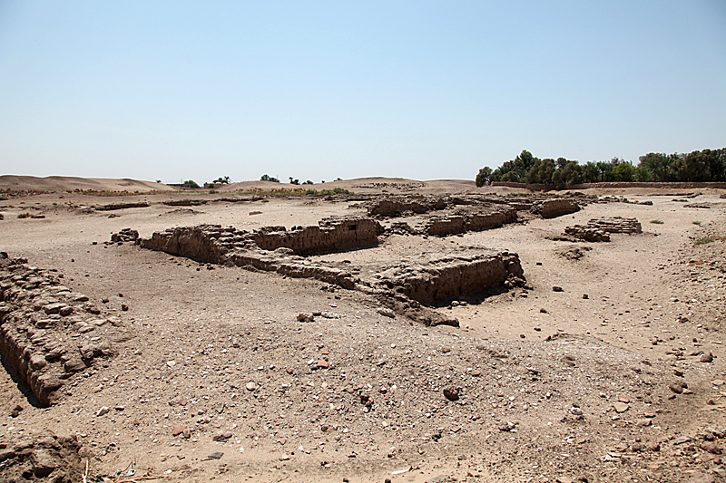
El-Tarif (Arabic: إلطارف aṭ-Ṭārif) is a necropolis on the West Bank of the Nile, at the site of ancient Thebes (Luxor), Egypt. It is located in the northwestern outskirts of Luxor and southeast of the Valley of the Kings, opposite Karnak, just to the southwest of the modern village of At-Tarif. It is the oldest of West Thebes' necropolises. It is a small mortuary temple, and the farthest north of the Tombs of the Nobles, and contains tombs of the late First Intermediate Period, Second Intermediate Period and early Middle Kingdom.
From the Wikipedia article El-Tarif (this version), under CC BY-SA 4.0.
Museums and landmarks91

Colossi of Memnon
Monument and historic site · 3.3 km
Ancient Egyptian statues

Deir el-Medina
Monument and historic site · 3.7 km
Ancient Egyptian village in the Valley of the Kings

El-Assasif
Monument and historic site · 2.5 km
Ancient necropolis in Egypt

Malkata
Monument and historic site · 5.2 km
Archaeological site of Egypt

Medinet Habu
Monument and historic site · 4.1 km
Archaeological locality situated near the foot of the Theban Hills on the West Bank of the River Nile opposite the modern city of Luxor, Egypt

Mortuary Temple of Amenhotep III
Monument and historic site · 3.4 km
Temple of Egyptian pharaoh Amenhotep III

Mortuary Temple of Merenptah
Monument and historic site · 3.4 km
Archaeological site in Egypt, at the Luxor West bank

Mortuary Temple of Ramesses III
Monument and historic site · 4.2 km
Mortuary temple of Ramses III in Egypt

Qurnet Murai
Monument and historic site · 3.6 km
Settlement and archaeological site at the Luxor West Bank


QV44
Monument and historic site · 4.6 km
Ancient Egyptian tomb in the Valley of the Queens
79 more on the map.
Parks, trails and playgrounds11

Restaurants and cafes5



Where to stay3

Churches and places of worship1
Gas and EV charging1
Healthcare1
Map of Aţ Ţārif
113 places. The map loads OpenStreetMap tiles when you open it.
Getting there and nearby towns
Luxor International Airport (LXR) is the nearest airport with scheduled flights listed in OpenStreetMap, 10 km away.
- Luxor 4 km south, about 4 min by car
- Az Zaynīyah Qiblī 4 km east, about 4 min by car
- Al Bayāḑīyah 8 km south, about 8 min by car
- Armant 16 km southwest, about 16 min by car
- Jarājūs 19 km northeast, about 19 min by car
- Naqādah 20 km northeast, about 20 min by car
- Ţūd 20 km southwest, about 20 min by car
- Qūş 23 km northeast, about 23 min by car
- Qifţ 34 km northeast, about 34 min by car
- Qina 48 km north, about 48 min by car
Drive times are estimates from straight-line distance, not routes.
Local news
Headlines from INDB.
Reviews, tips and questions
Loading what members have shared...
Sources and licences
- GeoNames (CC BY 4.0): population, coordinates, regions and time zone
- OpenStreetMap contributors (ODbL 1.0): places, airports, map data
- Wikidata (CC0 1.0): elevation, founding date, time zone, website, landmarks and historic places
- Wikimedia Commons (see each image): photos
- Wikipedia (CC BY-SA 4.0): overview and history text
Photo credits
- Colossi of Memnon May 2015 2, MusikAnimal, CC BY-SA 4.0
- Deir el-Medina, Luxor, Egipto, 2022-04-03, DD 18, Diego Delso, CC BY-SA 4.0
- View down into the valley of the kings at Luxor - panoramio, Merlin UK, CC BY-SA 3.0
- KV55 sarcophagus (Cairo Museum), Hans Ollermann, CC BY 2.0
- Ägypten 1999 (402) Theben West Tal der Könige, Rüdiger Stehn, CC BY-SA 2.0
- MalqataSite2, Roland Unger, CC BY-SA 3.0
- ThebesMadinatHabuAerial, Roland Unger, CC BY-SA 3.0
- Amenhotep III mortuary Temple, en:User:Markh, Public domain
- Egypt.MedinetHabu.01, Unknown author, CC BY-SA 3.0
- QurnatMuraiVillage, Roland Unger, CC BY-SA 3.0
- Schiaparelli's excavations - Theban region, Valley of the Queens, QV 44, Tomb of Khaemwaset, 1903, Unknown author, CC0
- Schiaparelli's excavations - Theban region, Valley of the Queens, Coptic monastery of Deir Rumi, 1903-1906, Unknown author, CC0
- Maison Carter - Louxor (EG) - 2025-12-12 - 31, Chabe01, CC BY-SA 4.0
- Maison Carter - Louxor (EG) - 2025-12-12 - 30, Chabe01, CC BY-SA 4.0
- Maison Carter - Louxor (EG) - 2025-12-12 - 34, Chabe01, CC BY-SA 4.0
- Maison Carter - Louxor (EG) - 2025-12-12 - 33, Chabe01, CC BY-SA 4.0
- Maison Carter - Louxor (EG) - 2025-12-12 - 33 (cropped), Chabe01, CC BY-SA 4.0
- Maison Carter - Louxor (EG) - 2025-12-12 - 32, Chabe01, CC BY-SA 4.0
- Maison Carter - Louxor (EG) - 2025-12-12 - 35, Chabe01, CC BY-SA 4.0
- Maison Carter - Louxor (EG) - 2025-12-12 - 36, Chabe01, CC BY-SA 4.0
- Maison Carter - Louxor (EG) - 2025-12-12 - 102, Chabe01, CC BY-SA 4.0
- Maison Carter - Louxor (EG) - 2025-12-12 - 54, Chabe01, CC BY-SA 4.0
- Maison Carter - Louxor (EG) - 2025-12-12 - 52, Chabe01, CC BY-SA 4.0
- Maison Carter - Louxor (EG) - 2025-12-12 - 53, Chabe01, CC BY-SA 4.0
- Maison Carter - Louxor (EG) - 2025-12-12 - 38, Chabe01, CC BY-SA 4.0
- Maison Carter - Louxor (EG) - 2025-12-12 - 37, Chabe01, CC BY-SA 4.0
- Maison Carter - Louxor (EG) - 2025-12-12 - 50, Chabe01, CC BY-SA 4.0
- Maison Carter - Louxor (EG) - 2025-12-12 - 51, Chabe01, CC BY-SA 4.0
- Maison Carter - Louxor (EG) - 2025-12-12 - 49, Chabe01, CC BY-SA 4.0
- Maison Carter - Louxor (EG) - 2025-12-12 - 107, Chabe01, CC BY-SA 4.0
- Maison Carter - Louxor (EG) - 2025-12-12 - 39, Chabe01, CC BY-SA 4.0
- Maison Carter - Louxor (EG) - 2025-12-12 - 40, Chabe01, CC BY-SA 4.0
- Maison Carter - Louxor (EG) - 2025-12-12 - 41, Chabe01, CC BY-SA 4.0
- Maison Carter - Louxor (EG) - 2025-12-12 - 97, Chabe01, CC BY-SA 4.0
- Maison Carter - Louxor (EG) - 2025-12-12 - 43, Chabe01, CC BY-SA 4.0
- Maison Carter - Louxor (EG) - 2025-12-12 - 42, Chabe01, CC BY-SA 4.0
- Maison Carter - Louxor (EG) - 2025-12-12 - 108, Chabe01, CC BY-SA 4.0
- Maison Carter - Louxor (EG) - 2025-12-12 - 96, Chabe01, CC BY-SA 4.0
- Masaken Al Zelzal Road - Louxor (EG) - 2025-12-12 - 1, Chabe01, CC BY-SA 4.0
- Maison Carter - Louxor (EG) - 2025-12-12 - 109, Chabe01, CC BY-SA 4.0


Page built November 7, 2026. Spotted a mistake? Tell us or suggest a place.