


Ismailia, Egypt
الإسماعيلية
Ismailia is a regional capital of 429,465 people in Ismailia, Egypt.
Why visit Ismailia
Townapedia lists 5 museums and landmarks, 4 parks and trails, 11 places to eat, 4 places to stay and 1 attraction in and around town.
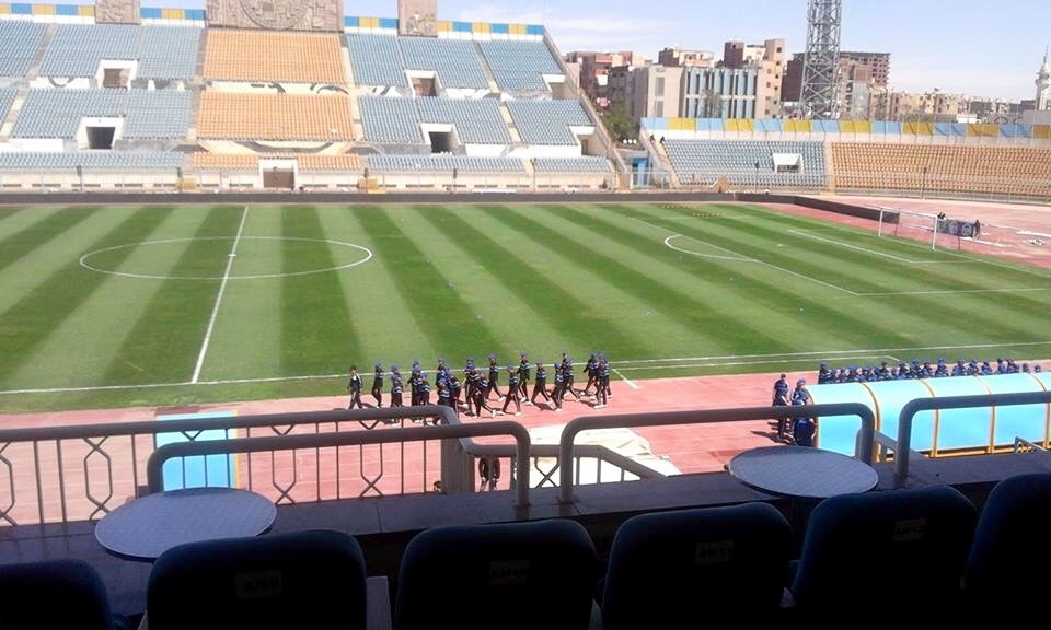
Highlights include El Ferdan Railway Bridge, Fort Lakekan (Bar-Lev Line), Ismailia Stadium and Suez Canal Authority Stadium.
Weather in Ismailia
Forecast from MET Norway (CC BY 4.0). Full forecast
About Ismailia
Ismailia (Egyptian Arabic: الإسماعيلية el-Ismāʻīlīyah, Egyptian Arabic: [lesmæʕiˈlejjæ]) is a city in north-eastern Egypt. The city is located near the midpoint of the Suez Canal, on the Northwestern shore of Lake Al-Timsah. It is the capital of the Ismailia Governorate. It is located approximately halfway between Port Said to the north and Suez to the south.
From the Wikipedia article Ismailia (this version), under CC BY-SA 4.0.
Travel tips from other travellers: Ismailia on Wikivoyage (CC BY-SA 4.0).
Things to do1

Museums and landmarks5



Parks, trails and playgrounds4




Restaurants and cafes11

Spark Restaurant
Restaurant · Pizza, Burger, Pasta · 1.5 km
الطريق السريع امام الذاعة والتفزيون, ismailia
13:00-01:30



Buffalo Burger - Ismailia
Fast food · Burger
طعم البرجر الأمريكي الأصلي بمكونات فاخرة ولمسة مصرية ملهاش حل بنقدملك ألذ برجر، فرايد تشيكن، مشويات، وتشكيلة واسعة ومتنوعة من...
شارع شبين الكوم, الأسماعلية
Mo-Su 11:00-03:00
History
Ismailia was founded in 1863, during the construction of the Suez Canal, by Khedive Ismail, after whom the city is named. Following the Battle of Kafr-el-Dawwar in 1882 the British established a base there.
The head office of the Suez Canal Authority is located in Ismailia at the shore of Lake Timsah. It has a large number of buildings dating from British and French involvement with the Canal. Most of these buildings are currently used by Canal employees and officials.
During World War I the British had an air base there and the Battle of Romani took place nearby. Ismailia War Cemetery was designed in 1919 by Sir Robert Lorimer marking the casualties of the battle.
In 1973, the Battle of Ismailia took place in the city between the Egyptian Armed Forces and the Israel Defense Forces. The battle resulted in the Egyptians successfully defending the city from the Israelis.
In October 2023, a massive fire broke out in the security directorate of the city, leaving the building fully burned with 38 injured and 1 dead.
From the History section of Ismailia on Wikipedia, under CC BY-SA 4.0.
Where to stay4
Churches and places of worship14
Shopping4
Schools, colleges and libraries7
Healthcare7
Map of Ismailia
57 places. The map loads OpenStreetMap tiles when you open it.
Getting there and nearby towns
Capital International Airport (CCE) is the nearest airport with scheduled flights listed in OpenStreetMap, 74 km away.
- Abu Suweir-el-Mahatta 16 km west, about 16 min by car
- Al Qanţarah 28 km north, about 28 min by car
- Aş Şāliḩīyah al Jadīdah 32 km west, about 32 min by car
- Al ‘Āshir min Ramaḑān 61 km southwest, about 1 h by car
- Būr Fu’ād 71 km north, about 1 h 15 min by car
- Port Said 74 km north, about 1 h 15 min by car
- Suez 74 km south, about 1 h 15 min by car
- Zagazig 74 km west, about 1 h 15 min by car
- Badr 75 km southwest, about 1 h 15 min by car
- Al-'Ubūr 87 km southwest, about 1 h 30 min by car
Drive times are estimates from straight-line distance, not routes.
Local news
Headlines from INDB.
Reviews, tips and questions
Loading what members have shared...
Sources and licences
- GeoNames (CC BY 4.0): population, coordinates, regions and time zone
- OpenStreetMap contributors (ODbL 1.0): places, airports, map data
- Wikidata (CC0 1.0): elevation, founding date, time zone, website, landmarks and historic places
- Wikimedia Commons (see each image): photos
- Wikipedia (CC BY-SA 4.0): overview and history text
Photo credits
- EG-suez-13-bg-ismailia, Balou46, CC BY-SA 4.0
- DelsolPierreIsmailia1942, Unknown author Unknown author, Public domain
- Flickr - casillero - Ismailia, De Lesseps’ Statue, Terry Cliss from Frome, Somerset, United Kingdom, CC BY-SA 2.0
- May 1942 - Beautiful French Gardens, Ismailia, Egypt - real photo card (circa 1930s) (37229354742), aussiejeff from Perth, WA, Australia, CC BY-SA 2.0
- May 1942 - Sweetwater Canal & beautiful French Gardens in Ismailia, Egypt - real photo card - circa 1930s (37245690042), aussiejeff from Perth, WA, Australia, CC BY-SA 2.0
- May 1942 - Avenue De Lesseps in magnificent French Gardens, Ismailia, Egypt - real photo card (circa 1930s) (37395889025), aussiejeff from Perth, WA, Australia, CC BY-SA 2.0
- May 1942 - Entrance to magnificent stands of trees in the French Gardens, Ismailia, Egypt - real photo card - circa 1930s (36587131633), aussiejeff from Perth, WA, Australia, CC BY-SA 2.0
- Suez canal , Ismailia, Manar hesham mostafa, CC BY-SA 4.0
- Ismailia (27309764445), Ahmed Helal from Ismailia, Egypt, CC BY 2.0
- Ismailia (27212818942), Ahmed Helal from Ismailia, Egypt, CC BY 2.0
- Ismailia, Egypt, The Egy King, CC BY-SA 4.0
- Ismailia, Egypt banner, The Egy King, CC BY-SA 4.0
- Villa Dr Ahmed Hegazi,Egypt,Ismailia,Al-Osra - panoramio, Dr.ahmed, CC BY 3.0
- El Ferdan Railway Bridge, H Nawara, Public domain
- Bar Lev line with prisoners, Unknown author, Public domain
- Ismailia Stadium, Jefferestiw, CC BY-SA 4.0
- Suez Canal Stadium, Ten Tv youtube channel, CC BY 3.0
- مسجد ابو بكر الصديق - الاسماعيلية, Basem.Eldoksh, CC BY-SA 4.0
- Hussien 1112, Hussien1112, CC BY-SA 4.0
- Two captured Turkish boats, Ismalia, Egypt - WW1 (19716208585), Aussie~mobs, Public domain
- Right on time - Flickr - Ranoush., rana ossama from ismailyah, Egypt, CC BY-SA 2.0
- محمود معتز فاروق, محمود معتز, CC BY-SA 4.0
- Silver Clouds and Lake, SallyR1976, CC BY-SA 4.0
- ISS065-E-7577 - View of Earth, Earth Science and Remote Sensing Unit , Lyndon B. Johnson Space Center, Public domain
- ISS042-E-34501 - View of Earth, Earth Science and Remote Sensing Unit , Lyndon B. Johnson Space Center, Public domain
- ISS044-E-54819 - View of Earth, Earth Science and Remote Sensing Unit , Lyndon B. Johnson Space Center, Public domain
- ISS045-E-73901 - View of Earth, Earth Science and Remote Sensing Unit , Lyndon B. Johnson Space Center, Public domain
- ISS044-E-52794 - View of Earth, Earth Science and Remote Sensing Unit , Lyndon B. Johnson Space Center, Public domain
- ISS067-E-77726 - View of Earth, Earth Science and Remote Sensing Unit , Lyndon B. Johnson Space Center, Public domain
- ISS044-E-103288 - View of Earth, Earth Science and Remote Sensing Unit , Lyndon B. Johnson Space Center, Public domain
- ISS065-E-7576 - View of Earth, Earth Science and Remote Sensing Unit , Lyndon B. Johnson Space Center, Public domain
- ISS044-E-54820 - View of Earth, Earth Science and Remote Sensing Unit , Lyndon B. Johnson Space Center, Public domain
- ISS045-E-73903 - View of Earth, Earth Science and Remote Sensing Unit , Lyndon B. Johnson Space Center, Public domain
- ISS045-E-73902 - View of Earth, Earth Science and Remote Sensing Unit , Lyndon B. Johnson Space Center, Public domain
- ISS044-E-52795 - View of Earth, Earth Science and Remote Sensing Unit , Lyndon B. Johnson Space Center, Public domain
- ISS006-E-34519 - View of Egypt, Earth Science and Remote Sensing Unit , Lyndon B. Johnson Space Center, Public domain
- Peace on the Lake, SallyR1976, CC BY-SA 4.0
- Aircraft of the Royal Air Force 1939-1945- Westland Lysander. CM5, Royal Air Force official photographer, Public domain
- Egypt (27034718010), Ahmed Helal from Ismailia, Egypt, CC BY 2.0
- Trip to Egypt 1988 73, Nicola, CC BY-SA 4.0


Page built November 7, 2026. Spotted a mistake? Tell us or suggest a place.