


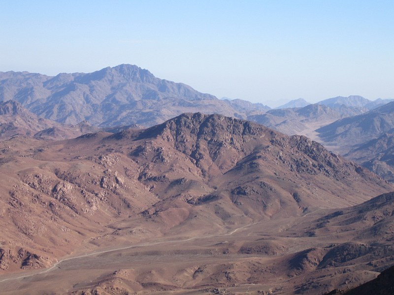

Saint Catherine, Egypt
مدينة سانت كاترين
Saint Catherine is a town of 4,603 people in South Sinai, Egypt.
Why visit Saint Catherine
Townapedia lists 10 museums and landmarks, 3 parks and trails, 2 places to eat, 9 places to stay and 8 attractions in and around town.
Highlights include Abu Madi and Saint Katherine Protectorate.
Weather in Saint Catherine
Forecast from MET Norway (CC BY 4.0). Full forecast
About Saint Catherine
Saint Catherine (Egyptian Arabic: سانت كاترين, pronounced [ˈsænte kætˈɾiːn]; also spelled Saint Katrine) is a town located in the South Sinai Governorate of Egypt, situated at the foot of Mount Sinai. The city is the site of Saint Catherine's Monastery.
From the Wikipedia article Saint Catherine, Egypt (this version), under CC BY-SA 4.0.
Things to do8


Museums and landmarks10

Abu Madi
Monument and historic site · 2.7 km
Archaeological site in Egypt

Parks, trails and playgrounds3
Saint Katherine Protectorate
Park · 2.1 km
Egyptian national park in the south of Sinai

Hiking in Sinai trails
Hiking and trails · 0.8 km
1 Saint Catherine city, Saint Catherine city

Restaurants and cafes2

History
During Egypt’s Pharaonic Era (3200-323 BCE), although Saint Catherine was not yet established as a city, the area was part of the Egyptian Empire in the province of "Deshret Reithu."
In the 16th century BCE, the Egyptian pharaohs built the way of Shur across Sinai to Beersheba and on to Jerusalem. The region provided the Egyptian Empire with turquoise, gold, and copper. Well-preserved ruins of mines and temples are found not far from Saint Catherine at Serabit el-Khadim and Wadi Mukattab, the Valley of Inscription. They include temples from the 12th Dynasty, dedicated to Hathor, goddess of love, music, and beauty, and from the New Kingdom dedicated to Sopdu, the god of the Eastern Desert.
Saint Catherine’s City was established between 527 and 565 CE, when Saint Catherine's Monastery was constructed at the foot of Mount Sinai by the order of Emperor Justinian.
From the History section of Saint Catherine, Egypt on Wikipedia, under CC BY-SA 4.0.
Where to stay9
Churches and places of worship2
Gas and EV charging1
Healthcare1
Map of Saint Catherine
36 places. The map loads OpenStreetMap tiles when you open it.
Getting there and nearby towns
Saint Catherine International Airport (SKV) is the nearest airport with scheduled flights listed in OpenStreetMap, 18 km away.
- El-Tor 48 km southwest, about 48 min by car
- Dahab 54 km east, about 54 min by car
- Sharm el-Sheikh 81 km southeast, about 1 h 15 min by car
- Ras Gharib 88 km west, about 1 h 30 min by car
- Nuwaybi‘a 88 km northeast, about 1 h 30 min by car
Drive times are estimates from straight-line distance, not routes.
Local news
Headlines from INDB.
Reviews, tips and questions
Loading what members have shared...
Sources and licences
- GeoNames (CC BY 4.0): population, coordinates, regions and time zone
- OpenStreetMap contributors (ODbL 1.0): places, airports, map data
- Wikidata (CC0 1.0): elevation, founding date, time zone, website, landmarks and historic places
- Wikimedia Commons (see each image): photos
- Wikipedia (CC BY-SA 4.0): overview and history text
Photo credits
- Snow in St. Katherine, Sinai Egypt - March 1, 2009, Zoltan Matrahazi, CC BY-SA 4.0
- MountSinaiView, Unknown author, CC BY-SA 1.0
Page built November 7, 2026. Spotted a mistake? Tell us or suggest a place.