


Why visit Sohag
Townapedia lists 9 museums and landmarks, 1 park or trail, 8 places to eat and 11 places to stay in and around town.
Highlights include Akhmim, Idfa and Sohag Stadium.
Weather in Sohag
Forecast from MET Norway (CC BY 4.0). Full forecast
About Sohag
Sohag (Arabic: سوهاج, romanized: Sawhāj, Egyptian Arabic pronunciation: [soˈhæːɡ], Sa'idi Arabic pronunciation: [suːˈhaːdʒ]), also spelled as Suhag or Suhaj, is a city on the west bank of the Nile in Egypt. It has been the capital of Sohag Governorate since 1960, before which the capital was Girga and the name of the governorate was Girga Governorate. It also included Esna Governorate (nowadays Qena Governorate).
From the Wikipedia article Sohag (this version), under CC BY-SA 4.0.
Travel tips from other travellers: Sohag on Wikivoyage (CC BY-SA 4.0).
Museums and landmarks9
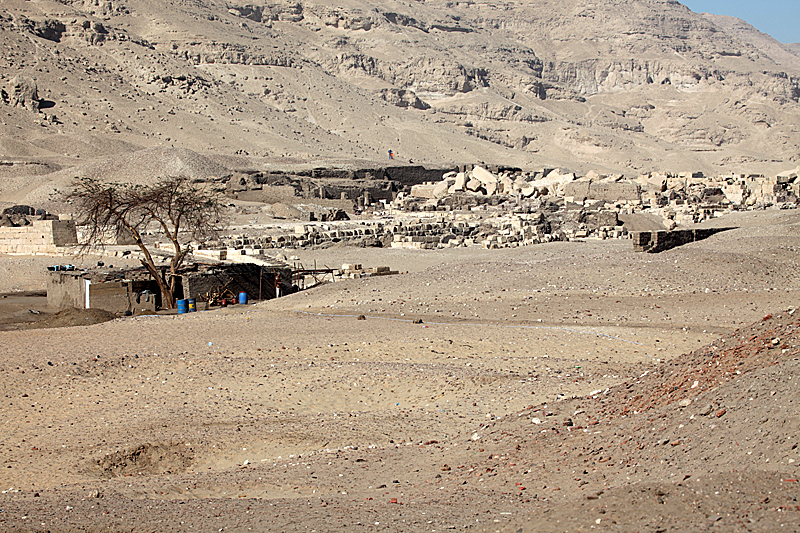
Akhmim
Monument and historic site · 5.2 km
City in the Sohag Governorate of Upper Egypt

Idfa
Monument and historic site · 5.8 km
Village in Sohag Governorate, Egypt
Parks, trails and playgrounds1


Restaurants and cafes8


Where to stay11

History
The modern city developed from the village of Suhay (Arabic: السوهاى) (or Sumay), the name of which eventually transformed into Suhaj, and is located on the site of several ancient settlements, the largest of which is Bompae (Ancient Greek: Βομπαή; Coptic: ⲃⲟⲙⲡⲁϩⲟ, lit. 'channel of Paho' or Coptic: ⲡⲓⲃⲟⲙⲡⲁϩⲉ, lit. 'the place of Paha'). The others include Tmupaie (Ancient Greek: Τμουπαει, Coptic: ⲧⲙⲟⲩⲡⲁϩⲟ, lit. 'the island of Paha'), Bay (Arabic: الباى, possibly an Arabisation of the aforementioned "Paha") and Sawaqi (Arabic: سواقى).
From the History section of Sohag on Wikipedia, under CC BY-SA 4.0.
Churches and places of worship3
Shopping3
Gas and EV charging2
Schools, colleges and libraries5
Healthcare30
Map of Sohag
72 places. The map loads OpenStreetMap tiles when you open it.
Getting there and nearby towns
Suhag International Airport (HMB) is the nearest airport with scheduled flights listed in OpenStreetMap, 24 km away.
- Akhmīm 5 km east, about 5 min by car
- Tūnis 6 km north, about 6 min by car
- Sāqultah 11 km north, about 11 min by car
- Al Minshāh 14 km southeast, about 14 min by car
- Al Marāghah 18 km northwest, about 18 min by car
- Juhaynah 24 km northwest, about 24 min by car
- Ţahţā 30 km northwest, about 30 min by car
- Girga 31 km southeast, about 31 min by car
- Ţimā 47 km northwest, about 47 min by car
- Al Balyanā 47 km southeast, about 47 min by car
Drive times are estimates from straight-line distance, not routes.
Local news
Headlines from INDB.
Reviews, tips and questions
Loading what members have shared...
Sources and licences
- GeoNames (CC BY 4.0): population, coordinates, regions and time zone
- OpenStreetMap contributors (ODbL 1.0): places, airports, map data
- Wikidata (CC0 1.0): elevation, founding date, time zone, website, landmarks and historic places
- Wikimedia Commons (see each image): photos
- Wikipedia (CC BY-SA 4.0): overview and history text
Photo credits
- SohagMidanCorniche, Roland Unger, CC BY-SA 3.0
- Sohag - panoramio, KaiAbuSir, CC BY-SA 3.0
- Typical apartment block in Sohag - panoramio, KaiAbuSir, CC BY-SA 3.0
- Appartment Buildings in Sohag, near river Nile - panoramio, KaiAbuSir, CC BY-SA 3.0
- Nile in Sohag - panoramio, KaiAbuSir, CC BY-SA 3.0
- AkhmimOpenAirMuseum, Roland Unger, CC BY-SA 3.0
- White Monastery 02, Einsamer Schütze, CC BY-SA 3.0
- AthribisViewToNW, Roland Unger, CC BY-SA 3.0
- Sohag stadium, aralg, CC BY-SA 3.0
- WhiteMonasteryCourtEast, Roland Unger, CC BY-SA 3.0
- كورنيش سوهاج - نادي التجديف - panoramio, Mohamed Sameer, CC BY 3.0
- همام باشا حمادي, خالد عبد الغفار, CC0
- محطة سكة حديد سوهاج - panoramio, Mohamed Sameer, CC BY 3.0
- شارع المحطة سوهاج - panoramio, Mohamed Sameer, CC BY 3.0
- محطة سوهاج - panoramio, Mohamed Sameer, CC BY 3.0
- نهر النيل بالليل فى سوهاج ٢٣٣٧٣٢, مو كامل, CC BY-SA 4.0
- Earth 2, Kyrillos Tharwat, CC BY-SA 4.0
- ISS038-E-26551 - View of Earth, Earth Science and Remote Sensing Unit , Lyndon B. Johnson Space Center, Public domain
- ISS065-E-433464 - View of Earth, Earth Science and Remote Sensing Unit , Lyndon B. Johnson Space Center, Public domain
- ISS038-E-26550 - View of Earth, Earth Science and Remote Sensing Unit , Lyndon B. Johnson Space Center, Public domain
- ISS042-E-179998 - View of Earth, Earth Science and Remote Sensing Unit , Lyndon B. Johnson Space Center, Public domain
- ISS042-E-179999 - View of Earth, Earth Science and Remote Sensing Unit , Lyndon B. Johnson Space Center, Public domain
- ISS048-E-6679 - View of Egypt, Earth Science and Remote Sensing Unit , Lyndon B. Johnson Space Center, Public domain
- ISS063-E-25685 - View of Earth, Earth Science and Remote Sensing Unit, NASA Johnson Space Center, Public domain
- ISS022-E-22636 - View of Earth, Earth Science and Remote Sensing Unit , Lyndon B. Johnson Space Center, Public domain
- ISS022-E-21893 - View of Earth, Earth Science and Remote Sensing Unit , Lyndon B. Johnson Space Center, Public domain
- ISS022-E-21205 - View of Earth, Earth Science and Remote Sensing Unit , Lyndon B. Johnson Space Center, Public domain
- ISS022-E-21892 - View of Earth, Earth Science and Remote Sensing Unit , Lyndon B. Johnson Space Center, Public domain
- ISS022-E-21894 - View of Earth, Earth Science and Remote Sensing Unit , Lyndon B. Johnson Space Center, Public domain
- ISS052-E-79936 - View of Earth, Earth Science and Remote Sensing Unit , Lyndon B. Johnson Space Center, Public domain
- ISS052-E-79935 - View of Earth, Earth Science and Remote Sensing Unit , Lyndon B. Johnson Space Center, Public domain
- ISS022-E-22635 - View of Earth, Earth Science and Remote Sensing Unit , Lyndon B. Johnson Space Center, Public domain
- ISS063-E-25684 - View of Earth, Earth Science and Remote Sensing Unit, NASA Johnson Space Center, Public domain


Page built November 7, 2026. Spotted a mistake? Tell us or suggest a place.