


Ellsworth, Maine
Ellsworth is a city of 8,657 people in Hancock County, Maine, founded in 1763.
Why visit Ellsworth
Townapedia lists 13 museums and landmarks, 28 parks and trails, 43 places to eat, 6 places to stay and 13 attractions in and around town.
Highlights include The Grand, The Grand Auditorium, Ellsworth Public Library and Surry Town Hall.
July is the warmest month, with average highs of 77°F; January lows average 11°F.
Weather in Ellsworth
Forecast from the National Weather Service. Full forecast
About Ellsworth
Ellsworth is a city in and the county seat of Hancock County, Maine, United States. The 2020 Census determined it had a population of 8,399. Named after United States Founding Father Oliver Ellsworth, it contains historic buildings and other points of interest, and is close to Acadia National Park.
From the Wikipedia article Ellsworth, Maine (this version), under CC BY-SA 4.0.
Things to do13

The Grand
Cinema and theater · National Register of Historic Places · 4.0 mi
Performing arts center and former movie theater in Ellsworth, Maine, United States




1 more on the map.
Museums and landmarks13
Ellsworth Public Library
Monument and historic site · National Register of Historic Places · 3.9 mi
Library in Ellsworth, Maine
20 State Street, Ellsworth

Surry Town Hall
Monument and historic site · National Register of Historic Places · 6.1 mi
Historic church in Maine, United States

Agassiz Bedrock Outcrop
Monument and historic site · National Register of Historic Places · 2.5 mi
United States historic place

Col. Charles and Mary Ann Jarvis Homestead
Monument and historic site · National Register of Historic Places · 4.0 mi
Ellsworth, Maine, listed on the NRHP in Hancock County, Maine

Ellsworth Power House and Dam
Monument and historic site · National Register of Historic Places · 3.6 mi
Embankment dam in Hancock County, United States of America

Hancock County Jail
Monument and historic site · National Register of Historic Places · 3.9 mi
Jail in Ellsworth (Maine)
Rural Hall
Monument and historic site · National Register of Historic Places · 6.3 mi
Community center in Surry, Maine
Samuel Kidder Whiting House
Monument and historic site · National Register of Historic Places · 4.0 mi
Ellsworth, in the National Register of Historic Places listings in Hancock County, Maine
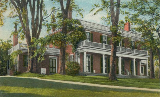


Woodlawn Museum
Monument and historic site · National Register of Historic Places · 4.0 mi
Archive organization in Ellsworth, United States
Old Hancock County Buildings
Monument and historic site · National Register of Historic Places · 3.9 mi

Colonel Black Mansion Museum
Museum · 4.0 mi
19 Black House Drive, Ellsworth
May,Oct Tu-Su 13:00-16:00, Jun-Sep Tu-Sa 10:00-17:00, Su 13:00-16:00
1 more on the map.
Parks, trails and playgrounds28

Stanwood Homestead
Park · National Register of Historic Places · 5.2 mi
Park in the United States of America
Ellsworth Harbor Park and Marina
Park · 4.4 mi
Ellsworth Harbor Park. A place where you can have a picnic meal at the many picnic tables provided. During the summer, the gazebo is the...
413 Water Street, Ellsworth

Donald Little Park
Park · 3.8 mi
A community park, maintained by the Ellsworth Garden Club, in memory of Donald Little.
99 State Street, Ellsworth
Knowlton Park
Park · 3.5 mi
Amenities; Comfort Station (Restrooms & Changing Rooms) Splash Pad (weather permitting) HOURS: 10am to 8pm (7 days a week)
160 State Street, Ellsworth

Indian Point Preserve
Hiking and trails · 4.6 mi
Indian Point Trail winds through the woods, over bog bridges down to a crest overlooking Card Brook and the Union River. The path...
S. K. Whiting Park
Park · 4.0 mi
The S. K. Whiting Park was built at the busy corner of Main Street and Oak Street to enhance the connection between the Downtown and...
Woodlawn
Park · 3.8 mi
Woodlawn offers over two miles of wooded trails, a championship croquet court, several large fields, orchards and wonderful gardens...
World War II Memorial Park
Park · 3.9 mi
World War II Memorial Park located at Ellsworth Public Library.
16 more on the map.
Restaurants and cafes43

Casa Jalisco
Restaurant · Mexican · 4.8 mi
205 High Street, Ellsworth
Su-Th 11:00-21:00, Fr-Sa 11:00-22:00
Crazy Sumo
Restaurant · Asian · 4.3 mi
75 High Street, Ellsworth
Mo-Th 11:00-21:00, Fr-Sa 11:00-22:00, Su 11:00-20:00
Martha's Diner
Restaurant · Diner, Breakfast · 4.6 mi
151 High Street, Ellsworth
Mo closed, Tu 06:00-14:00, We 06:00-14:00, Th 06:00-14:00, Fr...

Finns Irish Pub
Bar and pub · 4.0 mi
156 Main Street, Ellsworth
Mo-Tu 11:00-21:00; We-Th 11:00-22:00; Fr-Sa 11:00-23:00; Su 11:30-20:00
Union River Lobster Pot Restaurant
Restaurant · 4.0 mi
8 South Street, Ellsworth
Mo-Fr,Su 17:00-20:30; Sa 16:00-21:00
Black Moon Public House
Bar and pub · 4.0 mi
142 Main Street, Ellsworth
Su 12:00-19:00; Mo closed; Tu 12:00-20:00; We-Th 12:00-21:00;...
Ellsworth Pat's Pizza
Restaurant · Pizza, Italian, American, Sandwich · 6.0 mi
Hidden gem - local favorite featuring pizza, pasta & sandwiches in a laid-back style. Family friendly
396 High Street, Ellsworth
Tu-Sa 11:00-21:00, Su-Mo 11:00-20:00

31 more on the map.
Where to stay6
Churches and places of worship22
First Congregational Church of Ellsworth
Church · United Church Of Christ · 3.9 mi
2 Church Street, Ellsworth
Ellsworth Congregational Church
Church · National Register of Historic Places · 3.6 mi
Our Lady of the Lake Church
Church · Roman Catholic · 6.5 mi
5 Finnegan Drive, Dedham
Saint Joseph Catholic Church
Church · Roman Catholic · 4.1 mi
231 Main Street, Ellsworth
The Church of Jesus Christ of Latter-day Saints
Church · Mormon · 5.9 mi
180 Beechland Road, Ellsworth
Saint Dunstans Episcopal Church
Church · Episcopal · 3.6 mi
134 State Street, Ellsworth
Saint Thomas Anglican Church
Church · Anglican · 0.7 mi
373 Bangor Road, Ellsworth
St Andrew Lutheran Church
Church · Lutheran · 5.9 mi
175 Downeast Highway, Ellsworth
Shopping17
Gas and EV charging9
Schools, colleges and libraries8
Healthcare5
Map of Ellsworth
164 places. The map loads OpenStreetMap tiles when you open it.
Climate by month
Monthly table
| Month | High | Low | Rain |
|---|---|---|---|
| Jan | 30°F | 11°F | 4.1 in |
| Feb | 32°F | 12°F | 3.6 in |
| Mar | 40°F | 22°F | 4.2 in |
| Apr | 52°F | 32°F | 4.3 in |
| May | 63°F | 42°F | 3.7 in |
| Jun | 71°F | 51°F | 4.5 in |
| Jul | 77°F | 57°F | 3.1 in |
| Aug | 77°F | 56°F | 3.1 in |
| Sep | 69°F | 49°F | 3.9 in |
| Oct | 57°F | 38°F | 5.1 in |
| Nov | 46°F | 29°F | 4.9 in |
| Dec | 36°F | 19°F | 5.0 in |
U.S. Climate Normals 1991-2020 for E Surry (6 mi away), NOAA NCEI.
People and cost of living
American Community Survey 5-year estimates, 2020-2024, U.S. Census Bureau. Estimates have margins of error, larger for small towns.
Disaster history
Hancock County has had 17 federal disaster declarations since 2000, most often for severe storms.
- 2024-03-20: Severe Storms And Flooding (Severe Storm)
- 2024-01-30: Severe Storm And Flooding (Severe Storm)
- 2023-09-14: Hurricane Lee (Hurricane)
- 2020-04-04: Covid-19 Pandemic (Biological)
- 2020-03-13: Covid-19 (Biological)
- 2018-01-02: Severe Storm And Flooding (Severe Storm)
OpenFEMA disaster declarations summaries.
Getting there and nearby towns
Hancock County–Bar Harbor Airport (BHB) is the nearest airport with scheduled flights listed in OpenStreetMap, 11 miles away.
- Blue Hill 14 mi south, about 22 min by car
- Bucksport 16 mi west, about 25 min by car
- Brewer 19 mi northwest, about 30 min by car
- Bar Harbor 19 mi southeast, about 31 min by car
- Hampden 21 mi northwest, about 34 min by car
- Bangor 23 mi northwest, about 37 min by car
- Orono 23 mi northwest, about 37 min by car
- Belfast 29 mi west, about 47 min by car
- Camden 39 mi southwest, about 1 h by car
- Dexter 50 mi northwest, about 1 h 15 min by car
Drive times are estimates from straight-line distance, not routes.
Local news
Headlines from INDB, the NEMICO news database.
Reviews, tips and questions
Loading what members have shared...
Sources and licences
- NOAA NCEI U.S. Climate Normals 1991-2020 (Public domain): climate by month
- OpenFEMA (Public domain): disaster declarations
- OpenStreetMap contributors (ODbL 1.0): places, airports, map data
- U.S. Census Bureau (Public domain): population, income, housing, education, commute
- Wikidata (CC0 1.0): elevation, founding date, time zone, website, landmarks and historic places
- Wikimedia Commons (see each image): photos
- Wikipedia (CC BY-SA 4.0): overview and history text
Photo credits
- Bridge atop the Union River in Ellsworth, ME IMG 2396, Billy Hathorn, CC BY-SA 3.0
- SurryME OldTownHall, Doug Kerr, CC BY-SA 2.0
- Public Library, Ellsworth, ME, Unknown author, Public domain
- Hydro Electric Power House, showing Leonard Lake and dam, Ellsworth, Maine (66180), Tichnor Brothers, Publisher, Public domain
- The Grand, Ellsworth Maine, Main St Frontage, SarekOfVulcan, CC BY-SA 3.0
- EllsworthME OldCountyJail, Doug Kerr, CC BY-SA 2.0
- First congregational church of Ellsworth steve, Steve911b ( talk ), CC BY-SA 3.0
- The Black House, Ellsworth, ME, Unknown author Unknown author, Public domain
- Agassiz Bedrock Outcropping - another view, Nadine Lewis, CC BY-SA 4.0

Page built October 30, 2026. Spotted a mistake? Tell us or suggest a place.