




Emma, North Carolina
Emma is a community of 2,657 people in Buncombe County, North Carolina.
Why visit Emma
Townapedia lists 61 museums and landmarks, 4 parks and trails, 39 places to eat, 4 places to stay and 2 attractions in and around town.
Highlights include Dryman Mountain, Richmond Hill, Arcade Building and Asheville City Hall.
July is the warmest month, with average highs of 86°F; January lows average 29°F.
Weather in Emma
Forecast from the National Weather Service. Full forecast
About Emma
Emma is an unincorporated community and census-designated place (CDP) in Buncombe County, North Carolina, United States. It was first listed as a CDP in the 2020 census with a population of 2,174.
From the Wikipedia article Emma, North Carolina (this version), under CC BY-SA 4.0.
Things to do2

Museums and landmarks61

Arcade Building
Monument and historic site · National Register of Historic Places · 2.2 mi
Listed on the NRHP in Buncombe County, North Carolina

Asheville City Hall
Monument and historic site · National Register of Historic Places · 2.7 mi
City hall in Asheville, North Carolina

Asheville High School
Monument and historic site · National Register of Historic Places · 3.2 mi
Public school
Asheville School
Monument and historic site · National Register of Historic Places · 3.1 mi
Boarding school in North Carolina, U.S.
Asheville Transfer and Storage Company Building
Monument and historic site · National Register of Historic Places · 2.5 mi
United States historic place

B & B Motor Company Building
Monument and historic site · National Register of Historic Places · 2.4 mi
Historic building in North Carolina, US
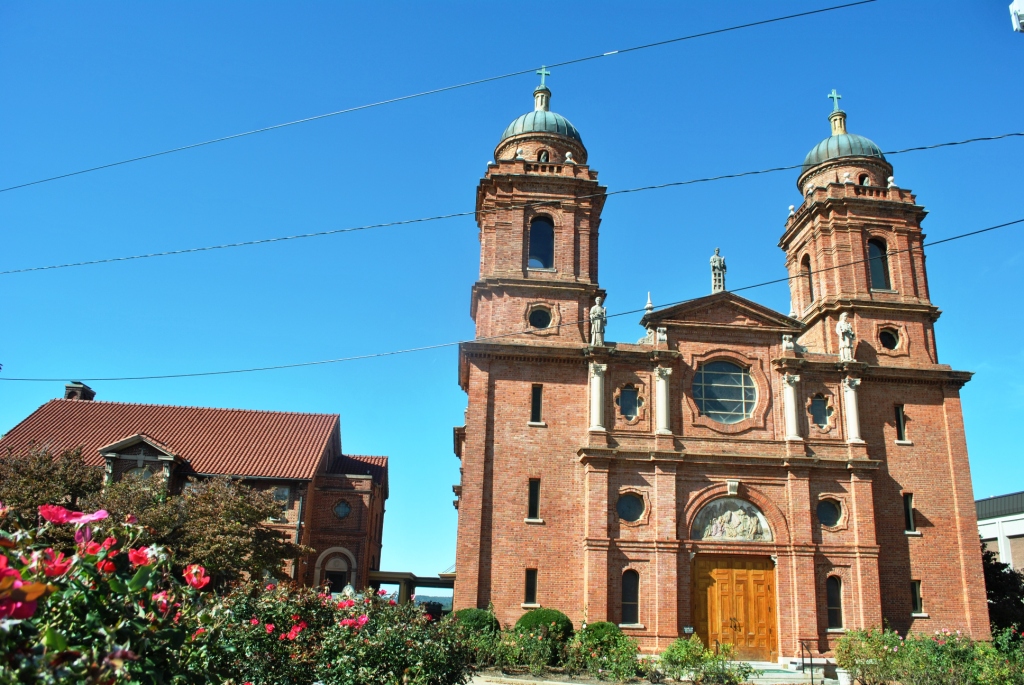
Basilica of St. Lawrence, Asheville
Monument and historic site · National Register of Historic Places · 2.2 mi
Minor basilica of the Roman Catholic Church in Asheville, North Carolina
Battery Park Hotel
Monument and historic site · National Register of Historic Places · 3.2 mi
Hotel in North Carolina, United States of America

Bledsoe Building
Monument and historic site · National Register of Historic Places · 1.6 mi
Historic building in North Carolina, US
Broadway Market Building
Monument and historic site · National Register of Historic Places · 2.2 mi
Asheville, NC, listed on the NRHP in North Carolina

Building at 130–132 Biltmore Avenue
Monument and historic site · National Register of Historic Places · 2.6 mi
Historic building in Asheville, North Carolina, USA


Building at 134–136½ Biltmore Avenue
Monument and historic site · National Register of Historic Places · 2.6 mi
Historic building in Asheville, North Carolina, USA
49 more on the map.
Parks, trails and playgrounds4

Wilma Dykeman RiverWay Plan
Park · 2.6 mi
Planned park in Asheville, North Carolina

Restaurants and cafes39

Georgie's Bunker
Bar and pub · 1.0 mi
1141 Patton Avenue, Asheville
Mo-Th 10:00-22:00; Fr 10:00-24:00; Sa 09:00-24:00; Su 09:00-22:00

Mizu
Restaurant · Noodle · 1.0 mi
22 New Leicester Highway, Asheville
Mo-Su 11:00-15:00,16:00-21:00; Th Off
Regina’s
Restaurant · American, Breakfast, Coffee Shop, Deli, Diner, Fine Dining, Local · 1.5 mi
1400 Patton Avenue
Th-Su 09:00-15:00, 17:00-21:00; We 09:00-15:00

Jersey South Bagel Company
Bakery · 1.1 mi
5 Regent Park Boulevard, Asheville
Mo,Fr-Su 08:00-14:00; PH closed

Favilla's New York Pizza
Restaurant · Pizza · 1.1 mi
5 Regent Park Boulevard, Asheville
French Broad Chocolate Factory & Cafe
Cafe · Ice Cream · 1.4 mi
821 Riverside Drive, Asheville
27 more on the map.
Where to stay4
Crowne Plaza Hotels & Resorts Asheville
Motel and hotel · 1.0 mi
1 Resort Drive, Asheville
Churches and places of worship10
Shopping12
Gas and EV charging7
Schools, colleges and libraries37
Buncombe County Schools Virtual Academy
School · 5.1 mi
21 Trinity Chapel Rd, Asheville
Healthcare3
Map of Emma
179 places. The map loads OpenStreetMap tiles when you open it.
Climate by month
Monthly table
| Month | High | Low | Rain | Snow |
|---|---|---|---|---|
| Jan | 48°F | 29°F | 3.3 in | 3.8 in |
| Feb | 52°F | 32°F | 2.9 in | 2.2 in |
| Mar | 59°F | 38°F | 3.5 in | 2.0 in |
| Apr | 69°F | 46°F | 3.7 in | 0.3 in |
| May | 76°F | 54°F | 3.5 in | 0.0 in |
| Jun | 83°F | 61°F | 3.4 in | 0.0 in |
| Jul | 86°F | 65°F | 4.1 in | 0.0 in |
| Aug | 85°F | 64°F | 3.6 in | 0.0 in |
| Sep | 79°F | 58°F | 3.7 in | 0.0 in |
| Oct | 69°F | 47°F | 2.6 in | 0.0 in |
| Nov | 59°F | 37°F | 3.0 in | 0.5 in |
| Dec | 50°F | 32°F | 3.3 in | 2.7 in |
U.S. Climate Normals 1991-2020 for Asheville (2 mi away), NOAA NCEI.
People and cost of living
American Community Survey 5-year estimates, 2020-2024, U.S. Census Bureau. Estimates have margins of error, larger for small towns.
Disaster history
Buncombe County has had 16 federal disaster declarations since 2000, most often for hurricanes.
- 2026-01-24: Severe Winter Storm (Winter Storm)
- 2024-09-28: Tropical Storm Helene (Tropical Storm)
- 2024-09-26: Hurricane Helene (Tropical Storm)
- 2022-10-01: Hurricane Ian (Hurricane)
- 2021-09-08: Remnants Of Tropical Storm Fred (Hurricane)
- 2020-08-02: Hurricane Isaias (Hurricane)
OpenFEMA disaster declarations summaries.
Getting there and nearby towns
Barker Private STOL Airport (53NR) is the nearest airport with scheduled flights listed in OpenStreetMap, 5 miles away.
- Asheville 3 mi southeast, about 5 min by car
- Biltmore Forest 6 mi southeast, about 9 min by car
- Bent Creek 6 mi south, about 10 min by car
- Avery Creek 10 mi south, about 15 min by car
- Canton 14 mi west, about 23 min by car
- Black Mountain 15 mi east, about 24 min by car
- Clyde 18 mi west, about 30 min by car
- Balfour 18 mi south, about 29 min by car
- Edneyville 20 mi southeast, about 32 min by car
- Hendersonville 21 mi south, about 33 min by car
Drive times are estimates from straight-line distance, not routes.
Local news
Headlines from INDB, the NEMICO news database.
Reviews, tips and questions
Loading what members have shared...
Sources and licences
- NCES EDGE (Public domain): public schools
- NOAA NCEI U.S. Climate Normals 1991-2020 (Public domain): climate by month
- OpenFEMA (Public domain): disaster declarations
- OpenStreetMap contributors (ODbL 1.0): places, airports, map data
- U.S. Census Bureau (Public domain): population, income, housing, education, commute
- Wikidata (CC0 1.0): elevation, founding date, time zone, website, landmarks and historic places
- Wikimedia Commons (see each image): photos
- Wikipedia (CC BY-SA 4.0): overview and history text
Photo credits
- Chestnut Historic District, Jhersk, CC BY-SA 3.0
- St. Matthias Episcopal Church (Asheville, North Carolina), Farragutful, CC BY-SA 3.0
- Basilica of St. Lawrence, Asheville (1), Elisa.rolle, CC BY-SA 4.0
- S&W Cafeteria Building, Asheville, NC (45827769765), Warren LeMay from Cincinnati, OH, United States, CC0
- Mrs Minnie Alexander Cottage, Bill Fitzpatrick, CC BY-SA 3.0
- Homewood School Building, Zillicoa St., Montford Area, Karen D. Hoffman, CC BY-SA 3.0
- North Carolina Electrical Power Company Electric Generating Plant, Upstateherd, CC BY-SA 4.0
- Saint Marys Episcopal Church, Bill Fitzpatrick, CC BY-SA 3.0
- Riverside Industrial District, Bill Fitzpatrick, CC BY-SA 3.0
- Ottari Sanatarium, Bill Fitzpatrick, CC BY-SA 3.0
- Asheville Downtown panorama, AbeEzekowitz, CC BY-SA 3.0
- Richbourg Motors Building, Nicole Justiniano, CC BY-SA 3.0
- George A. Mears House, Farragutful, CC BY-SA 3.0
- Conabeer Chrysler Building, Bill Fitzpatrick, CC BY-SA 3.0
- Smith McDowell House, Bill Fitzpatrick, CC BY-SA 3.0
- The Manor and Cottages, Bill Fitzpatrick, CC BY-SA 3.0
- B&B Motor Company Building, Nicole Justiniano, CC BY-SA 3.0
- Zealandia - Asheville, NC, Upstateherd, CC BY-SA 4.0
- Reynolds House, rossograph, CC BY-SA 4.0
- Fire Station Number 4, 300 Merrimon Ave., Asheville, Karen D. Hoffman, CC BY-SA 3.0
- Richnond Hill House, rossograph, CC BY-SA 4.0
- Arcade Building, Teemu08, CC BY-SA 3.0
- Bledsoe Building, Nyttend, Public domain
- Claxton Elementary, Bill Fitzpatrick, CC BY-SA 3.0
- E. D. Latta Nurses' Residence, Upstateherd, CC BY-SA 4.0
- Grove Park Historic District - Dr. Louie Mueller Griffith House, Upstateherd, CC BY-SA 4.0
- Seven Oaks - Asheville, NC, Upstateherd, CC BY-SA 4.0
- Sawyer Motor Company Building, 2013, Elisa.rolle, CC BY-SA 4.0
- 130 Biltmore Ave, Jhersk, CC BY-SA 3.0
- Demens House, Bill Fitzpatrick, CC BY-SA 3.0
- Thomas Wolfe's Home, Abe Ezekowitz, CC BY-SA 2.0
- End of Car Line, Jhersk, CC BY-SA 3.0
- Buncombe County Courthouse, Teemu08, CC BY-SA 3.0
- Clingmon Avenue Historic District Wide, Bill Fitzpatrick, CC BY-SA 3.0
- Jarrett 1, Daigle3541, CC BY-SA 3.0
- Ravenscroft School, Bill Fitzpatrick, CC BY-SA 3.0
- Asheville City Hall - Asheville, NC, Upstateherd, CC BY-SA 4.0
- Whitford G. Smith House 02, Elisa.rolle, CC BY-SA 4.0
- Building at 134-136½ Biltmore Avenue, Farragutful, CC BY-SA 3.0
- Dr. Carl V. Reynolds House, Upstateherd, CC BY-SA 4.0


Page built October 30, 2026. Spotted a mistake? Tell us or suggest a place.