
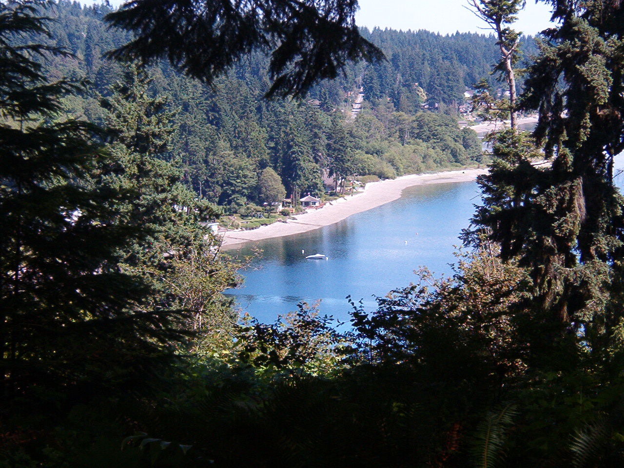


Why visit Enetai
Townapedia lists 7 museums and landmarks, 15 parks and trails, 33 places to eat, 2 places to stay and 6 attractions in and around town.
Highlights include Bremerton Farmer's Market, Manette Bridge, Bremerton Elks Temple Lodge No. 1181 Building and Hospital Reservation Historic District.
August is the warmest month, with average highs of 77°F; December lows average 35°F.
Weather in Enetai
Forecast from the National Weather Service. Full forecast
About Enetai
Enetai is a census-designated place (CDP) located in Kitsap County, Washington. The population was 2,497 at the 2020 census.
From the Wikipedia article Enetai, Washington (this version), under CC BY-SA 4.0.
Things to do6

Bremerton Farmer's Market
Farm and orchard · 1.5 mi
Bremerton Community Farmers Market (BCFM) is a non-profit farmers market dedicated to offering the freshest produce and local products...
1400 Park Avenue, Bremerton
May 01-Sep 16 Th 16:00-19:00; Sep 17-Oct 08 Th 15:30-18:30

Manette Bridge
Bridge · 1.4 mi
Bridge in the city of Bremerton, Washington State, USA (1930-2011); replaced by a bridge of the same name



Museums and landmarks7

Bremerton Elks Temple Lodge No. 1181 Building
Monument and historic site · National Register of Historic Places · 1.8 mi
Elks club building in Bremerton, United States of America

Hospital Reservation Historic District
Monument and historic site · National Register of Historic Places · 2.5 mi
Historic district in Bremerton, Washington

Marine Reservation Historic District
Monument and historic site · National Register of Historic Places · 2.5 mi
Historic district in Washington, United States


Officers' Row Historic District
Monument and historic site · National Register of Historic Places · 2.4 mi
Historic district in Washington, United States
Puget Sound Naval Shipyard Historic District
Monument and historic site · National Register of Historic Places · 2.5 mi
Building in Washington, United States
Kitsap 9/11 Memorial
Monument and historic site · 1.4 mi
Dedicated to those who lost their lives on September 11, 2001. Memorial includes steel pulled from New York's World Trade Center and...
1300 Park Avenue, Bremerton
Parks, trails and playgrounds15

Bataan Park
Park · 1.0 mi
0.83 acre pocket park dedicated to the memory of the American and Filipino prisoners of war who perished in the Bataan Death March of 1942.
1827 Northeast Sylvan Way, Bremerton
Evergreen Rotary Park
Park · 1.4 mi
10.31 acre community park. Site of the Farmers Market, inclusive playground and Kitsap 9/11 Memorial.
1500 Park Avenue, Bremerton
Bachmann Park
Park · 1.2 mi
0.15 acre pocket park with over water viewing shelter
906 Shore Drive, Bremerton
24/7
H. O. Whitey Domstad Park
Park · 1.3 mi
0.23 acre plaza with waterfront viewpoints overlooking downtown Bremerton
1101 Wheaton Way, Bremerton
sunrise-sunset

3 more on the map.
Restaurants and cafes33

Bubz Cafe Bremerton
Cafe · Coffee Shop · 1.1 mi
2601 Cherry Avenue, Bremerton
Mo-Th 11:00-19:00; Fr-Sa 11:00-20:00; Su 12:00-18:00


Chaos Bay Brewing Company
Bar and pub · American, Burger, Grill, Pizza · 0.6 mi
2901 Perry Avenue Northeast, Bremerton
We-Th 12:00-22:00; Fr-Sa 12:00-23:00; Su 12:00-21:00; Mo-Tu closed

Franz
Bakery · 0.5 mi
Outlet store with day-old bread, pastries and other items sold by Franz.
2547 Perry Avenue Northeast, Bremerton
Mo-Fr 10:00-17:00; Sa-Su Closed
Pepa's Lumpia Filipino Cuisine / Oriental Store
Restaurant · Asian, Filipino · 1.4 mi
1220 Sylvan Way, Bremerton
Tu-Sa 11:00-19:00; Su 11:00-18:00
Sunny Teriyaki
Restaurant · Asian · 1.4 mi
1221 Sylvan Way, Bremerton
Mo-Fr 11:00-20:00; Sa 14:00-20:00
Tik Tok's Workshop
Bar and pub · American · 1.4 mi
1216 Sylvan Way, Bremerton
Mo-Fr 16:00-02:00, Sa 12:00-02:00, Su 14:00-02:00
21 more on the map.
History
Enetai was the site of the Southern Lushootseed speaking native Salish peoples, similar to Seattle across the sound. Its name is derived from northwestern native language's term meaning "Across the water"
From the History section of Enetai, Washington on Wikipedia, under CC BY-SA 4.0.
Where to stay2
Churches and places of worship15
Kitsap Unitarian Universalist Fellowship
Church · Unitarian · 1.4 mi
4418 Perry Avenue Northeast, Bremerton
The Church of Jesus Christ of Latter-day Saints
Church · Mormon · 0.7 mi
2225 Perry Avenue, Bremerton
New Testament Christian Church of Bremerton
Church · Full Gospel · 0.8 mi
1712 Trenton Avenue Northeast, Bremerton
Shopping4
North Perry Avenue Mall
Shopping center · 0.6 mi
2901 Perry Avenue Northeast, Bremerton
Gas and EV charging3
North Perry Ave Mini Mart
Gas station · 0.6 mi
2805 Perry Avenue Northeast, Bremerton
Schools, colleges and libraries43
Bainbridge Special Education Services
School · 5.2 mi
8489 Madison Ave Ne, Bainbridge Island
Capt Johnston Blakely Elem Sch
School · 3.4 mi
4704 Blakely Ave Ne, Bainbridge Island
Healthcare7
Bremerton Health and Rehabilitation Center
Clinic and pharmacy · 1.3 mi
2701 Clare Avenue, Bremerton
Map of Enetai
135 places. The map loads OpenStreetMap tiles when you open it.
Climate by month
Monthly table
| Month | High | Low | Rain | Snow |
|---|---|---|---|---|
| Jan | 47°F | 36°F | 9.3 in | 0.6 in |
| Feb | 49°F | 35°F | 5.8 in | 0.7 in |
| Mar | 54°F | 38°F | 6.4 in | 0.1 in |
| Apr | 59°F | 41°F | 3.9 in | 0.0 in |
| May | 66°F | 46°F | 2.4 in | 0.0 in |
| Jun | 70°F | 51°F | 1.6 in | 0.0 in |
| Jul | 76°F | 55°F | 0.8 in | 0.0 in |
| Aug | 77°F | 55°F | 1.1 in | 0.0 in |
| Sep | 72°F | 51°F | 1.8 in | 0.0 in |
| Oct | 61°F | 45°F | 5.1 in | 0.0 in |
| Nov | 51°F | 39°F | 8.8 in | 0.3 in |
| Dec | 46°F | 35°F | 9.9 in | 1.3 in |
U.S. Climate Normals 1991-2020 for Bremerton (4 mi away), NOAA NCEI.
People and cost of living
American Community Survey 5-year estimates, 2020-2024, U.S. Census Bureau. Estimates have margins of error, larger for small towns.
Disaster history
Kitsap County has had 7 federal disaster declarations since 2000, most often for severe storms.
- 2020-03-22: Covid-19 Pandemic (Biological)
- 2020-03-13: Covid-19 (Biological)
- 2007-12-08: Severe Storms, Flooding, Landslides, And Mudslides (Severe Storm)
- 2006-05-17: Severe Storms, Flooding, Tidal Surge, Landslides, And Mudslides (Severe Storm)
- 2005-09-07: Hurricane Katrina Evacuation (Coastal Storm)
- 2003-11-07: Severe Storms And Flooding (Severe Storm)
OpenFEMA disaster declarations summaries.
Getting there and nearby towns
Bremerton National Airport (PWT) is the nearest airport with scheduled flights listed in OpenStreetMap, 10 miles away.
- Port Orchard 4 mi southwest, about 6 min by car
- East Port Orchard 5 mi south, about 7 min by car
- Bainbridge Island 6 mi northeast, about 9 min by car
- Bremerton 6 mi southwest, about 10 min by car
- Chico 6 mi northwest, about 10 min by car
- Silverdale 7 mi northwest, about 11 min by car
- Bethel 7 mi south, about 11 min by car
- Poulsbo 11 mi north, about 18 min by car
- Seattle 12 mi east, about 19 min by car
- White Center 13 mi southeast, about 21 min by car
Drive times are estimates from straight-line distance, not routes.
Local news
Headlines from INDB, the NEMICO news database.
Reviews, tips and questions
Loading what members have shared...
Sources and licences
- NCES EDGE (Public domain): public schools
- NOAA NCEI U.S. Climate Normals 1991-2020 (Public domain): climate by month
- OpenFEMA (Public domain): disaster declarations
- OpenStreetMap contributors (ODbL 1.0): places, airports, map data
- U.S. Census Bureau (Public domain): population, income, housing, education, commute
- Wikidata (CC0 1.0): elevation, founding date, time zone, website, landmarks and historic places
- Wikimedia Commons (see each image): photos
- Wikipedia (CC BY-SA 4.0): overview and history text
Photo credits
- Illahee State Park, Dyknowsore at en.wikipedia, CC BY-SA 3.0
- Naval Hospital at Puget Sound Navy Yard in 1938, U.S. Department of the Navy. Thirteenth Naval District. Office of the Commandant., Public domain
- View of Slope at Band Stand looking north, Unknown author Unknown author or not provided, Public domain
- Bremerton, WA - Max Hale Center 03, Joe Mabel, CC BY-SA 3.0
- Manette bridge, Dyknowsore at English Wikipedia, Public domain
- Point Herron Sunset (16143296188), Jonathan Miske from United States, CC BY-SA 2.0
- 2025-08-31, Illahee State Park, IMG 5126, Steven Pavlov, CC BY-SA 4.0
- 2025-08-31, Illahee State Park Memorial, IMG 5106, Steven Pavlov, CC BY-SA 4.0
- 2025-08-31, Illahee State Park Memorial, IMG 5105, Steven Pavlov, CC BY-SA 4.0
- 2025-08-31, Illahee State Park Memorial, IMG 5124, Steven Pavlov, CC BY-SA 4.0
- 2025-08-31, Illahee State Park Memorial, IMG 5118, Steven Pavlov, CC BY-SA 4.0
- 2025-08-31, Illahee State Park Memorial, IMG 5122, Steven Pavlov, CC BY-SA 4.0
- 2025-08-31, Illahee State Park Memorial, IMG 5116, Steven Pavlov, CC BY-SA 4.0
- 2025-08-31, Illahee State Park Memorial, IMG 5123, Steven Pavlov, CC BY-SA 4.0
- 2025-08-31, Illahee State Park Memorial, IMG 5108, Steven Pavlov, CC BY-SA 4.0
- 2025-08-31, Illahee State Park Memorial, IMG 5117, Steven Pavlov, CC BY-SA 4.0
- 2025-08-31, Illahee State Park Memorial, IMG 5109, Steven Pavlov, CC BY-SA 4.0
- 2025-08-31, Illahee State Park Memorial, IMG 5111, Steven Pavlov, CC BY-SA 4.0
- 2025-08-31, Illahee State Park Memorial, IMG 5110, Steven Pavlov, CC BY-SA 4.0
- 2025-08-31, Illahee State Park Memorial, IMG 5114, Steven Pavlov, CC BY-SA 4.0
- 2025-08-31, Illahee State Park Memorial, IMG 5115, Steven Pavlov, CC BY-SA 4.0
- Sailboat Sunset (16135892578), Jonathan Miske from United States, CC BY-SA 2.0
- Aerial view of Olympic Peninsula facing west from Port Orchard Bay, Dcoetzee, Public domain
- Human Spinnaker (16388935090), Jonathan Miske from United States, CC BY-SA 2.0
- ISS017-E-5547 - View of Washington, Earth Science and Remote Sensing Unit , Lyndon B. Johnson Space Center, Public domain
- ISS038-E-63953 - View of Earth, Earth Science and Remote Sensing Unit , Lyndon B. Johnson Space Center, Public domain
- ISS065-E-93560 - View of Earth, Earth Science and Remote Sensing Unit , Lyndon B. Johnson Space Center, Public domain
- Seattle Ferry, near Bremerton, August 2009 - panoramio, Kevin.Daniels, CC BY 3.0
- 1979 KZ1000LTD, Mkosharkii, CC0
- Helang sedang mencari mangsa bj, David Brodbeck, CC BY 2.0
- Bremerton - panoramio (1), runt35, CC BY 3.0
- Lingering Fog - panoramio, michaelwm25, CC BY 3.0
- Warren Ave. Bridge Sunrise - panoramio, michaelwm25, CC BY 3.0
- Manette (16367540427), Jonathan Miske from United States, CC BY-SA 2.0
- Clearer View of The Brothers - panoramio, michaelwm25, CC BY 3.0
- Coder-Coleman House in Bremerton, Steven Pavlov User:Senapa/TemplateFB, CC BY-SA 3.0


Page built October 30, 2026. Spotted a mistake? Tell us or suggest a place.