


Escondido, California
Escondido is a city of 149,668 people in San Diego County, California, founded in 1888.
Why visit Escondido
Townapedia lists 14 museums and landmarks, 34 parks and trails, 168 places to eat, 14 places to stay and 9 attractions in and around town.
Highlights include Regal Escondido Stadium 16, California Pacific University, A.H. Beach House and Queen Califia's Magic Circle.
August is the warmest month, with average highs of 89°F; December lows average 44°F.
Weather in Escondido
Forecast from the National Weather Service. Full forecast
About Escondido
Escondido (Spanish for 'hidden') is a city in San Diego County, California, United States. Located in the North County region, it was incorporated in 1888, and is one of the oldest cities in San Diego County. It has a population of 151,038 as of the 2020 census.
From the Wikipedia article Escondido, California (this version), under CC BY-SA 4.0.
Things to do9


California Pacific University
School · 0.6 mi
Private non-profit business school
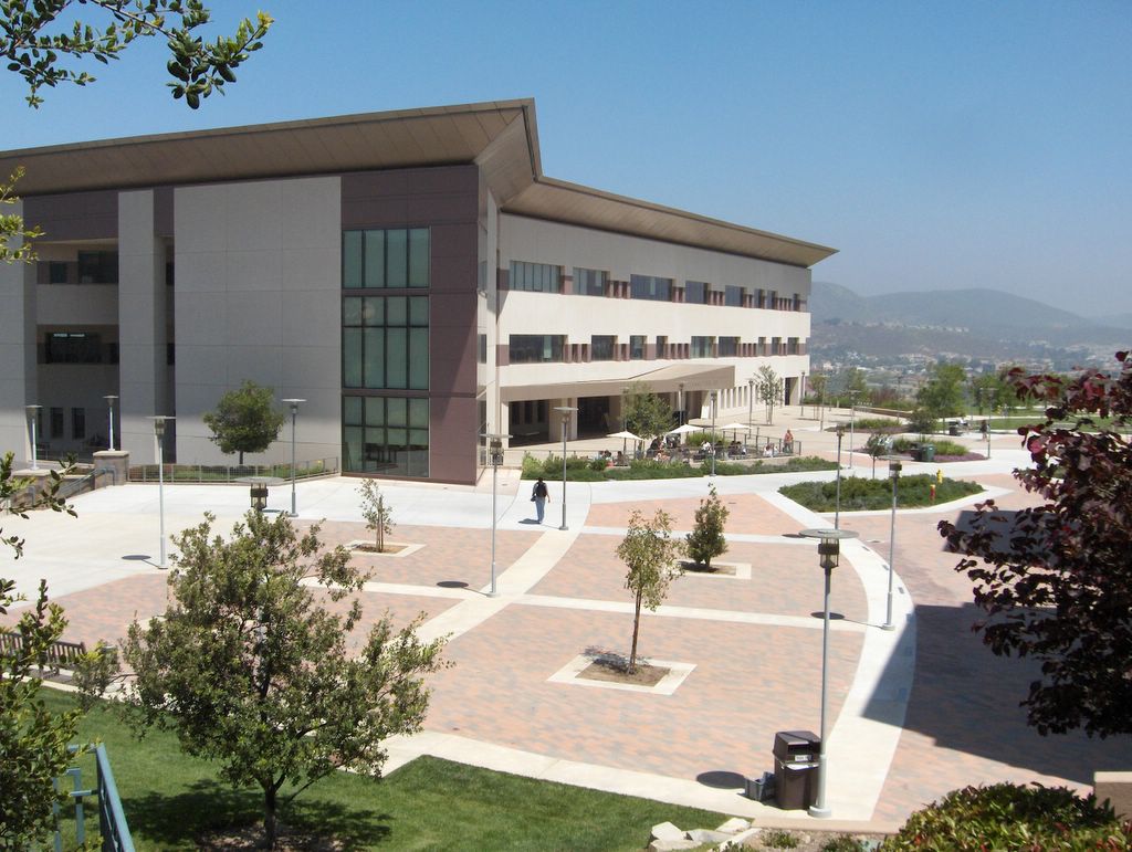
California State University San Marcos
School · 5.0 mi
Public university in San Marcos, California, United States
Eldorado College
School · 1.1 mi
Business college in California, United States

Lake Hodges Bridge
Bridge · 5.1 mi
Bridge in United States of America

San Diego Zoo Safari Park
Monument and historic site · 4.7 mi
Zoo in San Pasqual Valley area of San Diego County, California, United States

Museums and landmarks14

A.H. Beach House
Monument and historic site · National Register of Historic Places · 1.1 mi
House in Escondido, California, United States
700 South Juniper Street, Escondido

Queen Califia's Magic Circle
Museum · 3.7 mi
Queen Califia's Magical Circle is the only American sculpture garden and the last major international project created by Niki de Saint...
Tu,Th 09:00-12:00; Sa[2,4] 09:00-14:00


Thomas House
Monument and historic site · National Register of Historic Places · 1.0 mi
House in Escondido, California

Center for the Performing Arts, Escondido
Museum · 1.2 mi
340 North Escondido Boulevard, Escondido
Savannah Home
Monument and historic site · 0.8 mi
130 East Grand Avenue, Escondido
2 more on the map.
Parks, trails and playgrounds34

Kit Carson Park
Park · 3.6 mi
Park in Escondido, California, United States of America
3333 Bear Valley Parkway, Escondido
sunrise-sunset

22 more on the map.
Restaurants and cafes168


Filippi's Pizza Grotto Escondido
Restaurant · Italian, Pizza · 0.9 mi
114 Grand Avenue, Escondido
Mo-Su 11:00-21:00
Terramar Mexican Kitchen
Restaurant · Mexican · 1.2 mi
331 South Escondido Boulevard, Escondido
Mo-Su 11:00-22:00

Upper East
Restaurant · Burger, Sandwich, Chicken, Mexican, Fish, Salad · 0.8 mi
155 East Grand Avenue
Mo-Tu 15:00-22:30; We-Th 11:00-23:00; Fr 11:00-23:45; Sa...
Chuck E. Cheese
Restaurant · Pizza · 1.8 mi
1126 West Valley Parkway, Escondido
Su-Th 11:00-21:00; Fr 11:00-22:00; Sa 10:00-22:00

EscoGelato
Cafe · Coffee Shop, Ice Cream, Italian · 0.8 mi
122 South Kalmia Street, Escondido
Mo-Su 10:00-20:00
Mesa Agricola
Restaurant · 1.3 mi
Slow cooked guisados served on your choice of a house made flour or corn tortilla
707 South Escondido Boulevard
We-Su 11:00-18:00
Sopranos Pizza and Restaurant
Restaurant · 1.4 mi
360 North Midway Drive
Mo, Su 16:00-21:00; We-Sa 11:00-21:00
156 more on the map.
History
The Escondido area was first settled by the Luiseño, who established campsites and villages along the creek running through the area. They named the place Mixéelum Pompáwvo or "Mehel-om-pom-pavo." The Luiseno also had another village north of Mixéelum Pompáwvo called Panakare. The Kumeyaay migrated from areas near the Colorado River, settling both in San Pasqual Valley and near the San Dieguito River in the southwestern and western portions of what is now Escondido. Most of the villages and campsites today have been destroyed by development and agriculture.
From the History section of Escondido, California on Wikipedia, under CC BY-SA 4.0.
Where to stay14
Churches and places of worship54
First United Methodist Church of Escondido
Church · Methodist · 1.0 mi
341 South Kalmia Street, Escondido
Shopping47
Gas and EV charging32
OAAI Gas Station & Market
Gas station · 1.3 mi
2004 East Valley Parkway, Escondido
Schools, colleges and libraries83
Healthcare13
Centro Medico Escondido
Clinic and pharmacy
1121 East Washington Avenue, Escondido
Map of Escondido
250 places. The map loads OpenStreetMap tiles when you open it.
Climate by month
Monthly table
| Month | High | Low | Rain | Snow |
|---|---|---|---|---|
| Jan | 69°F | 45°F | 3.2 in | 0.0 in |
| Feb | 69°F | 46°F | 3.6 in | 0.0 in |
| Mar | 71°F | 49°F | 2.2 in | 0.0 in |
| Apr | 74°F | 52°F | 1.0 in | 0.0 in |
| May | 77°F | 56°F | 0.3 in | 0.0 in |
| Jun | 82°F | 60°F | 0.1 in | 0.0 in |
| Jul | 87°F | 64°F | 0.1 in | 0.0 in |
| Aug | 89°F | 65°F | 0.1 in | 0.0 in |
| Sep | 87°F | 63°F | 0.2 in | 0.0 in |
| Oct | 81°F | 57°F | 0.6 in | 0.0 in |
| Nov | 75°F | 49°F | 1.1 in | 0.0 in |
| Dec | 68°F | 44°F | 2.1 in | 0.0 in |
U.S. Climate Normals 1991-2020 for Escondido #2 (1 mi away), NOAA NCEI.
People and cost of living
American Community Survey 5-year estimates, 2020-2024, U.S. Census Bureau. Estimates have margins of error, larger for small towns.
Disaster history
San Diego County has had 35 federal disaster declarations since 2000, most often for fires.
- 2024-02-19: Severe Storm And Flooding (Flood)
- 2023-01-14: Severe Winter Storms, Flooding, Landslides, And Mudslides (Flood)
- 2023-01-09: Severe Winter Storms, Flooding, And Mudslides (Flood)
- 2020-10-16: Wildfires (Fire)
- 2020-03-22: Covid-19 Pandemic (Biological)
- 2020-03-13: Covid-19 (Biological)
OpenFEMA disaster declarations summaries.
Getting there and nearby towns
McClellan-Palomar Airport (CLD) is the nearest airport with scheduled flights listed in OpenStreetMap, 12 miles away.
- San Marcos 6 mi west, about 9 min by car
- Valley Center 8 mi northeast, about 12 min by car
- Vista 10 mi west, about 17 min by car
- Poway 10 mi south, about 17 min by car
- Carlsbad 12 mi west, about 20 min by car
- Encinitas 12 mi southwest, about 20 min by car
- Ramona 13 mi southeast, about 21 min by car
- Solana Beach 14 mi southwest, about 23 min by car
- Oceanside 15 mi northwest, about 24 min by car
- San Diego 21 mi south, about 34 min by car
Drive times are estimates from straight-line distance, not routes.
Local news
Headlines from INDB, the NEMICO news database.
Reviews, tips and questions
Loading what members have shared...
Sources and licences
- NCES EDGE (Public domain): public schools
- NOAA NCEI U.S. Climate Normals 1991-2020 (Public domain): climate by month
- OpenFEMA (Public domain): disaster declarations
- OpenStreetMap contributors (ODbL 1.0): places, airports, map data
- U.S. Census Bureau (Public domain): population, income, housing, education, commute
- Wikidata (CC0 1.0): elevation, founding date, time zone, website, landmarks and historic places
- Wikimedia Commons (see each image): photos
- Wikipedia (CC BY-SA 4.0): overview and history text
Photo credits
- San Diego Childrens Discovery Museum in Escondido, Alan Islas, CC BY-SA 4.0
- Escondido first library, Alan Islas, CC BY-SA 4.0
- Heritage Walk, Grape Day Park, Escondido, Downtowngal, CC BY-SA 3.0
- Escondido Public Library, Alan Islas, CC BY-SA 4.0
- A-H- Beach House 2012-09-25 13-19-42, scerruti, CC BY-SA 3.0
- Thomas House 2012-09-25 13-27-25, scerruti, CC BY-SA 3.0
- Cal State San Marcos library, Eamuscatuli at English Wikipedia, Public domain
- Sandiego wildanimalpark, Flickr user: Olivier Bruchez https://www.flickr.com/photos/bruchez/, CC BY-SA 2.0
- Lake Hodges Bridge, NapoliRoma, CC BY-SA 4.0
- 2016 Toyota Tacoma, Slapotoic, CC BY-SA 4.0
- Hissing cockroach - Flickr - scragz, Jason Scragz from Portland, Oregon, USA, CC BY 2.0
- Ehrharta erecta (6902521938), Matt Lavin from Bozeman, Montana, USA, CC BY-SA 2.0
- Brachypodium distachyon (6902517502), Matt Lavin from Bozeman, Montana, USA, CC BY-SA 2.0
- Ehrharta erecta (7048613127), Matt Lavin from Bozeman, Montana, USA, CC BY-SA 2.0
- Brachypodium distachyon (7048608847), Matt Lavin from Bozeman, Montana, USA, CC BY-SA 2.0
- Brachypodium distachyon (7048610049), Matt Lavin from Bozeman, Montana, USA, CC BY-SA 2.0
- Brachypodium distachyon (6902516838), Matt Lavin from Bozeman, Montana, USA, CC BY-SA 2.0
- Ehrharta erecta (7048612683), Matt Lavin from Bozeman, Montana, USA, CC BY-SA 2.0
- Ehrharta erecta (6902519782), Matt Lavin from Bozeman, Montana, USA, CC BY-SA 2.0
- Brachypodium distachyon (6902518978), Matt Lavin from Bozeman, Montana, USA, CC BY-SA 2.0
- Brachypodium distachyon (6902517928), Matt Lavin from Bozeman, Montana, USA, CC BY-SA 2.0
- Ehrharta erecta (6902520136), Matt Lavin from Bozeman, Montana, USA, CC BY-SA 2.0
- Brachypodium distachyon (6902519454), Matt Lavin from Bozeman, Montana, USA, CC BY-SA 2.0
- Train station in Grape Day Park, Downtowngal, CC BY-SA 3.0
- Santa Fe train station, Grape Day Park, Downtowngal, CC BY-SA 3.0
- Santa Fe train car in Grape Day Park, Downtowngal, CC BY-SA 3.0
- Coupling of Santa Fe train car in Grape Day Park, Downtowngal, CC BY-SA 3.0
- Cruisin' Grand (2686913100), Stephen Kruso from Ramona, CA, United States, CC BY-SA 2.0
- Cruisin' Grand (2686867892), Stephen Kruso from Ramona, CA, United States, CC BY-SA 2.0
- Cruisin' Grand (2685573915), Stephen Kruso from Ramona, CA, United States, CC BY-SA 2.0
- Cruisin' Grand (2685572143), Stephen Kruso from Ramona, CA, United States, CC BY-SA 2.0
- Cruisin' Grand (2686442490), Stephen Kruso from Ramona, CA, United States, CC BY-SA 2.0
- Cruisin' Grand (2685587711), Stephen Kruso from Ramona, CA, United States, CC BY-SA 2.0
- Cruisin' Grand (2686089527), Stephen Kruso from Ramona, CA, United States, CC BY-SA 2.0
- Cruisin' Grand (2686436956), Stephen Kruso from Ramona, CA, United States, CC BY-SA 2.0
- Cruisin' Grand (2686087799), Stephen Kruso from Ramona, CA, United States, CC BY-SA 2.0
- Cruisin' Grand (2686888714), Stephen Kruso from Ramona, CA, United States, CC BY-SA 2.0
- Cruisin' Grand (2685619309), Stephen Kruso from Ramona, CA, United States, CC BY-SA 2.0
- Cruisin' Grand (2686848874), Stephen Kruso from Ramona, CA, United States, CC BY-SA 2.0
- Cruisin' Grand (2685601621), Stephen Kruso from Ramona, CA, United States, CC BY-SA 2.0


Page built October 30, 2026. Spotted a mistake? Tell us or suggest a place.