
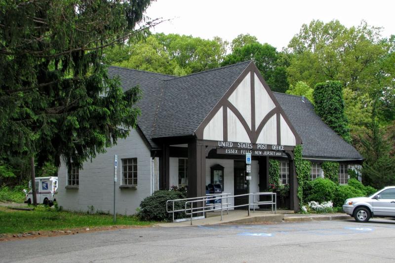


Essex Fells, New Jersey
Essex Fells is a borough of 2,361 people in Essex County, New Jersey, founded in March 31, 1902.
Why visit Essex Fells
Townapedia lists 21 museums and landmarks, 15 parks and trails, 19 places to eat, 1 place to stay and 4 attractions in and around town.
Highlights include Lincoln Group of Schools, Wellmont Theatre, Anderson Park and Canfield-Morgan House.
July is the warmest month, with average highs of 86°F; January lows average 21°F.
Weather in Essex Fells
Forecast from the National Weather Service. Full forecast
About Essex Fells
Essex Fells is a borough in Essex County, in the U.S. state of New Jersey. As of the 2020 United States census, the borough's population was 2,244, an increase of 131 (+6.2%) from the 2010 census count of 2,113, which in turn had reflected a decline of 49 (−2.3%) from the 2,162 counted in the 2000 census.
From the Wikipedia article Essex Fells, New Jersey (this version), under CC BY-SA 4.0.
Things to do4

Lincoln Group of Schools
School · 2.4 mi
Group of schools in New Jersey, US

Wellmont Theatre
Cinema and theater · 3.3 mi
Theater and concert venue in Montclair, New Jersey, United States

Museums and landmarks21

Anderson Park
Monument and historic site · National Register of Historic Places · 1.6 mi
County park in Montclair, United States of America

Canfield-Morgan House
Monument and historic site · National Register of Historic Places · 3.3 mi
Historic house in New Jersey, United States

Carnegie Library
Monument and historic site · National Register of Historic Places · 3.0 mi
Historic building in Montclair, New Jersey, United States

Casa Deldra
Monument and historic site · National Register of Historic Places · 2.5 mi
Historic house in Montclair, New Jersey

Charles S. Shultz House
Monument and historic site · National Register of Historic Places · 2.8 mi
Historic house in New Jersey, United States

Crane House and Museum
Museum · National Register of Historic Places · 3.0 mi
Historic house in Montclair, New Jersey

Eastward
Monument and historic site · National Register of Historic Places · 2.5 mi
Historical building erected in 1902

Egbert Farm
Monument and historic site · National Register of Historic Places · 3.0 mi
Building in New Jersey, United States

Haskell's Bloomfield Villa
Monument and historic site · National Register of Historic Places · 3.1 mi
Building in New Jersey, United States

J. M. Chapman House
Monument and historic site · National Register of Historic Places · 2.6 mi
Montclair, New Jersey, NRHP-listed

Jacobus House
Monument and historic site · National Register of Historic Places · 2.7 mi
Historic house in New Jersey, United States
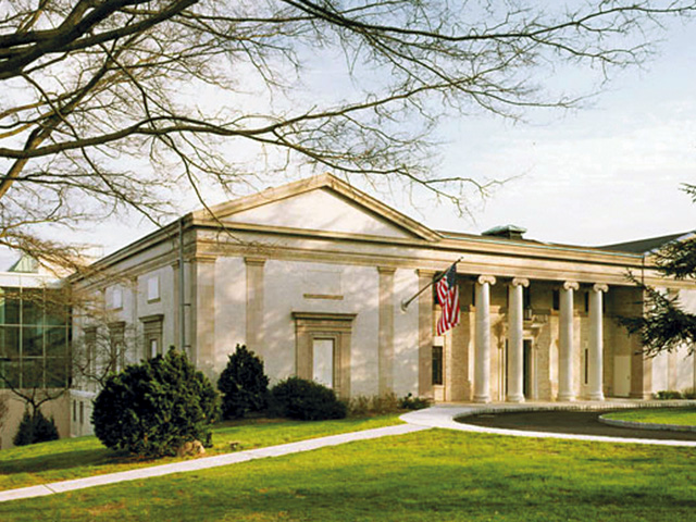
Montclair Art Museum
Museum · National Register of Historic Places · 2.8 mi
Art museum in Montclair, New Jersey
9 more on the map.
Parks, trails and playgrounds15





3 more on the map.
Restaurants and cafes19

Bagelwich
Restaurant · Bagel, Sandwich · 1.5 mi
652 Bloomfield Avenue, Verona
Mo-Sa 05:00-15:00; Su 05:00-14:00
Bella Gente
Restaurant · Italian · 1.5 mi
640 Bloomfield Avenue, Verona
Tu-Th,Su 11:30-21:00; Fr,Sa 11:00-22:00
Fandango Mexican Grill
Restaurant · Mexican · 1.5 mi
490 Pleasant Valley Way
Mo-Th 11:00-21:00; Fr-Sa 11:00-22:00; Su 12:00-21:00
Fortissimo Pizzeria/Osteria
Restaurant · Italian, Pizza · 1.5 mi
484 Pleasant Valley Way
Mo-Th 11:00-21:30; Fr-Sa 11:00-22:30; Su 12:00-21:30

Pizza & Sandwich Barn
Restaurant · Pizza, Sandwich · 0.8 mi
323 Bloomfield Avenue, Caldwell
Mo-Th 11:00-22:00; Fr-Sa 11:00-23:00; Su 14:00-21:00
Cloverleaf Tavern
Restaurant · 0.9 mi
395 Bloomfield Avenue, Caldwell
Mo-Su 11:00-24:00

Calandra's Italian Village
Bakery · 0.6 mi
234 Bloomfield Avenue, Caldwell
Mo-Su 07:00-21:00
Hong Kong Chinese Kitchen
Restaurant · Chinese · 0.9 mi
357 Bloomfield Avenue

Rock N Joe Espresso Cafe
Cafe · 0.8 mi
339 Bloomfield Avenue, Caldwell
Mo-Su 07:30-21:00

7 more on the map.
History
Essex Fells was part of the Horseneck Tract, which was an area that consisted of what are now the municipalities of Caldwell, West Caldwell, North Caldwell, Fairfield, Verona, Cedar Grove, Essex Fells, Roseland, and portions of Livingston and West Orange.
In 1702, settlers purchased the 14,000 acres (57 km2) Horseneck Tract—so-called because of its irregular shape that suggested a horse's neck and head—from the Lenni Lenape Native Americans for goods equal to $325. This purchase encompassed much of western Essex County, from the Orange, or First Mountain in the Watchung Mountain range to the Passaic River.
In the late 1800s, Philadelphia developer Anthony S. Drexel realized the impact of train travel on residential development and sent Charles W. Leavitt to the northern New Jersey area near the end of the Caldwell line. Leavitt, Drexel and Drexel's son-in-law John F. Fell formed the Suburban Land Company and purchased 1,000 acres of land from the estate of Revolutionary War General William J. Gould. In order to create their residential development the group commissioned noted architect Ernest W. Bowditch. The community's name was derived by taking "Essex" from the name of the county and adding "Fells" from the name of John F. Fell which also means hill or down.
From the History section of Essex Fells, New Jersey on Wikipedia, under CC BY-SA 4.0.
Where to stay1
Churches and places of worship14
Grover Cleveland Birthplace
Church · National Register of Historic Places · 0.6 mi
Central Presbyterian Church
Church · National Register of Historic Places · 3.1 mi
Congregational Church
Church · National Register of Historic Places · 3.2 mi
First Methodist Episcopal Church
Church · National Register of Historic Places · 3.2 mi
St. Luke's Church
Church · National Register of Historic Places · 3.3 mi
Ss. Nicholas, Constantine & Helen Greek Orthodox Church
Church · Greek Orthodox · 1.5 mi
80 Laurel Avenue, Roseland
Calvary Lutheran Church of Verona
Church · Lutheran · 1.5 mi
23 South Prospect Street, Verona
Verona United Methodist Church
Church · Methodist · 1.5 mi
24 Montrose Avenue, Verona
Shopping1
Gas and EV charging4
Schools, colleges and libraries45
Healthcare1
Map of Essex Fells
125 places. The map loads OpenStreetMap tiles when you open it.
Climate by month
Monthly table
| Month | High | Low | Rain |
|---|---|---|---|
| Jan | 38°F | 21°F | 3.6 in |
| Feb | 41°F | 22°F | 2.9 in |
| Mar | 49°F | 30°F | 4.2 in |
| Apr | 63°F | 40°F | 4.1 in |
| May | 72°F | 49°F | 4.0 in |
| Jun | 80°F | 59°F | 4.6 in |
| Jul | 86°F | 64°F | 4.8 in |
| Aug | 84°F | 62°F | 4.5 in |
| Sep | 78°F | 54°F | 4.5 in |
| Oct | 65°F | 43°F | 4.3 in |
| Nov | 53°F | 34°F | 3.6 in |
| Dec | 43°F | 27°F | 3.4 in |
U.S. Climate Normals 1991-2020 for Essex Fells Service Bldg (1 mi away), NOAA NCEI.
People and cost of living
American Community Survey 5-year estimates, 2020-2024, U.S. Census Bureau. Estimates have margins of error, larger for small towns.
Disaster history
Essex County has had 21 federal disaster declarations since 2000, most often for hurricanes.
- 2021-09-05: Remnants Of Hurricane Ida (Hurricane)
- 2021-09-02: Remnants Of Hurricane Ida (Hurricane)
- 2020-12-11: Tropical Storm Isaias (Hurricane)
- 2020-03-25: Covid-19 Pandemic (Biological)
- 2020-03-13: Covid-19 (Biological)
- 2018-06-08: Severe Winter Storm And Snowstorm (Severe Storm)
OpenFEMA disaster declarations summaries.
Getting there and nearby towns
Essex County Airport (CDW) is the nearest airport with scheduled flights listed in OpenStreetMap, 3 miles away.
- Caldwell 1 mi north, about 1 min by car
- Upper Montclair 4 mi east, about 7 min by car
- Brookdale 5 mi east, about 8 min by car
- East Orange 6 mi southeast, about 9 min by car
- Clifton 6 mi east, about 10 min by car
- Woodland Park 6 mi northeast, about 10 min by car
- Totowa 6 mi northeast, about 10 min by car
- Ampere North 6 mi southeast, about 9 min by car
- Short Hills 7 mi southwest, about 11 min by car
- Lake Hiawatha 7 mi northwest, about 11 min by car
Drive times are estimates from straight-line distance, not routes.
Local news
Headlines from INDB, the NEMICO news database.
Reviews, tips and questions
Loading what members have shared...
Sources and licences
- NCES EDGE (Public domain): public schools
- NOAA NCEI U.S. Climate Normals 1991-2020 (Public domain): climate by month
- OpenFEMA (Public domain): disaster declarations
- OpenStreetMap contributors (ODbL 1.0): places, airports, map data
- U.S. Census Bureau (Public domain): population, income, housing, education, commute
- Wikidata (CC0 1.0): elevation, founding date, time zone, website, landmarks and historic places
- Wikimedia Commons (see each image): photos
- Wikipedia (CC BY-SA 4.0): overview and history text
Photo credits
- EF PO, NAB1997, CC BY-SA 4.0
- Grover Cleveland birthplace01, Davidt8, Public domain
- 128 North Mountain Avenue Montclair NJ-SWM-TLW- 2012-09-23, Snowilli, CC BY-SA 3.0
- Central Presbyterian Church, Montclair, New Jersey, Jrogers123, CC BY-SA 3.0
- Montclair Congregational PM jeh, Jim.henderson, CC0
- Montclair Art Museum (Montclair, New Jersey), Blondhairblueeyed at English Wikipedia . Later version(s) were uploaded by DavidRavenMoon at English Wikipedia ., CC BY-SA 3.0
- Stone Eagles House Montclair, Jared Kofsky/PlaceNJ.com, CC BY-SA 3.0
- Harrison House Roseland, Lalmeister, CC BY-SA 3.0
- First Methodist Church, Montclair, New Jersey, Jrogers123, CC BY-SA 3.0
- Samuel Orton Harrison House, May 1937, Merritt Lacey, Public domain
- Israel Crane House, Montclair, NJ, Zeete, CC BY-SA 4.0
- CANFIELD-MORGAN HOUSE, ESSEX, NJ, JERRYE & ROY KLOTZ, M.D., CC BY-SA 4.0
- HASKELL'S BLOOMFIELD VILLA, ESSEX COUNTY, NJ, JERRYE & ROY KLOTZ MD, CC BY-SA 4.0
- St. Lukes Episcopal Church, Montclair, NJ jeh, Jim.henderson, CC0
- CARNEGIE LIBRARY, MONTCLAIR, ESSEX COUNTY, NJ, JERRYE & ROY KLOTZ MD, CC BY-SA 4.0
- J M Chapman House, Montclair, New Jersey, Jrogers123, CC BY-SA 3.0
- Red Gables Montclair jeh, Jim.henderson, CC0
- JACOB'S HOUSE, CEDAR GROVE, ESSEX COUNTY, NJ, JERRYE & ROY KLOTZ, M.D., CC BY-SA 4.0
- Charles S Schultz House, Montclair, New Jersey, Jrogers123, CC BY-SA 3.0
- Casa Deldra - Rear View, Montclair, New Jersey, Jrogers123, CC BY-SA 3.0
- EASTWARD, MONTCLAIR, ESSEX COUNTY, NJ, JERRYE & ROY KLOTZ MD, CC BY-SA 4.0
- Wellmont Theater, Montclair NJ (2006), Blondhairblueeyed at English Wikipedia, CC BY-SA 3.0
- Riker-hill-complex-radar-tower, Dmadeo, CC BY-SA 3.0
- St. Peter's Episcopal Church, Essex Fells, NJ (1), Dec. 2024, Mr. Matté (if there is an issue with this image, contact me using this image's Commons talk page , my Commons user talk page , or my English Wikipedia user talk page ; I'll know about it a lot faster), CC BY-SA 4.0


Page built October 30, 2026. Spotted a mistake? Tell us or suggest a place.