


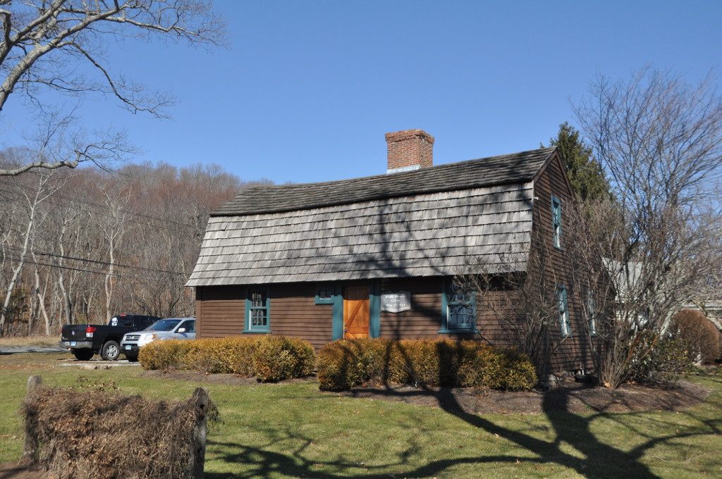

Why visit Essex Village
Townapedia lists 19 museums and landmarks, 26 parks and trails, 12 places to eat and 10 attractions in and around town.
Highlights include Chester Rock Light, Connecticut River Bridge, Connecticut River Museum and Benjamin Bushnell Farm.
July is the warmest month, with average highs of 82°F; February lows average 25°F.
Weather in Essex Village
Forecast from the National Weather Service. Full forecast
About Essex Village
Essex Village is a village and census-designated place (CDP) in the town of Essex, Connecticut, United States. The population was 2,583 at the 2020 census, out of 6,733 in the entire town of Essex. The government offices of the town are located within the village.
From the Wikipedia article Essex Village, Connecticut (this version), under CC BY-SA 4.0.
Things to do10

Chester Rock Light
Lighthouse · 2.5 mi
Lighthouse in Connecticut, United States

Connecticut River Bridge
Bridge · 3.9 mi
Railroad bridge in Connecticut, US
Essex Reef Light
Lighthouse · 1.1 mi
Lighthouse in Connecticut, United States
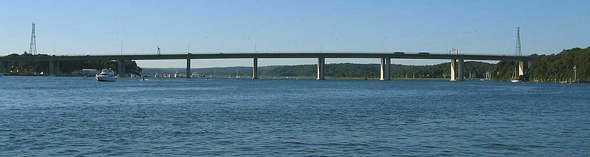
Raymond E. Baldwin Bridge
Bridge · 3.5 mi
Bridge in Connecticut, United States

Museums and landmarks19
Connecticut River Museum
Monument and historic site · National Register of Historic Places · 0.6 mi
Maritime museum in Connecticut, USA

Benjamin Bushnell Farm
Monument and historic site · National Register of Historic Places · 2.3 mi
Building in Connecticut, United States
Doris
Monument and historic site · National Register of Historic Places · 1.8 mi
American sailing yacht

Essex Freight Station
Monument and historic site · National Register of Historic Places · 0.8 mi
Disused station in Centerbrook, Connecticut
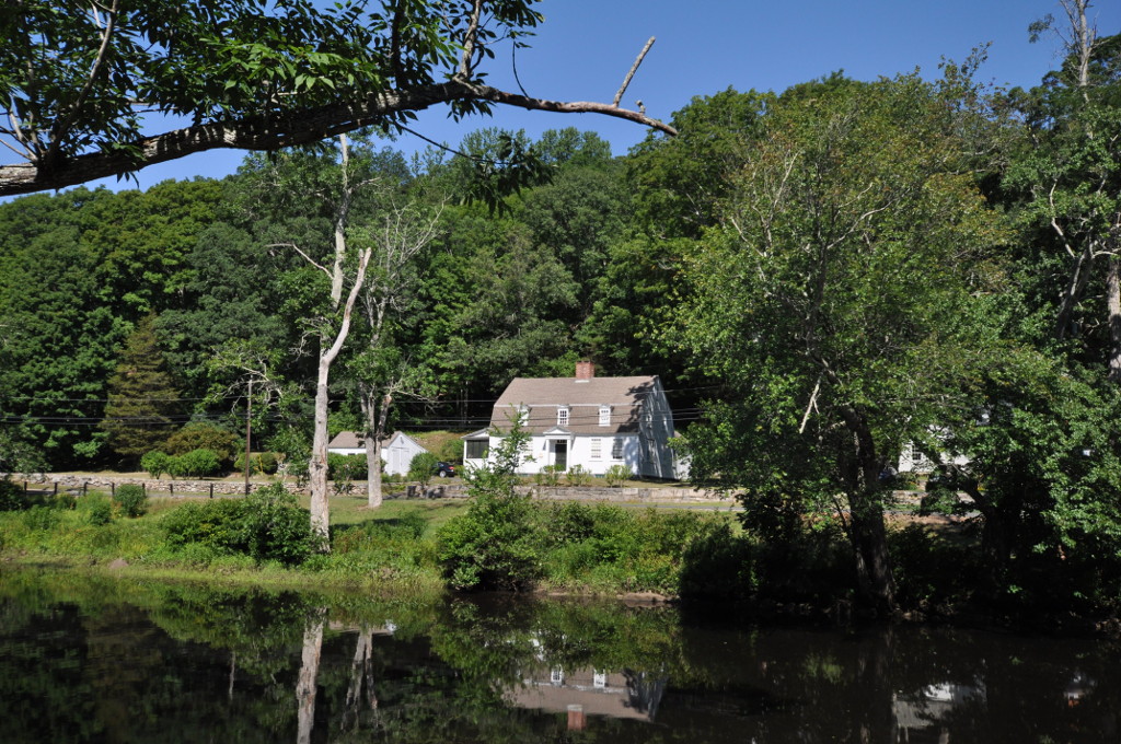
Hamburg Bridge Historic District
Monument and historic site · National Register of Historic Places · 3.3 mi
Historic district in Connecticut, United States

Hill's Academy
Museum · National Register of Historic Places
Building in Connecticut, United States

Ivoryton Playhouse
Cinema and theater · National Register of Historic Places · 2.6 mi
Theater in the village of Ivoryton near Essex, Connecticut, United States

Jedidiah Dudley House
Monument and historic site · National Register of Historic Places · 3.4 mi
Old Saybrook, Connecticut, listed on the NRHP in Middlesex County, Connecticut

John Whittlesey Jr. House
Monument and historic site · National Register of Historic Places · 3.4 mi
Historic house in Connecticut, United States
Parker House
Monument and historic site · National Register of Historic Places · 2.5 mi
Historic house in Connecticut, United States


Pratt House
Monument and historic site · National Register of Historic Places · 0.6 mi
Historic house in Connecticut, United States

Selden Island Site
Monument and historic site · National Register of Historic Places · 2.9 mi
Archaeological site in New London County, United States of America
7 more on the map.
Parks, trails and playgrounds26


Turtle Creek Preserve
Hiking and trails · 1.5 mi
Private, Open To Public Without Fee
South Cove Access
Hiking and trails · 0.6 mi
Municipal, Open To Public Without Fee
Sunset Pond
Hiking and trails · 0.4 mi
Leased By Town. Private, Open To Public Without Fee
Triangle (Deep River Road)
Hiking and trails · 1.3 mi
Municipal, Open To Public Without Fee

14 more on the map.
Restaurants and cafes12




Churches and places of worship7
Centerbrook Congregational Church
Church · National Register of Historic Places · 1.2 mi
Shopping7
Gas and EV charging2
Schools, colleges and libraries17
Map of Essex Village
100 places. The map loads OpenStreetMap tiles when you open it.
Climate by month
Monthly table
| Month | High | Low | Rain |
|---|---|---|---|
| Jan | 39°F | 25°F | 3.6 in |
| Feb | 39°F | 25°F | 3.5 in |
| Mar | 46°F | 32°F | 4.2 in |
| Apr | 57°F | 42°F | 4.6 in |
| May | 65°F | 49°F | 3.9 in |
| Jun | 75°F | 60°F | 4.2 in |
| Jul | 82°F | 67°F | 4.2 in |
| Aug | 80°F | 67°F | 4.9 in |
| Sep | 74°F | 60°F | 5.8 in |
| Oct | 65°F | 50°F | 4.8 in |
| Nov | 54°F | 41°F | 3.7 in |
| Dec | 45°F | 32°F | 4.7 in |
U.S. Climate Normals 1991-2020 for Orient Pt Sp (17 mi away), rain and snow from Killingworth 2.6 Ese, NOAA NCEI.
People and cost of living
American Community Survey 5-year estimates, 2020-2024, U.S. Census Bureau. Estimates have margins of error, larger for small towns.
Disaster history
The county has had 20 federal disaster declarations since 2000, most often for hurricanes.
- 2021-10-30: Remnants Of Hurricane Ida (Hurricane)
- 2021-08-22: Hurricane Henri (Hurricane)
- 2021-01-12: Tropical Storm Isaias (Hurricane)
- 2020-08-06: Tropical Storm Isaias (Hurricane)
- 2020-03-28: Covid-19 Pandemic (Biological)
- 2020-03-13: Covid-19 (Biological)
OpenFEMA disaster declarations summaries.
Getting there and nearby towns
Groton-New London Airport (GON) is the nearest airport with scheduled flights listed in OpenStreetMap, 18 miles away.
- Deep River Center 2 mi northwest, about 4 min by car
- Chester Center 5 mi northwest, about 7 min by car
- Saybrook Manor 5 mi south, about 8 min by car
- Old Saybrook Center 5 mi south, about 9 min by car
- Westbrook Center 6 mi southwest, about 9 min by car
- Clinton 9 mi southwest, about 14 min by car
- Niantic 10 mi east, about 17 min by car
- Moodus 10 mi north, about 17 min by car
- Madison Center 12 mi southwest, about 19 min by car
- Higganum 13 mi northwest, about 20 min by car
Drive times are estimates from straight-line distance, not routes.
Local news
Headlines from INDB, the NEMICO news database.
Reviews, tips and questions
Loading what members have shared...
Sources and licences
- NCES EDGE (Public domain): public schools
- NOAA NCEI U.S. Climate Normals 1991-2020 (Public domain): climate by month
- OpenFEMA (Public domain): disaster declarations
- OpenStreetMap contributors (ODbL 1.0): places, airports, map data
- U.S. Census Bureau (Public domain): population, income, housing, education, commute
- Wikidata (CC0 1.0): landmarks and historic places
- Wikimedia Commons (see each image): photos
- Wikipedia (CC BY-SA 4.0): overview and history text
Photo credits
- Main Street, Essex CT, John Phelan, CC BY-SA 4.0
- CONNECTICUT RIVER MUSEUM, ESSEX, CT, JERRYE AND ROY KLOTZ MD, CC BY-SA 3.0
- PRATT HOUSE - ESSEX, ROY KLOTZ MD, CC BY-SA 3.0
- COMSTOCK-CHENEY HALL, ROY KLOTZ MD, CC BY-SA 3.0
- OldSaybrookCT ParkerHouse, Magicpiano, CC BY-SA 3.0
- DorisYacht, William A. Scofield Jr., Public domain
- LymeCT HamburgHD 1, Magicpiano, CC BY-SA 3.0
- ESSEX FREIGHT STATION, ROY KLOTZ M.D., CC BY-SA 3.0
- OldSaybrookCT JedidiahDudleyHouse, Magicpiano, CC BY-SA 3.0
- HILL'S ACADEMY - ESSEX, ROY KLOTZ MD, CC BY-SA 3.0
- Springbank, Old Lyme, CT, Pi.1415926535, CC BY-SA 3.0
- EssexCT BenjaminBushnellFarm, Magicpiano, CC BY-SA 3.0
- JOHN WHITTLESEY JR HOUSE, OLD SAYBROOK, ROY KLOTZ MD, CC BY-SA 3.0
- Deep River station building, December 2016, Pi.1415926535, CC BY-SA 3.0
- DeepRiverCT PrattReadFactory1, Magicpiano, CC BY-SA 4.0
- Town Hall, Deep River, Connecticut, Doug Kerr from Albany, NY, United States, CC BY-SA 2.0
- Essex - First Baptist Church, JG, Public domain
- Connecticut River Bridge from Ferry Landing State Park (1), May 2014, Pi.1415926535, CC BY-SA 4.0
- IMG 4037 Raymond E. Baldwin Bridge, Denimadept, CC BY-SA 3.0


Page built October 30, 2026. Spotted a mistake? Tell us or suggest a place.