
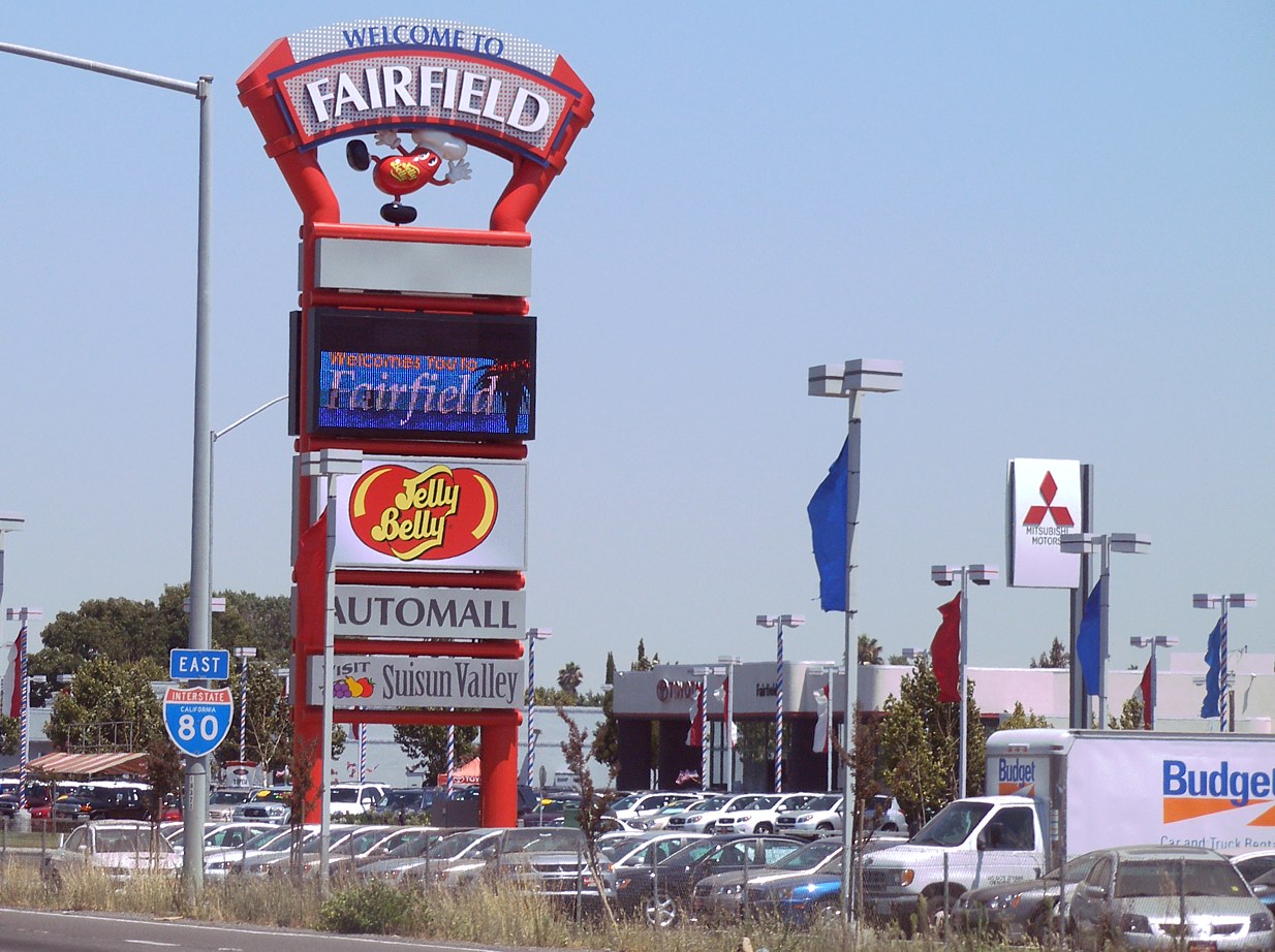


Fairfield, California
Fairfield is a city of 120,785 people in Solano County, California, founded in 1859.
Why visit Fairfield
Townapedia lists 31 museums and landmarks, 39 parks and trails, 123 places to eat, 17 places to stay and 1 attraction in and around town.
Highlights include Regal Edwards Fairfield & IMAX, Peña Adobe, Suisun Masonic Lodge No. 55 and Paradise Valley Golf Course.
July is the warmest month, with average highs of 90°F; December lows average 40°F.
Weather in Fairfield
Forecast from the National Weather Service. Full forecast
About Fairfield
Fairfield is a city in and the county seat of Solano County, California, United States, in the North Bay sub-region of the San Francisco Bay Area.
From the Wikipedia article Fairfield, California (this version), under CC BY-SA 4.0.
Things to do1

Museums and landmarks31

Peña Adobe
Monument and historic site · National Register of Historic Places · 5.3 mi
Historic building in Vacaville, California, United States

Suisun Masonic Lodge No. 55
Monument and historic site · National Register of Historic Places · 1.7 mi
Masonic temple in California, United States of America

Temelec Hall
Monument and historic site · National Register of Historic Places · 5.3 mi
Community hall in Sonoma, California

Vacaville Town Hall
Monument and historic site · National Register of Historic Places · 7.0 mi
Historic former government building in California, USA


Will H. Buck House
Monument and historic site · National Register of Historic Places · 6.9 mi
Vacaville, California


19 more on the map.
Parks, trails and playgrounds39





27 more on the map.
Restaurants and cafes123

Baskin-Robbins
Ice cream · Ice Cream · 1.9 mi
3069 Travis Boulevard, Fairfield
Mo-Th 11:00-21:00; Fr-Su 11:00-22:00

Hinata Japanese Steakhouse, Sushi, and Bar
Restaurant · Asian, Japanese, Sushi · 6.8 mi
5113 Business Center Drive, Fairfield
Mo-Fr 11:00-21:30; Sa-Su 12:00-21:30; PH unknown
Mountain Mike's
Restaurant · Pizza · 5.9 mi
251 Pittman Road, Fairfield
Mo-Th,Su 10:00-21:30; Fr-Sa 10:00-22:30

Quickly
Cafe · Bubble Tea · 1.1 mi
1350 Travis Boulevard, Fairfield
Mo-Fr 10:00-21:00; Sa 10:00-20:00; Su 11:00-18:00

Slanted Tree Kitchen & Taproom
Diner · American · 5.9 mi
251 Pittman Road
Mo-Th 11:00-22:00; Fr-Sa 11:00-24:00; Su 10:00-22:00
Yo Sushi
Restaurant · Asian, Japanese, Sushi
1430 North Texas Street, Fairfield
Mo-Th,Su 11:00-20:30; Fr-Sa 11:00-21:00; PH unknown
Dutch Bros. Coffee
Cafe · Coffee Shop · 1.4 mi
1420 West Texas Street, Fairfield
Mo 05:30-22:00; Tu 05:30-17:00; We-Th 05:30-22:00; Fr-Sa...

Journey Coffee Co.
Cafe · 4.5 mi
5350 One Lake Drive, Fairfield
Mo-Tu 07:00-14:00; We-Fr 07:00-20:00; PH unknown; Sa 08:00-20:00;...
111 more on the map.
History
Native Americans such as the Suisun people inhabited the area.
A clipper ship captain from Fairfield, Connecticut, named Robert H. Waterman, parceled out the town in 1856. He entered Fairfield in the race for Solano County seat in 1858, and won it from Benicia. As an inducement, he granted 16 acres (6.5 ha) of land for the construction of county buildings. In 1903, Fairfield was incorporated as a city.
In August 2020, parts of Fairfield were evacuated due to the LNU Lighting Complex Fires, which resulted in the burning of over 315,000 acres (127,476 ha) in five counties, including in nearby Vacaville.
From the History section of Fairfield, California on Wikipedia, under CC BY-SA 4.0.
Where to stay17
Homewood Suites by Hilton Fairfield-Napa Valley Area
Motel and hotel · 6.4 mi
4755 Business Center Drive, Fairfield
Staybridge Suites Fairfield Napa Valley Area by IHG
Motel and hotel · 6.4 mi
4775 Business Center Drive, Fairfield
Fairfield Inn & Suites Fairfield Napa Valley Area
Motel and hotel · 6.0 mi
315 Pittman Road, Fairfield
Churches and places of worship8
Our Lady of Mount Carmel Catholic Church
Church · Roman Catholic · 1.3 mi
2700 Dover Avenue, Fairfield
Shopping33
Gas and EV charging30
Schools, colleges and libraries77
Healthcare12
Kaiser Permanente Fairfield Medical Offices
Clinic and pharmacy · 1.3 mi
1550 Gateway Boulevard, Fairfield
Sutter Fairfield Medical Campus
Clinic and pharmacy · 3.4 mi
2700-2720 Low Court, Fairfield
Costco Pharmacy
Clinic and pharmacy · 6.9 mi
5101 Business Center Drive, Fairfield
Map of Fairfield
250 places. The map loads OpenStreetMap tiles when you open it.
Climate by month
Monthly table
| Month | High | Low | Rain | Snow |
|---|---|---|---|---|
| Jan | 57°F | 40°F | 4.7 in | 0.0 in |
| Feb | 62°F | 43°F | 5.0 in | 0.0 in |
| Mar | 66°F | 45°F | 3.3 in | 0.0 in |
| Apr | 71°F | 48°F | 1.5 in | 0.0 in |
| May | 78°F | 52°F | 0.7 in | 0.0 in |
| Jun | 85°F | 56°F | 0.2 in | 0.0 in |
| Jul | 90°F | 58°F | 0.0 in | 0.0 in |
| Aug | 89°F | 58°F | 0.0 in | 0.0 in |
| Sep | 87°F | 57°F | 0.1 in | 0.0 in |
| Oct | 78°F | 52°F | 1.1 in | 0.0 in |
| Nov | 66°F | 45°F | 2.5 in | 0.0 in |
| Dec | 57°F | 40°F | 5.4 in | 0.0 in |
U.S. Climate Normals 1991-2020 for Fairfield (2 mi away), NOAA NCEI.
People and cost of living
American Community Survey 5-year estimates, 2020-2024, U.S. Census Bureau. Estimates have margins of error, larger for small towns.
Disaster history
Solano County has had 16 federal disaster declarations since 2000, most often for fires.
- 2023-04-03: Severe Winter Storms, Straight-Line Winds, Flooding, Landslides, And Mudslides (Severe Storm)
- 2023-01-14: Severe Winter Storms, Flooding, Landslides, And Mudslides (Flood)
- 2023-01-09: Severe Winter Storms, Flooding, And Mudslides (Flood)
- 2020-08-22: Wildfires (Fire)
- 2020-08-18: Lnu Lightning Fire Complex (Fire)
- 2020-03-22: Covid-19 Pandemic (Biological)
OpenFEMA disaster declarations summaries.
Getting there and nearby towns
Travis Air Force Base (SUU) is the nearest airport with scheduled flights listed in OpenStreetMap, 6 miles away.
- Suisun City 2 mi southeast, about 2 min by car
- Vacaville 8 mi northeast, about 12 min by car
- American Canyon 14 mi southwest, about 22 min by car
- Napa 15 mi west, about 24 min by car
- Benicia 15 mi southwest, about 24 min by car
- Vallejo 16 mi southwest, about 26 min by car
- Bay Point 16 mi south, about 26 min by car
- Dixon 17 mi northeast, about 27 min by car
- Pittsburg 18 mi southeast, about 30 min by car
- Martinez 19 mi south, about 30 min by car
Drive times are estimates from straight-line distance, not routes.
Local news
Headlines from INDB, the NEMICO news database.
Reviews, tips and questions
Loading what members have shared...
Sources and licences
- NCES EDGE (Public domain): public schools
- NOAA NCEI U.S. Climate Normals 1991-2020 (Public domain): climate by month
- OpenFEMA (Public domain): disaster declarations
- OpenStreetMap contributors (ODbL 1.0): places, airports, map data
- U.S. Census Bureau (Public domain): population, income, housing, education, commute
- Wikidata (CC0 1.0): elevation, founding date, time zone, website, landmarks and historic places
- Wikimedia Commons (see each image): photos
- Wikipedia (CC BY-SA 4.0): overview and history text
Photo credits
- Welcometofairfield, Coolcaesar at English Wikipedia, CC BY-SA 3.0
- Suisun mason lodge, Epolk, CC0
- Pena Adobe - Vacaville, CA, Brian Irwin, CC BY-SA 3.0
- Temelec Hall, 220 and 221 Temelec Circle, Temelec, CA 6-12-2010 2-05-54 PM, Sanfranman59, CC BY-SA 3.0
- Old-town-hall-vacaville-ca, Brian Irwin, CC BY-SA 3.0
- Will H. Buck House, 301 Buck Ave., Vacaville, CA 5-4-2013 8-02-08 PM, Sanfranman59, CC BY-SA 3.0
Page built October 30, 2026. Spotted a mistake? Tell us or suggest a place.