


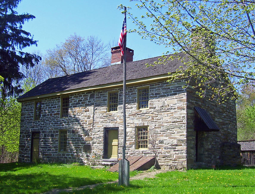


Firthcliffe, New York
Firthcliffe is a community of 5,432 people in Orange County, New York.
Why visit Firthcliffe
Townapedia lists 45 museums and landmarks, 16 parks and trails, 42 places to eat, 3 places to stay and 5 attractions in and around town.
Highlights include Lower Dock Hill Road Stone Arch Bridge, Moodna Viaduct, Amelia Barr House and Camp Olmsted.
July is the warmest month, with average highs of 85°F; January lows average 21°F, and about 36 inches of snow fall in a normal year.
Weather in Firthcliffe
Forecast from the National Weather Service. Full forecast
About Firthcliffe
Firthcliffe is a hamlet (and census-designated place) in Orange County, New York United States. The population was 5,022 at the 2020 Census. It is part of the Kiryas Joel–Poughkeepsie–Newburgh, NY Metropolitan Statistical Area as well as the larger New York–Newark–Bridgeport, NY-NJ-CT-PA Combined Statistical Area.
From the Wikipedia article Firthcliffe, New York (this version), under CC BY-SA 4.0.
Things to do5

Lower Dock Hill Road Stone Arch Bridge
Bridge · National Register of Historic Places · 1.6 mi
Bridge in United States of America

Moodna Viaduct
Bridge · 3.5 mi
Railroad bridge in United States of America


Museums and landmarks45

Amelia Barr House
Monument and historic site · National Register of Historic Places · 1.5 mi
Historic house in Cornwall-on-Hudson, New York
258 Mountain Road, Cornwall-on-Hudson

Camp Olmsted
Monument and historic site · National Register of Historic Places · 1.5 mi
Five Points Mission summer camp and retreat in Cornwall-on-Hudson

Cornwall Friends Meeting House
Monument and historic site · Quaker · National Register of Historic Places · 0.8 mi
Historic church in New York, United States
60 Quaker Avenue, Cornwall

Deer Hill
Monument and historic site · National Register of Historic Places · 1.5 mi
Historic house in Cornwall, New York, United States
Edmonston House
Monument and historic site · National Register of Historic Places · 1.8 mi
Historic house in New York, United States
1042 State Route 94, New Windsor

Sands Ring Homestead Museum
Monument and historic site · National Register of Historic Places
Historic house in New York, United States
180 Main Street, Cornwall

Wyant-Talbot House
Monument and historic site · National Register of Historic Places · 0.9 mi
Historic house in New York, United States
42 Clark Avenue, Cornwall-on-Hudson

A. J. Clark Store
Monument and historic site · National Register of Historic Places · 0.5 mi
Historic commercial building in Cornwall, New York state, USA

A. Walsh Stone House and Farm Complex
Monument and historic site · National Register of Historic Places · 3.5 mi
Historic house in Cornwall, New York

Adams–Chadeayne–Taft Estate
Monument and historic site · National Register of Historic Places · 0.9 mi
United States historic place in Cornwall-on-Hudson, Orange County, New York

Carvey–Gatfield House
Monument and historic site · National Register of Historic Places · 2.5 mi
Historic house in New York, United States


Cromwell Manor
Monument and historic site · National Register of Historic Places · 1.2 mi
Historic house
33 more on the map.
Parks, trails and playgrounds16

Edward Payson Roe Memorial Park
Park · 0.9 mi
Park in Cornwall-on-Hudson, New York

Storm King Art Center
Park · 1.8 mi
Open-air museum and sculpture park located in Mountainville, New York
Ward Pound Ridge Reservation
Park · 2.5 mi
Park in Westchester County, New York, United States of America



4 more on the map.
Restaurants and cafes42

Cieto Lindo Mexican Restaurant
Restaurant · Mexican · 0.4 mi
255 Main Street, Cornwall
Su-Th 10:00-21:00; Fr-Sa 10:00-22:00
Storm King Lounge and Fare
Restaurant · 0.9 mi
2 Idlewild Avenue, Cornwall-on-Hudson
We-Sa 16:00-22:00; Su 10:00-15:00


Sakura Asian Cuisine
Restaurant · Sushi, Japanese, Chinese, Asian, Thai, Poke · 0.7 mi
55 Quaker Avenue, Cornwall
30 more on the map.
Where to stay3
Churches and places of worship10
Canterbury Presbyterian Church
Church · National Register of Historic Places · 0.5 mi
St. Thomas Episcopal Church
Church · National Register of Historic Places · 2.1 mi
Saint Thomas of Canterbury Catholic Church
Church · Roman Catholic · 0.5 mi
10 Second Street, Cornwall-on-Hudson
Vails Gate United Methodist Church
Church · United Methodist · 1.4 mi
854 Blooming Grove Turnpike, New Windsor
Cornwall Presbyterian Church
Church · Presbyterian · 1.0 mi
222 Hudson Street, Cornwall-on-Hudson
Shopping9
Gas and EV charging5
Schools, colleges and libraries27
Highland Falls Intermediate School
School · 5.9 mi
52 Mountain Ave, Highland Falls
Healthcare6
Map of Firthcliffe
168 places. The map loads OpenStreetMap tiles when you open it.
Climate by month
Monthly table
| Month | High | Low | Rain | Snow |
|---|---|---|---|---|
| Jan | 36°F | 21°F | 3.8 in | 11.1 in |
| Feb | 39°F | 22°F | 3.0 in | 7.1 in |
| Mar | 47°F | 30°F | 4.0 in | 9.6 in |
| Apr | 60°F | 40°F | 4.0 in | 0.4 in |
| May | 72°F | 51°F | 3.8 in | 0.0 in |
| Jun | 80°F | 60°F | 4.6 in | 0.0 in |
| Jul | 85°F | 65°F | 4.6 in | 0.0 in |
| Aug | 83°F | 64°F | 5.0 in | 0.0 in |
| Sep | 76°F | 57°F | 4.6 in | 0.0 in |
| Oct | 63°F | 46°F | 5.3 in | 0.0 in |
| Nov | 51°F | 36°F | 4.2 in | 0.5 in |
| Dec | 41°F | 27°F | 4.6 in | 7.0 in |
U.S. Climate Normals 1991-2020 for West Point Hcn (5 mi away), NOAA NCEI.
People and cost of living
American Community Survey 5-year estimates, 2020-2024, U.S. Census Bureau. Estimates have margins of error, larger for small towns.
Disaster history
Orange County has had 26 federal disaster declarations since 2000, most often for severe storms.
- 2024-11-15: Jennings Creek Fire (Fire)
- 2023-07-22: Severe Storms And Flooding (Severe Storm)
- 2021-09-05: Remnants Of Hurricane Ida (Hurricane)
- 2021-09-02: Remnants Of Hurricane Ida (Hurricane)
- 2021-08-22: Hurricane Henri (Hurricane)
- 2020-03-20: Covid-19 Pandemic (Biological)
OpenFEMA disaster declarations summaries.
Getting there and nearby towns
New York Stewart International Airport (SWF) is the nearest airport with scheduled flights listed in OpenStreetMap, 6 miles away.
- Cornwall-on-Hudson 1 mi southeast, about 2 min by car
- Newburgh 4 mi north, about 7 min by car
- Cold Spring 4 mi east, about 7 min by car
- Beaver Dam Lake 5 mi west, about 8 min by car
- Beacon 6 mi northeast, about 9 min by car
- Balmville 6 mi north, about 10 min by car
- Mountain Lodge Park 7 mi southwest, about 11 min by car
- Woodbury 9 mi southwest, about 14 min by car
- Kiryas Joel 10 mi southwest, about 16 min by car
- Fishkill 10 mi northeast, about 15 min by car
Drive times are estimates from straight-line distance, not routes.
Local news
Headlines from INDB, the NEMICO news database.
Reviews, tips and questions
Loading what members have shared...
Sources and licences
- NCES EDGE (Public domain): public schools
- NOAA NCEI U.S. Climate Normals 1991-2020 (Public domain): climate by month
- OpenFEMA (Public domain): disaster declarations
- OpenStreetMap contributors (ODbL 1.0): places, airports, map data
- U.S. Census Bureau (Public domain): population, income, housing, education, commute
- Wikidata (CC0 1.0): elevation, founding date, time zone, website, landmarks and historic places
- Wikimedia Commons (see each image): photos
- Wikipedia (CC BY-SA 4.0): overview and history text
Photo credits
- Firthcliffe Firehouse, Daniel Case, CC BY-SA 3.0
- Knox's Headquarters, The original uploader was Daniel Case at English Wikipedia ., CC BY-SA 3.0
- Amelia Barr House, Daniel Case, CC BY-SA 3.0
- Edmonston House, The original uploader was Daniel Case at English Wikipedia ., CC BY-SA 3.0
- DEER HILL, CORNWALL, ORANGE COUNTY, NY, JERRYE & ROY KLOTZ M.D., CC BY-SA 4.0
- Wyant-Talbot House, Daniel Case, CC BY-SA 3.0
- Camp Olmsted gate, Daniel Case, CC BY-SA 3.0
- Sands-Ring House, The original uploader was Daniel Case at English Wikipedia ., CC BY-SA 3.0
- Cornwall Friends Meeting House, Daniel Case, CC BY-SA 3.0
- St Thomas Episcopal Church, New Windsor, NY, Daniel Case, CC BY-SA 3.0
- UNION CHAPEL, CORNWALL-ON-HUDSON, ORANGE COUNTY, NY, JERRYE & ROY KLOTZ M.D., CC BY-SA 4.0
- Scribner House, Cornwall, NY, Daniel Case, CC BY-SA 3.0
- Walsh Stone Farmhouse, Daniel Case, CC BY-SA 3.0
- ADAMS-CHADEAYNE-TAFT ESTATE, CORNWALL-ON-HUDSON, ORANGE COUNTY, NY, JERRYE & ROY KLOTZ M.D., CC BY-SA 4.0
- LOWER DOCK HILL ROAD STONE ARCH BRIDGE, ORANGE COUNTY, NY, JERRYE & ROY KLOTZ M.D., CC BY-SA 4.0
- Canterbury Presbyterian Church, Daniel Case, CC BY-SA 3.0
- NY 218 on Storm King, Daniel Case, CC BY-SA 3.0
- James Squire Patton House, Daniel Case, CC BY-SA 3.0
- AJ Clark Store, Daniel Case, CC BY-SA 3.0
- LeDoux-Healey House, Daniel Case, CC BY-SA 3.0
- Walter Hand House, Cornwall, NY, Daniel Case, CC BY-SA 3.0
- Patrick Piggot House, Daniel Case, CC BY-SA 3.0
- Carvey-Gatfield House, Daniel Case, CC BY-SA 3.0
- River View House, Caseycomara, CC BY-SA 4.0
- Dutchess Manor, Daniel Case, CC BY-SA 3.0
- WALSH-HAVEMEYER HOUSE, NEW WINDSOR, ORANGE COUNTY, NY, JERRYE & ROY KLOTZ M.D., CC BY-SA 4.0
- Samuel Brooks House, Cornwall, NY, Daniel Case, CC BY-SA 3.0
- Cromwell Manor, Daniel Case, CC BY-SA 3.0
- Mary Van Duzer-Sayer House, Daniel Case, CC BY-SA 3.0
- VERMONT HATCH MANSION, CORNWALL, ORANGE COUNTY, NY, JERRYE & ROY KLOTZ M.D., CC BY-SA 4.0
- Oliver Brewster House, Daniel Case, CC BY-SA 3.0
- Woodruff House, Cornwall, NY, Daniel Case, CC BY-SA 3.0
- Daniel Sutherland House, Daniel Case, CC BY-SA 3.0
- ISAAC COCKS HOUSE, CORNWALL, ORANGE COUNTY NY, JERRYE & ROY KLOTZ M.D., CC BY-SA 4.0
- David Sutherland House, Daniel Case, CC BY-SA 3.0
- DOCK HILL ROAD EXTENSION STONE ARCH BRIDGE, ORANGE COUNTY, NY, JERRYE & ROY KLOTZ M.D., CC BY-SA 4.0
- Wilford Wood House, Daniel Case, CC BY-SA 3.0
- Sands-Ring Homestead - panoramio, Jon Platek, CC BY-SA 3.0
- Cornwall, NY, town hall, Daniel Case, CC BY-SA 4.0
- Rings Pond - panoramio, Jon Platek, CC BY-SA 3.0


Page built October 30, 2026. Spotted a mistake? Tell us or suggest a place.