


Why visit Beacon
Townapedia lists 45 museums and landmarks, 15 parks and trails, 48 places to eat, 5 places to stay and 11 attractions in and around town.
Highlights include Tioronda Bridge, The Beacon, Dia:Beacon and Beacon Post Office.
July is the warmest month, with average highs of 85°F; January lows average 21°F, and about 36 inches of snow fall in a normal year.
Weather in Beacon
Forecast from the National Weather Service. Full forecast
About Beacon
Beacon is a city located on the Hudson River in Dutchess County, New York, United States. As of the 2020 census, the city's population was 13,769. Beacon is part of the Kiryas Joel–Poughkeepsie–Newburgh metropolitan area as well as the larger New York metropolitan area.
From the Wikipedia article Beacon, New York (this version), under CC BY-SA 4.0.
Things to do11

Tioronda Bridge
Bridge · National Register of Historic Places · 1.1 mi
Bridge in New York, United States

Beacon Theatre
Cinema and theater
Theater and movie theater in Beacon, New York

Newburgh–Beacon Bridge
Bridge · 1.9 mi
Bridge between Dutchess and Orange Counties, New York, United States
Ritz Theatre
Cinema and theater · 2.4 mi
Theater and former movie theater in Newburgh, New York, United States


Museums and landmarks45

Dia:Beacon
Museum · 0.9 mi
Art museum in Beacon, New York
3 Beekman Street, Beacon
Sa-Su 12:00-13:30; Mo-Fr 10:00-17:00

Beacon Post Office
Monument and historic site · National Register of Historic Places
Post office in Beacon, United States of America
369 Main Street, Beacon

Balmville Cemetery
Monument and historic site · National Register of Historic Places · 3.3 mi
Historic cemetery in New York, United States
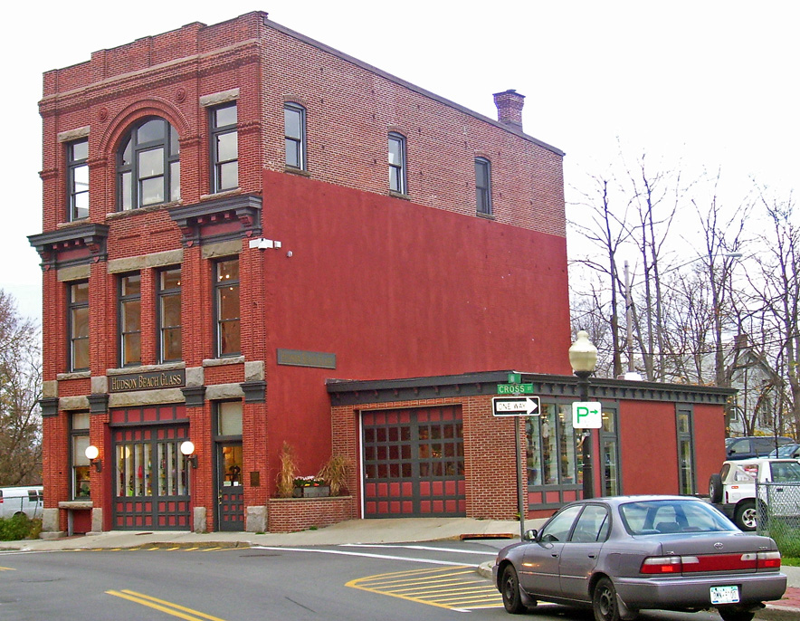
Beacon Engine Company No. 1 Firehouse
Monument and historic site · National Register of Historic Places · 0.7 mi
Fire station in Beacon, United States of America

Belknap Stone House
Monument and historic site · National Register of Historic Places · 3.9 mi
Historic house in New York, United States

Bloomer–Dailey House and Balmville Tree
Monument and historic site · National Register of Historic Places · 3.2 mi
Historic house and landscape in Balmville, New York state, USA

Bogardus-DeWindt House
Monument and historic site · National Register of Historic Places · 0.9 mi
Historic house in New York, United States

Captain Moses W. Collyer House
Monument and historic site · National Register of Historic Places · 3.3 mi
House in Wappinger, New York

Chelsea Grammar School
Monument and historic site · National Register of Historic Places · 3.4 mi
Gymnasium in New York, United States of America

Cornelius Carman House
Monument and historic site · National Register of Historic Places · 3.2 mi
Historic house in New York, United States

David Crawford House
Monument and historic site · National Register of Historic Places · 2.3 mi
Newburgh, New York, NRHP-listed

Dutchess Manor
Monument and historic site · National Register of Historic Places · 3.0 mi
Historic house in New York, United States
33 more on the map.
Parks, trails and playgrounds15


Madam Brett Homestead
Park · National Register of Historic Places
The Madam Brett Homestead is an early 18th-century home and grounds. Dating to 1709, it is the oldest standing building in its part of...
50 Van Nydeck Avenue, Beacon

Downing Park
Park · 2.8 mi
Park in New York, United States of America, United States of America


Roundhouse Trail
Park
Small public park, includes some flat open grass and a path through a wooded area with benches facing Fishkill Creek. Privately owned...
3 more on the map.
Restaurants and cafes48

Bank Square Coffeehouse
Cafe · Coffee Shop · 0.7 mi
129 Main Street, Beacon
Su 07:00-22:00; Mo-Th 06:00-21:00; Fr 06:00-22:00; Sa 07:00-22:00

Melzingah Tap House
Restaurant · American, Burger, Chicken
544 Main Street, Beacon
Mo-Fr 12:00-22:00, Sa-Su 12:00-16:00, 17:00-22:00
Noble Pies
Restaurant · Coffee Shop, Dessert, Breakfast, Pie · 0.7 mi
137 Main Street, Beacon
Mo-Su 08:00-20:00
Royal Crepes
Cafe · Crepe · 0.4 mi
303 Main Street, Beacon
Su 09:00-19:00; Tu-Fr 10:00-20:00; Sa 10:00-21:00

2 Way Brewery
Brewery and winery · 0.9 mi
18 West Main Street, Beacon
Mo-Tu 16:00-20:00; We 16:00-21:00; Th 16:00-22:00; Fr 15:00-22:00;...
Hudson Valley Brewery
Brewery and winery
7 East Main Street, Beacon
Mo 12:00-20:00; Tu-We off; Th-Sa 12:00-22:00; Su 12:00-20:00; PH off
Reserva Wine Bar
Brewery and winery · 0.6 mi
173 Main Street, Beacon
Th 17:00-22:00; Fr-Sa 18:00-24:00; Su 22:20-03:30
36 more on the map.
History
In 1683 Francis Rombout and Gulian Verplanck, merchant-fur traders from New York City, purchased the land that would come to include the City of Beacon from the Wappinger tribe. The sale was sanctioned by James II of England in 1685 in the Rombout Patent. Rombout died in 1691, leaving his share to his daughter, Catheryna Brett. The Rombout Patent was partitioned in 1706, and Brett received and maintained approximately 28,000 acres (110 km2) along the Vis Kill.
Brett sold some of her land to other settlers, often retaining the right to build a flour mill on the property. During the first third of the nineteenth century, Dutchess County ranked first among New York State counties in wheat production. Mills on Brett's property attracted farmers from both sides of the river. In 1748 Brett and a group of other settlers agreed to build the Frankfort Store House near the water at the "Lower Landing" north of Dennings Point. This store marked the beginning of river freighting in the area, and Fishkill Landing developed into a river port. As early as 1780 two dozen vessels operated out of Fishkill Landing. John Peter DeWint, owner of 2,000 acres at Fishkill Landing, helped further raise its status as a port by building the Long Dock in 1815. The village of Fishkill Landing was incorporated in 1864.
From the History section of Beacon, New York on Wikipedia, under CC BY-SA 4.0.
Where to stay5
Churches and places of worship19
Reformed Church of Beacon
Church · National Register of Historic Places · 0.8 mi
1113 Wolcott Avenue, Beacon
Dutch Reformed Church
Church · National Register of Historic Places · 2.3 mi
Saint Mark's Episcopal Church
Church · National Register of Historic Places · 3.4 mi
St. Luke's Episcopal Church
Church · National Register of Historic Places · 0.4 mi
St. Thomas Episcopal Church
Church · National Register of Historic Places · 3.5 mi
Trinity Methodist Church
Church · National Register of Historic Places · 0.5 mi
Shopping14
Gas and EV charging7
Schools, colleges and libraries37
Cornwall-On-Hudson Elementary School
School · 4.8 mi
234 Hudson St, Cornwall On Hudson
Gardnertown Leadership Academy Elementary School
School · 5.4 mi
6 Plattekill Tpke, Newburgh
Healthcare1
Map of Beacon
202 places. The map loads OpenStreetMap tiles when you open it.
Climate by month
Monthly table
| Month | High | Low | Rain | Snow |
|---|---|---|---|---|
| Jan | 36°F | 21°F | 3.8 in | 11.1 in |
| Feb | 39°F | 22°F | 3.0 in | 7.1 in |
| Mar | 47°F | 30°F | 4.0 in | 9.6 in |
| Apr | 60°F | 40°F | 4.0 in | 0.4 in |
| May | 72°F | 51°F | 3.8 in | 0.0 in |
| Jun | 80°F | 60°F | 4.6 in | 0.0 in |
| Jul | 85°F | 65°F | 4.6 in | 0.0 in |
| Aug | 83°F | 64°F | 5.0 in | 0.0 in |
| Sep | 76°F | 57°F | 4.6 in | 0.0 in |
| Oct | 63°F | 46°F | 5.3 in | 0.0 in |
| Nov | 51°F | 36°F | 4.2 in | 0.5 in |
| Dec | 41°F | 27°F | 4.6 in | 7.0 in |
U.S. Climate Normals 1991-2020 for West Point Hcn (8 mi away), NOAA NCEI.
People and cost of living
American Community Survey 5-year estimates, 2020-2024, U.S. Census Bureau. Estimates have margins of error, larger for small towns.
Disaster history
Dutchess County has had 19 federal disaster declarations since 2000, most often for severe storms.
- 2023-07-22: Severe Storms And Flooding (Severe Storm)
- 2021-09-05: Remnants Of Hurricane Ida (Hurricane)
- 2021-09-02: Remnants Of Hurricane Ida (Hurricane)
- 2021-08-22: Hurricane Henri (Hurricane)
- 2020-03-20: Covid-19 Pandemic (Biological)
- 2020-03-13: Covid-19 (Biological)
OpenFEMA disaster declarations summaries.
Getting there and nearby towns
New York Stewart International Airport (SWF) is the nearest airport with scheduled flights listed in OpenStreetMap, 7 miles away.
- Danbury 26 mi east, about 42 min by car
- Airmont 29 mi south, about 46 min by car
- Bethel 30 mi east, about 49 min by car
- Ramsey 32 mi south, about 51 min by car
- Ringwood 32 mi southwest, about 51 min by car
- Hillsdale 35 mi south, about 56 min by car
- Waldwick 35 mi south, about 56 min by car
- Stamford 36 mi southeast, about 59 min by car
- Ridgewood 37 mi south, about 59 min by car
- Yonkers 39 mi south, about 1 h by car
Drive times are estimates from straight-line distance, not routes.
Local news
Headlines from INDB, the NEMICO news database.
Reviews, tips and questions
Loading what members have shared...
Sources and licences
- NCES EDGE (Public domain): public schools
- NOAA NCEI U.S. Climate Normals 1991-2020 (Public domain): climate by month
- OpenFEMA (Public domain): disaster declarations
- OpenStreetMap contributors (ODbL 1.0): places, airports, map data
- U.S. Census Bureau (Public domain): population, income, housing, education, commute
- Wikidata (CC0 1.0): elevation, founding date, time zone, website, landmarks and historic places
- Wikimedia Commons (see each image): photos
- Wikipedia (CC BY-SA 4.0): overview and history text
Photo credits
- Lower Main Street Historic District 2012-09-28 11-16-17, chrisrun, CC BY-SA 3.0
- Diabeacon 2006, Rolf Müller ( User:Rolfmueller ), CC BY-SA 3.0
- Beacon Dutch Reformed Church, Daniel Case at English Wikipedia, CC BY-SA 3.0
- Beacon NY Post Office 5, AlexiusHoratius, CC BY-SA 4.0
- Madam brett homestead beacon 2006, Rolf Müller, CC BY-SA 3.0
- Stump of Balmville Tree, August 2015, Daniel Case, CC BY-SA 3.0
- Washington's Headquarters Newburgh NY, Unknown photographer, Public domain
- Captain Moses Collyer House, Daniel Case, CC BY-SA 3.0
- Downtown Fishkill, NY, Daniel Case, CC BY-SA 3.0
- St Luke's Episcopal Church, Beacon, NY, Daniel Case, CC BY-SA 3.0
- Eustatia, Daniel Case, CC BY-SA 3.0
- New York State Armory, Newburgh, NY, Daniel Case, CC BY-SA 3.0
- ECHO LAWN ESTATE BALMVILLE, ORANGE COUNTY NY, JERRYE & ROY KLOTZ. M.D., CC BY-SA 4.0
- Chelsea Grammar School, Chelsea, NY, Daniel Case, CC BY-SA 3.0
- Powelton Club, Daniel Case, CC BY-SA 3.0
- Dutchess Manor, Daniel Case, CC BY-SA 3.0
- BeaconNY TrinityMethodistChurch, Magicpiano, CC BY-SA 4.0
- WALSH-HAVEMEYER HOUSE, NEW WINDSOR, ORANGE COUNTY, NY, JERRYE & ROY KLOTZ M.D., CC BY-SA 4.0
- ChelseaNY StMarksEpiscopalChurch, Magicpiano, CC BY-SA 4.0
- Bogardus-DeWindt House, Daniel Case, CC BY-SA 3.0
- Division and Park, Peekskill, NY, Daniel Case, CC BY-SA 3.0
- William Street, Newburgh, NY, Daniel Case, CC BY-SA 3.0
- Newburgh, NY, post office, Daniel Case, CC BY-SA 3.0
- Cornelius Carman House, Chelsea, NY, Daniel Case, CC BY-SA 3.0
- New York - Mt. Beacon Fire Observation Tower - 20130917135844, Percolini, CC BY-SA 4.0
- Peter DuBois House, Daniel Case, CC BY-SA 3.0
- Lower Main Street, Beacon, NY, Daniel Case, CC BY-SA 3.0
- Beacon Firehouse -1, Daniel Case at en.wikipedia, CC BY-SA 3.0
- Howland Cultural Center, Beacon, NY 2009, Daniel Case, CC BY-SA 3.0
- Old Town Cemetery, Newburgh, NY, Daniel Case, CC BY-SA 3.0
- David Crawford House, Daniel Case, CC BY-SA 3.0
- Maple Lawn, Balmville, NY, Daniel Case, CC BY-SA 3.0
- Liberty Street, Newburgh, NY, Daniel Case, CC BY-SA 3.0
- St Thomas Episcopal Church, New Windsor, NY, Daniel Case, CC BY-SA 3.0
- Mount gulian fishkill closeup 2006, Rolf Müller, CC BY-SA 3.0
- Tioronda Bridge from west, Daniel Case, CC BY-SA 3.0
- Belknap Stone House, Daniel Case, CC BY-SA 3.0
- Stony Kill Farm, Daniel Case, CC BY-SA 3.0


Page built October 30, 2026. Spotted a mistake? Tell us or suggest a place.