


Fords Prairie, Washington
Fords Prairie is a community of 1,823 people in Lewis County, Washington.
Why visit Fords Prairie
Townapedia lists 10 museums and landmarks, 3 parks and trails, 15 places to eat, 5 places to stay and 1 attraction in and around town.
Highlights include Centralia Downtown Historic District, Centralia station, George Washington Park and Seminary Hill Natural Area.
August is the warmest month, with average highs of 78°F; February lows average 34°F.
Weather in Fords Prairie
Forecast from the National Weather Service. Full forecast
About Fords Prairie
Fords Prairie is an unincorporated community and census-designated place (CDP) in Lewis County, Washington, United States. The population was 2,234 at the 2020 census.
From the Wikipedia article Fords Prairie, Washington (this version), under CC BY-SA 4.0.
Things to do1

Museums and landmarks10
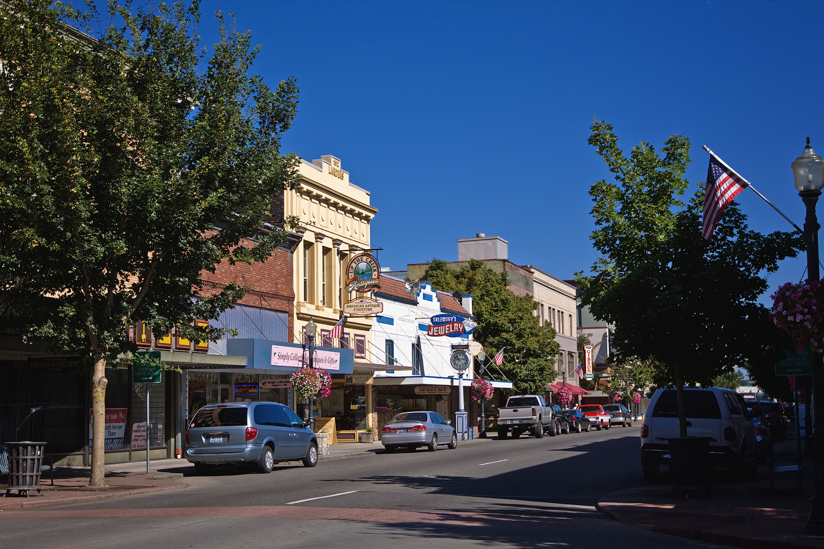
Centralia Downtown Historic District
Monument and historic site · National Register of Historic Places · 3.2 mi
Historic district in Centralia, Washington
Centralia station
Monument and historic site · National Register of Historic Places · 3.3 mi
Train station in Centralia, Washington, USA

George E. Birge House
Monument and historic site · National Register of Historic Places · 2.9 mi
Historic house in Centralia, Washington

Hubbard Bungalow
Monument and historic site · National Register of Historic Places · 2.7 mi
NRHP-listed residence in Centralia, Washington, US

Joseph Borst House
Monument and historic site · National Register of Historic Places · 2.2 mi
Historic house in Centralia, Washington

Main Post Office
Monument and historic site · National Register of Historic Places · 3.2 mi
U.S. Post Office in Centralia, Washington
Olympic Club Hotel
Monument and historic site · National Register of Historic Places · 3.3 mi
Hotel in Centralia, Washington, U.S
The Sentinel
Monument and historic site · National Register of Historic Places · 3.2 mi
National Register of Historic Places statue in Centralia, Washington


Wesley Everest Gravesite
Monument and historic site · National Register of Historic Places · 1.4 mi
NRHP-listed monument in Centralia, Washington, US

Parks, trails and playgrounds3

Seminary Hill Natural Area
Park · 3.9 mi
Natural area in the city of Centrailia, Washington, United States of America

Restaurants and cafes15





Domino's
Fast food · Pizza · 1.5 mi
1241 Harrison Avenue, Centralia
Mo-Th 10:00-24:00; Fr-Sa 10:00-01:00; Su 10:00-24:00
Taco Bell
Fast food · Tex-Mex · 1.8 mi
1120 Belmont Avenue, Centralia
Mo-Th 07:00-01:00; Fr-Sa 07:00-02:00; Su 07:00-01:00
3 more on the map.
Where to stay5
Churches and places of worship7
Mountain View Baptist Church
Church · Baptist · 1.7 mi
1201 Belmont Avenue, Centralia
Shopping2
Gas and EV charging5
Schools, colleges and libraries13
Centralia School District Sped Pre-School
School · 1.9 mi
2320 Borst Ave, Centralia
Healthcare2
A.C.N.W. Alternative Care Northwest
Clinic and pharmacy · 1.5 mi
21837 Old Highway 99 Southwest, Centralia
Map of Fords Prairie
63 places. The map loads OpenStreetMap tiles when you open it.
Climate by month
Monthly table
| Month | High | Low | Rain |
|---|---|---|---|
| Jan | 46°F | 34°F | 5.8 in |
| Feb | 50°F | 34°F | 4.2 in |
| Mar | 54°F | 36°F | 4.4 in |
| Apr | 60°F | 39°F | 3.2 in |
| May | 67°F | 44°F | 2.4 in |
| Jun | 71°F | 49°F | 1.5 in |
| Jul | 78°F | 53°F | 0.5 in |
| Aug | 78°F | 53°F | 0.8 in |
| Sep | 73°F | 48°F | 1.6 in |
| Oct | 61°F | 43°F | 4.0 in |
| Nov | 51°F | 37°F | 6.5 in |
| Dec | 45°F | 34°F | 6.4 in |
U.S. Climate Normals 1991-2020 for Centralia Hcn (3 mi away), NOAA NCEI.
People and cost of living
American Community Survey 5-year estimates, 2020-2024, U.S. Census Bureau. Estimates have margins of error, larger for small towns.
Disaster history
Lewis County has had 22 federal disaster declarations since 2000, most often for severe storms.
- 2026-04-07: Severe Storms, Straight-Line Winds, Flooding, Landslides, And Mudslides (Flood)
- 2025-12-12: Severe Storms, Straight-Line Winds, Flooding, Landslides, And Mudslides (Flood)
- 2024-04-28: Severe Winter Storms, Straight-Line Winds, Flooding, Landslides, And Mudslides (Severe Storm)
- 2023-01-12: Severe Winter Storm, Straight-Line Winds, Flooding, Landslides, And Mudslides (Severe Storm)
- 2022-03-29: Severe Winter Storms, Snowstorms, Straight-Line Winds, Flooding (Flood)
- 2022-01-05: Severe Storms, Straight-Line Winds, Flooding, Landslides, And Mudslides (Flood)
OpenFEMA disaster declarations summaries.
Getting there and nearby towns
Chehalis-Centralia Airport (CLS) is the nearest airport with scheduled flights listed in OpenStreetMap, 5 miles away.
- Centralia 2 mi southeast, about 3 min by car
- Tumwater 17 mi north, about 28 min by car
- Olympia 21 mi north, about 33 min by car
- Yelm 22 mi northeast, about 35 min by car
- Lacey 23 mi northeast, about 37 min by car
- Elma 26 mi northwest, about 42 min by car
- Fort Lewis 32 mi northeast, about 51 min by car
- Shelton 33 mi north, about 54 min by car
- Lakewood 36 mi northeast, about 59 min by car
- Spanaway 36 mi northeast, about 59 min by car
Drive times are estimates from straight-line distance, not routes.
Local news
Headlines from INDB, the NEMICO news database.
Reviews, tips and questions
Loading what members have shared...
Sources and licences
- NCES EDGE (Public domain): public schools
- NOAA NCEI U.S. Climate Normals 1991-2020 (Public domain): climate by month
- OpenFEMA (Public domain): disaster declarations
- OpenStreetMap contributors (ODbL 1.0): places, airports, map data
- U.S. Census Bureau (Public domain): population, income, housing, education, commute
- Wikidata (CC0 1.0): elevation, founding date, time zone, website, landmarks and historic places
- Wikimedia Commons (see each image): photos
- Wikipedia (CC BY-SA 4.0): overview and history text
Photo credits
- Olympic Club Hotel, G@nymede at en.wikipedia, CC BY-SA 3.0
- Centralia Union Depot, Steven Pavlov, CC BY-SA 3.0
- Wesley Everest grave 03, Joe Mabel, CC BY-SA 3.0
- Centralia, WA - Hubbard Bungalow 01, Joe Mabel, CC BY-SA 3.0
- Historic Borst family home, TateRay, CC BY-SA 4.0
- The Sentinel, statue in Centralia, Steven Pavlov, CC BY-SA 3.0
- Birge House Centralia 86003375 NRHP Lewis County, WA, Jon Roanhaus, CC BY-SA 3.0
- Centralia Downtown Historic District, Steven Pavlov, CC BY-SA 3.0
- Centralia, WA - main post office 01, Joe Mabel, CC BY-SA 3.0
- Ford (2332281060), JOHN LLOYD from Concrete, Washington, United States, CC BY 2.0
- Ford (2332280554), JOHN LLOYD from Concrete, Washington, United States, CC BY 2.0
- Ford (2331451655), JOHN LLOYD from Concrete, Washington, United States, CC BY 2.0
- Ford (2331450835), JOHN LLOYD from Concrete, Washington, United States, CC BY 2.0
- Ford (2332277418), JOHN LLOYD from Concrete, Washington, United States, CC BY 2.0
- Ford On Road Dead (4415237420), JOHN LLOYD from Concrete, Washington, United States, CC BY 2.0
- Ford (2332278410), JOHN LLOYD from Concrete, Washington, United States, CC BY 2.0
- Nathan Wesley Everest gravesite, Stephanie Baker, CC BY-SA 4.0
- Nathan Wesley Everest member of American member of the Industrial Workers of the World - IWW and a WWI Era Veteran Gravesite, Stephanie Baker, CC BY-SA 4.0
- Country Cousin Restaurant (3018302721), brewbooks from near Seattle, USA, CC BY-SA 2.0
- Country Cousin Restaurant (3018302577), brewbooks from near Seattle, USA, CC BY-SA 2.0
- Fort Borst Park 0464, Chris Light, CC BY-SA 4.0
- Fort Borst Park 0466, Chris Light, CC BY-SA 4.0
- Fort Borst Park 0465, Chris Light, CC BY-SA 4.0
- Fort Borst Park 0467, Chris Light, CC BY-SA 4.0


Page built October 30, 2026. Spotted a mistake? Tell us or suggest a place.