
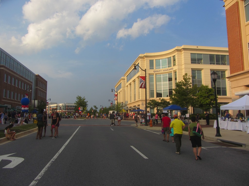


Fulton, Maryland
Fulton is a community of 5,677 people in Howard County, Maryland, founded in 1700.
Why visit Fulton
Townapedia lists 1 museum or landmark, 8 parks and trails, 35 places to eat, 2 places to stay and 2 attractions in and around town.
Highlights include Guilford Quarry Pratt Through Truss Bridge and Snell's Bridge.
July is the warmest month, with average highs of 89°F; January lows average 26°F.
Weather in Fulton
Forecast from the National Weather Service. Full forecast
About Fulton
Fulton is a census-designated place located in southern Howard County, Maryland, United States. As of the 2010 census it had a population of 2,049.
From the Wikipedia article Fulton, Maryland (this version), under CC BY-SA 4.0.
Things to do2

Guilford Quarry Pratt Through Truss Bridge
Bridge · 3.9 mi
Bridge in Guilford, Maryland


Museums and landmarks1

Parks, trails and playgrounds8


Restaurants and cafes35

Facci
Restaurant · Italian, Pizza · 1.2 mi
Casual restaurant serving delicious Neopolitan wood-fired pizza & classic Italian cuisine.
7530 Montpelier Road, Laurel
Su-Th 11:00-22:00; Fr-Sa 11:00-23:00
Ginza of Tokyo
Restaurant · Japanese · 1.2 mi
Japanese steakhouse serving cooked-to-order meats on a hibachi grill, sushi, udon & bento lunches.
7530 Montpelier Road, Laurel
Mo-Th 11:00-14:00, 16:30-21:00; Fr 11:00-14:00, 16:30-22:00; Sa...
Kloby's Smokehouse
Restaurant · Barbecue · 1.2 mi
Restaurant serving finger licking BBQ in a casual dining atmosphere. Pulled pork, beef brisket, ribs, chicken and more!
7500 Montpelier Road, Laurel
Mo-Th 11:00-21:00; Fr-Su 11:00-22:00
La Palapa Too
Restaurant · Mexican · 1.2 mi
A fun, festive, & casual neighborhood Mexican restaurant, serving traditional fare with margaritas, sangria & other drinks.
7500 Montpelier Road, Laurel
Su-Th 11:00-21:30; Fr-Sa 11:00-22:30
Ananda
Restaurant · Fine Dining, Indian · 0.7 mi
7421 Maple Lawn Boulevard, Fulton
Su, Tu-Th 16:00-22:00; Fr-Sa 16:00-23:00

Decadent A Coffee and Dessert Bar
Cafe · Breakfast, Coffee Shop, Sandwich
11710 East Market Place, Fulton
Mo-Th 08:00-20:00; Fr-Sa 08:00-21:00; Su 08:00-18:00
Galliano
Restaurant · Italian · 0.5 mi
8110 Westside Boulevard, Fulton
Su-Th 11:00-22:00; Fr-Sa 11:00-23:00

Mikey & Mel's Deli
Cafe · Bagel, Breakfast, Sandwich · 0.5 mi
East Market Place, Fulton
Su-Th 07:00-16:00; Fr-Sa 07:00-17:00
Royal Cuisine of India
Restaurant · Indian, Chicken, Curry · 1.2 mi
7500 Montpelier Road, Laurel
Su-Th 11:00-21:00; Fr-Sa 11:00-21:30
Sidamo
Cafe · Breakfast, Coffee Shop, Ethiopian, Tea · 0.4 mi
8180 Maple Lawn Boulevard
Mo-Fr 07:00-18:00; Sa-Su 08:00-16:00
Starbucks
Cafe · Coffee Shop · 1.0 mi
10985 Johns Hopkins Road, Laurel
Mo-Fr 05:30-20:00; Sa-Su 06:00-20:00
23 more on the map.
History
Indigenous peoples, likely Piscataway, used the land now known as Fulton for hunting and farming. The land's first European survey was by Thomas Browne, known as the "Patuxent Ranger", in 1700. In the mid-1700s Richard Snowden, the Quaker grandson of one of Maryland's first iron ore producers, purchased tracts of land up the Patuxent River valley. Fulton was then known as Queen Caroline Parish. In 1803 Rezin Hammond settled on a parcel of the land, and by 1805 Fulton was known as Hammond Directions and Snowden Second Addition. In 1855 German immigrants settled in the area.
By 1871, St Paul's Lutheran was founded to serve the German farming community and was expanded in 1933. By 1878 Fulton opened school house #3, a one-room school house for white children a half mile west of town that operated until 1939. The area was referred to as "Water's Store", for Richard Waters' blacksmith operation and post office which opened on December 29, 1874.
The name was changed to "Fulton", after the popular Baltimore Sun editor Charles C. Fulton on 28 March 1882. Albert W. Bradey purchased the Fulton corner stores of his father and Smallwood, operating it until his death in a house fire at the age of 90.
From the History section of Fulton, Maryland on Wikipedia, under CC BY-SA 4.0.
Where to stay2
Churches and places of worship9
Saint Francis of Assisi Catholic Church
Church · Roman Catholic · 0.6 mi
8300 Old Columbia Road, Fulton
Mount Zion United Methodist Church
Church · Methodist · 2.0 mi
12430 Scaggsville Road, Highland
Saint Paul's Lutheran Church
Church · Lutheran · 0.6 mi
11795 Scaggsville Road, Fulton
Shopping4
Gas and EV charging3
Schools, colleges and libraries50
Applications And Research Laboratory
School · 5.8 mi
10920 Clarksville Pike, Ellicott City
Healthcare5
Center for Advanced Orthopaedics,
Clinic and pharmacy
11810 West Market Place , Fulton
Fulton Pediatric Dental
Clinic and pharmacy
11810 West Market place Suite 202, Fulton
Map of Fulton
119 places. The map loads OpenStreetMap tiles when you open it.
Climate by month
Monthly table
| Month | High | Low | Rain |
|---|---|---|---|
| Jan | 43°F | 26°F | 3.5 in |
| Feb | 46°F | 28°F | 2.7 in |
| Mar | 55°F | 35°F | 4.2 in |
| Apr | 67°F | 45°F | 3.8 in |
| May | 76°F | 55°F | 4.4 in |
| Jun | 84°F | 64°F | 4.4 in |
| Jul | 89°F | 69°F | 4.2 in |
| Aug | 87°F | 68°F | 3.8 in |
| Sep | 80°F | 61°F | 4.7 in |
| Oct | 68°F | 50°F | 4.4 in |
| Nov | 57°F | 39°F | 3.5 in |
| Dec | 47°F | 31°F | 3.9 in |
U.S. Climate Normals 1991-2020 for Laurel 3 W Hcn (5 mi away), NOAA NCEI.
People and cost of living
American Community Survey 5-year estimates, 2020-2024, U.S. Census Bureau. Estimates have margins of error, larger for small towns.
Disaster history
Howard County has had 17 federal disaster declarations since 2000, most often for hurricanes.
- 2026-01-24: Severe Winter Storm (Winter Storm)
- 2020-03-26: Covid-19 Pandemic (Biological)
- 2020-03-13: Covid-19 (Biological)
- 2018-07-02: Severe Storm And Flooding (Flood)
- 2016-09-16: Severe Storm And Flooding (Flood)
- 2016-03-04: Severe Winter Storm And Snowstorm (Snowstorm)
OpenFEMA disaster declarations summaries.
Getting there and nearby towns
Tipton Airport (FME) is the nearest airport with scheduled flights listed in OpenStreetMap, 9 miles away.
- Scaggsville 2 mi southeast, about 3 min by car
- Burtonsville 2 mi southwest, about 4 min by car
- North Laurel 4 mi southeast, about 6 min by car
- Columbia 4 mi northeast, about 7 min by car
- Laurel 5 mi southeast, about 8 min by car
- Ashton-Sandy Spring 5 mi west, about 8 min by car
- Fairland 5 mi southwest, about 9 min by car
- Cloverly 6 mi southwest, about 9 min by car
- Maryland City 7 mi southeast, about 11 min by car
- Calverton 7 mi south, about 11 min by car
Drive times are estimates from straight-line distance, not routes.
Local news
Headlines from INDB, the NEMICO news database.
Reviews, tips and questions
Loading what members have shared...
Sources and licences
- NCES EDGE (Public domain): public schools
- NOAA NCEI U.S. Climate Normals 1991-2020 (Public domain): climate by month
- OpenFEMA (Public domain): disaster declarations
- OpenStreetMap contributors (ODbL 1.0): places, airports, map data
- U.S. Census Bureau (Public domain): population, income, housing, education, commute
- Wikidata (CC0 1.0): elevation, founding date, time zone, website, landmarks and historic places
- Wikimedia Commons (see each image): photos
- Wikipedia (CC BY-SA 4.0): overview and history text
Photo credits
- MapleLawnDevelopment, FlugKerl2, CC BY-SA 4.0
- Guilford Bridge, HCM1851, CC BY-SA 4.0
- Second Fort Snelling Bridge, Unknown author Unknown author, Public domain
Page built October 30, 2026. Spotted a mistake? Tell us or suggest a place.