


Georgetown-Quitman County unified government, Georgia
Georgetown-Quitman County unified government is a place of 2,264 people in Quitman County, Georgia.
Why visit Georgetown-Quitman County unified government
Townapedia lists 16 museums and landmarks, 6 parks and trails, 20 places to eat, 8 places to stay and 1 attraction in and around town.
Highlights include Bray-Barron House and Cato House.
July is the warmest month, with average highs of 88°F; January lows average 36°F.
Weather in Georgetown-Quitman County unified government
Forecast from the National Weather Service. Full forecast
About Georgetown-Quitman County unified government
Georgetown is a city in Quitman County, Georgia, United States. It is on the Alabama-Georgia state line next to Walter F. George Lake and across the Chattahoochee River from Eufaula, Alabama. Per the 2020 census, the population was 2,235.
From the Wikipedia article Georgetown, Quitman County, Georgia (this version), under CC BY-SA 4.0.
Things to do1

Museums and landmarks16

Bray-Barron House
Monument and historic site · National Register of Historic Places · 8.5 mi
House in Eufaula, Alabama, United States

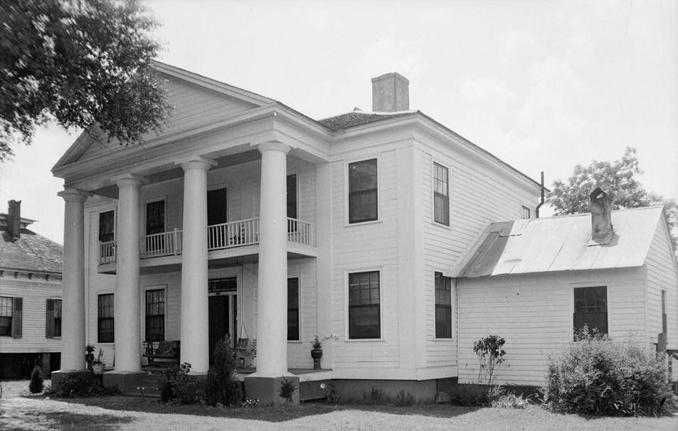
Cato House
Monument and historic site · National Register of Historic Places · 9.1 mi
House in Eufaula, Alabama

Drewry-Mitchell-Moorer House
Monument and historic site · National Register of Historic Places · 8.6 mi
Mansion in Eufaula, Alabama

Kendall Manor
Monument and historic site · National Register of Historic Places · 8.9 mi
Mansion in Eufaula, Alabama

Kiels-McNab House
Monument and historic site · National Register of Historic Places · 8.9 mi
Historic house in Alabama, United States

McNab Bank Building
Monument and historic site · National Register of Historic Places · 8.4 mi
Bank building in Eufaula, United States of America

Quitman County Courthouse and Old Jail
Monument and historic site · National Register of Historic Places · 6.3 mi
Courthouse in jail in Georgetown, United States
Seth Lore and Irwinton Historic District
Monument and historic site · National Register of Historic Places · 8.4 mi
Historic district in Alabama, United States

Sheppard Cottage
Monument and historic site · National Register of Historic Places · 8.1 mi
Historic house in Alabama, United States

Shorter Mansion
Monument and historic site · National Register of Historic Places · 8.6 mi
Historic house in Alabama, United States


The Tavern
Monument and historic site · National Register of Historic Places · 8.3 mi
Listed on the NRHP in Alabama
Wellborn
Monument and historic site · National Register of Historic Places · 8.2 mi
House in Eufaula, Alabama
4 more on the map.
Parks, trails and playgrounds6


Restaurants and cafes20

El Jalisco Mexican Grill
Restaurant · Mexican · 8.5 mi
128 East Broad Street
Mo-Sa 11:00-15:00; Su off
Sam’s Southern Eatery
Restaurant · American, Seafood · 8.4 mi
325 South Eufaula Avenue
Su 11:00-19:00; Mo-Sa 10:00-20:00


New No. 1 Buffet
Restaurant · Chinese · 8.7 mi
1601 South Eufaula Avenue, Eufaula
Mo-Su 10:00-22:00

American Deli
Fast food · American · 8.4 mi
801 South Eufaula Avenue, Eufaula
Mo-Sa 10:00-22:00; Su 11:00-21:00
8 more on the map.
History
Settled in the early 1830s, Georgetown was first named Tobanana for the nearby creek. The Tobanana Post Office was established on January 10, 1833. On September 21, 1836, the name of the town was changed to "Georgetown" after the historic neighborhood in Washington, D.C.
Georgetown was designated in 1859 as the county seat of Quitman County and was laid out as a town by order of the Inferior Court. The town was incorporated by an act of the legislature on December 9, 1859.
A brigade of federal cavalry, commanded by General Benjamin Grierson, camped for a time near Georgetown on the banks of the Tobanana Creek at the close of the American Civil War.
Georgetown was destroyed by fire in 1903; every building except for the post office and three houses were destroyed.
From the History section of Georgetown, Quitman County, Georgia on Wikipedia, under CC BY-SA 4.0.
Where to stay8
Churches and places of worship47
Holy Redeemer Catholic Church
Church · Roman Catholic · 8.8 mi
515 West Broad Street, Eufaula
Saint Lukes African Methodist Episcopal Church
Church · Methodist · 8.0 mi
240 Doctor T V McCoo Boulevard South, Eufaula
Shopping4
Gas and EV charging16
Schools, colleges and libraries11
Healthcare4
Map of Georgetown-Quitman County unified government
133 places. The map loads OpenStreetMap tiles when you open it.
Climate by month
Monthly table
| Month | High | Low | Rain |
|---|---|---|---|
| Jan | 56°F | 36°F | 5.5 in |
| Feb | 59°F | 38°F | 5.0 in |
| Mar | 66°F | 44°F | 4.7 in |
| Apr | 72°F | 50°F | 4.7 in |
| May | 80°F | 59°F | 3.9 in |
| Jun | 85°F | 66°F | 5.3 in |
| Jul | 88°F | 68°F | 4.8 in |
| Aug | 87°F | 68°F | 5.5 in |
| Sep | 83°F | 64°F | 3.7 in |
| Oct | 74°F | 54°F | 4.4 in |
| Nov | 64°F | 44°F | 4.0 in |
| Dec | 58°F | 37°F | 6.4 in |
U.S. Climate Normals 1991-2020 for Georgetown 4 E (3 mi away), rain and snow from Fort Gaines 13.0 Ene, NOAA NCEI.
People and cost of living
American Community Survey 5-year estimates, 2020-2024, U.S. Census Bureau. Estimates have margins of error, larger for small towns.
Disaster history
Quitman County has had 9 federal disaster declarations since 2000, most often for hurricanes.
- 2026-10-09: Hurricane Isaias (Tropical Storm)
- 2024-09-26: Hurricane Helene (Tropical Storm)
- 2020-03-29: Covid-19 Pandemic (Biological)
- 2020-03-13: Covid-19 (Biological)
- 2018-10-14: Hurricane Michael (Hurricane)
- 2018-10-10: Hurricane Michael (Hurricane)
OpenFEMA disaster declarations summaries.
Getting there and nearby towns
Weedon Field (EUF) is the nearest airport with scheduled flights listed in OpenStreetMap, 9 miles away.
- Eufaula 10 mi northwest, about 16 min by car
- Cuthbert 14 mi southeast, about 22 min by car
- Lumpkin 18 mi northeast, about 28 min by car
- Abbeville 25 mi southwest, about 41 min by car
- Richland 25 mi northeast, about 41 min by car
- Clayton 27 mi west, about 43 min by car
- Webster County unified government 29 mi northeast, about 47 min by car
- Blakely 34 mi south, about 54 min by car
- Dawson 34 mi east, about 54 min by car
- Cusseta-Chattahoochee County unified government 36 mi north, about 58 min by car
Drive times are estimates from straight-line distance, not routes.
Local news
Headlines from INDB, the NEMICO news database.
Reviews, tips and questions
Loading what members have shared...
Sources and licences
- NCES EDGE (Public domain): public schools
- NOAA NCEI U.S. Climate Normals 1991-2020 (Public domain): climate by month
- OpenFEMA (Public domain): disaster declarations
- OpenStreetMap contributors (ODbL 1.0): places, airports, map data
- U.S. Census Bureau (Public domain): population, income, housing, education, commute
- Wikidata (CC0 1.0): elevation, founding date, time zone, website, landmarks and historic places
- Wikimedia Commons (see each image): photos
- Wikipedia (CC BY-SA 4.0): overview and history text
Photo credits
- Quitman County Courthouse; Georgetown, GA, Rivers Langley; SaveRivers, CC BY-SA 3.0
- Sheppard Cottage Eufaula Alabama, Rivers Langley; SaveRivers, CC BY-SA 3.0
- Shorter Mansion 01, Carol M. Highsmith, Public domain
- The Tavern Eufaula Alabama, Rivers Langley; SaveRivers, CC BY-SA 3.0
- Drewry-Mitchell-Moorer House Eufaula Alabama, Rivers Langley; SaveRivers, CC BY-SA 3.0
- Wellborn Eufaula Alabama, Rivers Langley; SaveRivers, CC BY-SA 3.0
- Kendall Manor Eufaula Alabama, Rivers Langley; SaveRivers, CC BY-SA 3.0
- Bray-Barron House Eufaula Alabama, Rivers Langley; SaveRivers, CC BY-SA 3.0
- Kiels-McNab House Eufaula Alabama, Rivers Langley; SaveRivers, CC BY-SA 3.0
- Lewis Llewellyn Cato House, W. N. Manning, Public domain
- McNab Bank Building Eufaula Alabama, Rivers Langley; SaveRivers, CC BY-SA 3.0
- 2011.05.21.074604 United Methodist Church Eufaula Alabama USA, Hermann Luyken, CC0
- First Baptist Church of Eufaula, Michael Rivera, CC BY-SA 3.0
- ISS065-E-50583 - View of Earth, Earth Science and Remote Sensing Unit , Lyndon B. Johnson Space Center, Public domain
- ISS065-E-56283 - View of Earth, Earth Science and Remote Sensing Unit , Lyndon B. Johnson Space Center, Public domain
- ISS030-E-151614 - View of Earth, Earth Science and Remote Sensing Unit , Lyndon B. Johnson Space Center, Public domain
- ISS061-E-109418 - View of Earth, Earth Science and Remote Sensing Unit, NASA Johnson Space Center, Public domain
- ISS030-E-151615 - View of Earth, Earth Science and Remote Sensing Unit , Lyndon B. Johnson Space Center, Public domain
- ISS061-E-109419 - View of Earth, Earth Science and Remote Sensing Unit, NASA Johnson Space Center, Public domain
- ISS061-E-109417 - View of Earth, Earth Science and Remote Sensing Unit, NASA Johnson Space Center, Public domain
- ISS062-E-60478 - View of Earth, Earth Science and Remote Sensing Unit, NASA Johnson Space Center, Public domain
- ISS062-E-37826 - View of Earth, Earth Science and Remote Sensing Unit, NASA Johnson Space Center, Public domain
- ISS048-E-71684 - View of Earth, Earth Science and Remote Sensing Unit , Lyndon B. Johnson Space Center, Public domain
- ISS062-E-60479 - View of Earth, Earth Science and Remote Sensing Unit, NASA Johnson Space Center, Public domain
- ISS065-E-50582 - View of Earth, Earth Science and Remote Sensing Unit , Lyndon B. Johnson Space Center, Public domain
- ISS055-E-32285 - View of Earth, Earth Science and Remote Sensing Unit, NASA Johnson Space Center, Public domain
- ISS062-E-37827 - View of Earth, Earth Science and Remote Sensing Unit, NASA Johnson Space Center, Public domain
- ISS065-E-54077 - View of Earth, Earth Science and Remote Sensing Unit , Lyndon B. Johnson Space Center, Public domain
- Quitman County Board of Education, Child Development Center, Michael Rivera, CC BY-SA 3.0
- Quitman County Schools, Michael Rivera, CC BY-SA 3.0
- Quitman County Community Center, Michael Rivera, CC BY-SA 3.0
- Georgetown water tower, Michael Rivera, CC BY-SA 3.0
- Georgetown Park behind community center, Michael Rivera, CC BY-SA 3.0
- MORRIS, GA, Rivers Langley; SaveRivers, CC BY-SA 3.0


Page built October 30, 2026. Spotted a mistake? Tell us or suggest a place.