


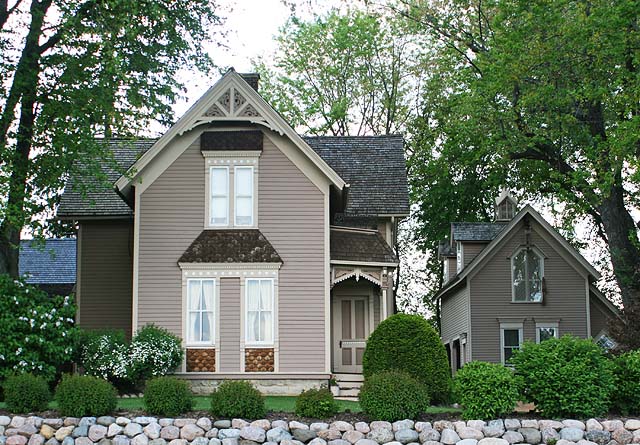
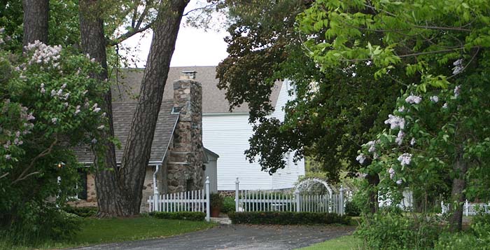

Germantown, Wisconsin
Germantown is a village of 20,962 people in Washington County, Wisconsin.
Why visit Germantown
Townapedia lists 9 museums and landmarks, 32 parks and trails, 68 places to eat, 9 places to stay and 4 attractions in and around town.
Highlights include Barthel Fruit Farm, Marcus Cinema Menomonee Falls, Christian Turck House and Jacob Voigt House.
July is the warmest month, with average highs of 81°F; January lows average 11°F, and about 54 inches of snow fall in a normal year.
Weather in Germantown
Forecast from the National Weather Service. Full forecast
About Germantown
Germantown is a village in Washington County, Wisconsin, United States. The population was 20,917 at the 2020 census. The village surrounds the Town of Germantown, and is part of the Milwaukee metropolitan area.
From the Wikipedia article Germantown, Wisconsin (this version), under CC BY-SA 4.0.
Things to do4


Marcus Cinema Menomonee Falls
Cinema and theater · 3.4 mi
W180N9393 Premier Lane, Menomonee Falls
Milwaukee Tool Amphitheater
Cinema and theater · 4.0 mi
N87W16649 Mill Street, Menomonee Falls
Museums and landmarks9

Christian Turck House
Monument and historic site · National Register of Historic Places · 3.4 mi
Historic house in Wisconsin, United States
Jacob Voigt House
Monument and historic site · National Register of Historic Places · 6.1 mi
Historic house in Wisconsin, United States
John Reichert Farmhouse
Monument and historic site · National Register of Historic Places · 6.6 mi
Historic house in Wisconsin, United States


Main Street Historic District
Monument and historic site · National Register of Historic Places · 3.9 mi
Historic district in Menomonee Falls, Wisconsin
O'Brien–Peuschel Farmstead
Monument and historic site · National Register of Historic Places · 6.2 mi
Farmhouse in Ozaukee County, United States of America
William F. Jahn Farmstead
Monument and historic site · National Register of Historic Places · 6.1 mi
Building in Mequon, United States of America
Parks, trails and playgrounds32


20 more on the map.
Restaurants and cafes68

Cracker Barrel
Diner · American · 2.7 mi
W176N9778 Rivercrest Drive, Germantown
Su-Th 06:00-22:00; Fr-Sa 06:00-23:00

Matteo's Mexican Grill
Restaurant · Mexican, Sandwich · 1.6 mi
W156N11058 Pilgrim Road, Germantown
Su 07:30-20:00; Mo 11:00-20:00; Tu-Th 11:00-21:00; Fr 07:30-22:00;...
Robert's Frozen Custard
Restaurant · Burger · 1.2 mi
N112W16040 Mequon Road, Germantown
Su-Th 10:30-21:00; Fr-Sa 10:30-22:00
Evie's Viatnamese Restaurant
Restaurant · Vietnamese · 3.8 mi
N89W16851 Appleton Avenue, Menomonee Falls
We-Mo 11:00-21:00; Su 11:00-18:00; Tu off
Old Germantown
Restaurant · American, Burger, German, Grill, Pizza, Sausage · 2.0 mi
W148 N12696 Pleasant View Drive

Latitude coffee
Cafe · Coffee Shop · 4.5 mi
Offers coffee and light snacks. Located on the 2nd floor of the library.
Mo-Th 09:00-18:00; Fr,Sa 09:00-16:00
The Coffeehouse @ Purloin Studio
Cafe · Coffee Shop · 3.9 mi
N88 W16567 Main Street, Menomonee Falls
Tu-Fr 07:00-15:00; Sa 09:00-15:00

56 more on the map.
History
The land that became Germantown was originally inhabited by members of the Potawatomi tribe. The Potawatomi surrendered the land that became Germantown to the United States Federal Government in 1833 through the 1833 Treaty of Chicago, which (after being ratified in 1835) required them to leave Wisconsin by 1838. While many Native people moved west of the Mississippi River to Kansas, some chose to remain or return after temporarily settling in the west, and were referred to as "strolling Potawatomi" in contemporary documents because many of them were migrants who subsisted by squatting on their ancestral lands, which were now owned by White settlers. In the late 19th and early 20th centuries, the Potawatomi who evaded forced removal gathered in northern Wisconsin and the Upper Peninsula of Michigan where many worked in the timber industry and formed the Forest County Potawatomi Community.
The community was originally designated as the Wisconsin Territory's "Town Nine," making it the oldest settlement in Washington County. Beginning in the 1840s, many German immigrants—particularly from the regions of Bavaria, Hessen, Rheinland, Pommern, and Prussia—settled in the area, which led to it being named "Germantown".
From the History section of Germantown, Wisconsin on Wikipedia, under CC BY-SA 4.0.
Where to stay9
Delta Hotels by Marriott Milwaukee Northwest
Motel and hotel · 4.2 mi
N88W14750 Main Street, Menomonee Falls
Churches and places of worship12
Christ Evangelical Church
Church · National Register of Historic Places · 1.9 mi
Bethlehem Evangelical Lutheran Church
Church · Lutheran · 2.3 mi
N108W14290 Bel Aire Lane, Germantown
Holy Cross Lutheran Church
Church · Evangelical Lutheran Chuch In America · 4.9 mi
Calvary Baptist Church
Church · 4.8 mi
N84W19049 Menomonee Avenue, Menomonee Falls
Good Shepherd Catholic Church
Church · 3.9 mi
N88W17658 Christman Road, Menomonee Falls
St. Paul's United Church of Christ
Church · 3.7 mi
N89W16856 Appleton Avenue, Menomonee Falls
Shopping16
Gas and EV charging13
Schools, colleges and libraries36
Benjamin Franklin Elementary And Early Learning Center
School · 5.1 mi
N81W14701 Franklin Dr, Menomonee Falls
Healthcare5
Ascension Wisconsin Hospital - Menomonee Falls
Clinic and pharmacy · 4.4 mi
N88W14275 Main Street, Menomonee Falls
Aurora Health Center
Clinic and pharmacy · 4.5 mi
N84W16889 Menomonee Avenue, Menomonee Falls
Map of Germantown
204 places. The map loads OpenStreetMap tiles when you open it.
Climate by month
Monthly table
| Month | High | Low | Rain | Snow |
|---|---|---|---|---|
| Jan | 27°F | 11°F | 1.6 in | 16.5 in |
| Feb | 31°F | 14°F | 1.4 in | 16.0 in |
| Mar | 42°F | 24°F | 1.9 in | 6.5 in |
| Apr | 54°F | 34°F | 3.8 in | 2.0 in |
| May | 66°F | 45°F | 4.0 in | 0.3 in |
| Jun | 76°F | 54°F | 4.4 in | 0.0 in |
| Jul | 81°F | 60°F | 3.9 in | 0.0 in |
| Aug | 79°F | 58°F | 3.8 in | 0.0 in |
| Sep | 72°F | 50°F | 3.2 in | 0.0 in |
| Oct | 59°F | 39°F | 2.6 in | 0.3 in |
| Nov | 45°F | 28°F | 2.0 in | 2.4 in |
| Dec | 33°F | 18°F | 1.7 in | 10.3 in |
U.S. Climate Normals 1991-2020 for Germantown (0 mi away), NOAA NCEI.
People and cost of living
American Community Survey 5-year estimates, 2020-2024, U.S. Census Bureau. Estimates have margins of error, larger for small towns.
Disaster history
Washington County has had 9 federal disaster declarations since 2000, most often for floods.
- 2026-06-30: Severe Storms, Tornadoes, And Flooding (Flood)
- 2025-09-11: Severe Storms, Straight-Line Winds, Flooding, And Mudslides (Flood)
- 2020-04-04: Covid-19 Pandemic (Biological)
- 2020-03-13: Covid-19 (Biological)
- 2011-04-05: Severe Winter Storm And Snowstorm (Snowstorm)
- 2008-06-14: Severe Storms, Tornadoes, And Flooding (Severe Storm)
OpenFEMA disaster declarations summaries.
Getting there and nearby towns
Lawrence J. Timmerman Airport (MWC) is the nearest airport with scheduled flights listed in OpenStreetMap, 9 miles away.
- Cedarburg 8 mi northeast, about 13 min by car
- Brown Deer 9 mi southeast, about 14 min by car
- Brookfield 12 mi south, about 19 min by car
- Milwaukee 14 mi southeast, about 23 min by car
- Cudahy 24 mi southeast, about 38 min by car
- Franklin 25 mi south, about 40 min by car
- Caledonia 33 mi southeast, about 53 min by car
- Beaver Dam 39 mi northwest, about 1 h by car
- Burlington 39 mi south, about 1 h by car
- Fond du Lac 40 mi northwest, about 1 h by car
Drive times are estimates from straight-line distance, not routes.
Local news
Headlines from INDB, the NEMICO news database.
Reviews, tips and questions
Loading what members have shared...
Sources and licences
- NCES EDGE (Public domain): public schools
- NOAA NCEI U.S. Climate Normals 1991-2020 (Public domain): climate by month
- OpenFEMA (Public domain): disaster declarations
- OpenStreetMap contributors (ODbL 1.0): places, airports, map data
- U.S. Census Bureau (Public domain): population, income, housing, education, commute
- Wikidata (CC0 1.0): landmarks and historic places
- Wikimedia Commons (see each image): photos
- Wikipedia (CC BY-SA 4.0): overview and history text
Photo credits
- Christ Evangelical Church Germantown Wisconsin - Sept 2013 02, Shawn Conrad, CC BY-SA 3.0
- Christ Evangelical Church Germantown Wisconsin - Sept 2013 01, Shawn Conrad, CC BY-SA 3.0
- Germantown Wisconsin 20090124 1576, Dori, CC BY-SA 3.0 us
- John Reichert Farmhouse May09, Freekee, Public domain
- Jahn Farmstead Mequon WI May-09, Freekee, Public domain
- O'Brien-Peuschel Farmstead Mequon WI May-09, Freekee, Public domain
- Main Street Historic District of Menomonee Falls, WI, Shadowe, CC BY-SA 3.0
- Jacob Schunk Farmhouse, David Moore, CC BY-SA 3.0
- ISS045-E-2798 - View of Earth, Earth Science and Remote Sensing Unit , Lyndon B. Johnson Space Center, Public domain
- ISS037-E-8305 - View of Illinois, Earth Science and Remote Sensing Unit , Lyndon B. Johnson Space Center, Public domain
- ISS016-E-20648 - View of Earth, Earth Science and Remote Sensing Unit , Lyndon B. Johnson Space Center, Public domain
- ISS067-E-123656 - View of Earth, Earth Science and Remote Sensing Unit , Lyndon B. Johnson Space Center, Public domain
- ISS014-E-8232 - View of Michigan, Earth Science and Remote Sensing Unit , Lyndon B. Johnson Space Center, Public domain
- Menomonee Falls Historical Society at Old Falls Village Historical Park and Museum June 2026 10 (Miller-Davidson House), Michael Barera, CC BY-SA 4.0
- Menomonee Falls Historical Society at Old Falls Village Historical Park and Museum June 2026 11 (gazebo), Michael Barera, CC BY-SA 4.0
- Menomonee Falls Historical Society at Old Falls Village Historical Park and Museum June 2026 09 (Miller-Davidson House), Michael Barera, CC BY-SA 4.0
- Menomonee Falls Historical Society at Old Falls Village Historical Park and Museum June 2026 14 (barn), Michael Barera, CC BY-SA 4.0
- Menomonee Falls Historical Society at Old Falls Village Historical Park and Museum June 2026 12 (Public House), Michael Barera, CC BY-SA 4.0
- Menomonee Falls Historical Society at Old Falls Village Historical Park and Museum June 2026 13 (Menomonee Falls Depot), Michael Barera, CC BY-SA 4.0
- Menomonee Falls Historical Society at Old Falls Village Historical Park and Museum June 2026 04 (Koch House), Michael Barera, CC BY-SA 4.0
- Menomonee Falls Historical Society at Old Falls Village Historical Park and Museum June 2026 01 (Menomonee Falls Depot), Michael Barera, CC BY-SA 4.0
- Menomonee Falls Historical Society at Old Falls Village Historical Park and Museum June 2026 08 (Umhoefer Cabin), Michael Barera, CC BY-SA 4.0
- Menomonee Falls Historical Society at Old Falls Village Historical Park and Museum June 2026 05 (Steichen House), Michael Barera, CC BY-SA 4.0
- Menomonee Falls Historical Society at Old Falls Village Historical Park and Museum June 2026 02 (Chicago & North Western caboose No. 10869), Michael Barera, CC BY-SA 4.0
- Menomonee Falls Historical Society at Old Falls Village Historical Park and Museum June 2026 07 (Steichen House), Michael Barera, CC BY-SA 4.0
- Menomonee Falls Historical Society at Old Falls Village Historical Park and Museum June 2026 06 (School House), Michael Barera, CC BY-SA 4.0
- Menomonee Falls Historical Society at Old Falls Village Historical Park and Museum June 2026 03 (Menomonee Falls Depot), Michael Barera, CC BY-SA 4.0
- The Miller-Davidson House, Boscophotos, CC BY-SA 3.0
- Miller-Dacidson House, Boscophotos, CC BY-SA 3.0
- Christian Turck House at Old World Wisconsin, Royalbroil, CC BY-SA 3.0
- Menomonee Falls June 2026 85 (W156 N9390 Pilgrim Road), Michael Barera, CC BY-SA 4.0
- Zimmer Farmhouse, Boscophotos, CC BY-SA 3.0
- Menomonee Falls June 2026 84 (W156 N9390 Pilgrim Road), Michael Barera, CC BY-SA 4.0
- Canoe Ride on Amy Bell Lake, mheisel, CC BY 2.0
- Menomonee Falls June 2026 44 (Menomonee River and Mill Pond Park), Michael Barera, CC BY-SA 4.0
- Menomonee Falls June 2026 43 (Menomonee River and Mill Pond Park), Michael Barera, CC BY-SA 4.0
- Menomonee Falls June 2026 45 (bench at Mill Pond Park), Michael Barera, CC BY-SA 4.0
- Third Street Bridge, Boscophotos, CC BY-SA 3.0
- Menomonee Falls June 2026 42 (Schramka Funeral Home), Michael Barera, CC BY-SA 4.0
- Elizabeth Hoos House, Boscophotos, CC BY-SA 3.0


Page built October 30, 2026. Spotted a mistake? Tell us or suggest a place.