


Glendale Heights, Illinois
Glendale Heights is a village of 32,808 people in DuPage County, Illinois, founded in 1959.
Why visit Glendale Heights
Townapedia lists 13 museums and landmarks, 40 parks and trails, 61 places to eat and 3 attractions in and around town.
Highlights include Grand Theatre, Adventureland, Alfred A. Schiller House and Blanchard Hall.
Weather in Glendale Heights
Forecast from the National Weather Service. Full forecast
About Glendale Heights
Glendale Heights is a village in DuPage County, Illinois, United States. Per the 2020 census, the population was 33,176. The village is almost entirely residential, and is a far west suburb of Chicago.
From the Wikipedia article Glendale Heights, Illinois (this version), under CC BY-SA 4.0.
Things to do3

Grand Theatre
Cinema and theater · National Register of Historic Places · 3.9 mi
Theater and movie theater in Wheaton, Illinois, United States

Adventureland
Monument and historic site · 2.9 mi
Amusement park in Addison, Illinois, US

Museums and landmarks13

Alfred A. Schiller House
Monument and historic site · National Register of Historic Places · 2.4 mi
Single-family detached home in Glen Ellyn, Illinois
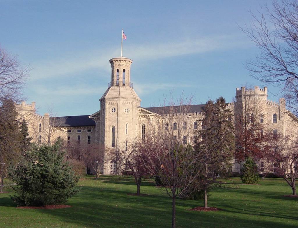
Blanchard Hall
Monument and historic site · National Register of Historic Places · 3.7 mi
Building located on the campus of Wheaton College in Wheaton, Illinois

Bloomingdale School
Monument and historic site · National Register of Historic Places · 2.7 mi
Bloomingdale, Illinois

DuPage County Historical Museum
Museum · National Register of Historic Places · 3.9 mi
Library

DuPage Theater
Monument and historic site · National Register of Historic Places · 3.9 mi
Former movie theater in Lombard, Illinois, United States

Glen Ellyn Downtown North Historic District
Monument and historic site · National Register of Historic Places · 3.0 mi
Historic district in Illinois, United States

Glen Ellyn Downtown South Historic District
Monument and historic site · National Register of Historic Places · 3.1 mi
Historic district in Illinois, United States

Glen Ellyn Main Street Historic District
Monument and historic site · National Register of Historic Places · 2.7 mi
Historic district in Illinois, United States

Old DuPage County Courthouse
Monument and historic site · National Register of Historic Places · 4.0 mi
Former courthouse in Wheaton, Illinois
Randecker's Hardware Store
Monument and historic site · National Register of Historic Places · 2.6 mi
Stacy's Tavern
Monument and historic site · National Register of Historic Places · 2.1 mi

1 more on the map.
Parks, trails and playgrounds40


Lake Ellyn Park
Park · National Register of Historic Places · 2.6 mi
Park in Glen Ellyn, Illinois

Euclid Park
Park · 0.7 mi
Tennis/pickleball court, playground with swingsets and jungle gym, parking
2N507 Euclid Avenue, Glen Ellyn
Highland Park
Park · 0.9 mi
2.5 acre park with quarter-mile paved walking path, covered pavilion, picnic tables, parking, and public restrooms during business...
2N351 Highland Avenue, Glen Ellyn
28 more on the map.
Restaurants and cafes61

Chili's
Restaurant · Tex-Mex · 2.0 mi
310 West Army Trail Road, Bloomingdale
Su-Th 11:00-22:00; Fr, Sa 11:00-23:00
El Famous Burrito
Restaurant · Mexican · 1.2 mi
1165 Bloomingdale Road, Glendale Heights
Mo 10:30-20:30; Tu-Sa 10:30-22:00; Su 11:30-20:30
First Watch
Restaurant · American, Breakfast · 1.8 mi
302 West Army Trail Road, Bloomingdale
07:00-14:30
Fry N' Wings
Restaurant · Fried Chicken, Asian, Fusion, Korean · 2.3 mi
369 West Army Trail Road, Bloomingdale
Tu-Su 11:00-22:00
Mabuhay Restaurant & Catering
Restaurant · Filipino · 1.1 mi
1232 Bloomingdale Road, Glendale Heights
Mo-Fr 15:00-20:00; Sa 09:00-20:00; Su 11:00-16:00

Olive Garden
Restaurant · Italian · 2.0 mi
332 West Army Trail Road, Bloomingdale
Su-Th 11:00-23:00; Fr, Sa 11:00-24:00
Moonsun Sushi
Restaurant · 1.3 mi
324 E Army Trail Rd, Glendale Heights
Tu-Th 11:30-21:30; Fr 11:30-22:00; Sa 12:00-22:00; Su 12:00-21:00
Oberweis
Ice cream · 2.2 mi
338 West Army Trail Road, Bloomingdale
Su-Th 10:00-22:00, Fr-Sa 10:00-23:00
Schnitzel Platz
Restaurant · German · 1.6 mi
Mo,Su 11:00-20:00; Tu off; We-Th 16:00-21:00; Fr-Sa 11:00-22:00

49 more on the map.
History
Glendale Heights was a small farming area served by the Glen Ellyn post office up until the 1950s, with a population of just 104 in 1959. Midland Enterprises, run by Charles and Harold Reskin, started building houses in Glendale Heights in 1958. The Reskins bought two farms on Glen Ellyn Road north of North Avenue. Houses were first built on Glen Ellyn Road and Larry Lane near Fullerton Avenue. On June 16, 1959, a petition was filed and on July 13, the village became incorporated. The first election was held later that summer on August 2.
The town was originally named Glendale as it was between Glen Ellyn and Bloomingdale, but after a conflict arose with the small town of Glendale in Southern Illinois, the city decided in March 1960 to add the term Heights, in reference to its different topographies, a difference of about 100 feet (30 m) because of its location straddling the Valparaiso Moraine, thus becoming Glendale Heights.
From the History section of Glendale Heights, Illinois on Wikipedia, under CC BY-SA 4.0.
Churches and places of worship16
First Church of Lombard
Church · National Register of Historic Places · 3.9 mi
Trinity Episcopal Church
Church · National Register of Historic Places · 4.1 mi
Saint Andrew Ukrainian Orthodox Cathedral
Church · Ukrainian Orthodox · 1.4 mi
300 East Army Trail Road, Bloomingdale
Parkview Community Church
Church · Baptist · 2.2 mi
764 East Saint Charles Road, Glen Ellyn
Seventh Day Adventist Church of Glen Ellyn
Church · Seventh Day Adventist · 1.7 mi
Shopping14
Angelo Caputo's Fresh Markets
Grocery · 1.9 mi
550 East North Avenue, Carol Stream
Gas and EV charging9
Schools, colleges and libraries55
Healthcare5
Midwest Express Clinic
Clinic and pharmacy · 2.2 mi
865 East Geneva Road, Carol Stream
Map of Glendale Heights
216 places. The map loads OpenStreetMap tiles when you open it.
People and cost of living
American Community Survey 5-year estimates, 2020-2024, U.S. Census Bureau. Estimates have margins of error, larger for small towns.
Disaster history
DuPage County has had 8 federal disaster declarations since 2000, most often for biologicals.
- 2020-03-26: Covid-19 Pandemic (Biological)
- 2020-03-13: Covid-19 (Biological)
- 2013-05-10: Severe Storms, Straight-Line Winds, And Flooding (Flood)
- 2011-03-17: Severe Winter Storm And Snowstorm (Snowstorm)
- 2010-08-19: Severe Storms And Flooding (Severe Storm)
- 2008-10-03: Severe Storms And Flooding (Severe Storm)
OpenFEMA disaster declarations summaries.
Getting there and nearby towns
DuPage County Airport (DPA) is the nearest airport with scheduled flights listed in OpenStreetMap, 9 miles away.
- Bloomingdale 2 mi north, about 4 min by car
- Carol Stream 3 mi west, about 5 min by car
- Addison 4 mi east, about 6 min by car
- Glen Ellyn 4 mi south, about 6 min by car
- Roselle 4 mi north, about 7 min by car
- Lombard 4 mi southeast, about 7 min by car
- Wheaton 5 mi south, about 7 min by car
- Winfield 5 mi southwest, about 7 min by car
- Itasca 5 mi northeast, about 8 min by car
- Hanover Park 6 mi northwest, about 9 min by car
Drive times are estimates from straight-line distance, not routes.
Local news
Headlines from INDB, the NEMICO news database.
Reviews, tips and questions
Loading what members have shared...
Sources and licences
- NCES EDGE (Public domain): public schools
- OpenFEMA (Public domain): disaster declarations
- OpenStreetMap contributors (ODbL 1.0): places, airports, map data
- U.S. Census Bureau (Public domain): population, income, housing, education, commute
- Wikidata (CC0 1.0): landmarks and historic places
- Wikimedia Commons (see each image): photos
- Wikipedia (CC BY-SA 4.0): overview and history text
Photo credits
- DuPage Theater, Dale Hahn, Wheaton. Illinois, CC BY-SA 4.0
- AdamsMemorial, Teemu08 at en.wikipedia, CC BY-SA 3.0
- First Church of Lombard (Lombard, Illinois) 01, G LeTourneau, CC BY-SA 3.0
- TrinityEpiscopalWheaton, Teemu08 at en.wikipedia, CC BY-SA 3.0
- Image Old Glen Ellyn Jr. High School, Boscophotos, CC BY-SA 3.0
- Bloomingdale School–Village Hall, Teemu08 ( talk ), CC BY-SA 3.0
- WheatonCollege, Neatpete86 at English Wikipedia, Public domain
- Alfred A. Schiller House, Teemu08 ( talk ), CC BY-SA 3.0
- DuPage County Courthouse, Teemu008, CC BY-SA 2.0
- GrandTheatreWheaton, Teemu08 at en.wikipedia, CC BY-SA 3.0
- Image Glen Theater, Boscophotos, CC BY-SA 3.0
- Glen Ellyn Main Street Historic District, Teemu08 ( talk ), CC BY-SA 3.0
- Lake-glen-ellyn-il, Dmadeo, CC BY-SA 3.0
Page built October 30, 2026. Spotted a mistake? Tell us or suggest a place.