
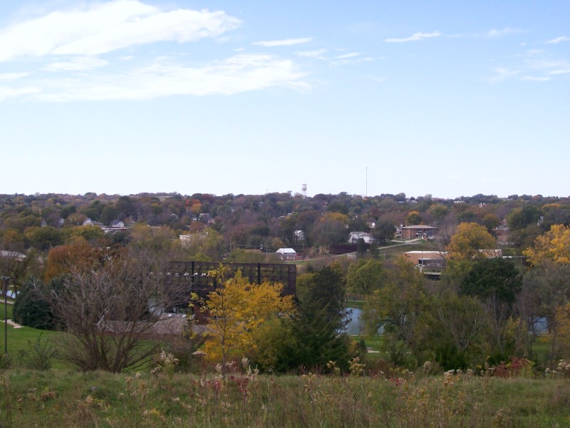


Glenwood, Iowa
Glenwood is a city of 5,144 people in Mills County, Iowa, founded in 1848.
Why visit Glenwood
Townapedia lists 2 museums and landmarks, 5 parks and trails, 8 places to eat, 1 place to stay and 1 attraction in and around town.
Highlights include Davies Amphitheater, Pony Creek Park, Glenwood Golf Course and Glenwood Archaeological State Preserve.
July is the warmest month, with average highs of 87°F; January lows average 12°F, and about 24 inches of snow fall in a normal year.
Weather in Glenwood
Forecast from the National Weather Service. Full forecast
About Glenwood
Glenwood is the largest city in and the county seat of Mills County, Iowa, United States. The population was 5,073 in the 2020 census, a decline from 5,358 in 2000. The city was originally founded by Mormons, before they left for Utah. After the Second World War, Glenwood became a center for meatpacking, particularly kosher meatpacking.
From the Wikipedia article Glenwood, Iowa (this version), under CC BY-SA 4.0.
Things to do1

Museums and landmarks2
Pony Creek Park
Monument and historic site · National Register of Historic Places · 3.0 mi
Park in Iowa

Parks, trails and playgrounds5



Courthouse Lawn
Park
The Courthouse Lawn is uesd for a variety of community events through the year.
Restaurants and cafes8

Buck Snort
Restaurant
419 Sharp Street, Glenwood
Su-Th 11:00-21:00; Fr-Sa 11:00-22:00
Tom and Tiff's
Restaurant · Fried Chicken, Chicken · 0.4 mi
607 South Hazel Street, Glenwood



Subway
Fast food · Sandwich · 0.6 mi
948 South Locust, Glenwood
Mo-Fr 07:00-22:00; Sa 08:00-22:00; Su 09:00-22:00
History
Located in a hollow of the Loess Hills on the east side of the Missouri River, Glenwood was established by Mormons in 1848 as Coonsville. It prospered during the California Gold Rush largely due to the grain mill on Keg Creek. Coonsville was the scene of anti-Mormon mob violence. It became the county seat of Mills County in 1851. In 1852, after most Mormons left for Utah, it was renamed Glenwood after a Presbyterian minister, Glenn Wood.
The community supported the creation of Nebraska Territory in 1854. Two Glenwood attorneys were elected to the Nebraska territorial legislature, and they were run out of town for accepting shares in Scriptown. At the end of the Civil War, an Iowa Veteran's Orphans Home was founded here. The evangelist (and professional baseball athlete) Billy Sunday lived at the orphanage as a child.
From the History section of Glenwood, Iowa on Wikipedia, under CC BY-SA 4.0.
Where to stay1
Churches and places of worship11
Shopping1
Gas and EV charging2
Schools, colleges and libraries8
Healthcare3
Map of Glenwood
42 places. The map loads OpenStreetMap tiles when you open it.
Climate by month
Monthly table
| Month | High | Low | Rain | Snow |
|---|---|---|---|---|
| Jan | 33°F | 12°F | 0.7 in | 8.2 in |
| Feb | 38°F | 16°F | 1.0 in | 7.0 in |
| Mar | 52°F | 28°F | 2.0 in | 3.4 in |
| Apr | 64°F | 38°F | 3.7 in | 0.4 in |
| May | 74°F | 50°F | 5.2 in | 0.0 in |
| Jun | 83°F | 61°F | 6.0 in | 0.0 in |
| Jul | 87°F | 65°F | 4.3 in | 0.0 in |
| Aug | 85°F | 62°F | 3.8 in | 0.0 in |
| Sep | 79°F | 53°F | 3.3 in | 0.0 in |
| Oct | 67°F | 40°F | 2.3 in | 0.0 in |
| Nov | 51°F | 28°F | 1.3 in | 1.3 in |
| Dec | 38°F | 18°F | 1.2 in | 3.4 in |
U.S. Climate Normals 1991-2020 for Glenwood 3Sw (3 mi away), NOAA NCEI.
People and cost of living
American Community Survey 5-year estimates, 2020-2024, U.S. Census Bureau. Estimates have margins of error, larger for small towns.
Disaster history
Mills County has had 12 federal disaster declarations since 2000, most often for severe storms.
- 2024-05-14: Severe Storms And Tornadoes (Tornado)
- 2022-02-23: Severe Storms, Straight-Line Winds, And Tornadoes (Severe Storm)
- 2020-03-23: Covid-19 Pandemic (Biological)
- 2020-03-13: Covid-19 (Biological)
- 2019-03-23: Severe Storms And Flooding (Flood)
- 2014-07-14: Severe Storms, Tornadoes, Straight-Line Winds, And Flooding (Severe Storm)
OpenFEMA disaster declarations summaries.
Getting there and nearby towns
Offutt Air Force Base (OFF) is the nearest airport with scheduled flights listed in OpenStreetMap, 10 miles away.
- Malvern 9 mi east, about 14 min by car
- Bellevue 12 mi northwest, about 20 min by car
- Council Bluffs 14 mi northwest, about 23 min by car
- Treynor 15 mi northeast, about 24 min by car
- Papillion 19 mi west, about 30 min by car
- La Vista 19 mi northwest, about 31 min by car
- Carter Lake 19 mi northwest, about 31 min by car
- Omaha 22 mi northwest, about 36 min by car
- Chalco 23 mi northwest, about 36 min by car
- Oakland 26 mi northeast, about 41 min by car
Drive times are estimates from straight-line distance, not routes.
Local news
Headlines from INDB, the NEMICO news database.
Reviews, tips and questions
Loading what members have shared...
Sources and licences
- NCES EDGE (Public domain): public schools
- NOAA NCEI U.S. Climate Normals 1991-2020 (Public domain): climate by month
- OpenFEMA (Public domain): disaster declarations
- OpenStreetMap contributors (ODbL 1.0): places, airports, map data
- U.S. Census Bureau (Public domain): population, income, housing, education, commute
- Wikidata (CC0 1.0): elevation, founding date, time zone, website, landmarks and historic places
- Wikimedia Commons (see each image): photos
- Wikipedia (CC BY-SA 4.0): overview and history text
Photo credits
- Glenwood, Iowaryan at English Wikipedia, Public domain
- DavisOrioleLodge, National Park Service (all photos in this publication are NPS unless otherwise specified, which this one is not), Public domain
Page built October 30, 2026. Spotted a mistake? Tell us or suggest a place.