


Goffstown, New Hampshire
Goffstown is a community of 3,490 people in Hillsborough County, New Hampshire.
Why visit Goffstown
Townapedia lists 4 museums and landmarks, 7 parks and trails, 9 places to eat and 2 attractions in and around town.
Highlights include Goffstown Covered Railroad Bridge, Goffstown Main Street Historic District, Grasmere Schoolhouse No. 9 and Town Hall and Barnard Park.
July is the warmest month, with average highs of 80°F; January lows average 13°F.
Weather in Goffstown
Forecast from the National Weather Service. Full forecast
About Goffstown
Goffstown is a census-designated place (CDP) and the main village in the town of Goffstown, New Hampshire, United States. The population of the CDP was 3,366 at the 2020 census, out of 18,577 in the entire town.
From the Wikipedia article Goffstown (CDP), New Hampshire (this version), under CC BY-SA 4.0.
Things to do2
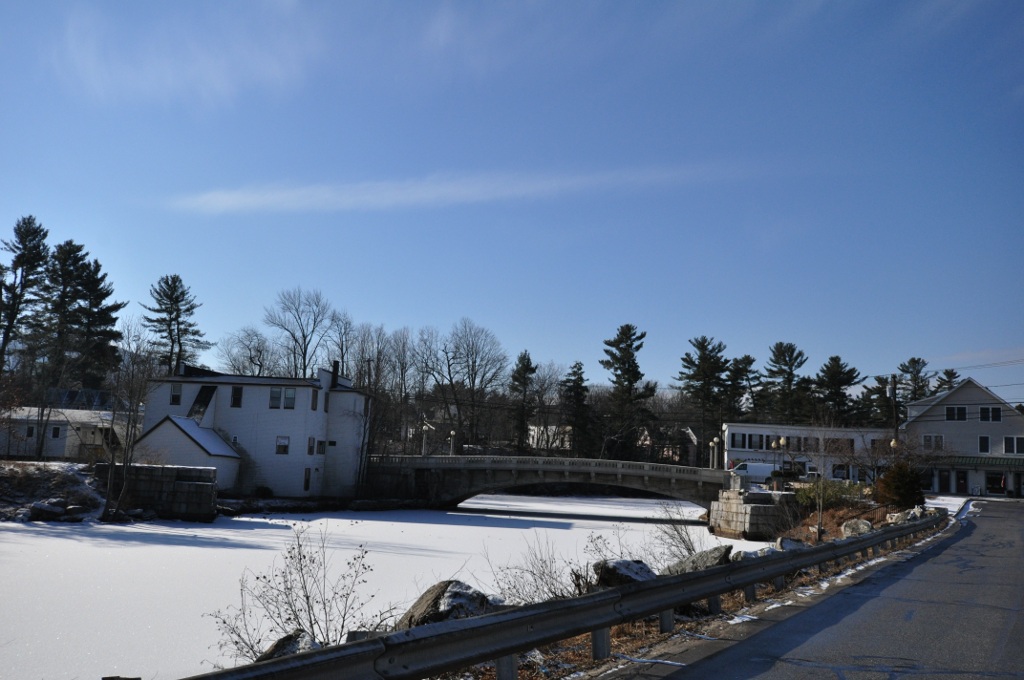
Goffstown Covered Railroad Bridge
Bridge · National Register of Historic Places

Museums and landmarks4

Goffstown Main Street Historic District
Monument and historic site · National Register of Historic Places
Historic district in New Hampshire, United States

Grasmere Schoolhouse No. 9 and Town Hall
Monument and historic site · National Register of Historic Places · 2.6 mi
Rathaus in New Hampshire, United States of America

Parker's Store
Monument and historic site · National Register of Historic Places · 1.5 mi
Historic building in Goffstown, New Hampshire, USA
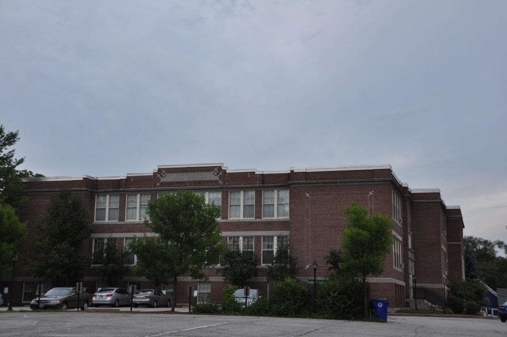


Upper Elementary School
Monument and historic site · National Register of Historic Places
Historic school building in Goffstown, New Hampshire
Parks, trails and playgrounds7


Restaurants and cafes9

Goffstown House of Pizza
Restaurant · Pizza
23 Main Street, Goffstown
Su-Th 11:00-20:00; Fr,Sa 11:00-21:00


China Gourmet
Restaurant · Chinese
Mo-Th 11:30-21:30; Fr,Sa 11:30-22:00; Su 11:30-21:30
Village Trestle
Restaurant
25` Main Street, Goffstown
Tu-Th 11:30-22:00; Fr,Sa 11:30-23:00; Su 11:30-20:00
Churches and places of worship4
Goffstown Congregational Church
Church · National Register of Historic Places
Shopping4
Gas and EV charging2
Schools, colleges and libraries11
Spark Academy of Advanced Technologies Charter School
School · 5.8 mi
1066 Front St., Manchester
Map of Goffstown
43 places. The map loads OpenStreetMap tiles when you open it.
Climate by month
Monthly table
| Month | High | Low | Rain |
|---|---|---|---|
| Jan | 31°F | 13°F | 3.3 in |
| Feb | 34°F | 14°F | 3.0 in |
| Mar | 42°F | 23°F | 3.8 in |
| Apr | 55°F | 33°F | 3.9 in |
| May | 67°F | 45°F | 3.7 in |
| Jun | 74°F | 55°F | 4.4 in |
| Jul | 80°F | 60°F | 4.0 in |
| Aug | 78°F | 58°F | 4.0 in |
| Sep | 71°F | 50°F | 3.8 in |
| Oct | 58°F | 38°F | 5.1 in |
| Nov | 47°F | 30°F | 3.8 in |
| Dec | 37°F | 20°F | 4.3 in |
U.S. Climate Normals 1991-2020 for Weare (8 mi away), rain and snow from Dunbarton 0.3 N, NOAA NCEI.
People and cost of living
American Community Survey 5-year estimates, 2020-2024, U.S. Census Bureau. Estimates have margins of error, larger for small towns.
Disaster history
Hillsborough County has had 22 federal disaster declarations since 2000, most often for severe storms.
- 2020-04-03: Covid-19 Pandemic (Biological)
- 2020-03-13: Covid-19 (Biological)
- 2015-03-25: Severe Winter Storm And Snowstorm (Severe Storm)
- 2013-03-19: Severe Winter Storm And Snowstorm (Severe Storm)
- 2012-10-30: Hurricane Sandy (Hurricane)
- 2011-12-05: Severe Storm And Snowstorm (Severe Storm)
OpenFEMA disaster declarations summaries.
Getting there and nearby towns
Manchester–Boston Regional Airport (MHT) is the nearest airport with scheduled flights listed in OpenStreetMap, 11 miles away.
- Manchester 8 mi east, about 13 min by car
- East Merrimack 12 mi southeast, about 19 min by car
- Concord 15 mi north, about 24 min by car
- Contoocook 15 mi north, about 25 min by car
- Londonderry 17 mi southeast, about 27 min by car
- Derry 19 mi southeast, about 30 min by car
- Nashua 20 mi south, about 32 min by car
- Pepperell 24 mi south, about 39 min by car
- Methuen 29 mi southeast, about 46 min by car
- Lowell 30 mi southeast, about 48 min by car
Drive times are estimates from straight-line distance, not routes.
Local news
Headlines from INDB, the NEMICO news database.
Reviews, tips and questions
Loading what members have shared...
Sources and licences
- NCES EDGE (Public domain): public schools
- NOAA NCEI U.S. Climate Normals 1991-2020 (Public domain): climate by month
- OpenFEMA (Public domain): disaster declarations
- OpenStreetMap contributors (ODbL 1.0): places, airports, map data
- U.S. Census Bureau (Public domain): population, income, housing, education, commute
- Wikidata (CC0 1.0): elevation, founding date, time zone, website, landmarks and historic places
- Wikimedia Commons (see each image): photos
- Wikipedia (CC BY-SA 4.0): overview and history text
Photo credits
- Main Street, Goffstown NH, John Phelan, CC BY-SA 3.0
- Maple Avenue Elementary School · Goffstown, New Hampshire · 20080602, Struthious Bandersnatch, CC BY-SA 3.0
- Maple Avenue Elementary School · South-East corner · Goffstown, New Hampshire · 20080602, Struthious Bandersnatch, CC BY-SA 3.0
- Saint Matthew's Episcopal Church · Goffstown, New Hampshire · 20080602, Struthious Bandersnatch, CC BY-SA 3.0
- Goffstown Public Library · Goffstown, New Hampshire · 20080602, Struthious Bandersnatch, CC BY-SA 3.0
- Goffstown Town Hall · Goffstown, New Hampshire · 20080602, Struthious Bandersnatch, CC BY-SA 3.0
- Goffstown station 1912 postcard, Unknown author Unknown author, Public domain
- Goffstown station white border postcard, Tichnor Brothers, Public domain
- W, Goffstown Rail Trail, Goffstown NH, John Phelan, CC BY-SA 4.0
- Goffstown NH 4-21-26, Ascended Dreamer, CC BY-SA 4.0
- Westlawn Cemetery · Goffstown, New Hampshire · 20080602 02, Struthious Bandersnatch, CC BY-SA 3.0
- Westlawn Cemetery · Goffstown, New Hampshire · 20080602 01, Struthious Bandersnatch, CC BY-SA 3.0
- Memorial Library, Goffstown NH, John Phelan, CC BY 4.0
- GoffstownNH GrasmereTownHall, User:Magicpiano, CC BY-SA 4.0
- GoffstownNH CongregationalChurch, User:Magicpiano, CC BY-SA 4.0
- GoffstownNH ParkersStore, User:Magicpiano, CC BY-SA 4.0
- GoffstownNH FormerHighSchool, User:Magicpiano, CC BY-SA 4.0
- GoffstownNH Bridges, User:Magicpiano, CC BY-SA 4.0
- Wayne Messam (47852570872), Marc Nozell from Merrimack, New Hampshire, USA, CC BY 2.0
- Wayne Messam (47115275894), Marc Nozell from Merrimack, New Hampshire, USA, CC BY 2.0
- Wayne Messam (46988587085), Marc Nozell from Merrimack, New Hampshire, USA, CC BY 2.0
- Wayne Messam (47904682751), Marc Nozell from Merrimack, New Hampshire, USA, CC BY 2.0
- Wayne Messam (46988594745), Marc Nozell from Merrimack, New Hampshire, USA, CC BY 2.0
- New Hampshire Young Democrats (NHYD) (46988589935), Marc Nozell from Merrimack, New Hampshire, USA, CC BY 2.0
- Wayne Messam (46988589225), Marc Nozell from Merrimack, New Hampshire, USA, CC BY 2.0
- Wayne Messam (47115277984), Marc Nozell from Merrimack, New Hampshire, USA, CC BY 2.0
- Wayne Messam (47904676651), Marc Nozell from Merrimack, New Hampshire, USA, CC BY 2.0
- Wayne Messam (47115274694), Marc Nozell from Merrimack, New Hampshire, USA, CC BY 2.0
- Wayne Messam (47904679411), Marc Nozell from Merrimack, New Hampshire, USA, CC BY 2.0
- Wayne Messam (47115280204) (1), Marc Nozell from Merrimack, New Hampshire, USA, CC BY 2.0
- Wayne Messam (47115280204), Marc Nozell from Merrimack, New Hampshire, USA, CC BY 2.0
- Wayne Messam by Marc Nozell (cropped), Marc Nozell, CC BY 2.0
- Wayne Messam by Marc Nozell, Marc Nozell, CC BY 2.0
- Wayne Messam (47904680401), Marc Nozell from Merrimack, New Hampshire, USA, CC BY 2.0
- Wayne Messam (47904680401) (1), Marc Nozell from Merrimack, New Hampshire, USA, CC BY 2.0
- Wayne Messam (47904683191), Marc Nozell from Merrimack, New Hampshire, USA, CC BY 2.0
- Wayne Messam (47115277684), Marc Nozell from Merrimack, New Hampshire, USA, CC BY 2.0
- Wayne Messam (47852568782), Marc Nozell from Merrimack, New Hampshire, USA, CC BY 2.0
- Wayne Messam (46988583975), Marc Nozell from Merrimack, New Hampshire, USA, CC BY 2.0
- Lindsay Graham offers a Christian prayer in exchange for a flower from Rod Webber (18970775673), Marc Nozell from Merrimack, New Hampshire, USA, CC BY 2.0


Page built October 30, 2026. Spotted a mistake? Tell us or suggest a place.