


Nashua, New Hampshire
Nashua is a city of 91,294 people in Hillsborough County, New Hampshire, founded in 1746.
Why visit Nashua
Townapedia lists 46 museums and landmarks, 88 parks and trails, 224 places to eat, 12 places to stay and 20 attractions in and around town.
Highlights include Chunky's Cinema Pub, Rivier University, Nashville Historic District and Abbot House.
July is the warmest month, with average highs of 85°F; January lows average 14°F.
Weather in Nashua
Forecast from the National Weather Service. Full forecast
About Nashua
Nashua () is a city in southern New Hampshire, United States. As of the 2020 census, it had a population of 91,322, the second-largest in northern New England after nearby Manchester. It is one of two county seats of New Hampshire's most populous county, Hillsborough; the other being Manchester.
From the Wikipedia article Nashua, New Hampshire (this version), under CC BY-SA 4.0.
Things to do20



Benson's Wild Animal Farm
Monument and historic site · 4.5 mi
Former private zoo in New Hampshire, United States

Tyngsborough Bridge
Bridge · 6.2 mi
Bridge in Tyngsborough, Massachusetts, US

8 more on the map.
Museums and landmarks46
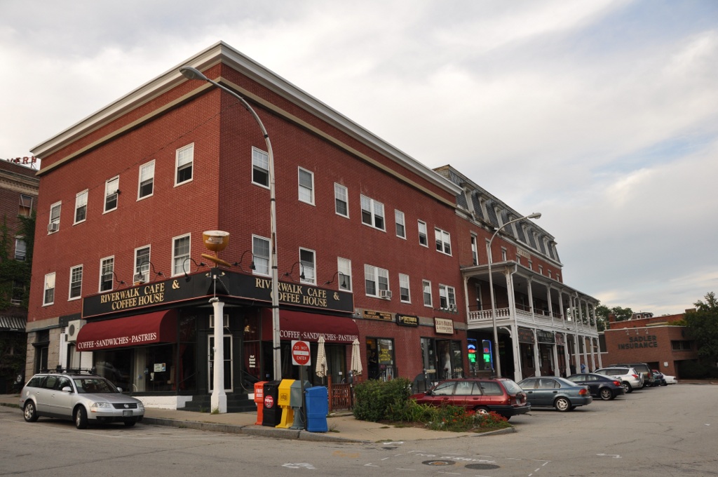
Nashville Historic District
Monument and historic site · National Register of Historic Places · 1.8 mi
Historic district in Nashua, New Hampshire

Abbot House
Monument and historic site · National Register of Historic Places · 1.6 mi
Historic house in Nashua, New Hampshire, United States

Dunstable Center Historic District
Monument and historic site · National Register of Historic Places · 5.2 mi
Historic district in Dunstable, Massachusetts

Dunstable Town Hall
Monument and historic site · National Register of Historic Places · 5.1 mi
Rathaus in Massachusetts, United States of America

G.O. Sanders House
Monument and historic site · National Register of Historic Places · 2.8 mi
Historic house in New Hampshire, United States
Gen. George Stark House
Monument and historic site · National Register of Historic Places · 1.7 mi
Historic house in New Hampshire, United States
Hills House
Monument and historic site · National Register of Historic Places · 4.3 mi
Historic house in New Hampshire, United States

Hills Memorial Library
Monument and historic site · National Register of Historic Places · 2.9 mi
Former public library of Hudson, New Hampshire, United States

Hillsborough County Registry of Deeds
Monument and historic site · National Register of Historic Places · 1.6 mi
Historic building in Nashua, New Hampshire, USA
Hollis Village Historic District
Monument and historic site · National Register of Historic Places · 4.8 mi
Historic district in New Hampshire, United States


Hunt Memorial Library
Monument and historic site · National Register of Historic Places · 1.3 mi
Historic building in Nashua, New Hampshire, United States
Killicut-Way House
Monument and historic site · National Register of Historic Places · 1.5 mi
Historic house in New Hampshire, United States
34 more on the map.
Parks, trails and playgrounds88

Greeley Park
Park · 2.5 mi
Public park in Nashua, New Hampshire, US
sunrise-22:00

SkyVenture
Sports field and stadium · 3.5 mi
100 Adventure Way, Nashua
Mo-Fr 11:00-21:00; Sa 10:00-21:00; Su 10:00-20:00 || "sport...

76 more on the map.
Restaurants and cafes224

jajaBelle's
Cafe · Coffee Shop · 1.5 mi
Pastry & Coffee Shop
182 Main Street, Nashua
Mo 08:00-13:30; Tu-Fr 08:00-17:00; Sa 09:00-17:00; Su 09:00-13:30

Christopher's Subs & Pizza
Restaurant · Pizza, Sandwich · 0.6 mi
Christopher's Subs & Pizza has been a beloved establishment in Nashua, NH, since 1977, serving up mouthwatering pizzas, flavorful subs,...
264 Main Dunstable Road, Nashua
Mo-Su 11:00-21:00

110 Grill
Diner · American · 2.5 mi
27 Trafalgar Square, Nashua
Mo-Su 11:30-21:00; We,Th 11:30-22:00; Fr,Sa 11:30-23:00
Aegean Pizza & Seafood
Restaurant · Pizza, Seafood · 1.3 mi
150 Broad Street, Nashua
Su-Th 11:00-21:00; Fr-Sa 11:00-22:00
Applebee's
Diner · American · 2.7 mi
379 Amherst Street, Nashua
Mo-Fr 11:00-24:00; Sa,Su 00:00-01:00,11:00-24:00
Barnes & Noble Cafe
Cafe · Coffee Shop · 3.6 mi
235 Daniel Webster Highway, Nashua
Mo-Th 09:00-21:00; Fr,Sa 09:00-23:00; Su 10:00-21:00
Casa Vieja
Restaurant · Mexican · 1.6 mi
96 Main Street, Nashua
Mo 00:00-01:00,11:00-22:00; Tu,We 11:00-22:00; Th 11:00-24:00;...
Cedar's Cafe
Restaurant · Mediterranean · 2.7 mi
379 Amherst Street, Nashua
Mo-Fr 10:00-21:00; Sa 10:00-20:00
Chen Yang Li
Restaurant · Chinese, Japanese · 2.7 mi
379 Amherst Street, Nashua
Mo-Th 11:30-22:00; Fr,Sa 11:30-23:00; Su 12:00-22:00
Chili's
Restaurant · Tex-Mex · 3.9 mi
285 Daniel Webster Highway, Nashua
Mo-Su 11:00-23:00; Fr,Sa 11:00-24:00
212 more on the map.
History
The area was part of a 200-square-mile (520 km2) tract of land in Massachusetts called "Dunstable", named after Edward Tyng of Dunstable in England. Located at the confluence of the Nashua and Merrimack rivers, Dunstable was first settled about 1654 as a fur trading town. Nashua lies approximately in the center of the original 1673 grant. In 1732, Dunstable was split along the Merrimack River, with the town of Nottingham West (now the town of Hudson, New Hampshire) created out of the eastern portion. The previously disputed boundary between Massachusetts and New Hampshire was fixed in 1741 when the governorships of the two provinces were separated. As a result, the township of Dunstable was divided in two. Tyngsborough and some of Dunstable remained in Massachusetts, while Dunstable, New Hampshire, was incorporated in 1746 from the northern section of the town.
Like many 19th century riverfront New England communities, New Hampshire's Dunstable was developed during the Industrial Revolution with textile mills operated from water power. In 1823, the Nashua Manufacturing Company was incorporated. The company eventually had four mills and employed approximately 1,000 people. The following year, the Jackson Manufacturing Company was incorporated.
From the History section of Nashua, New Hampshire on Wikipedia, under CC BY-SA 4.0.
Where to stay12
Churches and places of worship57
Shopping52
Gas and EV charging33
Schools, colleges and libraries73
Healthcare26
Map of Nashua
250 places. The map loads OpenStreetMap tiles when you open it.
Climate by month
Monthly table
| Month | High | Low | Rain |
|---|---|---|---|
| Jan | 34°F | 14°F | 3.0 in |
| Feb | 38°F | 16°F | 3.1 in |
| Mar | 45°F | 24°F | 4.1 in |
| Apr | 58°F | 35°F | 3.9 in |
| May | 69°F | 46°F | 3.6 in |
| Jun | 79°F | 56°F | 4.2 in |
| Jul | 85°F | 62°F | 3.6 in |
| Aug | 83°F | 60°F | 3.7 in |
| Sep | 75°F | 52°F | 4.2 in |
| Oct | 62°F | 39°F | 4.7 in |
| Nov | 50°F | 29°F | 3.7 in |
| Dec | 40°F | 20°F | 4.5 in |
U.S. Climate Normals 1991-2020 for Nashua Cwsu (1 mi away), NOAA NCEI.
People and cost of living
American Community Survey 5-year estimates, 2020-2024, U.S. Census Bureau. Estimates have margins of error, larger for small towns.
Disaster history
Hillsborough County has had 22 federal disaster declarations since 2000, most often for severe storms.
- 2020-04-03: Covid-19 Pandemic (Biological)
- 2020-03-13: Covid-19 (Biological)
- 2015-03-25: Severe Winter Storm And Snowstorm (Severe Storm)
- 2013-03-19: Severe Winter Storm And Snowstorm (Severe Storm)
- 2012-10-30: Hurricane Sandy (Hurricane)
- 2011-12-05: Severe Storm And Snowstorm (Severe Storm)
OpenFEMA disaster declarations summaries.
Getting there and nearby towns
Nashua Airport (ASH) is the nearest airport with scheduled flights listed in OpenStreetMap, 2 miles away.
- Londonderry 10 mi northeast, about 16 min by car
- Lowell 11 mi southeast, about 18 min by car
- Derry 14 mi northeast, about 23 min by car
- Manchester 16 mi north, about 26 min by car
- Methuen 16 mi east, about 25 min by car
- Lawrence 17 mi east, about 27 min by car
- Fitchburg 19 mi southwest, about 31 min by car
- Haverhill 21 mi east, about 33 min by car
- Leominster 21 mi southwest, about 34 min by car
- Wilmington 21 mi southeast, about 34 min by car
Drive times are estimates from straight-line distance, not routes.
Local news
Headlines from INDB, the NEMICO news database.
Reviews, tips and questions
Loading what members have shared...
Sources and licences
- NCES EDGE (Public domain): public schools
- NOAA NCEI U.S. Climate Normals 1991-2020 (Public domain): climate by month
- OpenFEMA (Public domain): disaster declarations
- OpenStreetMap contributors (ODbL 1.0): places, airports, map data
- U.S. Census Bureau (Public domain): population, income, housing, education, commute
- Wikidata (CC0 1.0): elevation, founding date, time zone, website, landmarks and historic places
- Wikimedia Commons (see each image): photos
- Wikipedia (CC BY-SA 4.0): overview and history text
Photo credits
- Nashua NH Main Street 50, Jon Platek, CC BY-SA 3.0
- Nashua Heritage Rail Trail, Nashua NH, John Phelan, CC BY-SA 4.0
- Mine Falls Park. Nashua, NH - panoramio, Bernie Ongewe, CC BY-SA 3.0
- Nashua, NH, USA - panoramio (2), Bernie Ongewe, CC BY-SA 3.0
- Nashua, NH, USA - panoramio (5), Bernie Ongewe, CC BY-SA 3.0
- A mottled trail in Mine Falls Park. Nashua, NH - panoramio, Bernie Ongewe, CC BY-SA 3.0
- Nashua, NH, USA - panoramio (8), Bernie Ongewe, CC BY-SA 3.0
- Nashua, NH, USA - panoramio (9), Bernie Ongewe, CC BY-SA 3.0
- Nashua, NH, USA - panoramio (4), Bernie Ongewe, CC BY-SA 3.0
- Nashua, NH, USA - panoramio (3), Bernie Ongewe, CC BY-SA 3.0
- Nashua, NH, USA - panoramio (10), Bernie Ongewe, CC BY-SA 3.0
- Nashua, NH, USA - panoramio (6), Bernie Ongewe, CC BY-SA 3.0
- Nashua, NH, USA - panoramio (1), Bernie Ongewe, CC BY-SA 3.0
- Nashua, NH, USA - panoramio (7), Bernie Ongewe, CC BY-SA 3.0
- Nashua Heritage Rail Trail bridge, Nashua NH, John Phelan, CC BY-SA 4.0
- NashuaNH RailroadSquare, User:Magicpiano, CC BY-SA 4.0
- Hills-memorial-library-front-2007, K. Butler, Public domain
- MerrimackNH MclureHiltonHouse, User:Magicpiano, CC BY-SA 4.0
- NashuaNH AbbotHouse, User:Magicpiano, CC BY-SA 4.0
- NashuaNH HillsboroughCountyCourthouse, User:Magicpiano, CC BY-SA 4.0
- HudsonNH GOSandersHouse, User:Magicpiano, CC BY-SA 4.0
- Huntlibrarynashua, The original uploader was GMcGath at English Wikipedia ., CC BY-SA 2.5
- NashuaNH GummedPaperCompany1, Magicpiano, CC BY-SA 4.0
- Town Hall, Dunstable MA, John Phelan, CC BY 3.0
- Reeds Ferry 05, Jane023, CC BY-SA 4.0
- HollisNH Meetinghouse, User:Magicpiano, CC BY-SA 4.0
- Pleasant Street, Dunstable Center MA, John Phelan, CC BY 3.0
- Veterinary Office, MarkBuckawicki, CC0
- Veterinary Office with dog, MarkBuckawicki, CC0
- 080421 St Joseph's, Dan4th Nicholas, CC BY 2.0
- Mine Falls Generating Station, Taborfrench20, CC BY-SA 3.0
- Danger Fast Flowing Water, MarkBuckawicki, CC0
- Danger Keep Out, MarkBuckawicki, CC0
- Leashed Dogs Only, MarkBuckawicki, CC0
- Billiards table 1, MarkBuckawicki, CC0
- Billiards Rack, MarkBuckawicki, CC0
- Billiards table 2, MarkBuckawicki, CC0
- Billiards Table, MarkBuckawicki, CC0
- Dog food aisle, MarkBuckawicki, CC0
- Bananas on Display, MarkBuckawicki, CC0


Page built October 30, 2026. Spotted a mistake? Tell us or suggest a place.