



Why visit Grand Bay
Townapedia lists 1 museum or landmark, 1 park or trail and 5 places to eat in and around town.
Highlights include Grand Bay Historic District.
August is the warmest month, with average highs of 88°F; January lows average 40°F.
Weather in Grand Bay
Forecast from the National Weather Service. Full forecast
About Grand Bay
Grand Bay is an unincorporated community and census-designated place (CDP) in southwest Mobile County, Alabama, United States. It is part of the Mobile metropolitan area. The population was 3,460 at the 2020 census.
From the Wikipedia article Grand Bay, Alabama (this version), under CC BY-SA 4.0.
Museums and landmarks1
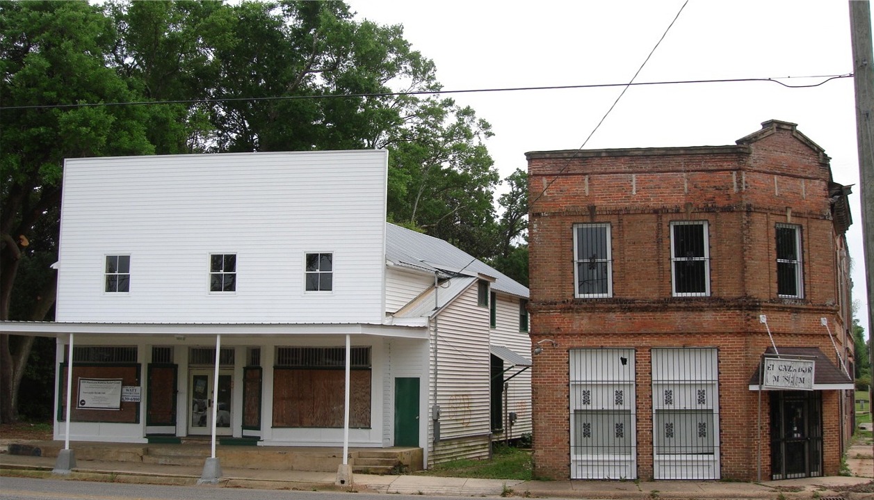
Grand Bay Historic District
Monument and historic site · National Register of Historic Places
Historic district in Alabama, United States
Parks, trails and playgrounds1

Restaurants and cafes5

Frank N Lola’s
Restaurant · 2.4 mi
Frank N Lola’s, founded in 2021 and based in Grand Bay, AL, serves the surrounding area with unbeatable burger specials and delicious...
8887 Grand Bay Wilmer Road, Grand Bay
Su-Mo 10:30-20:00, We-Th 10:30-20:00, Fr-Sa 10:30-22:00

Arby's
Fast food · Sandwich · 1.8 mi
12411 Creel Road, Grand Bay
Mo-We 10:00-23:00; Th-Sa 10:00-24:00; Su 10:00-23:00
McDonald's
Fast food · Burger · 1.9 mi
9200 Grand Bay Wilmer Road
Mo-Th 05:00-23:00; Fr-Sa 05:00-24:00; Su 05:00-23:00
Churches and places of worship8

Saint John the Baptist Catholic Church
Church · Roman Catholic · 0.6 mi
12450 Highway 188, Grand Bay
History
According to local accounts, George Cassibry was the first person to settle in Grand Bay. He came to the area in 1853, establishing a home site near the headwaters of Franklin Creek located today near the intersection of Highway 90 and Ramsey Road. Exploration and settlement of the area was well underway by the mid-nineteenth century.
During the Civil War, the town saw brief military action as a column of troops under U.S. General Gordon Granger reached the town as a preliminary move in the siege of Mobile. In 1870 the U.S. Postal Service established a post office at a location near the center of the current community.
Settlement began in earnest when the Grand Bay Land Company began offering ten-acre lots for sale in the early 1900s. The lots were marketed to people living in and around Chicago and other northern cities as a way to live self-sufficiently in a mild climate. Supposedly, ten acres planted in pecan and satsuma trees would be enough to supply the needs of anyone. The timber industry also attracted many to the area. Much of the region south of Grand Bay to the coast along the Mississippi Sound was clearcut.
From the History section of Grand Bay, Alabama on Wikipedia, under CC BY-SA 4.0.
Gas and EV charging1
Schools, colleges and libraries6
Map of Grand Bay
22 places. The map loads OpenStreetMap tiles when you open it.
Climate by month
Monthly table
| Month | High | Low | Rain | Snow |
|---|---|---|---|---|
| Jan | 60°F | 40°F | 5.6 in | 0.0 in |
| Feb | 63°F | 43°F | 5.1 in | 0.0 in |
| Mar | 69°F | 48°F | 5.1 in | 0.0 in |
| Apr | 76°F | 55°F | 5.3 in | 0.0 in |
| May | 82°F | 63°F | 5.7 in | 0.0 in |
| Jun | 86°F | 70°F | 6.7 in | 0.0 in |
| Jul | 88°F | 73°F | 8.2 in | 0.0 in |
| Aug | 88°F | 72°F | 7.5 in | 0.0 in |
| Sep | 86°F | 68°F | 6.0 in | 0.0 in |
| Oct | 78°F | 58°F | 4.4 in | 0.0 in |
| Nov | 69°F | 47°F | 4.0 in | 0.0 in |
| Dec | 62°F | 42°F | 5.3 in | 0.0 in |
U.S. Climate Normals 1991-2020 for Coden (9 mi away), NOAA NCEI.
People and cost of living
American Community Survey 5-year estimates, 2020-2024, U.S. Census Bureau. Estimates have margins of error, larger for small towns.
Disaster history
Mobile County has had 28 federal disaster declarations since 2000, most often for hurricanes.
- 2026-10-09: Hurricane Isaias (Hurricane)
- 2024-09-26: Hurricane Helene (Hurricane)
- 2023-01-15: Severe Storms, Straight-Line Winds, And Tornadoes (Severe Storm)
- 2020-12-10: Hurricane Zeta (Hurricane)
- 2020-09-20: Hurricane Sally (Hurricane)
- 2020-09-14: Hurricane Sally (Hurricane)
OpenFEMA disaster declarations summaries.
Getting there and nearby towns
Trent Lott International Airport (PGL) is the nearest airport with scheduled flights listed in OpenStreetMap, 11 miles away.
- Bayou La Batre 7 mi southeast, about 11 min by car
- Tillmans Corner 11 mi northeast, about 18 min by car
- Moss Point 12 mi west, about 19 min by car
- Pascagoula 15 mi southwest, about 24 min by car
- Gautier 19 mi west, about 31 min by car
- Dauphin Island 19 mi southeast, about 31 min by car
- Mobile 20 mi northeast, about 31 min by car
- Prichard 24 mi northeast, about 39 min by car
- Ocean Springs 27 mi west, about 43 min by car
- Fairhope 28 mi east, about 45 min by car
Drive times are estimates from straight-line distance, not routes.
Local news
Headlines from INDB, the NEMICO news database.
Reviews, tips and questions
Loading what members have shared...
Sources and licences
- NCES EDGE (Public domain): public schools
- NOAA NCEI U.S. Climate Normals 1991-2020 (Public domain): climate by month
- OpenFEMA (Public domain): disaster declarations
- OpenStreetMap contributors (ODbL 1.0): places, airports, map data
- U.S. Census Bureau (Public domain): population, income, housing, education, commute
- Wikidata (CC0 1.0): elevation, founding date, time zone, website, landmarks and historic places
- Wikimedia Commons (see each image): photos
- Wikipedia (CC BY-SA 4.0): overview and history text
Photo credits
- US 90 and Alabama 188, Brandonrush, CC BY-SA 3.0
- Grand Bay Alabama Historic District, Citizens36541, CC BY-SA 3.0
Page built October 30, 2026. Spotted a mistake? Tell us or suggest a place.