


Why visit Greenhills
Townapedia lists 16 museums and landmarks, 20 parks and trails, 3 places to eat and 1 attraction in and around town.
Highlights include Jediah Hill Covered Bridge, Becker House, Burchenal Mound and Winton Woods.
July is the warmest month, with average highs of 87°F; January lows average 21°F.
Weather in Greenhills
Forecast from the National Weather Service. Full forecast
About Greenhills
Greenhills is a village in Hamilton County, Ohio, United States. The population was 3,741 at the 2020 census. A planned community, it was established by the United States government during the Great Depression. Most of the village is a National Historic Landmark for its history as a planned modernist community.
From the Wikipedia article Greenhills, Ohio (this version), under CC BY-SA 4.0.
Things to do1

Jediah Hill Covered Bridge
Bridge · National Register of Historic Places · 1.8 mi
Museums and landmarks16

Becker House
Monument and historic site · National Register of Historic Places · 3.4 mi
Springdale, Ohio, NRHP-listed

Burchenal Mound
Monument and historic site · National Register of Historic Places · 2.5 mi
Archaeological site in Ohio, United States

Charles Fay House
Monument and historic site · National Register of Historic Places · 3.4 mi
Historic house in Ohio, United States

Edward R. Stearns House
Monument and historic site · National Register of Historic Places · 3.3 mi
Historic house in Ohio, United States

Glendale Historic District
Monument and historic site · National Register of Historic Places · 3.0 mi
Historic district in Glendale, Ohio

Glendale Police Station
Monument and historic site · National Register of Historic Places · 3.3 mi
Prison in Ohio, United States of America

Greenhills Historic District
Monument and historic site · National Register of Historic Places

James Whallon House
Monument and historic site · National Register of Historic Places
Historic house in Ohio, United States

Louis Sawyer House
Monument and historic site · National Register of Historic Places · 3.4 mi
Historic house in Ohio, United States

Morgan-Hueston House
Monument and historic site · National Register of Historic Places · 3.1 mi
Historic house in Ohio, United States

Mount Healthy Public School
Monument and historic site · National Register of Historic Places · 2.9 mi
School building in Mount Healthy, United States of America
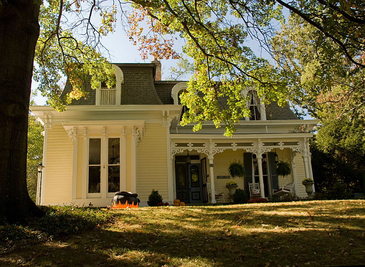


Professor William Pabodie House
Monument and historic site · National Register of Historic Places · 3.4 mi
Historic house in Ohio, United States
4 more on the map.
Parks, trails and playgrounds20


Greenhills Golf Course
Golf course
10 Enfield Street, Greenhills
8 more on the map.
Restaurants and cafes3

La Fiesta Mexico
Restaurant · Mexican · 1.5 mi
1195 West Kemper Road, Forest Park

History
As one of three Greenbelt Communities built by the Resettlement Administration during the 1930s (the other two are Greenbelt, Maryland and Greendale, Wisconsin), Greenhills was designed to be surrounded by a "belt" of woodland and natural landscaping. Like the other six "FDR towns", Greenhills was founded as a sundown town, using restrictive covenants to prevent minorities from purchasing homes there. Many families include third- and fourth-generation descendants of the village's original "pioneers" who occupied the original International-style townhomes. The original government-built area, the Greenhills Historic District, is listed on the National Register of Historic Places and is a National Historic Landmark. The community's James Whallon House, which serves as the village hall is also listed in the National Register of Historic Places. The landmarked area encompasses about three quarters of the area within the village bounds, excepting only the northeastern section northeast of Farragut and Ingram Roads.
From the History section of Greenhills, Ohio on Wikipedia, under CC BY-SA 4.0.
Churches and places of worship6
Schools, colleges and libraries45
Cincinnati Achievement Academy
School · 5.7 mi
5555 Little Flower Ave, Cincinnati
Map of Greenhills
91 places. The map loads OpenStreetMap tiles when you open it.
Climate by month
Monthly table
| Month | High | Low | Rain |
|---|---|---|---|
| Jan | 38°F | 21°F | 3.4 in |
| Feb | 42°F | 23°F | 3.0 in |
| Mar | 53°F | 31°F | 3.9 in |
| Apr | 66°F | 41°F | 4.9 in |
| May | 75°F | 52°F | 4.9 in |
| Jun | 84°F | 61°F | 4.4 in |
| Jul | 87°F | 65°F | 3.9 in |
| Aug | 87°F | 63°F | 3.5 in |
| Sep | 80°F | 55°F | 3.3 in |
| Oct | 67°F | 43°F | 3.3 in |
| Nov | 54°F | 32°F | 3.2 in |
| Dec | 42°F | 26°F | 3.5 in |
U.S. Climate Normals 1991-2020 for Fairfield (7 mi away), NOAA NCEI.
People and cost of living
American Community Survey 5-year estimates, 2020-2024, U.S. Census Bureau. Estimates have margins of error, larger for small towns.
Disaster history
Hamilton County has had 11 federal disaster declarations since 2000, most often for severe storms.
- 2026-10-02: Severe Storms, Straight-Line Winds, Tornadoes, Flooding, And Landslides (Flood)
- 2020-03-31: Covid-19 Pandemic (Biological)
- 2020-03-13: Covid-19 (Biological)
- 2018-04-17: Severe Storms, Landslides, And Mudslides (Flood)
- 2012-06-30: Severe Storms (Severe Storm)
- 2011-07-13: Severe Storms And Flooding (Severe Storm)
OpenFEMA disaster declarations summaries.
Getting there and nearby towns
Butler County Regional Airport (HAO) is the nearest airport with scheduled flights listed in OpenStreetMap, 7 miles away.
- Forest Park 1 mi north, about 2 min by car
- Pleasant Hills 2 mi south, about 3 min by car
- Springdale 3 mi northeast, about 5 min by car
- Glendale 3 mi east, about 5 min by car
- Finneytown 4 mi south, about 6 min by car
- Northbrook 4 mi southwest, about 6 min by car
- Lincoln Heights 4 mi southeast, about 6 min by car
- Skyline Acres 4 mi southwest, about 6 min by car
- Fairfield 5 mi north, about 7 min by car
- Reading 5 mi southeast, about 9 min by car
Drive times are estimates from straight-line distance, not routes.
Local news
Headlines from INDB, the NEMICO news database.
Reviews, tips and questions
Loading what members have shared...
Sources and licences
- NCES EDGE (Public domain): public schools
- NOAA NCEI U.S. Climate Normals 1991-2020 (Public domain): climate by month
- OpenFEMA (Public domain): disaster declarations
- OpenStreetMap contributors (ODbL 1.0): places, airports, map data
- U.S. Census Bureau (Public domain): population, income, housing, education, commute
- Wikidata (CC0 1.0): elevation, founding date, time zone, website, landmarks and historic places
- Wikimedia Commons (see each image): photos
- Wikipedia (CC BY-SA 4.0): overview and history text
Photo credits
- Greenhills Ohio Municipal Building, Greg Hume, CC BY-SA 4.0
- MtHealthySchool03, Photo by Greg Hume ( Greg5030 ), CC BY-SA 3.0
- Burchenal Mound from the south, Nyttend, Public domain
- Glendale OH shops, User:Bedford, Public domain
- Twin Oaks, Robert Reily House, Nyttend, Public domain
- MorganHuestonHouse, Photo by Greg Hume ( Greg5030 ), CC BY-SA 3.0
- LouisSawyerHouseLR, Photo by Greg Hume ( Greg5030 ), CC BY 3.0
- CharlesFayHouseLR, Photo by Greg Hume ( Greg5030 ), CC BY 3.0
- ProfessorWilliamPabodieHouse, Photo by Greg Hume ( Greg5030 ), CC BY 3.0
- Becker House in Springdale, Nyttend, Public domain
- GlendalePolice, Photo by Greg Hume ( Greg5030 ), CC BY-SA 3.0
- St. Francis Seminary entrance, Nyttend, Public domain
- WilliamStearnsHouseLR, Photo by Greg Hume ( Greg5030 ), CC BY 3.0
- EdwardStearnsHouseLR, Photo by Greg Hume ( Greg5030 ), CC BY 3.0
- Winton and Farragut in Greenhills, Nyttend, Public domain
- JediahHillBridge, Photo by Greg Hume ( Greg5030 ), CC BY-SA 3.0
- James Whallon House, Nyttend, Public domain
- Flowers of Winton Woods July 2023c, Antony-22, CC BY-SA 4.0
- Flowers of Winton Woods July 2023b, Antony-22, CC BY-SA 4.0
- Flowers of Winton Woods July 2023f, Antony-22, CC BY-SA 4.0
- Flowers of Winton Woods July 2023a, Antony-22, CC BY-SA 4.0
- Flowers of Winton Woods July 2023g, Antony-22, CC BY-SA 4.0
- Flowers of Winton Woods July 2023d, Antony-22, CC BY-SA 4.0
- Flowers of Winton Woods July 2023e, Antony-22, CC BY-SA 4.0
- Flowers of Winton Woods July 2023j, Antony-22, CC BY-SA 4.0
- Flowers of Winton Woods July 2023i, Antony-22, CC BY-SA 4.0
- Flowers of Winton Woods July 2023h, Antony-22, CC BY-SA 4.0
- Flowers of Winton Woods July 2023m, Antony-22, CC BY-SA 4.0
- Flowers of Winton Woods July 2023k, Antony-22, CC BY-SA 4.0
- Flowers of Winton Woods July 2023l, Antony-22, CC BY-SA 4.0
- Flowers of Winton Woods July 2023n, Antony-22, CC BY-SA 4.0
- Flowers of Winton Woods July 2023o, Antony-22, CC BY-SA 4.0
- Flowers of Winton Woods July 2023p, Antony-22, CC BY-SA 4.0
- Flowers of Winton Woods July 2023q, Antony-22, CC BY-SA 4.0
- Flowers of Winton Woods July 2023r, Antony-22, CC BY-SA 4.0
- Flowers of Winton Woods July 2023s, Antony-22, CC BY-SA 4.0
- Flowers of Winton Woods July 2023t, Antony-22, CC BY-SA 4.0
- Flowers of Winton Woods May 2023r, Antony-22, CC BY-SA 4.0
- Flowers of Winton Woods May 2023q, Antony-22, CC BY-SA 4.0
- Flowers of Winton Woods May 2023a, Antony-22, CC BY-SA 4.0


Page built October 30, 2026. Spotted a mistake? Tell us or suggest a place.