


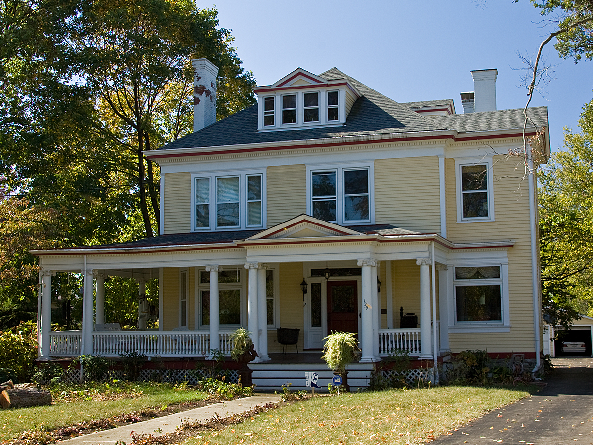

Lincoln Heights, Ohio
Lincoln Heights is a village of 3,124 people in Hamilton County, Ohio.
Why visit Lincoln Heights
Townapedia lists 27 museums and landmarks, 24 parks and trails, 9 places to eat and 2 attractions in and around town.
Highlights include Burchenal Mound and Charles Fay House.
July is the warmest month, with average highs of 87°F; January lows average 22°F.
Weather in Lincoln Heights
Forecast from the National Weather Service. Full forecast
About Lincoln Heights
Lincoln Heights is a village in Hamilton County, Ohio, United States. The population was 3,144 at the 2020 census. It is a suburb of Cincinnati.
From the Wikipedia article Lincoln Heights, Ohio (this version), under CC BY-SA 4.0.
Things to do2

Museums and landmarks27

Burchenal Mound
Monument and historic site · National Register of Historic Places · 1.5 mi
Archaeological site in Ohio, United States

Charles Fay House
Monument and historic site · National Register of Historic Places · 1.6 mi
Historic house in Ohio, United States

Charles H. Moore House
Monument and historic site · National Register of Historic Places · 1.1 mi
Wyoming, Ohio, NRHP-listed

Charles Woodruff House
Monument and historic site · National Register of Historic Places · 1.5 mi
Historic house in Ohio, United States

Edward R. Stearns House
Monument and historic site · National Register of Historic Places · 1.4 mi
Historic house in Ohio, United States

Elmer Hess House
Monument and historic site · National Register of Historic Places · 1.6 mi
Historic house in Ohio, United States

Glendale Historic District
Monument and historic site · National Register of Historic Places · 2.0 mi
Historic district in Glendale, Ohio

Glendale Police Station
Monument and historic site · National Register of Historic Places · 1.9 mi
Prison in Ohio, United States of America

Gorman Heritage Farm
Monument and historic site · National Register of Historic Places · 1.7 mi
Working farm museum in Evendale, Ohio, United States

Jacob Bromwell House
Monument and historic site · National Register of Historic Places · 1.7 mi
Historic house in Ohio, United States
John C. Pollock House
Monument and historic site · National Register of Historic Places · 1.5 mi
In Ohio, United States


John Tangeman House
Monument and historic site · National Register of Historic Places · 1.5 mi
Historic house in Ohio, United States
15 more on the map.
Parks, trails and playgrounds24



12 more on the map.
Restaurants and cafes9


Gilligan's Brewery
Bar and pub · 1.2 mi
400 Wyoming Avenue, Wyoming
Fr-Sa 11:00-23:00; Mo-Th 11:00-22:00


McDonald's
Fast food · Burger · 1.2 mi
10573 Springfield Pike, Woodlawn
Mo-Sa 05:00-23:00; Su 06:00-23:00
Popeyes
Fast food · Chicken · 1.4 mi
10601 Springfield Pike, Cincinnati
Mo-We 10:00-23:00; Th-Sa 10:00-24:00; Su 10:00-23:00
Popeyes
Fast food · Chicken · 1.5 mi
9200 Reading Road, Cincinnati
Mo-We 10:00-23:00; Th-Sa 10:00-24:00; Su 10:00-23:00
Tip Top Wings
Fast food · Chicken · 0.4 mi
9557 Mangham Drive, Cincinnati
Mo-Th 10:00-23:00; Fr-Sa 10:00-24:00; Su 10:00-22:00
History
Lincoln Heights was founded in the 1920s by property developers as a suburban enclave for black homeowners working in nearby industries. It was originally an unincorporated area which had no fire, police, streetlights, or paved roads. At the time, only some houses had electricity. Many black families bought houses in the community because zoning laws and redlining prevented them from purchasing property in other communities. It incorporated in 1946 and elected Reverend Michael J. Mangham as mayor, one of the earliest African mayors in the North.
From the History section of Lincoln Heights, Ohio on Wikipedia, under CC BY-SA 4.0.
Churches and places of worship24
Wyoming Presbyterian Church
Church · Presbyterian · National Register of Historic Places · 1.3 mi
First Church of Christ, Scientist
Church · Christ Scientist · 1.3 mi
620 Springfield Pike, Cincinnati
Shopping3
Gas and EV charging4
Schools, colleges and libraries56
Academy For Multilingual Immersion Studies
School · 3.8 mi
1908 Seymour Ave, Cincinnati
Dublin Preparatory Academy Dba Northside Preparatory Academy
School · 5.6 mi
4750 Winton Rd, Cincinnati
Healthcare2
Map of Lincoln Heights
151 places. The map loads OpenStreetMap tiles when you open it.
Climate by month
Monthly table
| Month | High | Low | Rain |
|---|---|---|---|
| Jan | 40°F | 22°F | 2.9 in |
| Feb | 44°F | 23°F | 2.4 in |
| Mar | 54°F | 32°F | 3.5 in |
| Apr | 67°F | 42°F | 4.6 in |
| May | 75°F | 52°F | 4.6 in |
| Jun | 83°F | 60°F | 4.1 in |
| Jul | 87°F | 64°F | 3.7 in |
| Aug | 86°F | 62°F | 3.0 in |
| Sep | 80°F | 54°F | 3.0 in |
| Oct | 68°F | 42°F | 3.2 in |
| Nov | 55°F | 32°F | 3.2 in |
| Dec | 44°F | 26°F | 3.3 in |
U.S. Climate Normals 1991-2020 for Hamilton Butler Co Rgnl Ap (9 mi away), NOAA NCEI.
People and cost of living
American Community Survey 5-year estimates, 2020-2024, U.S. Census Bureau. Estimates have margins of error, larger for small towns.
Disaster history
Hamilton County has had 11 federal disaster declarations since 2000, most often for severe storms.
- 2026-10-02: Severe Storms, Straight-Line Winds, Tornadoes, Flooding, And Landslides (Flood)
- 2020-03-31: Covid-19 Pandemic (Biological)
- 2020-03-13: Covid-19 (Biological)
- 2018-04-17: Severe Storms, Landslides, And Mudslides (Flood)
- 2012-06-30: Severe Storms (Severe Storm)
- 2011-07-13: Severe Storms And Flooding (Severe Storm)
OpenFEMA disaster declarations summaries.
Getting there and nearby towns
Butler County Regional Airport (HAO) is the nearest airport with scheduled flights listed in OpenStreetMap, 9 miles away.
- Reading 2 mi southeast, about 3 min by car
- Evendale 2 mi east, about 3 min by car
- Glendale 2 mi north, about 3 min by car
- Springdale 3 mi north, about 5 min by car
- Finneytown 4 mi southwest, about 6 min by car
- Sharonville 4 mi northeast, about 6 min by car
- Blue Ash 4 mi east, about 6 min by car
- Elmwood Place 4 mi southwest, about 7 min by car
- Forest Park 5 mi northwest, about 8 min by car
- Norwood 6 mi south, about 9 min by car
Drive times are estimates from straight-line distance, not routes.
Local news
Headlines from INDB, the NEMICO news database.
Reviews, tips and questions
Loading what members have shared...
Sources and licences
- NCES EDGE (Public domain): public schools
- NOAA NCEI U.S. Climate Normals 1991-2020 (Public domain): climate by month
- OpenFEMA (Public domain): disaster declarations
- OpenStreetMap contributors (ODbL 1.0): places, airports, map data
- U.S. Census Bureau (Public domain): population, income, housing, education, commute
- Wikidata (CC0 1.0): elevation, founding date, time zone, website, landmarks and historic places
- Wikimedia Commons (see each image): photos
- Wikipedia (CC BY-SA 4.0): overview and history text
Photo credits
- Steffen west of McIntyre, Lincoln Heights, Nyttend, Public domain
- Mount Moriah Missionary Baptist Church, Lincoln Heights, Nyttend, Public domain
- WyomingPresbyterianChurchLR, Photo by Greg Hume ( Greg5030 ), CC BY 3.0
- Ornate houses on Wyoming Avenue, Nyttend, Public domain
- WCRetszchHouseLR, Photo by Greg Hume ( Greg5030 ), CC BY 3.0
- JohnPollockHouse, Photo by Greg Hume ( Greg5030 ), CC BY-SA 3.0
- Mathew Mound from Oak Road, Nyttend, Public domain
- Brown-Gorman Farm barn, Nyttend, Public domain
- JohnTangemanHouseLR, Photo by Greg Hume ( Greg5030 ), CC BY 3.0
- JosiahKirbyHouse, Photo by Greg Hume ( Greg5030 ), CC BY 3.0
- Burchenal Mound from the south, Nyttend, Public domain
- Glendale OH shops, User:Bedford, Public domain
- Twin Oaks, Robert Reily House, Nyttend, Public domain
- JacobBromwellHouseLR, Photo by Greg Hume ( Greg5030 ), CC BY 3.0
- CharlesHMooreHouse, Photo by Greg Hume ( Greg5030 ), CC BY 3.0
- LouisSawyerHouseLR, Photo by Greg Hume ( Greg5030 ), CC BY 3.0
- LuethstromHurinHouseLR, Photo by Greg Hume ( Greg5030 ), CC BY 3.0
- JosephWBaldwinHouseLR, Photo by Greg Hume ( Greg5030 ), CC BY 3.0
- Bandstand and World War One Memorial in Veterans Park, Margaretw1020, CC BY-SA 4.0
- CharlesFayHouseLR, Photo by Greg Hume ( Greg5030 ), CC BY 3.0
- RiddleFriendHouseLR, Photo by Greg Hume ( Greg5030 ), CC BY 3.0
- ProfessorWilliamPabodieHouse, Photo by Greg Hume ( Greg5030 ), CC BY 3.0
- 12MileHouse, Photo by Greg Hume ( Greg5030 ), CC BY-SA 3.0
- GlendalePolice, Photo by Greg Hume ( Greg5030 ), CC BY-SA 3.0
- WilliamStearnsHouseLR, Photo by Greg Hume ( Greg5030 ), CC BY 3.0
- CharlesWoodruffHouse, Photo by Greg Hume ( Greg5030 ), CC BY-SA 3.0
- ElmerHessHouseLR, Photo by Greg Hume ( Greg5030 ), CC BY 3.0
- EdwardStearnsHouseLR, Photo by Greg Hume ( Greg5030 ), CC BY 3.0
- 20211209-OSEC-BD-0006 (51736206634), U.S. Department of Agriculture Brooke DeCubellis./FPAC/USDA photo by Brooke DeCubellis., Public domain
- 20211209-OSEC-BD-0004 (51735564416), U.S. Department of Agriculture Brooke DeCubellis./FPAC/USDA photo by Brooke DeCubellis., Public domain
- 20211209-OSEC-BD-0003 (51735796053), U.S. Department of Agriculture Brooke DeCubellis./FPAC/USDA photo by Brooke DeCubellis., Public domain
- 20211209-OSEC-BD-0002 (51734737457), U.S. Department of Agriculture Brooke DeCubellis./FPAC/USDA photo by Brooke DeCubellis., Public domain
- 20211209-OSEC-BD-0001 (51736206969), U.S. Department of Agriculture Brooke DeCubellis./FPAC/USDA photo by Brooke DeCubellis., Public domain
- Woodlawn-Former Hexion Specialty Chemicals (CORF) - 6021877287, Ohio Redevelopment Projects - ODSA, CC BY 2.0
- Woodlawn-Former Hexion Specialty Chemicals (CORF) - 6021873357, Ohio Redevelopment Projects - ODSA, CC BY 2.0
- Woodlawn-Former Hexion Specialty Chemicals (CORF) - 6021876023, Ohio Redevelopment Projects - ODSA, CC BY 2.0
- Woodlawn-Former Hexion Specialty Chemicals (CORF) - 6021872665, Ohio Redevelopment Projects - ODSA, CC BY 2.0
- Woodlawn-Former Hexion Specialty Chemicals (CORF) - 6021871753, Ohio Redevelopment Projects - ODSA, CC BY 2.0
- Woodlawn-Former Hexion Specialty Chemicals (CORF) - 6021874701, Ohio Redevelopment Projects - ODSA, CC BY 2.0
- Woodlawn-Former Hexion Specialty Chemicals (CORF) - 6022431124, Ohio Redevelopment Projects - ODSA, CC BY 2.0


Page built October 30, 2026. Spotted a mistake? Tell us or suggest a place.