
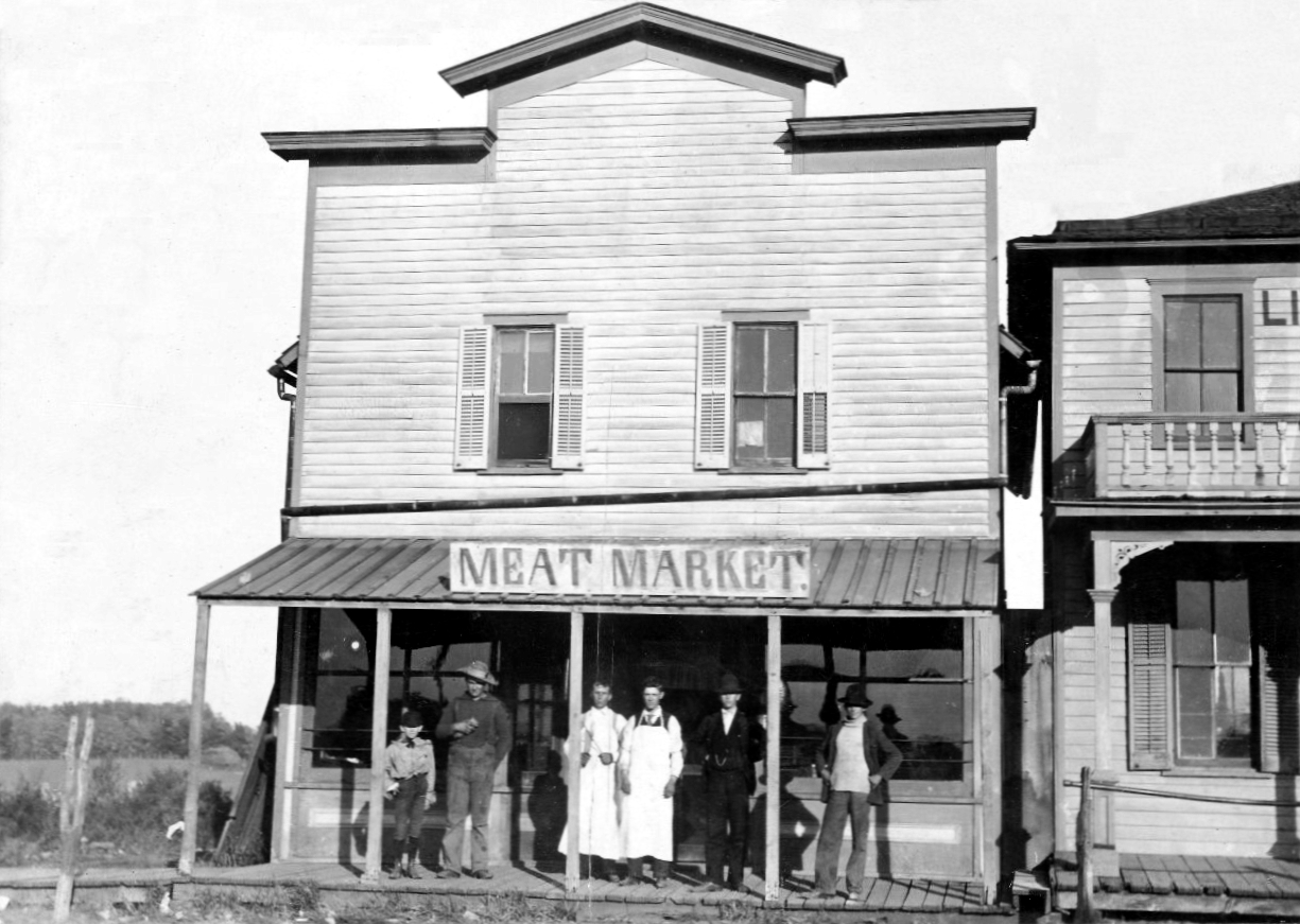

Gretna, Nebraska
Gretna is a city of 9,193 people in Sarpy County, Nebraska, founded in 1886.
Why visit Gretna
Townapedia lists 7 parks and trails, 16 places to eat and 1 place to stay in and around town.
Highlights include Peterson Park.
July is the warmest month, with average highs of 86°F; January lows average 14°F, and about 36 inches of snow fall in a normal year.
Weather in Gretna
Forecast from the National Weather Service. Full forecast
About Gretna
Gretna is a city in Sarpy County, Nebraska, United States. It is part of the Omaha metropolitan area and considered a suburban bedroom community for Omaha. The city's population was 5,083 at the 2020 census and estimated to be 9,071 in 2022.
From the Wikipedia article Gretna, Nebraska (this version), under CC BY-SA 4.0.
Parks, trails and playgrounds7



Vala's Pumpkin Patch
Sports field and stadium
Su-Th 09:00-21:00; Fr-Sa 09:00-22:00


Restaurants and cafes16

Mama's Pizza To Go
Restaurant · Pizza · 2.3 mi
10156 South 168th Avenue, Omaha
Su-Th 11:00-20:00; Fr-Sa 11:00-21:00



Arby's
Fast food · Sandwich · 2.1 mi
11310 Wickersham Boulevard, Gretna
Su-Th 10:00-23:00; Fr,Sa 10:00-01:00
Subway
Fast food · Sandwich · 2.5 mi
623 North Highway 6, Gretna
Mo 09:00-22:00; Tu 09:00-21:00; We-Su 09:00-22:00
Taco John's
Fast food · Mexican · 2.2 mi
11310 Wickersham Boulevard, Gretna
4 more on the map.
Where to stay1

Churches and places of worship4

United Methodist Church
Church · Methodist · 2.1 mi
11457 South 204th Street, Gretna
History
Gretna started shortly after the Burlington Railroad built a short line between Omaha and Ashland in the summer of 1886. Advent of the village of Gretna on this new laid rail line was the cue for the exit of the nearby trading post of Forest City, which had existed since 1856. In its day, Forest City, located 2.5 miles southwest of where Gretna now stands, was a flourishing and busy place, but it was doomed by the railroad which passed it by. The only markers that exist today to show the site of old Forest City is the cemetery (Holy Sepulchre) which is located a little to the east of what was the center of activity in the settlement and the 1886 homestead originally owned by the Schnack Family and located on Schnack Acres at 234th St. Names that were prominent in the beginnings of Forest City were the families of Adolph Schnack, William Langdon, John Thomas and John Conner.
The Lincoln Land Company, recognizing the potential of the site, surveyed and platted the town site of Gretna in 1887. The village was incorporated by July 10, 1889. The name suggests Scotland's Gretna Green, the place of origin of some of the earliest settlers.
From the History section of Gretna, Nebraska on Wikipedia, under CC BY-SA 4.0.
Shopping3
Gas and EV charging5
Schools, colleges and libraries35
Healthcare2
Map of Gretna
73 places. The map loads OpenStreetMap tiles when you open it.
Climate by month
Monthly table
| Month | High | Low | Rain | Snow |
|---|---|---|---|---|
| Jan | 32°F | 14°F | 0.9 in | 8.6 in |
| Feb | 37°F | 18°F | 1.2 in | 10.9 in |
| Mar | 50°F | 28°F | 1.9 in | 5.4 in |
| Apr | 62°F | 38°F | 3.3 in | 1.0 in |
| May | 72°F | 51°F | 5.0 in | 0.2 in |
| Jun | 83°F | 62°F | 5.4 in | 0.0 in |
| Jul | 86°F | 66°F | 3.5 in | 0.0 in |
| Aug | 84°F | 64°F | 3.8 in | 0.0 in |
| Sep | 77°F | 54°F | 2.9 in | 0.0 in |
| Oct | 64°F | 42°F | 2.6 in | 1.2 in |
| Nov | 49°F | 29°F | 1.4 in | 1.3 in |
| Dec | 36°F | 19°F | 1.4 in | 7.8 in |
U.S. Climate Normals 1991-2020 for Gretna 4Ne (2 mi away), NOAA NCEI.
People and cost of living
American Community Survey 5-year estimates, 2020-2024, U.S. Census Bureau. Estimates have margins of error, larger for small towns.
Disaster history
Sarpy County has had 17 federal disaster declarations since 2000, most often for severe storms.
- 2025-05-21: Severe Winter Storm And Straight-Line Winds (Winter Storm)
- 2024-10-21: Severe Storms, Straight-Line Winds, Tornadoes, And Flooding (Severe Storm)
- 2024-08-20: Severe Storms, Straight-Line Winds, Tornadoes, And Flooding (Severe Storm)
- 2022-02-23: Severe Storms, Straight-Line Winds, And Tornadoes (Severe Storm)
- 2021-09-06: Severe Storms And Straight-Line Winds (Severe Storm)
- 2020-04-04: Covid-19 Pandemic (Biological)
OpenFEMA disaster declarations summaries.
Getting there and nearby towns
Millard Airport (MIQ) is the nearest airport with scheduled flights listed in OpenStreetMap, 6 miles away.
- Chalco 5 mi northeast, about 8 min by car
- Papillion 6 mi east, about 10 min by car
- La Vista 8 mi northeast, about 12 min by car
- Ashland 11 mi southwest, about 18 min by car
- Omaha 12 mi northeast, about 19 min by car
- Bellevue 13 mi east, about 22 min by car
- Bennington 17 mi north, about 27 min by car
- Carter Lake 18 mi northeast, about 29 min by car
- Council Bluffs 19 mi northeast, about 31 min by car
- Fremont 26 mi northwest, about 42 min by car
Drive times are estimates from straight-line distance, not routes.
Local news
Headlines from INDB, the NEMICO news database.
Reviews, tips and questions
Loading what members have shared...
Sources and licences
- NCES EDGE (Public domain): public schools
- NOAA NCEI U.S. Climate Normals 1991-2020 (Public domain): climate by month
- OpenFEMA (Public domain): disaster declarations
- OpenStreetMap contributors (ODbL 1.0): places, airports, map data
- U.S. Census Bureau (Public domain): population, income, housing, education, commute
- Wikidata (CC0 1.0): elevation, founding date, time zone, website
- Wikimedia Commons (see each image): photos
- Wikipedia (CC BY-SA 4.0): overview and history text
Photo credits
- Meat Market, Gretna NB, Hughes, G. photographer, Public domain
Page built October 30, 2026. Spotted a mistake? Tell us or suggest a place.