


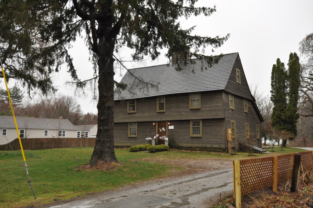

Guilford Center, Connecticut
Guilford Center is a community of 2,263 people in Connecticut.
Why visit Guilford Center
Townapedia lists 28 museums and landmarks, 23 parks and trails, 22 places to eat, 2 places to stay and 1 attraction in and around town.
Highlights include Acadian House, Dudleytown Historic District, Chittenden Park and Guilford Town Green.
July is the warmest month, with average highs of 82°F; January lows average 23°F.
Weather in Guilford Center
Forecast from the National Weather Service. Full forecast
Things to do1

Museums and landmarks28

Acadian House
Monument and historic site · National Register of Historic Places · 0.4 mi
Saltbox house in Guilford, Connecticut, USA

Dudleytown Historic District
Monument and historic site · National Register of Historic Places · 1.6 mi
Historic district in Connecticut, United States
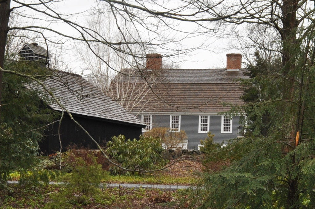
Elisha Pitkin House
Monument and historic site · National Register of Historic Places · 2.8 mi
House in Guilford, Connecticut

Griswold House
Monument and historic site · National Register of Historic Places
Listed on the NRHP in New Haven County, Connecticut
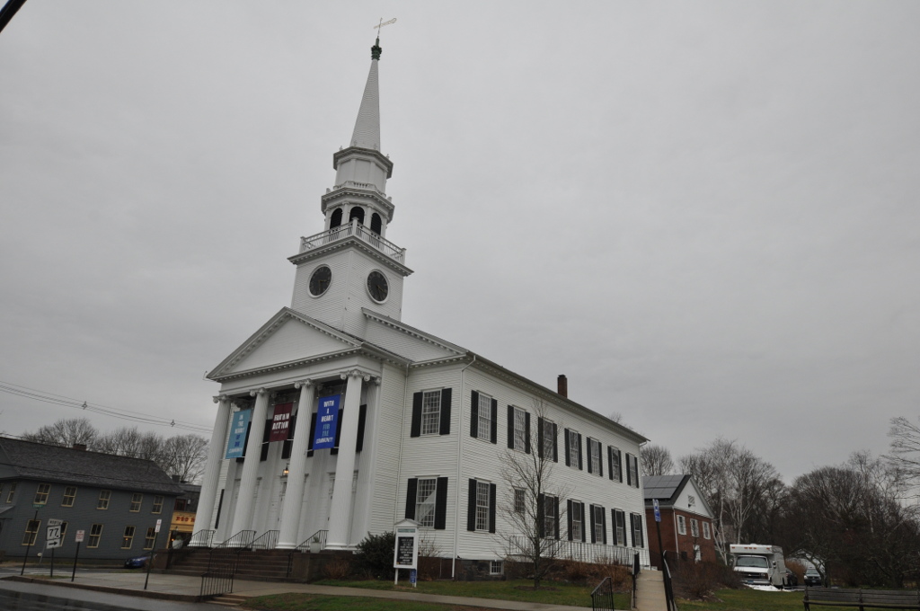
Guilford Historic Town Center
Monument and historic site · National Register of Historic Places
Historic district in Connecticut, USA

Hyland-Wildman House
Monument and historic site · National Register of Historic Places
Historic house in Connecticut, United States

Jared Eliot House
Monument and historic site · National Register of Historic Places · 0.9 mi
Historic house at 88 Mulbery Farms Road in Guilford, Connecticut

John Rogers House
Monument and historic site · National Register of Historic Places · 3.3 mi
Listed on the National Register of Historic Places in Branford, Connecticut, United States
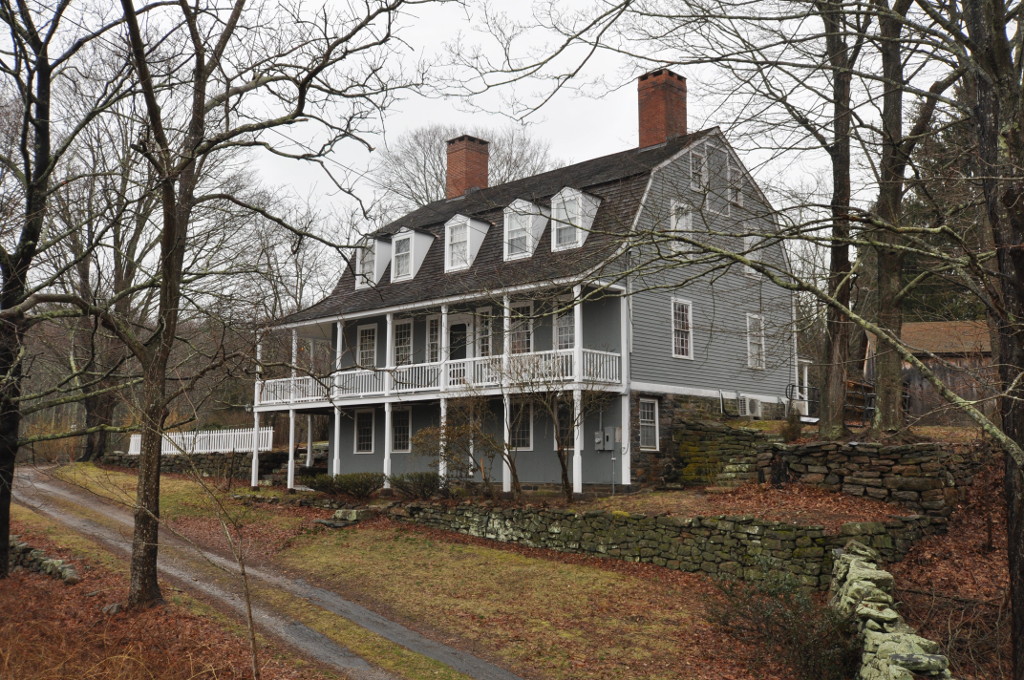
Medad Stone Tavern
Monument and historic site · National Register of Historic Places · 1.1 mi
Historic house museum at 191 Three Mile Course in Guilford, Connecticut

Norcross Brothers Granite Quarry
Monument and historic site · National Register of Historic Places · 3.4 mi
Historic granite quarry on Quarry Road in Branford, Connecticut
Pelatiah Leete House
Monument and historic site · National Register of Historic Places · 2.7 mi
Historic house in Connecticut, United States


Route 146 Historic District
Monument and historic site · National Register of Historic Places · 2.1 mi
Historic district in Branford and Guilford, Connecticut
16 more on the map.
Parks, trails and playgrounds23



East Creek Saltmarsh Meadows
Hiking and trails · 0.6 mi
PO Box 200, Guilford
sunrise-sunset
East River Saltmarsh Meadows
Hiking and trails · 1.5 mi
PO Box 200, Guilford
sunrise-sunset
Long Cove Saltmarsh Meadows
Hiking and trails · 1.3 mi
PO Box 200, Guilford
sunrise-sunset
Mill Pasture Preserve
Hiking and trails · 1.0 mi
Mill Road, Guilford
sunrise-sunset
11 more on the map.
Restaurants and cafes22

The Place
Restaurant · Barbecue · 0.6 mi
Outdoor dining only weather permitting
901 Boston Post Road, Guilford
May-Sep: Mo-Th 17:00-21:00; May-Sep: Fr 17:00-22:00; May-Oct: Sa...

Chapter One
Diner · American · 0.4 mi
25 Whitfield Street, Guilford
Mo-Fr 11:30-22:00; Sa,Su 12:00-22:00

Belle Vie Cafe
Cafe · Coffee Shop, Bakery · 0.5 mi
20 Church Street
08:00-15:30


Little Red BarN
Bar and pub · 1.2 mi
1355 Boston Post Road, Guilford
Fr-Su 17:00-21:00
10 more on the map.
Where to stay2
Churches and places of worship6
First Congregational Church
Church · United Church Of Christ · 0.4 mi
Saint George Catholic Church
Church · Catholic · 0.4 mi
33 Whitfield Street, Guilford
Shopping9
Gas and EV charging5
Schools, colleges and libraries15
Healthcare2
Map of Guilford Center
113 places. The map loads OpenStreetMap tiles when you open it.
Climate by month
Monthly table
| Month | High | Low | Rain |
|---|---|---|---|
| Jan | 38°F | 23°F | 2.7 in |
| Feb | 40°F | 24°F | 2.8 in |
| Mar | 47°F | 30°F | 3.7 in |
| Apr | 58°F | 39°F | 4.2 in |
| May | 68°F | 49°F | 3.5 in |
| Jun | 76°F | 59°F | 3.5 in |
| Jul | 82°F | 66°F | 3.4 in |
| Aug | 81°F | 65°F | 3.5 in |
| Sep | 75°F | 57°F | 4.0 in |
| Oct | 64°F | 46°F | 3.8 in |
| Nov | 53°F | 36°F | 3.1 in |
| Dec | 44°F | 29°F | 3.5 in |
U.S. Climate Normals 1991-2020 for New Haven Tweed Ap (11 mi away), NOAA NCEI.
People and cost of living
American Community Survey 5-year estimates, 2020-2024, U.S. Census Bureau. Estimates have margins of error, larger for small towns.
Disaster history
The county has had 27 federal disaster declarations since 2000, most often for severe storms.
- 2024-10-24: Hawthorne Fire (Fire)
- 2024-09-20: Severe Storm, Flooding, Landslides, And Mudslides (Severe Storm)
- 2024-08-21: Severe Storms, Flooding, Landslides, And Mudslides (Severe Storm)
- 2021-10-30: Remnants Of Hurricane Ida (Hurricane)
- 2021-08-22: Hurricane Henri (Hurricane)
- 2021-01-12: Tropical Storm Isaias (Hurricane)
OpenFEMA disaster declarations summaries.
Getting there and nearby towns
Tweed New Haven Airport (HVN) is the nearest airport with scheduled flights listed in OpenStreetMap, 11 miles away.
- Branford Center 7 mi west, about 12 min by car
- Clinton 8 mi east, about 12 min by car
- East Haven 9 mi west, about 15 min by car
- North Haven 12 mi northwest, about 19 min by car
- New Haven 13 mi west, about 21 min by car
- Durham 13 mi north, about 21 min by car
- Wallingford Center 14 mi northwest, about 22 min by car
- Deep River Center 14 mi northeast, about 23 min by car
- Chester Center 14 mi northeast, about 23 min by car
- West Haven 15 mi west, about 24 min by car
Drive times are estimates from straight-line distance, not routes.
Local news
Headlines from INDB, the NEMICO news database.
Reviews, tips and questions
Loading what members have shared...
Sources and licences
- NCES EDGE (Public domain): public schools
- NOAA NCEI U.S. Climate Normals 1991-2020 (Public domain): climate by month
- OpenFEMA (Public domain): disaster declarations
- OpenStreetMap contributors (ODbL 1.0): places, airports, map data
- U.S. Census Bureau (Public domain): population, income, housing, education, commute
- Wikidata (CC0 1.0): elevation, founding date, time zone, website, landmarks and historic places
- Wikimedia Commons (see each image): photos
Photo credits
- GuilfordCT Library, Magicpiano, CC BY-SA 4.0
- Griswoldhouse guilfordct, Versageek, CC BY-SA 3.0
- GuilfordCT PelatiahLeeteHouse, Magicpiano, CC BY-SA 4.0
- NORCROSS BROTHERS GRANITE QUARRY, NEW HAVEN COUNTY, CT, JERRYE & ROY KLOTZ, M.D., CC BY-SA 4.0
- MadisonCT ShelleyHouse, Magicpiano, CC BY-SA 4.0
- Thomasburgishouse guilfordct, Versageek, CC BY-SA 3.0
- Sabbathdayhouse guilfordct, Versageek, CC BY-SA 3.0
- GuilfordCT ElishaPitkinHouse1, Magicpiano, CC BY-SA 4.0
- Johnrogershouse bfdct, Versageek, CC BY-SA 3.0
- GuilfordCT DudleytownHD 1, Magicpiano, CC BY-SA 4.0
- Hylandhouse guilfordct, Versageek, CC BY-SA 3.0
- GuilfordCT FirstCongregationalChurch, Magicpiano, CC BY-SA 4.0
- GuilfordCT JaredEliotHouse, Magicpiano, CC BY-SA 4.0
- ROUTE 146 HISTORIC DISTRICT, NEW HAVEN COUNTY, CT, JERRYE & ROY KLOTZ, M.D., CC BY-SA 4.0
- GuilfordCT MedadStoneTavern, Magicpiano, CC BY-SA 4.0

Page built October 30, 2026. Spotted a mistake? Tell us or suggest a place.