


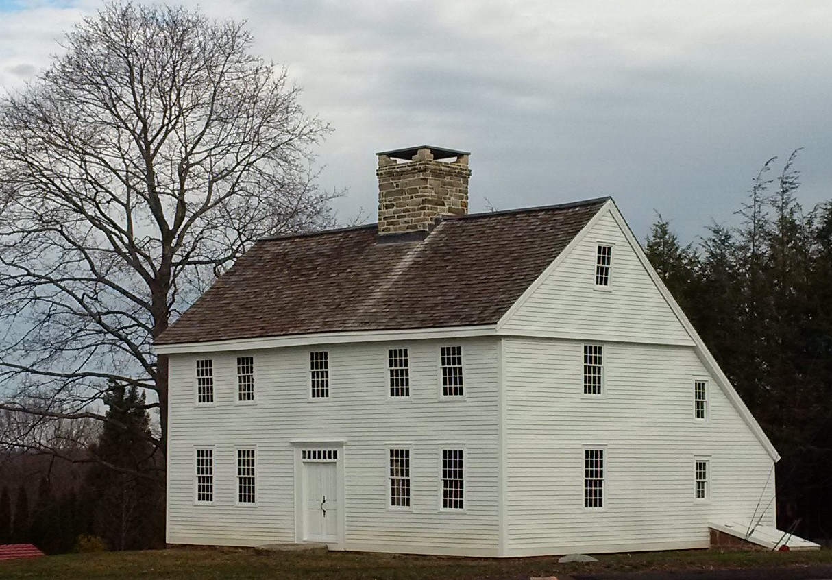
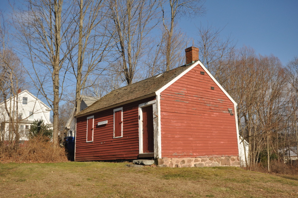

Wallingford Center, Connecticut
Wallingford Center is a community of 18,208 people in Connecticut.
Why visit Wallingford Center
Townapedia lists 23 museums and landmarks, 40 parks and trails, 58 places to eat, 2 places to stay and 10 attractions in and around town.
Highlights include Oakdale Theater, Oakdale Theatre, Center Street Cemetery and Fourth District School.
July is the warmest month, with average highs of 84°F; January lows average 19°F.
Weather in Wallingford Center
Forecast from the National Weather Service. Full forecast
About Wallingford Center
Wallingford Center is a historic district in the heart of Wallingford comprising the primary community in the town of Wallingford, New Haven County, Connecticut, United States.
From the Wikipedia article Wallingford Center, Connecticut (this version), under CC BY-SA 4.0.
Things to do10

Oakdale Theatre
Cinema and theater · 1.4 mi
Theater and multi-purpose venue in Wallingford, Connecticut

Quinnipiac University
School · 4.4 mi
Private university in Hamden, Connecticut, United States

Blake's Aqua Den
Zoo and aquarium · 1.3 mi
920 South Colony Road
Mo-Su 11:00-19:00


Museums and landmarks23

Center Street Cemetery
Monument and historic site · National Register of Historic Places · 0.5 mi
Cemetery in Wallingford, Connecticut
Fourth District School
Monument and historic site · National Register of Historic Places · 4.1 mi
Historic district school building on Old Post Road in North Branford, Connecticut

Franklin Johnson House
Monument and historic site · National Register of Historic Places
Historic house at 153 South Main Street in Wallingford, Connecticut
Howd-Linsley House
Monument and historic site · National Register of Historic Places · 3.8 mi
Historic house at 1795 Middletown Avenue in the Northford area of North Branford, Connecticut

John Barker House
Monument and historic site · National Register of Historic Places · 2.6 mi
Historic house at 898 Clintonville Road in Wallingford, Connecticut
Joseph Blakeslee House
Monument and historic site · National Register of Historic Places · 3.3 mi
Historic house in Connecticut, United States
Nehemiah Royce House
Monument and historic site · National Register of Historic Places · 1.2 mi
Historic house in Connecticut, United States

Northford Center Historic District
Monument and historic site · National Register of Historic Places · 3.9 mi
Historic district in Connecticut, United States
Samuel Parsons House
Monument and historic site · National Register of Historic Places
House in Wallingford, Connecticut
Samuel Simpson House
Monument and historic site · National Register of Historic Places · 0.5 mi
Historic house in Connecticut, United States


Theophilus Jones House
Monument and historic site · National Register of Historic Places · 1.8 mi
Historic house at 40 Jones Road in Wallingford, Connecticut
Wallingford Center Historic District
Monument and historic site · National Register of Historic Places
Historic district in Connecticut, United States
11 more on the map.
Parks, trails and playgrounds40



28 more on the map.
Restaurants and cafes58

Back 9 Social
Bar and pub · 1.9 mi
This place features golf simulation
805 North Colony Road, Wallingford
Mo-Tu off; We-Th 16:00-22:00; Fr-Sa 10:00-23:00; Su 10:00-18:00

Malachy’s Public House
Restaurant · Irish · 0.7 mi
171 Quinnipiac Street, Wallingford
We-Mo 14:00-01:00
Six One Nine Supper Club
Restaurant · American, Fine Dining · 0.5 mi
23 South Colony Road
Su 11:00-20:00; Mo-We 15:00-21:30; Th 11:00-22:00; Fr-Sa 11:00-23:00

Jaya’s Kitchen
Restaurant · 1.3 mi
600 North Colony Road
Mo,We-Th 16:00-21:00, Fr-Su 11:00-14:30,16:30-21:00

The Wine Cellar Outlet Wallingford
Brewery and winery · 2.1 mi
42 Capital Dr, Wallingford
Mo-We 11:00-18:00; Th-Fr 10:00-19:00; Sa 10:00-18:00; Su 11:00-18:00
Center Street Brewing Company
Brewery and winery
24 Wallace Avenue
We-Fr 16:00-22:00, Sa 12:00-22:00, Su 12:00-19:00
46 more on the map.
Where to stay2
The Wallingford Victorian Inn
Motel and hotel · 0.5 mi
245 North Main Street, Wallingford
Churches and places of worship18
Most Holy Trinity Roman Catholic Church
Church · Roman Catholic · 0.6 mi
68 North Colony Street, Wallingford
Evangelical and Reformed United Church of Christ
Church · United Church Of Christ · 0.6 mi
107 South Cherry Street, Wallingford
First Baptist Church
Church · Baptist · 0.4 mi
114 North Main Street, Wallingford
Kingdom Hall of Jehovahs Witnesses
Church · Jehovahs Witness · 2.5 mi
9 Cottage Street, Wallingford
Shopping13
Taylor True Value Rental
Hardware store · 1.4 mi
620 North Colony Road, Wallingford
Gas and EV charging9
Schools, colleges and libraries40
Healthcare2
Map of Wallingford Center
215 places. The map loads OpenStreetMap tiles when you open it.
Climate by month
Monthly table
| Month | High | Low | Rain |
|---|---|---|---|
| Jan | 37°F | 19°F | 3.0 in |
| Feb | 39°F | 20°F | 2.9 in |
| Mar | 48°F | 28°F | 4.0 in |
| Apr | 60°F | 38°F | 4.1 in |
| May | 70°F | 48°F | 3.5 in |
| Jun | 79°F | 57°F | 4.0 in |
| Jul | 84°F | 62°F | 3.4 in |
| Aug | 82°F | 61°F | 3.5 in |
| Sep | 75°F | 54°F | 4.3 in |
| Oct | 64°F | 42°F | 4.5 in |
| Nov | 52°F | 32°F | 3.4 in |
| Dec | 42°F | 24°F | 4.1 in |
U.S. Climate Normals 1991-2020 for Meriden Markham Muni Ap (4 mi away), NOAA NCEI.
People and cost of living
American Community Survey 5-year estimates, 2020-2024, U.S. Census Bureau. Estimates have margins of error, larger for small towns.
Disaster history
The county has had 27 federal disaster declarations since 2000, most often for severe storms.
- 2024-10-24: Hawthorne Fire (Fire)
- 2024-09-20: Severe Storm, Flooding, Landslides, And Mudslides (Severe Storm)
- 2024-08-21: Severe Storms, Flooding, Landslides, And Mudslides (Severe Storm)
- 2021-10-30: Remnants Of Hurricane Ida (Hurricane)
- 2021-08-22: Hurricane Henri (Hurricane)
- 2021-01-12: Tropical Storm Isaias (Hurricane)
OpenFEMA disaster declarations summaries.
Getting there and nearby towns
Tweed New Haven Airport (HVN) is the nearest airport with scheduled flights listed in OpenStreetMap, 14 miles away.
- Northford 4 mi southeast, about 7 min by car
- Quinnipiac University 4 mi southwest, about 7 min by car
- North Haven 5 mi south, about 8 min by car
- Meriden 6 mi north, about 10 min by car
- Cheshire Village 6 mi northwest, about 9 min by car
- Durham 7 mi east, about 11 min by car
- Plantsville 10 mi north, about 16 min by car
- New Haven 11 mi southwest, about 18 min by car
- Middletown 11 mi northeast, about 17 min by car
- East Haven 11 mi south, about 18 min by car
Drive times are estimates from straight-line distance, not routes.
Local news
Headlines from INDB, the NEMICO news database.
Reviews, tips and questions
Loading what members have shared...
Sources and licences
- NCES EDGE (Public domain): public schools
- NOAA NCEI U.S. Climate Normals 1991-2020 (Public domain): climate by month
- OpenFEMA (Public domain): disaster declarations
- OpenStreetMap contributors (ODbL 1.0): places, airports, map data
- U.S. Census Bureau (Public domain): population, income, housing, education, commute
- Wikidata (CC0 1.0): elevation, founding date, time zone, website, landmarks and historic places
- Wikimedia Commons (see each image): photos
- Wikipedia (CC BY-SA 4.0): overview and history text
Photo credits
- Moses Yale Beach monument - Wallingford, CT, Daderot, Public domain
- NorthBranfordCT HowdLinsleyHouse, Magicpiano, CC BY-SA 4.0
- 898 Clintonville Road, Wallingford, CT, UDChE89, CC BY-SA 3.0
- Nehemiah Royce House front spring 2016, Tomticker5, CC BY-SA 4.0
- NorthfordCT FourthDistrictSchool, Magicpiano, CC BY-SA 4.0
- WallingfordCT SamuelSimpsonHouse, Magicpiano, CC BY-SA 4.0
- 40 Jones Road, UDChE89, CC BY-SA 3.0
- NorthfordCongregationalChurch, Jerry Dougherty, CC BY 2.5
- Wallingford Amtrak station, November 2013, Adam Moss from Highland Park, NJ, United States, CC BY-SA 2.0
- Lender School of Business 2005, JlsElsewhere at English Wikipedia, Public domain
- Paul Mellon Arts Center - Choate Rosemary Hall, Wallingford, Connecticut, The original uploader was Daderot at English Wikipedia ., CC BY-SA 3.0
- Wallingford Historical Society, UDChE89, CC BY-SA 3.0
- SE Side View, UDChE89, CC BY-SA 3.0
- View from the East, UDChE89, CC BY-SA 3.0
- WallingfordCT CenterHD 5, Magicpiano, CC BY-SA 4.0
- WallingfordCT CenterHD 3, Magicpiano, CC BY-SA 4.0
- WallingfordCT CenterHD 6, Magicpiano, CC BY-SA 4.0
- WallingfordCT CenterHD 4, Magicpiano, CC BY-SA 4.0
- WallingfordCT CenterHD 2, Magicpiano, CC BY-SA 4.0
- WallingfordCT CenterHD 7, Magicpiano, CC BY-SA 4.0
- WallingfordCT FormerArmoryNowPoliceStation, Magicpiano, CC BY-SA 4.0
- WallingfordCT CenterHD 1, Magicpiano, CC BY-SA 4.0
- Streetcar on Main Street, Wallingford - 1908 postcard, Unknown author Unknown author, Public domain
- Wallingford Connecticut, Spudgun67, CC BY-SA 4.0
- Wallingford 1976, Spudgun67, CC BY-SA 4.0
- The Parade Ground - 23 South Main Street Wallingford CT, Spudgun67, CC BY-SA 4.0
- The Parade Ground Wallingford CT, Spudgun67, CC BY-SA 4.0
- St Paul's Episcopal Church Wallingford, Gloucester1692, CC BY-SA 4.0
- Wallingford, CT Memorial Day, Marcus Balcher, CC BY-SA 2.0
- 1970 Deville Convertaable In The Wallingford Memorial Day Parade 2015, Mark Balcher, CC BY 3.0
- (187 365) Most Holy Trinity Church at Sunrise Wallingford, CT (15748508354), Marcus Balcher from Daytona, FL, United States, CC BY-SA 2.0
- Wallingford station postcard, Unknown author Unknown author, Public domain
- Wallingford station postcard (2), Unknown author Unknown author, Public domain
- Choate Hill House Circle, Wiki User: Tommyren, Public domain
- Wallingford station with temporary platform, July 2016, Pi.1415926535, CC BY-SA 3.0
- Abandoned platform at Wallingford, June 2015, Pi.1415926535, CC0
- Wallingford station and grade crossing, June 2015, Pi.1415926535, CC0
- Choate20sPlaque, Toadspike, CC BY-SA 4.0
- Former Wallingford freight house, December 2016, Pi.1415926535, CC BY-SA 3.0
- Ceiling handholds inside Trackside Brick Oven Pizzeria, December 2017, Pi.1415926535, CC BY-SA 3.0


Page built October 30, 2026. Spotted a mistake? Tell us or suggest a place.