
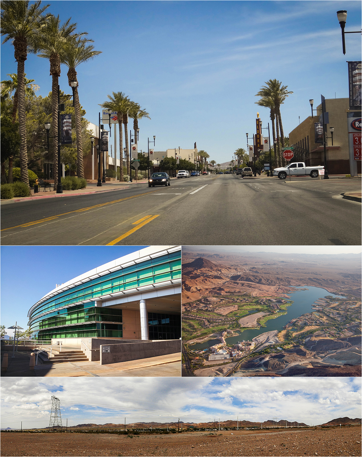

Henderson, Nevada
Henderson is a city of 332,141 people in Clark County, Nevada, founded in September 15, 1941.
Why visit Henderson
Townapedia lists 38 museums and landmarks, 64 parks and trails, 287 places to eat, 13 places to stay and 13 attractions in and around town.
Highlights include Cinemark Cinedome 12, Old Vegas, Tabletop Jump and The Little Church of the West.
July is the warmest month, with average highs of 104°F; December lows average 40°F.
Weather in Henderson
Forecast from the National Weather Service. Full forecast
About Henderson
Henderson is a city in Clark County, Nevada, United States, about 16 miles (26 km) southeast of Las Vegas. It is the 2nd most populous city in Nevada, after Las Vegas, with 317,610 residents as of the 2020 census. The city is part of the Las Vegas Valley metropolitan area.
From the Wikipedia article Henderson, Nevada (this version), under CC BY-SA 4.0.
Things to do13


Old Vegas
Monument and historic site · 5.3 mi
1970s-1980s theme park in Henderson, Nevada

Roseman University of Health Sciences
School · 5.2 mi
University in the United States

1 more on the map.
Museums and landmarks38
The Little Church of the West
Monument and historic site · National Register of Historic Places · 10.0 mi
Wedding chapel in Las Vegas, Nevada
Welcome to Fabulous Las Vegas sign
Monument and historic site · National Register of Historic Places · 9.9 mi
Historic neon sign in Paradise, Nevada, United States
Sloan Canyon National Conservation Area
Monument and historic site · National Register of Historic Places · 8.4 mi

Clark County Heritage Museum
Museum · 4.4 mi
Archive organization in Henderson, Nevada, United States
Marjorie Barrick Museum of Art
Museum · 9.5 mi
Museum at University of Nevada, Las Vegas
Pinball Hall of Fame
Museum · 9.9 mi
Pinball museum in Paradise, Nevada
26 more on the map.
Parks, trails and playgrounds64

Desert Willow Golf Course
Golf course · 2.9 mi
18 hole Par 60
2020 West Horizon Ridge Parkway, Henderson

Shark Reef at Mandalay Bay
Park · 10.4 mi
Aquarium in Nevada, United States
Camelback Ridge Avenue Park
Park · 2.9 mi
243 Camelback Ridge Avenue, Henderson
Mo-Su 06:00-22:00
52 more on the map.
Restaurants and cafes287

BIGGIES Sandwiches
Restaurant · Sandwich · 3.0 mi
237 North Stephanie Street, Henderson
Mo-Su 10:00-22:00
Black Mountain Griddle
Restaurant · American, Breakfast · 1.8 mi
72 West Horizon Ridge Parkway, Henderson
Mo-Su 07:00-15:00
Coo Coo's Cafe
Restaurant · Coffee Shop, Sandwich, Breakfast · 3.1 mi
35 East Basic Road, Henderson
Mo-Fr 07:00 - 17:00

Coo Coo's Gourmet Coffee Cafe
Cafe · Coffee Shop · 2.8 mi
19 West Pacific Avenue
Mo-Fr 06:00-17:00; Sa 06:30-16:00

Echo & Rig
Restaurant · Steak House · 3.8 mi
2270 Village Walk Drive, Henderson
Mo-Th 11:00-22:00; Fr 11:00-23:00; Sa 10:00-15:00, 16:00-23:00; Su...
Hog & Tradition
Restaurant · Barbecue · 2.9 mi
221 North Stephanie Street, Henderson
Mo-Su 12:00-22:00

Island Frozen Yogurt
Ice cream · Frozen Yogurt · 1.8 mi
76 West Horizon Ridge Parkway, Henderson
Mo-Su 12:00-22:00
Jessie Rae's BBQ
Restaurant · Barbecue · 3.3 mi
308 North Boulder Highway, Henderson
Mo-Th 11:00-19:00; Fr-Sa 11:00-20:00; Su 11:00-19:00
Johnny Mac's
Restaurant · Burger, Fish And Chips, Pasta, Pizza, Sandwich · 3.6 mi
842 South Boulder Highway, Henderson
Mo-Th, Sa 11:00-22:00; Fr 11:00-23:00; Su 11:00-21:00
275 more on the map.
Where to stay13
Sunset Station
Motel and hotel · 3.9 mi
1301 West Sunset Road, Henderson
Hawthorn Suites By Wyndham Las Vegas/Henderson
Motel and hotel · 3.6 mi
910 South Boulder Highway, Henderson
Hilton Garden Inn Las Vegas/Henderson
Motel and hotel · 3.7 mi
1340 West Warm Springs Road, Henderson
Churches and places of worship22
Saint Peter the Apostle Catholic Church
Church · Roman Catholic · 3.3 mi
204 South Boulder Highway, Henderson
Highland Hills Baptist Church
Church · Baptist · 3.4 mi
615 College Drive, Henderson
Kingdom Hall of Jehovah's Witnesses
Church · Jehovahs Witness · 3.6 mi
601 Arrowhead Trail, Henderson
Saint Francis of Assisi Roman Catholic Church
Church · Roman Catholic · 3.7 mi
2300 Sunridge Heights Parkway, Henderson
Green Valley Lutheran School
Church · Lutheran · 3.0 mi
1799 Wigwam Parkway, Henderson
Lake Mead Christian Academy
Church · 3.8 mi
540 East Lake Mead Parkway, Henderson
Shopping46
Gas and EV charging30
Schools, colleges and libraries78
College of Southern Nevada Green Valley Center
School · 3.9 mi
1560 West Warm Springs Road, Henderson
Healthcare18
Saint Rose Dominican hospitals - Rose-De Lima Campus
Hospital · 3.1 mi
102 East Lake Mead Parkway, Henderson
Concentra Urgent Care
Clinic and pharmacy · 2.3 mi
149 North Gibson Road, Henderson
VA Southeast Primary Care Clinic
Clinic and pharmacy · 3.8 mi
1020 Boulder Highway, Henderson
Golden Eyes Optometry
Clinic and pharmacy · 1.7 mi
25 East Horizon Ridge Parkway, Henderson
Map of Henderson
250 places. The map loads OpenStreetMap tiles when you open it.
Climate by month
Monthly table
| Month | High | Low | Rain | Snow |
|---|---|---|---|---|
| Jan | 58°F | 40°F | 0.6 in | 0.0 in |
| Feb | 63°F | 44°F | 0.8 in | 0.0 in |
| Mar | 71°F | 50°F | 0.4 in | 0.0 in |
| Apr | 78°F | 57°F | 0.2 in | 0.0 in |
| May | 88°F | 66°F | 0.1 in | 0.0 in |
| Jun | 99°F | 76°F | 0.0 in | 0.0 in |
| Jul | 104°F | 82°F | 0.4 in | 0.0 in |
| Aug | 103°F | 81°F | 0.3 in | 0.0 in |
| Sep | 95°F | 72°F | 0.3 in | 0.0 in |
| Oct | 81°F | 60°F | 0.3 in | 0.0 in |
| Nov | 67°F | 47°F | 0.3 in | 0.0 in |
| Dec | 57°F | 40°F | 0.5 in | 0.2 in |
U.S. Climate Normals 1991-2020 for Las Vegas Mccarran Ap Gsn 72386 (9 mi away), NOAA NCEI.
People and cost of living
American Community Survey 5-year estimates, 2020-2024, U.S. Census Bureau. Estimates have margins of error, larger for small towns.
Disaster history
Clark County has had 11 federal disaster declarations since 2000, most often for fires.
- 2020-04-04: Covid-19 Pandemic (Biological)
- 2020-03-13: Covid-19 (Biological)
- 2013-07-05: Carpenter 1 Fire (Fire)
- 2010-07-01: Cathedral Fire (Fire)
- 2005-09-13: Hurricane Katrina Evacuation (Hurricane)
- 2005-06-24: Good Springs Fire (Fire)
OpenFEMA disaster declarations summaries.
Getting there and nearby towns
Henderson Executive Airport (HSH) is the nearest airport with scheduled flights listed in OpenStreetMap, 7 miles away.
- Whitney 7 mi north, about 11 min by car
- Paradise 8 mi northwest, about 14 min by car
- Enterprise 11 mi west, about 18 min by car
- Winchester 11 mi northwest, about 18 min by car
- Sunrise Manor 12 mi north, about 19 min by car
- Boulder City 12 mi southeast, about 20 min by car
- Spring Valley 15 mi northwest, about 24 min by car
- Nellis AFB 17 mi north, about 27 min by car
- North Las Vegas 20 mi north, about 32 min by car
- Las Vegas 21 mi northwest, about 33 min by car
Drive times are estimates from straight-line distance, not routes.
Local news
Headlines from INDB, the NEMICO news database.
Reviews, tips and questions
Loading what members have shared...
Sources and licences
- NCES EDGE (Public domain): public schools
- NOAA NCEI U.S. Climate Normals 1991-2020 (Public domain): climate by month
- OpenFEMA (Public domain): disaster declarations
- OpenStreetMap contributors (ODbL 1.0): places, airports, map data
- U.S. Census Bureau (Public domain): population, income, housing, education, commute
- Wikidata (CC0 1.0): elevation, founding date, time zone, website, landmarks and historic places
- Wikimedia Commons (see each image): photos
- Wikipedia (CC BY-SA 4.0): overview and history text
Photo credits
- HendersonMontage, Collages and images: Aaron Tozier Image of Lake Las Vegas: Carol M. Highsmith, CC BY-SA 3.0
Page built October 30, 2026. Spotted a mistake? Tell us or suggest a place.