


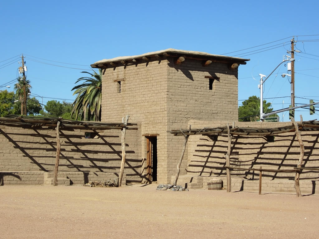
Sunrise Manor, Nevada
Sunrise Manor is a community of 200,218 people in Clark County, Nevada, founded in May 1957.
Why visit Sunrise Manor
Townapedia lists 43 museums and landmarks, 52 parks and trails, 192 places to eat, 37 places to stay and 10 attractions in and around town.
Highlights include Clark Avenue Railroad Underpass, Regal Boulder Station 11, Berkley Square and El Cortez.
July is the warmest month, with average highs of 106°F; December lows average 37°F.
Weather in Sunrise Manor
Forecast from the National Weather Service. Full forecast
About Sunrise Manor
Sunrise Manor is a census-designated place in Clark County, Nevada, United States, located on the western base of Frenchman Mountain, east of Las Vegas. The population was 205,618 at the 2020 census. If Sunrise Manor were to be incorporated, it would be one of the largest cities in Nevada. Sunrise Manor was formed in May 1957.
From the Wikipedia article Sunrise Manor, Nevada (this version), under CC BY-SA 4.0.
Things to do10

Clark Avenue Railroad Underpass
Bridge · National Register of Historic Places · 5.3 mi
Historic underpass in Las Vegas, Nevada, United States

Las Vegas Little Theater
Cinema and theater · 5.4 mi
Theater in Las Vegas, Nevada

The STRAT Hotel, Casino & SkyPod
Monument and historic site · 6.4 mi
Hotel, casino, and tower located in Las Vegas
Maya Cinemas North Las Vegas
Cinema and theater · 4.6 mi
2195 North Las Vegas Boulevard, Las Vegas

Museums and landmarks43

Berkley Square
Monument and historic site · National Register of Historic Places · 5.7 mi
Historic district in Las Vegas, Nevada, United States

El Cortez
Monument and historic site · National Register of Historic Places · 5.1 mi
Historic hotel and casino in Las Vegas, Nevada, United States

Harrison's Guest House
Monument and historic site · National Register of Historic Places · 5.6 mi
Guest house in Las Vegas, Nevada, United States

Huntridge Theatre
Monument and historic site · National Register of Historic Places · 5.1 mi
Music venue and former movie theater in Las Vegas, Nevada, United States

Jay Dayton Smith House
Monument and historic site · National Register of Historic Places · 5.4 mi
Historic house in Las Vegas, Nevada, United States

John S. Park Historic District
Monument and historic site · National Register of Historic Places · 5.5 mi
Historic district in Nevada, United States

Las Vegas Grammar School
Monument and historic site · National Register of Historic Places · 5.4 mi
Defunct school in Las Vegas, Nevada, United States

Las Vegas Grammar School
Monument and historic site · National Register of Historic Places · 5.3 mi
School building in Las Vegas, United States of America
Las Vegas High School Academic Building and Gymnasium
Monument and historic site · National Register of Historic Places · 5.1 mi
High school in Nevada, United States

Las Vegas High School Neighborhood Historic District
Monument and historic site · National Register of Historic Places · 5.2 mi
Historic district in Nevada, United States


Las Vegas Post Office and Courthouse
Monument and historic site · National Register of Historic Places · 5.2 mi
Las Vegas, Nevada, NRHP-listed
Morelli House
Monument and historic site · National Register of Historic Places · 5.1 mi
Historic house in Las Vegas, Nevada, United States
31 more on the map.
Parks, trails and playgrounds52


Sunrise Vista Golf Course (Nellis Air Force Base)
Golf course · 2.6 mi
3 x 9 hole Par 36 Falcon & Eagle & Phantom Courses
2841 Kinley Drive, Nellis AFB

40 more on the map.
Restaurants and cafes192

Better Buzz Coffee Roasters
Cafe · Coffee Shop · 1.4 mi
71 North Nellis Boulevard, Las Vegas
Mo-Su 04:30-21:00


Olive Garden
Restaurant · Italian · 1.4 mi
80 North Nellis Boulevard
Su-Th 11:00-22:00; Fr-Sa 11:00-23:00
Starbucks
Cafe · Coffee Shop · 2.1 mi
4505 East Charleston Boulevard, Las Vegas
Mo-Sa 04:30-23:30; Su 05:00-23:30
Starbucks
Cafe · Coffee Shop · 4.2 mi
2001 East Lake Mead Boulevard, North Las Vegas
Mo-We, Fr, Sa 04:30-22:30; Th 05:00-18:00; Su 05:00-22:30
mcayo
Restaurant · Mexican · 4.5 mi
1741 East Charleston Boulevard, Las Vegas
Su-Th 11:00-21:00; Fr-Sa 11:00-22:00
Dutch Bros. Coffee
Cafe · Coffee Shop · 2.9 mi
2830 South Nellis Boulevard, Las Vegas
Mo-Th 05:00-22:00; Fr-Sa 05:00-23:00; Su 05:00-22:00
Dutch Bros. Coffee
Cafe · Coffee Shop · 4.4 mi
2245 North Las Vegas Boulevard, North Las Vegas
05:00-23:00
180 more on the map.
History
In 1957, North Las Vegas was planning for annexation of the area; the Clark County Commission did not approve of it and so created Sunrise Manor in May of the same year. It originally only consisted of the northern fraction of its modern-day boundary. By the time of the 1970 Census, the census-designated place of Vegas Creek was formed to the south of Sunrise Manor. It was dissolved in 1980, and added to Sunrise Manor the same year, roughly making Sunrise Manor's boundaries similar to its modern-day borders.
In 2018, some of the residents of Sunrise Manor proposed incorporation as its own city. This proposed city would include Sunrise Manor and neighboring Whitney. Residents who were for incorporation argued that Sunrise Manor does not get enough recognition being part of Clark County and that a city would need to address crime, drugs, and homelessness, while residents who were against incorporation argued that incorporation will be costly and inefficient, comparing it to North Las Vegas.
On January 31, 2026, the Federal Bureau of Investigation and the Las Vegas Metropolitan Police Department searched a home located on Sugar Springs Drive in Sunrise Manor, containing an illegal biology lab. The home had been owned by Ori Solomon (born 1970/71), an Israeli citizen. A similar lab had been found in Reedley, California in 2023.
From the History section of Sunrise Manor, Nevada on Wikipedia, under CC BY-SA 4.0.
Where to stay37
Boulder Station
Motel and hotel · 3.7 mi
4111 Boulder Highway, Las Vegas
Arizona Charlie's Boulder
Motel and hotel · 4.0 mi
4575 Boulder Highway, Las Vegas
Holiday Inn Express Las Vegas - Nellis
Motel and hotel · 3.9 mi
4035 North Nellis Boulevard, Las Vegas
Churches and places of worship64
Saint Christopher Catholic Church
Church · Roman Catholic · 4.3 mi
1840 North Bruce Street, North Las Vegas
Unitarian Universalist Congregation of Las Vegas
Place of worship · 2.9 mi
3616 East Lake Mead Boulevard, Las Vegas
Prince of Peace Catholic Church
Church · Roman Catholic · 1.4 mi
5485 East Charleston Boulevard, Las Vegas
Saint Bridget Catholic Church
Church · Roman Catholic · 4.5 mi
220 North 14th Street, Las Vegas
The Church of Jesus Christ of Latter-day Saints
Church · Mormon · 2.8 mi
4040 East Wyoming Avenue
The Church of Jesus Christ of Latter-day Saints
Church · Mormon · 2.8 mi
2295 North Walnut Road, Las Vegas
Shopping38
Gas and EV charging66
Schools, colleges and libraries127
Saint Christopher Catholic School
School · Roman Catholic · 4.3 mi
1840 North Bruce Street, North Las Vegas
Cristo Rey College Preparatory High School
School · 3.9 mi
2880 North Van Der Meer Street, North Las Vegas
Desert Pines High School
School · 2.4 mi
3800 Harris Avenue, Las Vegas
Healthcare21
CareNow Urgent Care - Charleston & Sloan
Clinic and pharmacy · 1.4 mi
5891 East Charleston Boulevard, Las Vegas
Machuca Family Medicine
Clinic and pharmacy · 4.3 mi
1501 South Eastern Avenue, Las Vegas
Map of Sunrise Manor
250 places. The map loads OpenStreetMap tiles when you open it.
Climate by month
Monthly table
| Month | High | Low | Rain | Snow |
|---|---|---|---|---|
| Jan | 61°F | 38°F | 0.6 in | 0.0 in |
| Feb | 65°F | 41°F | 0.8 in | 0.0 in |
| Mar | 73°F | 49°F | 0.5 in | 0.0 in |
| Apr | 80°F | 55°F | 0.2 in | 0.0 in |
| May | 89°F | 64°F | 0.2 in | 0.0 in |
| Jun | 101°F | 73°F | 0.0 in | 0.0 in |
| Jul | 106°F | 79°F | 0.3 in | 0.0 in |
| Aug | 104°F | 78°F | 0.3 in | 0.0 in |
| Sep | 97°F | 70°F | 0.3 in | 0.0 in |
| Oct | 84°F | 57°F | 0.4 in | 0.0 in |
| Nov | 70°F | 45°F | 0.3 in | 0.0 in |
| Dec | 59°F | 37°F | 0.5 in | 0.0 in |
U.S. Climate Normals 1991-2020 for N Las Vegas (5 mi away), NOAA NCEI.
People and cost of living
American Community Survey 5-year estimates, 2020-2024, U.S. Census Bureau. Estimates have margins of error, larger for small towns.
Disaster history
Clark County has had 11 federal disaster declarations since 2000, most often for fires.
- 2020-04-04: Covid-19 Pandemic (Biological)
- 2020-03-13: Covid-19 (Biological)
- 2013-07-05: Carpenter 1 Fire (Fire)
- 2010-07-01: Cathedral Fire (Fire)
- 2005-09-13: Hurricane Katrina Evacuation (Hurricane)
- 2005-06-24: Good Springs Fire (Fire)
OpenFEMA disaster declarations summaries.
Getting there and nearby towns
Nellis Air Force Base (LSV) is the nearest airport with scheduled flights listed in OpenStreetMap, 4 miles away.
- Whitney 5 mi south, about 9 min by car
- Nellis AFB 5 mi north, about 8 min by car
- Winchester 6 mi southwest, about 9 min by car
- North Las Vegas 8 mi north, about 13 min by car
- Paradise 8 mi southwest, about 13 min by car
- Henderson 12 mi south, about 19 min by car
- Las Vegas 13 mi west, about 20 min by car
- Spring Valley 13 mi southwest, about 21 min by car
- Enterprise 15 mi southwest, about 25 min by car
- Summerlin South 16 mi west, about 26 min by car
Drive times are estimates from straight-line distance, not routes.
Local news
Headlines from INDB, the NEMICO news database.
Reviews, tips and questions
Loading what members have shared...
Sources and licences
- NCES EDGE (Public domain): public schools
- NOAA NCEI U.S. Climate Normals 1991-2020 (Public domain): climate by month
- OpenFEMA (Public domain): disaster declarations
- OpenStreetMap contributors (ODbL 1.0): places, airports, map data
- U.S. Census Bureau (Public domain): population, income, housing, education, commute
- Wikidata (CC0 1.0): elevation, founding date, time zone, website, landmarks and historic places
- Wikimedia Commons (see each image): photos
- Wikipedia (CC BY-SA 4.0): overview and history text
Photo credits
- Las Vegas Sunrise Manor 1, Stan Shebs, CC BY-SA 3.0
- 2015-11-04 12 32 24 View west along Nevada State Route 147 (Lake Mead Boulevard) near Easement Lane in Sunrise Manor, Nevada, Famartin, CC BY-SA 4.0
- 2010-1218-LVGrammarSchool-Westside, Bobak Ha'Eri, CC BY 3.0
- 2010-1218-JohnSParkHD, Bobak Ha'Eri, CC BY 3.0
- Las Vegas High School Neighborhood Historic District, 3, Amanda C Wolfe, CC BY-SA 3.0
- Old Mormon Fort (8227858878), David Stanley from Nanaimo, Canada, CC BY 2.0
- Elcortez02, Reinhard Schaffner, CC BY-SA 2.0
- 2010-1218-JayDaytonSmithHouse, Bobak Ha'Eri, CC BY 3.0
- 2010-1218-BonanzaUnderpass, Bobak Ha'Eri, CC BY 3.0
- 2010-1218-BerkleySquare, Bobak Ha'Eri, CC BY 3.0
- 2010-1218-WashingtonSchool, Bobak Ha'Eri, CC BY 3.0
- Green Shack, Amanda C Wolfe, CC BY-SA 3.0
- U.S. Post Office and Courthouse, Las Vegas, Tavo Olmos, Public domain
- 2010-1218-LVGrammarSchool-5th1, Bobak Ha'Eri, CC BY 3.0
- Huntridge theatre, Chicknhawk, CC BY-SA 3.0
- 2010-1218-RailroadCottageHD, Bobak Ha'Eri, CC BY 3.0
- 2010-1218-WoodlawnCemetery, Bobak Ha'Eri, CC BY 3.0
- Harrison's guest house, Einbierbitte, CC BY-SA 3.0
- National Nurses United Rally for Bernie, Marcywinograd, CC BY-SA 4.0
- Drilling a hole in a jade key fob, Thomas Farley, CC0
- Las Vegas Summer Skys 2018-06-06 (28760273558), keith schurr from Las Vegas, Nv., U.S.A., CC BY-SA 2.0
- Las Vegas Sunsets 2018-06-15 08-27-09 (41925805335), keith schurr from Las Vegas, Nv., U.S.A., CC BY-SA 2.0
- Las Vegas Nevada Temple, Window, Altus Photo Design, CC BY 2.0
- Las Vegas Nevada Temple, Panoramic Color, Altus Photo Design, CC BY 2.0
- Las Vegas Nevada Temple, Date Completed, Altus Photo Design, CC BY 2.0
- Las Vegas Nevada Temple, Bench and Patio, Altus Photo Design, CC BY 2.0
- Las Vegas Nevada Temple, Spires Aged, Altus Photo Design, CC BY 2.0
- Las Vegas Nevada Temple, Windows, Altus Photo Design, CC BY 2.0
- Las Vegas Nevada Temple, Spires Black and White, Altus Photo Design, CC BY 2.0
- Las Vegas Nevada Temple, Holiness to the Lord, Altus Photo Design, CC BY 2.0
- Las Vegas Nevada Temple, Spires Color, Altus Photo Design, CC BY 2.0
- Las Vegas Nevada Temple, Lotus Detail, Altus Photo Design, CC BY 2.0
- Las Vegas Nevada Temple, Spire through Trees, Altus Photo Design, CC BY 2.0
- Las Vegas Nevada Temple, Window - 3005381355, Altus Photo Design, CC BY 2.0
- Las Vegas Nevada Temple, Spire through Trees 2, Altus Photo Design, CC BY 2.0
- Las Vegas Nevada Temple, Panoramic B&W, Altus Photo Design, CC BY 2.0
- Las Vegas Nevada Temple, Window CU, Altus Photo Design, CC BY 2.0
- The lights of Las Vegas (42827052871), keith schurr from Las Vegas, Nv., U.S.A., CC BY-SA 2.0
- Sonora semiannulata 23271291, Rod, CC0
- Sonora semiannulata 23271284, Rod, CC0


Page built October 30, 2026. Spotted a mistake? Tell us or suggest a place.