
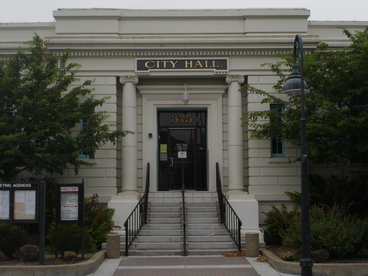


Hollister, California
Hollister is a city of 43,811 people in San Benito County, California, founded in 1868.
Why visit Hollister
Townapedia lists 6 museums and landmarks, 15 parks and trails, 88 places to eat, 7 places to stay and 4 attractions in and around town.
Highlights include Premiere Cinemas, Downtown Hollister Historic District and Hollister Carnegie Library.
August is the warmest month, with average highs of 81°F; December lows average 38°F.
Weather in Hollister
Forecast from the National Weather Service. Full forecast
About Hollister
Hollister is a city in and the county seat of San Benito County located in the Central Coast region of California, United States. With a 2020 United States census population of 41,678, Hollister is one of the most populous cities in the Monterey Bay Area and a member of the Association of Monterey Bay Area Governments. The city is an agricultural town known primarily for its local Blenheim apricots, olive oil, vineyards, pomegranates, and chocolate.
From the Wikipedia article Hollister, California (this version), under CC BY-SA 4.0.
Things to do4


McAbee Feed & Supply
Farm and orchard · 0.9 mi
71 McCloskey Road, Hollister
Museums and landmarks6


Downtown Hollister Historic District
Monument and historic site · National Register of Historic Places · 0.4 mi
Historic district in Hollister, California, United States

Hollister Carnegie Library
Monument and historic site · National Register of Historic Places
Historic building in Hollister, California, United States

Parks, trails and playgrounds15

3 more on the map.
Restaurants and cafes88

Grillin & Chillin Alehouse Brewery
Bar and pub · Pub, Burger
401 McCray Street, Hollister
Mo-Th 11:00-21:00; Fr-Sa 11:00-22:00; Su 10:00-21:00


Seabrisa's Eatery
Restaurant · American, Seafood · 0.6 mi
696 4th Street, Hollister
Su-Th 07:00-21:00
Valley Pizzeria
Restaurant · Pizza · 0.4 mi
551 McCray Street, Hollister
Mo-Su 11:00-22:00; Fr,Sa 11:00-23:00
X Noodles & Dumplings
Restaurant · Chinese · 0.4 mi
355 San Felipe Road, Hollister
Mo-Su 11:00-21:00
El Rinconcito
Restaurant · Mexican
191 San Felipe Road, Hollister

Capo Signora Italian Cuisine
Restaurant · Italian · 1.4 mi
Airline Highway, Hollister
76 more on the map.
History
The area of modern-day Hollister was historically inhabited by the Mutsun band of the Ohlone Indians. With the construction of Mission San Juan Bautista in 1797, the Ohlone went into the California mission system.
The town of Hollister was founded on November 19, 1868, by William Welles Hollister on the grounds of the former Mexican land-grant Rancho San Justo. At the time, Hollister was located within Monterey County, until San Benito County was formed by the California Legislature in 1874 from portions of Monterey, Merced, and Santa Cruz counties.
The city is intermittently the site of an annual motorcycle rally around July Fourth. The riot at the original 1947 event was the basis for the 1953 film The Wild One. The rally was revived in 1997 as the Hollister Independence Rally.
From the History section of Hollister, California on Wikipedia, under CC BY-SA 4.0.
Where to stay7
Holiday Inn Express & Suites
Motel and hotel · 0.5 mi
391 Gateway Drive, Hollister
Churches and places of worship30
Apostolic Full Gospel Church of Christ
Church · Apostolic · 1.4 mi
1515 Santa Ana Rd, Hollister
Church of God of Prophecy
Church · Church Of God · 0.4 mi
530 Virginia Drive, Hollister
Gateway City Church
Church · Nondenominational · 0.4 mi
321 San Felipe Road, Hollister
Shopping16
Gas and EV charging15
Schools, colleges and libraries46
Hollister Dual Language Academy
School · 0.8 mi
873 Santa Ana Rd. Ste. 200, Hollister
Healthcare8
Hazel Hawkins Health Clinic
Clinic and pharmacy · 0.9 mi
991 San Juan Road, Hollister
Satellite Heathcare
Clinic and pharmacy · 0.8 mi
1100 East Park Street, Hollister
Map of Hollister
235 places. The map loads OpenStreetMap tiles when you open it.
Climate by month
Monthly table
| Month | High | Low | Rain | Snow |
|---|---|---|---|---|
| Jan | 60°F | 39°F | 3.1 in | 0.0 in |
| Feb | 62°F | 41°F | 2.6 in | 0.0 in |
| Mar | 66°F | 43°F | 2.2 in | 0.0 in |
| Apr | 69°F | 44°F | 1.0 in | 0.0 in |
| May | 73°F | 48°F | 0.4 in | 0.0 in |
| Jun | 78°F | 51°F | 0.1 in | 0.0 in |
| Jul | 80°F | 54°F | 0.0 in | 0.0 in |
| Aug | 81°F | 54°F | 0.0 in | 0.0 in |
| Sep | 81°F | 53°F | 0.1 in | 0.0 in |
| Oct | 77°F | 48°F | 0.6 in | 0.0 in |
| Nov | 67°F | 42°F | 1.2 in | 0.0 in |
| Dec | 59°F | 38°F | 2.3 in | 0.1 in |
U.S. Climate Normals 1991-2020 for Hollister 2 (1 mi away), NOAA NCEI.
People and cost of living
American Community Survey 5-year estimates, 2020-2024, U.S. Census Bureau. Estimates have margins of error, larger for small towns.
Disaster history
San Benito County has had 9 federal disaster declarations since 2000, most often for floods.
- 2023-04-03: Severe Winter Storms, Straight-Line Winds, Flooding, Landslides, And Mudslides (Severe Storm)
- 2023-03-10: Severe Winter Storms, Flooding, Landslides, And Mudslides (Flood)
- 2023-01-14: Severe Winter Storms, Flooding, Landslides, And Mudslides (Flood)
- 2023-01-09: Severe Winter Storms, Flooding, And Mudslides (Flood)
- 2020-03-22: Covid-19 Pandemic (Biological)
- 2020-03-13: Covid-19 (Biological)
OpenFEMA disaster declarations summaries.
Getting there and nearby towns
Hollister Municipal Airport (HLI) is the nearest airport with scheduled flights listed in OpenStreetMap, 2 miles away.
- Ridgemark 4 mi southeast, about 6 min by car
- San Juan Bautista 8 mi west, about 12 min by car
- Aromas 13 mi west, about 21 min by car
- Prunedale 14 mi west, about 23 min by car
- Gilroy 15 mi northwest, about 24 min by car
- Salinas 17 mi southwest, about 28 min by car
- Las Lomas 18 mi west, about 30 min by car
- Elkhorn 18 mi west, about 29 min by car
- San Martin 19 mi northwest, about 31 min by car
- Watsonville 21 mi west, about 34 min by car
Drive times are estimates from straight-line distance, not routes.
Local news
Headlines from INDB, the NEMICO news database.
Reviews, tips and questions
Loading what members have shared...
Sources and licences
- NCES EDGE (Public domain): public schools
- NOAA NCEI U.S. Climate Normals 1991-2020 (Public domain): climate by month
- OpenFEMA (Public domain): disaster declarations
- OpenStreetMap contributors (ODbL 1.0): places, airports, map data
- U.S. Census Bureau (Public domain): population, income, housing, education, commute
- Wikidata (CC0 1.0): elevation, founding date, time zone, website, landmarks and historic places
- Wikimedia Commons (see each image): photos
- Wikipedia (CC BY-SA 4.0): overview and history text
Photo credits
- Hollistor City Hall, BrendelSignature, CC BY-SA 3.0
- Police at motorcycle rally, Hollister, California 2007, Ashi Fachler from San Diego, CC BY-SA 2.0
- Black Cooper Sander Funeral Home, Hollister, California motorcycle rally, 2007, Ashi Fachler from San Diego, CC BY-SA 2.0
- Custom painted chopper, motorcycle rally in Hollister, California 2007, Ashi Fachler from San Diego, CC BY 2.0
- Downtown Hollister, California 1863, Cristiano Tomás, CC BY-SA 4.0
- Downtown Hollister, California 1864, Cristiano Tomás, CC BY-SA 4.0
- Downtown Hollister, California 1874, Cristiano Tomás, CC BY-SA 4.0
- Hollister Carnegie Library, NoeHill, CC BY-SA 3.0
- Downtown Hollister, California 1865, Cristiano Tomás, CC BY-SA 4.0
- Hollister United Methodist 1873, Cristiano Tomás, CC BY-SA 4.0
- Hollister United Methodist 1872, Cristiano Tomás, CC BY-SA 4.0
- Hollister United Methodist 1871, Cristiano Tomás, CC BY-SA 4.0
- Downtown Hollister, California 1867, Cristiano Tomás, CC BY-SA 4.0
- Traditional Californian townhomes in Hollister, California 1879, Cristiano Tomás, CC BY-SA 4.0
- DSC00735 Eastern Star Masonic Temple building, Hollister, California, June 16, 2007, BrendelSignature, CC BY-SA 3.0
- Stibnite (33876007348), Pacific Museum of Earth from Canada, CC BY-SA 2.0
- Weatherly 201 (5235656178), Bill Larkins, CC BY-SA 2.0
- San Benito County Courthouse 1875, Cristiano Tomás, CC BY-SA 4.0
- San Benito County Courthouse 1-May-2015, Michael Patrick, CC BY-SA 4.0
- San Benito County Courthouse 1876, Cristiano Tomás, CC BY-SA 4.0
- San Benito County Administration 1862, Cristiano Tomás, CC BY-SA 4.0
- San Benito County Courthouse 23-Aug-2008-e, Michael Patrick, Public domain
- San Benito County Administration 1861, Cristiano Tomás, CC BY-SA 4.0
- Curb Offset by the Calaveras Fault - panoramio - Robert DuHamel (1), Robert DuHamel, CC BY-SA 3.0
- Locust Street Looking East - panoramio, Robert DuHamel, CC BY-SA 3.0
- Dunne Park Club House 23-Aug-2008 (cropped), Michael Patrick, Public domain
- Dunne Park Club House 23-Aug-2008, Michael Patrick, Public domain
- Sidewalk and Wall Offset by the Calaveras Fault - panoramio, Robert DuHamel, CC BY-SA 3.0
- Sidewalk and Wall Offset by the Calaveras Fault - panoramio - Robert DuHamel, Robert DuHamel, CC BY-SA 3.0
- Sidewalk Offset by the Calaveras Fault (stereo) - panoramio, Robert DuHamel, CC BY-SA 3.0
- Curb offset by the Calaveras Fault - panoramio, Robert DuHamel, CC BY-SA 3.0
- Original Hazel Hawkins Hospital 23-Aug-2008 (cropped), Michael Patrick, Public domain
- Original Hazel Hawkins Hospital 23-Aug-2008, Michael Patrick, Public domain
- Joel and Rena Hawkins House, NoeHill, CC BY-SA 3.0


Page built October 30, 2026. Spotted a mistake? Tell us or suggest a place.