


Hopkinsville, Kentucky
Hopkinsville is a city of 30,906 people in Christian County, Kentucky, founded in 1796.
Why visit Hopkinsville
Townapedia lists 12 museums and landmarks, 4 parks and trails, 54 places to eat, 8 places to stay and 2 attractions in and around town.
Highlights include Alhambra Theatre, The Showbox, Attucks High School and Boatright House.
July is the warmest month, with average highs of 88°F; January lows average 27°F.
Weather in Hopkinsville
Forecast from the National Weather Service. Full forecast
About Hopkinsville
Hopkinsville is a city in and the county seat of Christian County, Kentucky, United States. The population at the 2020 census was 31,180. Hopkinsville is a home-rule class city under Kentucky law.
From the Wikipedia article Hopkinsville, Kentucky (this version), under CC BY-SA 4.0.
Things to do2

Museums and landmarks12

Attucks High School
Monument and historic site · National Register of Historic Places · 2.1 mi
Historic building in Hopkinsville, Kentucky, United States
Boatright House
Monument and historic site · National Register of Historic Places · 1.5 mi
House in Hopkinsville, Kentucky

Confederate Memorial Fountain in Hopkinsville
Monument and historic site · National Register of Historic Places · 2.1 mi
Sculpture in Hopkinsville, United States of America
East 7th Street Historic District
Monument and historic site · National Register of Historic Places · 1.7 mi
Historic district in Hopkinsville, Kentucky

Hopkinsville Commercial Historic District
Monument and historic site · National Register of Historic Places · 1.8 mi
Historic district in Kentucky, United States

Hopkinsville L & N Railroad Depot
Monument and historic site · National Register of Historic Places · 1.8 mi
Former railway station in Kentucky, USA
J. B. Knight House
Monument and historic site · National Register of Historic Places · 1.5 mi
House in Hopkinsville, Kentucky
Judge Joseph Crockett House
Monument and historic site · National Register of Historic Places · 1.7 mi
Historic house in Christian County, Kentucky, United States
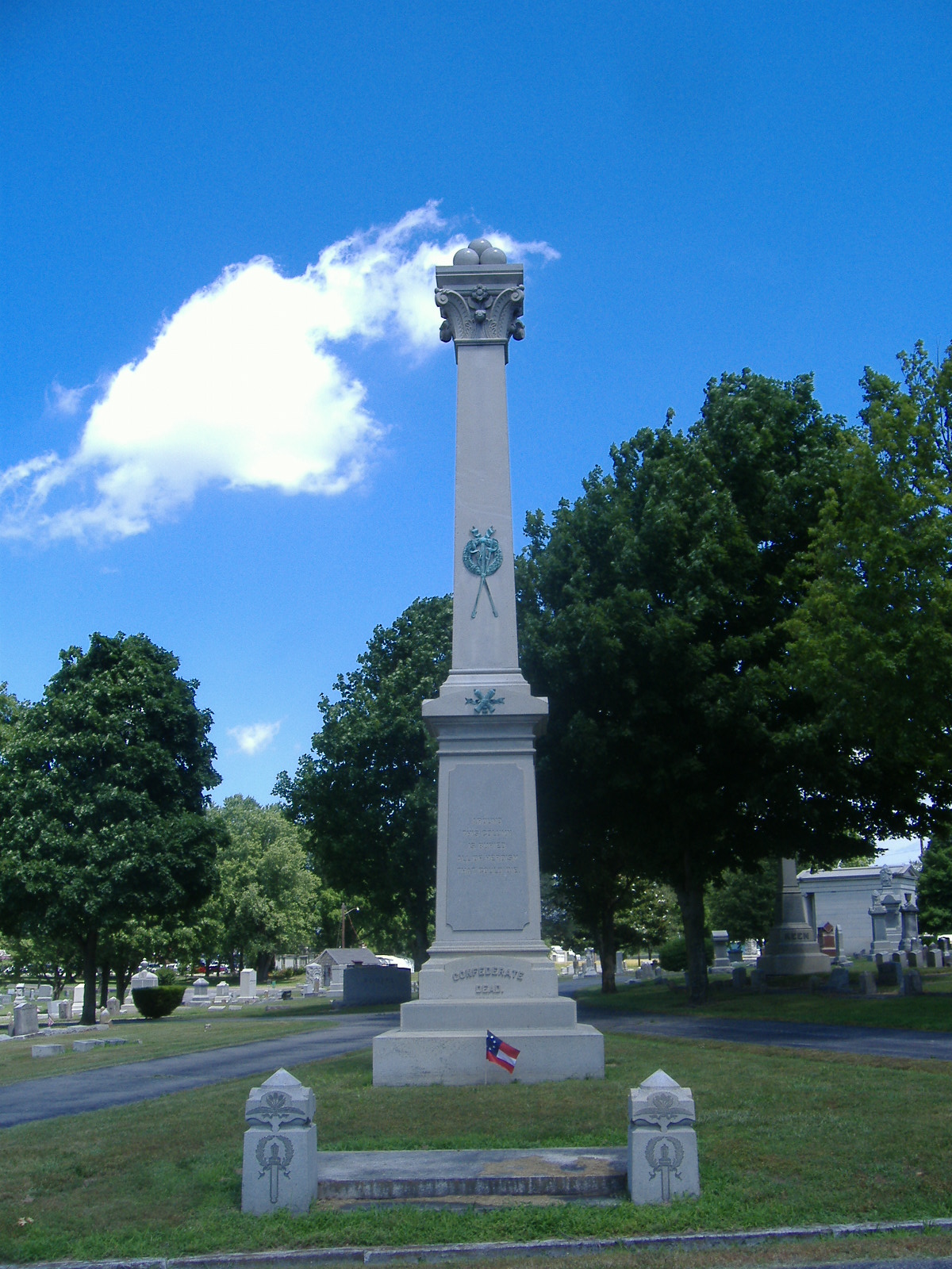
Latham Confederate Monument
Monument and historic site · National Register of Historic Places · 2.5 mi
Historic place in Hopkinsville, Kentucky
E.H. Higgins House
Monument and historic site · National Register of Historic Places · 1.8 mi
Parks, trails and playgrounds4



Restaurants and cafes54



Da Vinci Little Italian Restaurant
Restaurant · Seafood, Pasta, Italian · 2.3 mi
304 North Drive, Hopkinsville
Dodge's Southern Style
Restaurant · Chicken · 2.8 mi
West 7th Street, Hopkinsville
Los Compadres
Restaurant · Mexican · 0.4 mi
4011 Fort Campbell Boulevard, Hopkinsville
42 more on the map.
Where to stay8
Holiday Inn & Suites Hopkinsville - Convention Ctr, an IHG Hotel
Motel and hotel · 2.3 mi
100 Tilly Wy
SureStay Plus Hotel by Best Western Hopkinsville
Motel and hotel · 0.8 mi
4101 Fort Campbell Boulevard, Hopkinsville
Wyndham Garden Hopkinsville
Motel and hotel
2910 Fort Campbell Boulevard, Hopkinsville
Churches and places of worship16
Freeman Chapel C.M.E. Church
Church · National Register of Historic Places · 2.2 mi
137 South Virginia Street, Hopkinsville
Grace Episcopal Church
Church · Protestant · National Register of Historic Places · 2.0 mi
216 East 6th Street, Hopkinsville
Church Hill Grange Hall
Church · National Register of Historic Places · 6.2 mi
Shopping13
Gas and EV charging11
Schools, colleges and libraries24
Christian County Day Treatment
School · 0.4 mi
4001 Fort Campbell Blvd, Hopkinsville
Christian County Public Schools Vla
School · 2.8 mi
200 Glass Avenue, Hopkinsville
Hopkinsville Middle School
School · 2.2 mi
14405 Dr Martin Luther King Jr Way, Hopkinsville
Healthcare5
Western State Hospital
Hospital · National Register of Historic Places · 2.2 mi
2400 Russellville Road, Hopkinsville
Map of Hopkinsville
149 places. The map loads OpenStreetMap tiles when you open it.
Climate by month
Monthly table
| Month | High | Low | Rain | Snow |
|---|---|---|---|---|
| Jan | 44°F | 27°F | 3.4 in | 1.8 in |
| Feb | 48°F | 31°F | 4.1 in | 1.8 in |
| Mar | 58°F | 38°F | 4.8 in | 0.8 in |
| Apr | 69°F | 47°F | 4.8 in | 0.1 in |
| May | 77°F | 58°F | 5.4 in | 0.0 in |
| Jun | 85°F | 66°F | 4.3 in | 0.0 in |
| Jul | 88°F | 70°F | 4.9 in | 0.0 in |
| Aug | 88°F | 68°F | 4.3 in | 0.0 in |
| Sep | 82°F | 61°F | 3.5 in | 0.0 in |
| Oct | 71°F | 49°F | 3.8 in | 0.0 in |
| Nov | 58°F | 38°F | 3.9 in | 0.0 in |
| Dec | 47°F | 31°F | 4.7 in | 0.7 in |
U.S. Climate Normals 1991-2020 for Hopkinsville Hcn (3 mi away), NOAA NCEI.
People and cost of living
American Community Survey 5-year estimates, 2020-2024, U.S. Census Bureau. Estimates have margins of error, larger for small towns.
Disaster history
Christian County has had 19 federal disaster declarations since 2000, most often for severe storms.
- 2026-01-24: Severe Winter Storm (Winter Storm)
- 2025-05-23: Severe Storms, Straight-Line Winds, And Tornadoes (Severe Storm)
- 2025-04-24: Severe Storms, Straight-Line Winds, Tornadoes, Flooding, Landslides, And Mudslides (Severe Storm)
- 2025-04-03: Severe Storms, Straight-Line Winds, Tornadoes, And Flooding (Severe Storm)
- 2025-02-16: Severe Storms, Straight-Line Winds, Flooding, And Landslides (Severe Storm)
- 2024-07-23: Severe Storms, Straight-Line Winds, Tornadoes, Landslides, And Mudslides (Severe Storm)
OpenFEMA disaster declarations summaries.
Getting there and nearby towns
Campbell Army Airfield (HOP) is the nearest airport with scheduled flights listed in OpenStreetMap, 12 miles away.
- Pembroke 8 mi southeast, about 12 min by car
- Fort Campbell North 12 mi south, about 20 min by car
- Oak Grove 12 mi south, about 19 min by car
- Crofton 14 mi north, about 23 min by car
- Trenton 14 mi southeast, about 23 min by car
- Elkton 17 mi east, about 28 min by car
- Cadiz 19 mi west, about 31 min by car
- Clarksville 20 mi south, about 32 min by car
- Guthrie 22 mi southeast, about 35 min by car
- Franklin 52 mi east, about 1 h 30 min by car
Drive times are estimates from straight-line distance, not routes.
Local news
Headlines from INDB, the NEMICO news database.
Reviews, tips and questions
Loading what members have shared...
Sources and licences
- NCES EDGE (Public domain): public schools
- NOAA NCEI U.S. Climate Normals 1991-2020 (Public domain): climate by month
- OpenFEMA (Public domain): disaster declarations
- OpenStreetMap contributors (ODbL 1.0): places, airports, map data
- U.S. Census Bureau (Public domain): population, income, housing, education, commute
- Wikidata (CC0 1.0): elevation, founding date, time zone, website, landmarks and historic places
- Wikimedia Commons (see each image): photos
- Wikipedia (CC BY-SA 4.0): overview and history text
Photo credits
- Hopkinsville First Presbyterian, Bedford at en.wikipedia, Public domain
- Yost House in Hopkinsville, Nyttend, Public domain
- Alumni east of Latham, Hopkinsville, Nyttend, Public domain
- 1900 block of Main, Hopkinsville, Nyttend, Public domain
- East Seventh HD in Hopkinsville, Nyttend, Public domain
- HopkinsvilleHighSchool2026, Hammersoft, CC BY 4.0
- Clay and Eleventh in Hopkinsville, Nyttend, Public domain
- Attucks High School, Hopkinsville, Nyttend, Public domain
- Greetings from Hopkinsville, Kentucky, Gateway to Kentucky Lake - Large Letter Postcard (7991489960), Steve Shook from Moscow, Idaho, USA, CC BY 2.0
- Virginia Street Baptist Church, Hopkinsville, Nyttend, Public domain
- Western State Hospital, Hopkinsville, Nyttend, Public domain
- Grace Church (Hopkinsville), JaMikePA ( talk ) ( Uploads ), Public domain
- Hopkinsville L&N Depot, Bedford at English Wikipedia, Public domain
- Confederate Memorial Fountain in Hopkinsville, Bedford at English Wikipedia, Public domain
- Latham Confederate Monument, Bedford at English Wikipedia, Public domain
- Christian County courthouse Kentucky, Bedford at en.wikipedia, Public domain
- Hopper Court, Nyttend, Public domain
- Fairelond, Nyttend, Public domain
- Judge Joseph Crockett House, Nyttend, Public domain
- J.B. Knight House, Nyttend, Public domain
- E.W. Walker House, Nyttend, Public domain
- Monroe Dalton House, Nyttend, Public domain
- E.H. Higgins House, Nyttend, Public domain
- Poston House, Nyttend, Public domain
- Freeman Chapel CME, Nyttend, Public domain
- ISS064-E-11520 - View of Earth, Earth Science and Remote Sensing Unit, NASA Johnson Space Center, Public domain
- ISS064-E-10503 - View of Earth, Earth Science and Remote Sensing Unit, NASA Johnson Space Center, Public domain
- ISS066-E-2248 - View of Earth, Earth Science and Remote Sensing Unit , Lyndon B. Johnson Space Center, Public domain
- ISS060-E-47867 - View of Earth, Earth Science and Remote Sensing Unit, NASA Johnson Space Center, Public domain
- ISS066-E-2247 - View of Earth, Earth Science and Remote Sensing Unit , Lyndon B. Johnson Space Center, Public domain


Page built October 30, 2026. Spotted a mistake? Tell us or suggest a place.