
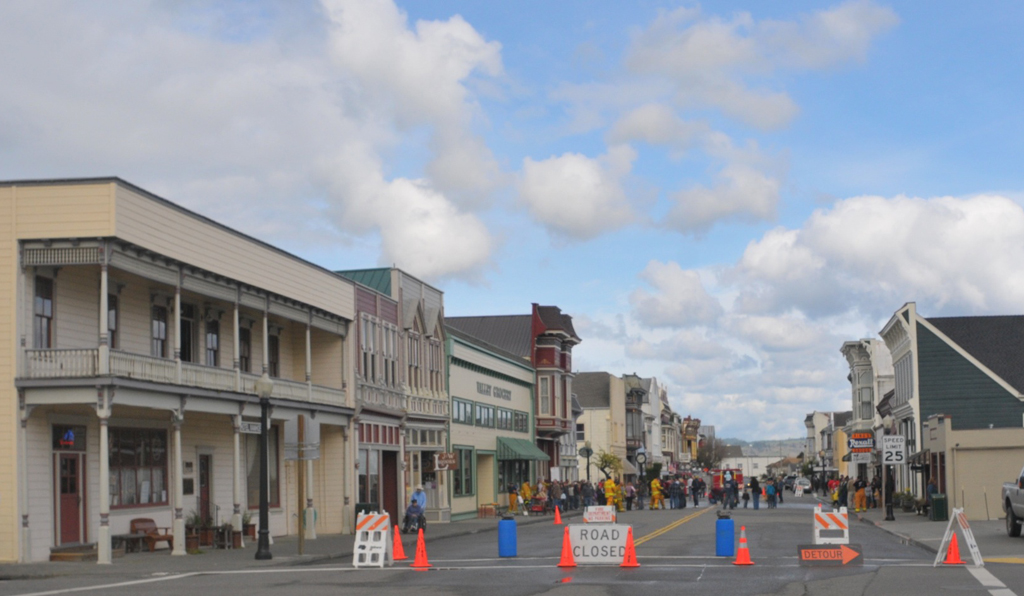


Humboldt Hill, California
Humboldt Hill is a community of 3,551 people in Humboldt County, California.
Why visit Humboldt Hill
Townapedia lists 2 museums and landmarks, 3 parks and trails, 2 places to eat, 1 place to stay and 2 attractions in and around town.
Highlights include Humboldt Harbor Light, Ferndale Main Street Historic District, Humboldt Bay Life-Saving Station and Humboldt Botanical Garden.
August is the warmest month, with average highs of 64°F; December lows average 40°F.
Weather in Humboldt Hill
Forecast from the National Weather Service. Full forecast
About Humboldt Hill
Humboldt Hill is a census-designated place (CDP) in Humboldt County, California, United States. Humboldt Hill rises to an elevation of 636 feet (194 m). The population was 3,498 at the 2020 census, up from 3,414 at the 2010 census. The area is in the 95503 zip code and part of unincorporated Eureka.
From the Wikipedia article Humboldt Hill, California (this version), under CC BY-SA 4.0.
Things to do2


Humboldt Harbor Light
Lighthouse · 3.4 mi
Lighthouse in California, United States

Museums and landmarks2
Ferndale Main Street Historic District
Monument and historic site · National Register of Historic Places · 3.8 mi
Historic district in California, United States
Humboldt Bay Life-Saving Station
Monument and historic site · National Register of Historic Places · 3.3 mi
Parks, trails and playgrounds3


Elk River Wildlife Area
Hiking and trails · 1.9 mi
Access open, but refer to regulations or contact CDFW regional or area office prior to visit.
Restaurants and cafes2

Where to stay1
Schools, colleges and libraries23
Humboldt County Office of Education Juvenile Hall Court
School · 5.4 mi
2006 Harrison Ave., Eureka
Map of Humboldt Hill
33 places. The map loads OpenStreetMap tiles when you open it.
Climate by month
Monthly table
| Month | High | Low | Rain | Snow |
|---|---|---|---|---|
| Jan | 55°F | 41°F | 6.7 in | 0.0 in |
| Feb | 55°F | 41°F | 5.6 in | 0.0 in |
| Mar | 56°F | 42°F | 5.8 in | 0.0 in |
| Apr | 57°F | 44°F | 3.6 in | 0.0 in |
| May | 60°F | 48°F | 1.7 in | 0.0 in |
| Jun | 62°F | 50°F | 0.7 in | 0.0 in |
| Jul | 63°F | 52°F | 0.2 in | 0.0 in |
| Aug | 64°F | 53°F | 0.2 in | 0.0 in |
| Sep | 64°F | 50°F | 0.7 in | 0.0 in |
| Oct | 62°F | 47°F | 2.3 in | 0.0 in |
| Nov | 58°F | 43°F | 4.9 in | 0.0 in |
| Dec | 55°F | 40°F | 8.1 in | 0.0 in |
U.S. Climate Normals 1991-2020 for Eureka Wfo Woodley Island Gsn Hcn 72594 (6 mi away), NOAA NCEI.
People and cost of living
American Community Survey 5-year estimates, 2020-2024, U.S. Census Bureau. Estimates have margins of error, larger for small towns.
Disaster history
Humboldt County has had 11 federal disaster declarations since 2000, most often for severe storms.
- 2023-04-03: Severe Winter Storms, Straight-Line Winds, Flooding, Landslides, And Mudslides (Severe Storm)
- 2023-03-10: Severe Winter Storms, Flooding, Landslides, And Mudslides (Flood)
- 2023-01-14: Severe Winter Storms, Flooding, Landslides, And Mudslides (Flood)
- 2023-01-09: Severe Winter Storms, Flooding, And Mudslides (Flood)
- 2020-03-22: Covid-19 Pandemic (Biological)
- 2020-03-13: Covid-19 (Biological)
OpenFEMA disaster declarations summaries.
Getting there and nearby towns
Murray Field (EKA) is the nearest airport with scheduled flights listed in OpenStreetMap, 7 miles away.
- Fields Landing 1 mi west, about 2 min by car
- Bayview 3 mi north, about 5 min by car
- Cutten 4 mi northeast, about 7 min by car
- Eureka 6 mi northeast, about 9 min by car
- Fortuna 10 mi south, about 16 min by car
- Ferndale 11 mi south, about 17 min by car
- Arcata 12 mi northeast, about 19 min by car
- Hydesville 13 mi southeast, about 21 min by car
- McKinleyville 17 mi north, about 27 min by car
- Garberville 48 mi southeast, about 1 h 15 min by car
Drive times are estimates from straight-line distance, not routes.
Local news
Headlines from INDB, the NEMICO news database.
Reviews, tips and questions
Loading what members have shared...
Sources and licences
- NCES EDGE (Public domain): public schools
- NOAA NCEI U.S. Climate Normals 1991-2020 (Public domain): climate by month
- OpenFEMA (Public domain): disaster declarations
- OpenStreetMap contributors (ODbL 1.0): places, airports, map data
- U.S. Census Bureau (Public domain): population, income, housing, education, commute
- Wikidata (CC0 1.0): elevation, founding date, time zone, website, landmarks and historic places
- Wikimedia Commons (see each image): photos
- Wikipedia (CC BY-SA 4.0): overview and history text
Photo credits
- Ferndale CA Main Street to North, Ellin Beltz, Public domain
- Humboldt Bay Life-Saving Station, Ellin Beltz, Public domain
- Humboldt Harbor CA 1920 REE, Unknown author Unknown author, Public domain
- Bridge Scream, Eethove Jeffrey Maiten, CC BY 3.0
- College of the Redwoods North Entry, Ellin Beltz, CC BY-SA 3.0
- ISS047-E-110387 - View of Earth, Earth Science and Remote Sensing Unit , Lyndon B. Johnson Space Center, Public domain
- ISS047-E-110386 - View of Earth, Earth Science and Remote Sensing Unit , Lyndon B. Johnson Space Center, Public domain
- King Salmon, CA view south, Ellin Beltz, Public domain
- Humboldt Harbor Historical District Plaque, Ellin Beltz, Public domain
- KS-Buhne Point Memorial, Ellin Beltz, CC BY-SA 3.0
- Humboldt Bay from Buhne Point, Ellin Beltz, CC BY-SA 3.0
- KS-Tsunami Escape This Way, Ellin Beltz, CC BY-SA 3.0
- College of the Redwoods Cloudscape After Rain, Eethove Jeffrey Maiten, CC BY 3.0
- KS-Tsunami Warning Buhne Point, Ellin Beltz, CC BY-SA 3.0
- Humboldt County - California Quail - panoramio, MARELBU, CC BY 3.0
- College of the Redwoods Main Entry, Ellin Beltz, CC BY-SA 3.0


Page built October 30, 2026. Spotted a mistake? Tell us or suggest a place.