


Why visit Hurley
Townapedia lists 13 museums and landmarks, 8 parks and trails, 17 places to eat and 6 places to stay in and around town.
Highlights include Annala Round Barn, Chicago and Northwestern Railroad Depot, Eagle Bluff Golf Club and Curry Park.
July is the warmest month, with average highs of 77°F; January lows average 3°F, and about 155 inches of snow fall in a normal year.
Weather in Hurley
Forecast from the National Weather Service. Full forecast
About Hurley
Hurley is a city in and the county seat of Iron County, Wisconsin, United States. The population was 1,558 at the 2020 census. It is located directly across the Montreal River from Ironwood, Michigan.
From the Wikipedia article Hurley, Wisconsin (this version), under CC BY-SA 4.0.
Museums and landmarks13

Annala Round Barn
Monument and historic site · National Register of Historic Places · 2.9 mi
United States historic place near Hurley, Wisconsin

Chicago and Northwestern Railroad Depot
Monument and historic site · National Register of Historic Places · 2.0 mi
Railway station in Ironwood, the United States of America

Ironwood Carnegie Library
Monument and historic site · National Register of Historic Places · 1.8 mi
Historic library in Ironwood, Michigan, United States
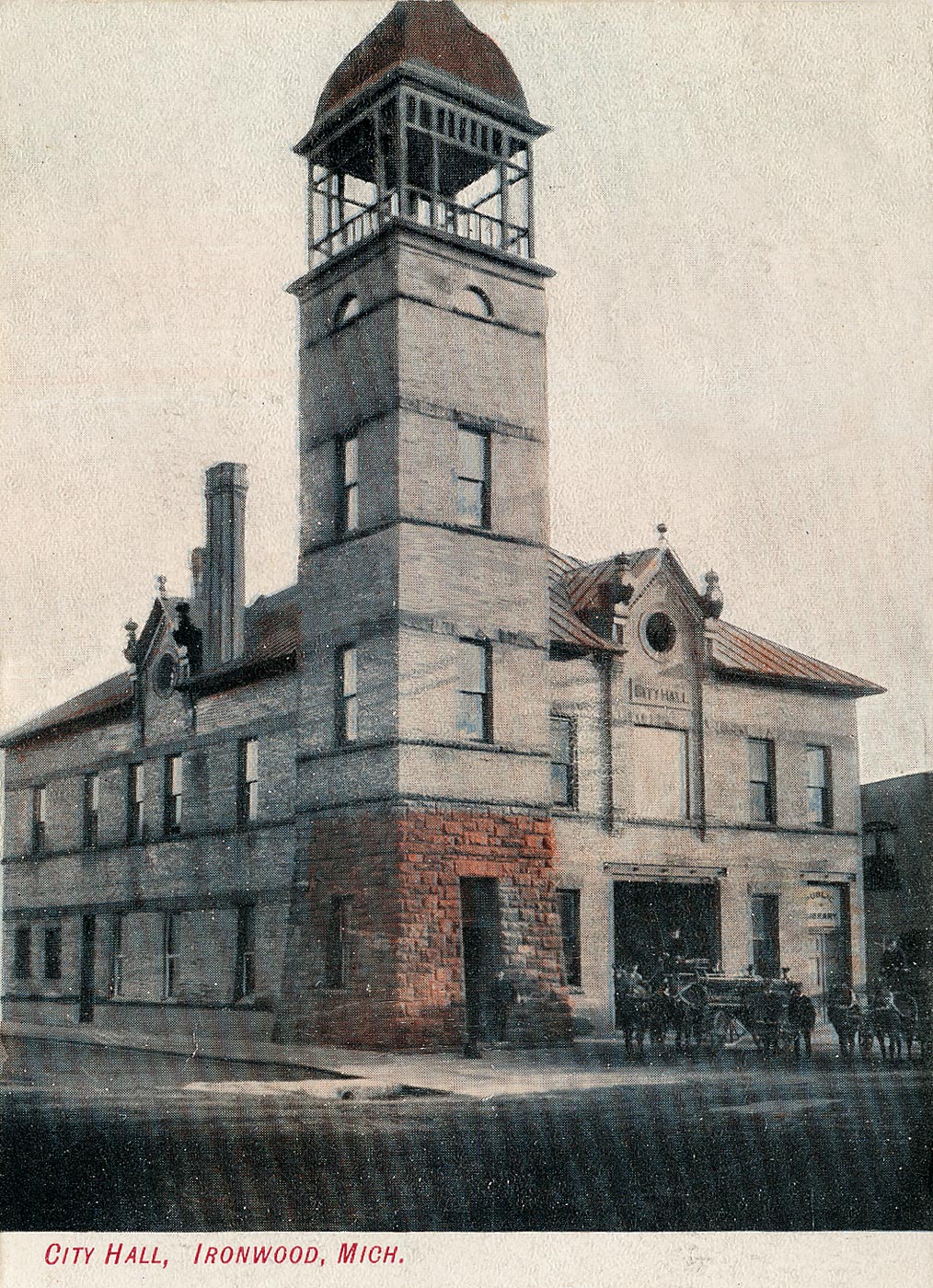
Ironwood City Hall
Monument and historic site · National Register of Historic Places · 2.1 mi
Demolished city hall in Ironwood, Michigan, United States

Ironwood Memorial/Municipal Building
Monument and historic site · National Register of Historic Places · 2.2 mi
Government building located at the corner of McLeod Avenue and Marquette Street in Ironwood, Michigan

Ironwood Theatre
Cinema and theater · National Register of Historic Places · 2.0 mi
Theater and former movie theater in Ironwood, Michigan, United States

Montreal Company Location Historic District
Monument and historic site · National Register of Historic Places · 1.7 mi
Historic district in Montreal, Wisconsin, United States

Old Iron County Courthouse
Monument and historic site · National Register of Historic Places · 1.2 mi
Hurley, Wisconsin, listed on the National Register of Historic Places in Iron County, Wisconsin

Solomon S. Curry House
Monument and historic site · National Register of Historic Places · 2.4 mi
Ironwood, Michigan, listed on the NRHP in Gogebic County, Michigan

Iron County Historical Museum
Museum · 1.2 mi
303 Iron Street, Hurley

The City of Montreal: Site of the World's Deepest Iron Mine
Monument and historic site · 1.4 mi
1 more on the map.
Parks, trails and playgrounds8




Restaurants and cafes17

Joe's Pasty Shop
Diner · American · 1.9 mi
116 West Aurora Street

Iron Nugget Restaurant
Restaurant · 1.2 mi
404 Silver Street, Hurley
Liberty Bell Chalet
Restaurant · Italian Pizza · 1.1 mi
109 5th Avenue South, Hurley



5 more on the map.
Where to stay6

History
Hurley is located on the Montreal River, the border between Wisconsin and the Upper Peninsula of Michigan. The city is on U.S. Highway 2 (US 2), and is the northern terminus of US 51, and is about 18 miles (29 km) south of Lake Superior. Hurley had its origins in the iron mining and lumbering booms of the 1880s. The city is located, along with adjacent Ironwood, Michigan, at the center of the Gogebic Range. The economy of Hurley, together with the city of Montreal in Wisconsin, and the cities of Ironwood, Bessemer and Wakefield in Michigan, was dependent upon the extraction of iron ore from the Gogebic (a/k/a Penokee) Range during the 19th and 20th centuries.
Hurley took its name from Canadian-born M. A. Hurley, a prominent attorney of Wausau who won a lawsuit for the Northern Chief Iron Company in 1884. The compensation for winning the lawsuit was that he asked for no fee, but only requested that the town involved in the case be named after him. M.A. Hurley held stock in the Northern Chief Iron Company. The full name "Glen Hurley" was used for one year, but in 1885, the first name was dropped and the community became known as Hurley. The first Plat Map of Glen Hurley was recorded in the Ashland County Register of Deeds by C.N. Nutter, surveyor for the Northern Chief Iron Company of Wausau, in December 1884.
From the History section of Hurley, Wisconsin on Wikipedia, under CC BY-SA 4.0.
Churches and places of worship4
Jehovahs Witness Kingdom Hall
Church · Jehovahs Witness · 1.9 mi
1112 Superior Street, Ironwood
Shopping3
Gas and EV charging4
Schools, colleges and libraries5
Map of Hurley
60 places. The map loads OpenStreetMap tiles when you open it.
Climate by month
Monthly table
| Month | High | Low | Rain | Snow |
|---|---|---|---|---|
| Jan | 20°F | 3°F | 2.3 in | 38.8 in |
| Feb | 25°F | 4°F | 1.7 in | 26.2 in |
| Mar | 36°F | 15°F | 2.0 in | 18.2 in |
| Apr | 49°F | 28°F | 2.9 in | 9.4 in |
| May | 64°F | 41°F | 3.6 in | 1.4 in |
| Jun | 73°F | 51°F | 3.8 in | 0.0 in |
| Jul | 77°F | 56°F | 4.1 in | 0.0 in |
| Aug | 76°F | 54°F | 3.7 in | 0.0 in |
| Sep | 67°F | 46°F | 3.8 in | 0.2 in |
| Oct | 53°F | 34°F | 3.9 in | 4.6 in |
| Nov | 38°F | 23°F | 3.0 in | 21.5 in |
| Dec | 26°F | 11°F | 2.6 in | 34.7 in |
U.S. Climate Normals 1991-2020 for Hurley (1 mi away), NOAA NCEI.
People and cost of living
American Community Survey 5-year estimates, 2020-2024, U.S. Census Bureau. Estimates have margins of error, larger for small towns.
Disaster history
Iron County has had 8 federal disaster declarations since 2000, most often for floods.
- 2020-04-04: Covid-19 Pandemic (Biological)
- 2020-03-13: Covid-19 (Biological)
- 2018-10-18: Severe Storms, Tornadoes, Straight-Line Winds, Flooding, And Landslides (Flood)
- 2018-08-10: Severe Storms, Straight-Line Winds, And Flooding (Flood)
- 2016-08-09: Severe Storms And Flooding (Severe Storm)
- 2005-09-13: Hurricane Katrina Evacuation (Hurricane)
OpenFEMA disaster declarations summaries.
Getting there and nearby towns
Gogebic–Iron County Airport (IWD) is the nearest airport with scheduled flights listed in OpenStreetMap, 7 miles away.
- Montreal 2 mi southwest, about 3 min by car
- Ironwood 3 mi east, about 5 min by car
- Bessemer 8 mi east, about 13 min by car
- Ramsay 10 mi east, about 16 min by car
- Wakefield 13 mi east, about 21 min by car
- Birch Hill 17 mi west, about 28 min by car
- Mercer 21 mi south, about 34 min by car
- Mellen 23 mi west, about 37 min by car
- Ashland 33 mi west, about 53 min by car
- Ontonagon 52 mi northeast, about 1 h 30 min by car
Drive times are estimates from straight-line distance, not routes.
Local news
Headlines from INDB, the NEMICO news database.
Reviews, tips and questions
Loading what members have shared...
Sources and licences
- NCES EDGE (Public domain): public schools
- NOAA NCEI U.S. Climate Normals 1991-2020 (Public domain): climate by month
- OpenFEMA (Public domain): disaster declarations
- OpenStreetMap contributors (ODbL 1.0): places, airports, map data
- U.S. Census Bureau (Public domain): population, income, housing, education, commute
- Wikidata (CC0 1.0): elevation, founding date, time zone, website, landmarks and historic places
- Wikimedia Commons (see each image): photos
- Wikipedia (CC BY-SA 4.0): overview and history text
Photo credits
- 2009-0617-SilverStreet-Hurley, Bobak Ha'Eri, CC BY 3.0
- 2009-0617-MemorialBuilding-Ironwood, Bobak Ha'Eri, CC BY 3.0
- 2009-0617-ChicagoNorthwesternDepot -Ironwood, Bobak Ha'Eri, CC BY 3.0
- 2013-07-13 Solomon S. Curry House, 634 McLeod Ave, Ironwood, MI, side view, Sa magnuson33, CC BY-SA 3.0
- Annala Round Barn Buildings Hurley Iron County Wisconsin, Royalbroil, CC BY-SA 3.0
- 2009-0617-OldIronCtyCourthouse-Hurley, Bobak Ha'Eri, CC BY 3.0
- 2009-0617-IronwoodTheatreComplex-Ironwood, Bobak Ha'Eri, CC BY 3.0
- Montreal Company Historic District Larger House Style August 2012, Royalbroil, CC BY-SA 3.0
- Ironwood-city-hall-1905, Unknown author Unknown author, Public domain
- 2013-07-13 Ironwood Carnegie Library, 235 E. Aurora St., Ironwood, MI, Sa magnuson33, CC BY-SA 3.0
Page built October 30, 2026. Spotted a mistake? Tell us or suggest a place.