


Hyde Park, Utah
Hyde Park is a city of 5,540 people in Cache County, Utah, founded in April 16, 1860.
Why visit Hyde Park
Townapedia lists 8 museums and landmarks, 7 parks and trails, 9 places to eat and 4 attractions in and around town.
Highlights include Utah State University, Douglas General Mercantile, John E. Lee House and Eccles Ice Center.
July is the warmest month, with average highs of 91°F; January lows average 15°F.
Weather in Hyde Park
Forecast from the National Weather Service. Full forecast
About Hyde Park
Hyde Park is a city in north-central Cache County, Utah, United States. The population was 5,234 at the 2020 census.
From the Wikipedia article Hyde Park, Utah (this version), under CC BY-SA 4.0.
Things to do4
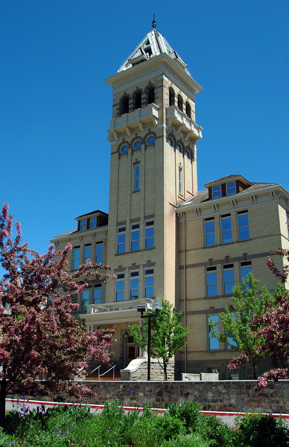
Utah State University
School · 4.1 mi
Public university in Logan, Utah, United States

Museums and landmarks8

Douglas General Mercantile
Monument and historic site · National Register of Historic Places · 2.5 mi
Commercial building in Smithfield, Utah

John E. Lee House
Monument and historic site · National Register of Historic Places · 0.6 mi
Historic two-story house in Hyde Park, Utah

Samuel and Lana Ewing House
Monument and historic site · National Register of Historic Places · 2.5 mi
Historic house in Smithfield, Utah

Smithfield Public Library
Monument and historic site · National Register of Historic Places · 2.6 mi
Historic building in Smithfield, Utah, United States

Smithfield Tabernacle
Monument and historic site · National Register of Historic Places · 2.7 mi
Historic former tabernacle in Smithfield, Utah

Smithfield Tithing Office
Monument and historic site · National Register of Historic Places · 2.7 mi

Nora Eccles Harrison Museum of Art
Museum · 4.0 mi
Art museum in Logan, Utah
Parks, trails and playgrounds7




Restaurants and cafes9

La Unica
Restaurant · Mexican · 1.8 mi
785 South Main Street, Smithfield
Mo-Th 09:00-21:00; Fr-Sa 09:00-22:00; Su off


Subway
Fast food · Sandwich · 1.6 mi
898 South Main Street, Smithfield
Mo-Sa 10:00-21:00; Su 10:00-20:00
History
The first settlers were Latter-day Saints who moved from Lehi in 1860. Hyde Park was officially organized by Ezra T. Benson on July 1, 1860. The settlement was named in honor of William Hyde, one of the first settlers to arrive in the area on April 23, 1860. The name choice also evoked Hyde Park in London, England which was the homeland of many early settlers. It was at this same meeting that Hyde was also appointed as Bishop of the members of the Church of Jesus Christ of Latter-day Saints in Hyde Park. Hyde served as branch president from 1860–1872 and then as bishop from 1872–1874, when he died.
Hyde Park was surveyed in 1864 and homes on city lots began to replace the earlier fort-style dwellings. The first post office was established on June 15, 1864 and the first town elections were held on September 7, 1864. The first school and church meetings were held in a one-room log structure built in the summer of 1863. As the community grew, church meetings were moved to the new, larger Rock Meeting House constructed in 1866. Early settlers also had to deal with the problem of bringing water to the area for their crops. The first irrigation canal was built in the summer of 1860 and was known as the “Old Ditch.” A second canal known as the Logan-Richmond Canal was constructed in 1865 to help with the increasing demand for water.
From the History section of Hyde Park, Utah on Wikipedia, under CC BY-SA 4.0.
Churches and places of worship9
The Church of Jesus Christ of Latter-day Saints
Church · Mormon · 2.0 mi
451 South 250 East, Smithfield
The Church of Jesus Christ of Latter-day Saints
Church · Mormon · 0.8 mi
480 North 100 West, Hyde Park
The Church of Jesus Christ of Latter-day Saints
Church · Mormon · 1.3 mi
2750 North 800 East, North Logan
The Church of Jesus Christ of Latter-day Saints
Church · Mormon · 1.6 mi
625 East 600 South, Smithfield
The Church of Jesus Christ of Latter-day Saints
Church · Mormon · 1.7 mi
2550 North 400 East, North Logan
Shopping5
Gas and EV charging3
Schools, colleges and libraries36
Healthcare3
Map of Hyde Park
84 places. The map loads OpenStreetMap tiles when you open it.
Climate by month
Monthly table
| Month | High | Low | Rain |
|---|---|---|---|
| Jan | 32°F | 15°F | 1.4 in |
| Feb | 37°F | 18°F | 1.3 in |
| Mar | 50°F | 29°F | 1.7 in |
| Apr | 60°F | 35°F | 2.0 in |
| May | 69°F | 42°F | 2.1 in |
| Jun | 81°F | 47°F | 1.2 in |
| Jul | 91°F | 55°F | 0.3 in |
| Aug | 89°F | 53°F | 0.7 in |
| Sep | 78°F | 44°F | 1.2 in |
| Oct | 63°F | 34°F | 1.5 in |
| Nov | 47°F | 25°F | 1.2 in |
| Dec | 33°F | 17°F | 1.1 in |
U.S. Climate Normals 1991-2020 for Logan Cache Ap (2 mi away), NOAA NCEI.
People and cost of living
American Community Survey 5-year estimates, 2020-2024, U.S. Census Bureau. Estimates have margins of error, larger for small towns.
Disaster history
Cache County has had 5 federal disaster declarations since 2000, most often for biologicals.
- 2020-04-04: Covid-19 Pandemic (Biological)
- 2020-03-13: Covid-19 (Biological)
- 2017-04-21: Severe Winter Storms And Flooding (Flood)
- 2011-08-08: Flooding (Flood)
- 2005-09-05: Hurricane Katrina Evacuation (Coastal Storm)
OpenFEMA disaster declarations summaries.
Getting there and nearby towns
Logan-Cache Airport (LGU) is the nearest airport with scheduled flights listed in OpenStreetMap, 2 miles away.
- North Logan 2 mi south, about 3 min by car
- Smithfield 3 mi north, about 4 min by car
- Logan 5 mi southwest, about 7 min by car
- Benson 7 mi southwest, about 11 min by car
- Hyrum 12 mi south, about 19 min by car
- Franklin 14 mi north, about 23 min by car
- Garland 19 mi west, about 30 min by car
- Elwood 19 mi southwest, about 31 min by car
- Tremonton 20 mi west, about 33 min by car
- Preston 21 mi north, about 34 min by car
Drive times are estimates from straight-line distance, not routes.
Local news
Headlines from INDB, the NEMICO news database.
Reviews, tips and questions
Loading what members have shared...
Sources and licences
- NCES EDGE (Public domain): public schools
- NOAA NCEI U.S. Climate Normals 1991-2020 (Public domain): climate by month
- OpenFEMA (Public domain): disaster declarations
- OpenStreetMap contributors (ODbL 1.0): places, airports, map data
- U.S. Census Bureau (Public domain): population, income, housing, education, commute
- Wikidata (CC0 1.0): elevation, founding date, time zone, website, landmarks and historic places
- Wikimedia Commons (see each image): photos
- Wikipedia (CC BY-SA 4.0): overview and history text
Photo credits
- Lee House Hyde Park Utah, Tricia Simpson, CC BY-SA 3.0
- Douglas Mercantile Smithfield Utah, Tricia Simpson, CC BY-SA 3.0
- Smithfield Utah Tabernacle, Tricia Simpson, CC BY-SA 3.0
- Ewing House Smithfield Utah, Tricia Simpson, CC BY-SA 3.0
- Smithfield Utah Carnegie Library, Tricia Simpson, CC BY-SA 3.0
- Smithfield Utah Tithing Office, Tricia Simpson, CC BY-SA 3.0
- Old Main Utah St Univ, Cory Maylett, CC BY-SA 3.0
- ISS040-E-125477 - View of Earth, Earth Science and Remote Sensing Unit , Lyndon B. Johnson Space Center, Public domain
- ISS040-E-108700 - View of Earth, Earth Science and Remote Sensing Unit , Lyndon B. Johnson Space Center, Public domain
- ISS021-E-21444 - View of Earth, Earth Science and Remote Sensing Unit , Lyndon B. Johnson Space Center, Public domain
- ISS064-E-2833 - View of Earth, Earth Science and Remote Sensing Unit, NASA Johnson Space Center, Public domain
- Forb Seed increase plot photo 2 (30122023276), Intermountain Forest Service, USDA Region 4 Photography, Public domain
- Honey bee on pink wild rose, AdvaitaMakaranda, CC0
- Poppy full of pollen, AdvaitaMakaranda, CC0


Page built October 30, 2026. Spotted a mistake? Tell us or suggest a place.