



Jambi City, Indonesia
Jambi
Jambi City is a regional capital of 635,101 people in Jambi, Indonesia, founded in June 6, 1401.
Why visit Jambi City
Townapedia lists 4 museums and landmarks, 27 parks and trails, 125 places to eat, 47 places to stay and 3 attractions in and around town.
Highlights include Jambi University, Museum Perjuangan Rakyat Jambi, Museum Siginjei and Balai Pertemuan Yayasan Sulthan Thaha Jambi.
Weather in Jambi City
Forecast from MET Norway (CC BY 4.0). Full forecast
About Jambi City
Jambi is the capital and largest city of the Indonesian province of Jambi. Located on the island of Sumatra, the city is a busy port on the Batang Hari River and an oil- and rubber-producing centre. The city is located 26 km (16 mi) from the ruins of Muaro Jambi Temple Compounds, an important city in the ancient Srivijaya kingdom.
From the Wikipedia article Jambi (city) (this version), under CC BY-SA 4.0.
Travel tips from other travellers: Jambi City on Wikivoyage (CC BY-SA 4.0).
Things to do3



Stage Arena Remaja
Cinema and theater · 3.7 km
Openair Theater Arena Taman Remaja Kota Jambi
Museums and landmarks4

Museum Perjuangan Rakyat Jambi
Museum · 1.2 km
12 Jalan Sultan Agung, Jambi
Mo-Su 08:00-16:00
Museum Siginjei
Museum · 2.8 km
Jalan Jenderal Urip Sumoharjo, Jambi
Mo-Su 08:00-16:00
Muaro Jambi Temple Compounds
Monument and historic site · 13.8 km
Buddhist temple in Indonesia

Tugu Bundaran Simpang Dado Pasar Buah Kota Jambi
Monument and historic site · 0.8 km
Parks, trails and playgrounds27


Taman Anggrek Sri Sudewi
Park · 3.8 km
Taman Anggrek Sri Sudewi merupakan taman yang penuhi oleh berbagai macam tanaman-tanaman indah.
Jl. A. Yani, Telanaipura, Jambi, Kota Jambi, Jambi, Jambi
Tugu Juang Park
Park · 3.5 km
Tugu Juang merupakan salah satu tempat bersejarah yang ada dikota Jambi dimana telah terjadi pertempuran oleh para pejuang Jambi melawan...
Jalan HOS. Cokroaminoto, Selamat, Telanaipura, Kota Jambi, Jambi
Tugu Keris Siginjai
Park · 3.5 km
Tugu Keris Siginjai
Jl. Bundaran Kota Baru, Jambi

Makam Pahlawan Satria Bakti Jambi Park
Park · 1.1 km
Jalan H. Abdulrahman Saleh, jambi


15 more on the map.
Restaurants and cafes125

Simon & Sons
Restaurant · 1.7 km
Bakery & Coffee
1 Jl. Gaja Mada
Mo-Th, Su 07:00-21:30; Fr, Sa 07:00-22:00


Pempek Mage 610
Restaurant · 0.8 km
Pempek Asli 10 Ulu Palembang
Tu-Su 10:00-19:00
Sajian Kopitiam
Restaurant · 3.1 km
67-68 Jl. HOS. Cokroaminoto
Mo-Su 08:00-21:00
Burger Bangor Mayang Jambi
Restaurant · 5.6 km
Mo-Su 10:00-22:00
Kedai Ibu
Restaurant · 5.4 km
Khusus buat sarapan Nasi Gemuk, Nasi Lemak, aneka kue basah
Mo-Su 07:00-11:00
Khan's Kitchen 78b
Restaurant · 2.1 km
Authentic Indian Kitchen
39 Jalan D.I. Panjaitan
Kopitiam Sahabat
Restaurant · 3.8 km
3 Jl. Marsda Abdurahman Saleh
Mo-Su 06:00-14:00
113 more on the map.
History
The history of the city of Jambi is inextricably linked with ancient Malay kingdoms and the maritime trade that flourished in this region for centuries. The city emerged as one of the key centres on the island of Sumatra, playing a vital role in the economic and cultural life of Southeast Asia.
The first settlements in the territory of modern Jambi appeared due to the existence of the ancient Melayu Kingdom, which is mentioned in Chinese chronicles as early as the 7th century. The Chinese Buddhist monk and traveller Yijing visited the state of Melayu during his journey to India in 671, which historians believe was located in this very region. Later, this territory became a crucial part of the powerful maritime empire of Srivijaya, which dominated the region from the 7th to the 13th centuries. Jambi, alongside Palembang, was one of the key hubs of this empire.
From the History section of Jambi (city) on Wikipedia, under CC BY-SA 4.0.
Where to stay47
Churches and places of worship136
Masjid Munajatur Rahman
Place of worship · 4.9 km
Suka Karya, Kec. Kota Baru Jl. Gado-Gado, Jambi City
Shopping29
Gas and EV charging17
Schools, colleges and libraries129
Healthcare57
Map of Jambi City
250 places. The map loads OpenStreetMap tiles when you open it.
Getting there and nearby towns
Sultan Thaha Airport (DJB) is the nearest airport with scheduled flights listed in OpenStreetMap, 5 km away.
- Bejubang Dua 40 km southwest, about 40 min by car
- Mendaha 65 km north, about 1 h by car
- Simpang 65 km northeast, about 1 h by car
- Kuala Tungkal 89 km north, about 1 h 30 min by car
Drive times are estimates from straight-line distance, not routes.
Local news
Headlines from INDB.
Reviews, tips and questions
Loading what members have shared...
Sources and licences
- GeoNames (CC BY 4.0): population, coordinates, regions and time zone
- OpenStreetMap contributors (ODbL 1.0): places, airports, map data
- Wikidata (CC0 1.0): elevation, founding date, time zone, website, landmarks and historic places
- Wikimedia Commons (see each image): photos
- Wikipedia (CC BY-SA 4.0): overview and history text
Photo credits
- Universitas Jambi Kampus Pinang Masak Mendalo, Muhamad Izzul Fiqih, CC BY-SA 4.0
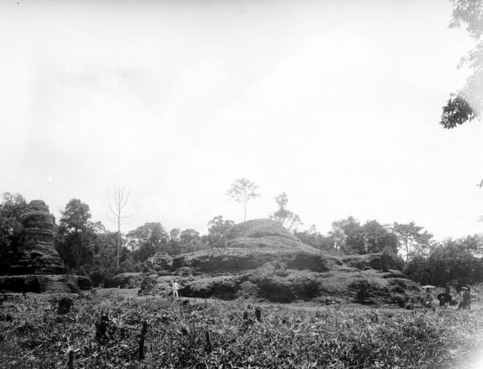
- COLLECTIE TROPENMUSEUM De stupa Candi Mahligai de Candi Bungsu en de Candi Tua op het tempelcomplex Candi Muara Takus TMnr 10016233, Unknown author Unknown author, CC BY-SA 3.0
- Raden Mattaher Regional General Hospital in Jambi, Muhamad Izzul Fiqih, CC BY-SA 4.0
- Parkiran Rumah Sakit Mitra, Muhamad Izzul Fiqih, CC BY-SA 4.0
- In de vroege ochtend van de 30e december 1948 werd door de Nederlandse troepen o, Bestanddeelnr 2780, Nationaal Archief, CC0
- Persemian Rumah Sakit Baiturrahim, Muhamad Izzul Fiqih, CC BY-SA 4.0
- Tugu Juang Jambi, Adhmi, CC BY-SA 4.0
Page built November 3, 2026. Spotted a mistake? Tell us or suggest a place.