


Why visit Klungkung
Townapedia lists 65 museums and landmarks, 30 parks and trails, 121 places to eat, 61 places to stay and 74 attractions in and around town.
Highlights include Bali Safari & Marine Park, Kemenuh Butterfly Park, Museum Gedong Arca and Taman Nusa Bali.
Weather in Klungkung
Forecast from MET Norway (CC BY 4.0). Full forecast
About Klungkung
Klungkung Regency (Indonesian: Kabupaten Klungkung; Balinese: ᬓᬩᬸᬧᬢᬾᬦ᭄ᬓ᭄ᬮᬸᬂᬓᬸᬂ, Kabupatén Klungkung) is the smallest regency (kabupaten) in the province of Bali, Indonesia. It has an area of 315 km2 and had a population at the 2024 census of 223,720.
From the Wikipedia article Klungkung Regency (this version), under CC BY-SA 4.0.
Travel tips from other travellers: Klungkung on Wikivoyage (CC BY-SA 4.0).
Things to do74
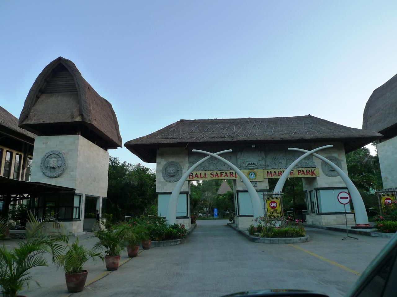
Bali Safari & Marine Park
Zoo and aquarium · 8.1 km
Jl. Profesor Ida Bagus Mantra km 19,8, Serongga, Kec. Gianyar, Kabupaten Gianyar, Bali 80551
Jl. Profesor Ida Bagus Mantra

Kemenuh Butterfly Park
Zoo and aquarium · 13.2 km
Zoo in Bali, Indonesia

Tegenungan Waterfall
Waterfall · 12.9 km
Waterfall in Bali, Indonesia

62 more on the map.
Museums and landmarks65

Museum Gedong Arca
Museum · 11.9 km
Merupakan Museum cagar budaya dengan koleksi berupa benda-benda hasil penemuan dari berbagai daerah di Bali berupa Sarkofagus, beberapa...
Jln. Raya Tampaksiring, Desa Bedulu, Kecamatan Balhbatuh, Kabupaten Gianyar
Mo-Fr 08:00-17:00
Taman Nusa Bali
Museum · 4.8 km
Taman Nusa is an Indonesian cultural park that aims to offer a comprehensive and interactive experience on the cultures of Indonesia’s...
Jl. Taman Bali, Banjar Blahpane Kelod, Gianyar – Bali, Gianyar
09:00-17:00


Goa Gajah
Monument and historic site · 12.5 km
Hindu temple in Indonesia

Gunung Kawi
Monument and historic site · 15.6 km
Hindu temple in Bali, Indonesia

Purbakala Archaeological Museum
Museum · 11.9 km
Museum in Bedulu on Bali, Indonesia


Museum Nyoman Gunarsa
Museum · 2.5 km
1 Jl. Pertigaan Banda, Takmung, Banjarangkan, Takmung, Kec. Klungkung, Kabupaten Klungkung, Bali
09:00-16:00
53 more on the map.
Parks, trails and playgrounds30


Dipta Stadium
Sports field and stadium · 10.4 km
Jalan Dharma Giri, Gianyar

The Difable Statue Garden
Park · 2.1 km
An oasis in the middle of residential area
4 Perumahan, Klungkung
24/7
Taman Kota Klungkung
Park · 0.9 km
No.4a Jl. Ahmad Yani, Semarapura Kaja, Kec. Klungkung, Kabupaten Klungkung, Bali
18 more on the map.
Restaurants and cafes121

Junkana BNB
Cafe · 5.8 km
99 Jl. Raya Sidan No.99, Sidan, Kec. Gianyar, Kabupaten Gianyar, Bali 80515
Mo-Su 06:00-18:00

Sudut Kopi
Cafe · Coffee Shop, Outdoor Seating · 10.3 km
Jalan Raya Bona, gianyar
Mo-Su 09:00-21:00
Warung Dapur Kapulaga
Restaurant · Indonesian · 8.1 km
Jalan Raya Tebola, Sidemen
Mo-Su 11:00-22:00
Warung Embang
Restaurant · Indonesian · 7.8 km
Telaga Tawang
Mo-Su 09:00-20:30
Hōgi Coffee & Eatery
Cafe · Coffee Shop, Indonesian · 8.5 km
Jalan Manik
Mo-Su 08:00-23:00
109 more on the map.
History
Klungkung Regency is the successor of the Kingdom of Klungkung (Kloengkoeng in older spelling), one of several kingdoms on Bali that traces its founding to before European arrival in Southeast Asia. The realm, while small in comparison to its neighbors, is actually the most important one. Its rulers, titled Dewa Agung (lit. 'Great God'), are long considered by other lords as high king of Bali with both spiritual and temporal powers.
The royal house of Klungkung is direct descendant of the kings of Gelgel, a kingdom which ruled over the entire island, first as vassal kingdom of Majapahit, and later as an independent kingdom with influence over eastern Java and nearby Nusa Penida, Lombok, and Sumbawa. According to Babad Dalem, a breakdown in royal authority following a palace coup sometime in the 16th century resulted in regional lords attaining greater autonomy. While the royal family managed to resumed control in Klungkung, they were in no position to assert any lost authority over the now-independent rajahs. However, the rajah of Klungkung is still considered senior in rank to other rajahs.
The arrival of European ships on Balinese ports introduced the isolated island to global trade. Especially the Dutch, missions to establish economic relations soon turn into military colonial expeditions:
Dutch intervention in Buleleng, Karangasem, and Klungkung (1849);
From the History section of Klungkung Regency on Wikipedia, under CC BY-SA 4.0.
Where to stay61
Churches and places of worship124
Gereja Santa Maria Ratu Rosari, Gianyar
Church · Catholic · 8.4 km
92A Jl. Mulawarman, Gianyar
Pura Luhur Andakasa
Place of worship · 8.4 km
Pura Andakasa, Antiga, Manggis, Karangasem
Shopping29
Gas and EV charging22
Schools, colleges and libraries25
Dinas Kearsipan dan Perpustakaan Kabupaten Klungkung
Library · 0.7 km
Jalan Ngurah Rai, Semarapura Kaja, Kecamatan Klungkung, Kabupaten Klungkung, Bali 80711
Dinas Perpustakaan dan Kearsipan Gianyar
Library · 8.6 km
Jalan Kaliasem, Gianyar, Kecamatan Gianyar, Kabupaten Gianyar, Bali 80511
Perpustakaan Daerah Gianyar
Library · 7.9 km
Jalan Ngurah Rai-Gianyar, Gianyar, Kecamatan Gianyar, Kabupaten Gianyar, Bali 80511
Perpustakaan Desa Sampalan Tengah
Library · 1.8 km
Jalan Bima No.9, Sampalan Tengah, Kecamatan Dawan, Kabupaten Klungkung, Bali 80761
Healthcare20
Rumah Sakit Umum Sanjiwani Gianyar
Hospital · 8.6 km
2 Jalan Ciung Wanara, Gianyar
Rumah Sakit Umum Daerah Kabupaten Klungkung
Hospital · 0.8 km
No.40 Jl. Flamboyan, Klungkung
Map of Klungkung
250 places. The map loads OpenStreetMap tiles when you open it.
Getting there and nearby towns
Ngurah Rai International Airport (DPS) is the nearest airport with scheduled flights listed in OpenStreetMap, 35 km away.
- Banjar Wangsian 5 km northeast, about 5 min by car
- Padangbai 12 km east, about 12 min by car
- Ubud 15 km west, about 15 min by car
- Batubulan 18 km southwest, about 18 min by car
- Sanur 22 km southwest, about 22 min by car
- Bedugul 23 km northeast, about 23 min by car
- Pabean 22 km southwest, about 22 min by car
- Denpasar 24 km southwest, about 24 min by car
- Amlapura city 25 km northeast, about 25 min by car
- Singaraja 58 km northwest, about 58 min by car
Drive times are estimates from straight-line distance, not routes.
Local news
Headlines from INDB.
Reviews, tips and questions
Loading what members have shared...
Sources and licences
- GeoNames (CC BY 4.0): population, coordinates, regions and time zone
- OpenStreetMap contributors (ODbL 1.0): places, airports, map data
- Wikidata (CC0 1.0): elevation, founding date, time zone, website, landmarks and historic places
- Wikimedia Commons (see each image): photos
- Wikipedia (CC BY-SA 4.0): overview and history text
Photo credits
- Klungkung-Palace-1, Christian Eckhardt, Public domain
- Tegenungan Waterfall 2017-08-18 (2), Magul, CC BY-SA 4.0
- AgungRaiMuseum, Arabsalam, CC BY 3.0
- Antonio Blanco le musée, Taguelmoust, CC BY-SA 3.0
- Goa Gajah Front, DerGenaue Allrounder, CC BY-SA 3.0
- Indonesia - Bali (26781246023), Visions of Domino, CC BY 2.0
- Foliage at the Neka Art Museum, Mx. Granger, CC0
- Puri Lukisan Museum (17032156926), Jorge Láscar from Melbourne, Australia, CC BY 2.0
- ID-bali-klungkung-mus-semarajaya, Balou46, CC BY-SA 4.0
- Monkey Forest, Merbabu, CC BY-SA 3.0
- Bali Safari & Marine Park, Walter Lim, CC BY 2.0
- Stadion Dipta, Wira rhea, CC BY-SA 4.0
- Pura Kehen temple complex in Bali, Esme Vos, CC BY 2.0
- Pura Samuan Tiga (2022) img 07, Chainwit., CC BY-SA 4.0
- Gate Taman Safari Bali, Innekefi, CC BY-SA 4.0
- Goa Lawah Bali53, Arabsalam, CC BY-SA 4.0
- Bali Zoo, Ossi Petruska from Espoo, Finland, CC BY-SA 2.0
- Building museum Semarajaya, former MULO school 36, Hannolans, CC BY 4.0
- Building museum Semarajaya, former MULO school 38, Hannolans, CC BY 4.0
- Building museum Semarajaya, former MULO school 37, Hannolans, CC BY 4.0
- Building museum Semarajaya, former MULO school 35, Hannolans, CC BY 4.0
- Building museum Semarajaya, former MULO school 34, Hannolans, CC BY 4.0
- Building museum Semarajaya, former MULO school 33, Hannolans, CC BY 4.0
- Building museum Semarajaya, former MULO school 39, Hannolans, CC BY 4.0
- Puputan Monument in Semarapura 05, Hannolans, CC BY 4.0
- Building museum Semarajaya, former MULO school 32, Hannolans, CC BY 4.0
- Building museum Semarajaya, former MULO school 11, Hannolans, CC BY 4.0
- Building museum Semarajaya, former MULO school 41, Hannolans, CC BY 4.0
- Building museum Semarajaya, former MULO school 40, Hannolans, CC BY 4.0
- Building museum Semarajaya, former MULO school 10, Hannolans, CC BY 4.0
- Building museum Semarajaya, former MULO school 08, Hannolans, CC BY 4.0
- Building museum Semarajaya, former MULO school 09, Hannolans, CC BY 4.0
- Building museum Semarajaya, former MULO school 30, Hannolans, CC BY 4.0
- Building museum Semarajaya, former MULO school 07, Hannolans, CC BY 4.0
- Building museum Semarajaya, former MULO school 31, Hannolans, CC BY 4.0
- Building museum Semarajaya, former MULO school 05, Hannolans, CC BY 4.0
- Building museum Semarajaya, former MULO school 06, Hannolans, CC BY 4.0
- Building museum Semarajaya, former MULO school 12, Hannolans, CC BY 4.0
- Building museum Semarajaya, former MULO school 04, Hannolans, CC BY 4.0
- Building museum Semarajaya, former MULO school 24, Hannolans, CC BY 4.0


Page built November 3, 2026. Spotted a mistake? Tell us or suggest a place.