


Padang, Indonesia
Padang is a regional capital of 942,938 people in West Sumatra, Indonesia, founded in August 7, 1669.
Why visit Padang
Townapedia lists 41 museums and landmarks, 13 parks and trails, 93 places to eat, 54 places to stay and 10 attractions in and around town.
Highlights include Andalas University, Padang Beach, Museum Adityawarman and Galeri Taman Budaya Sumatera Barat.
Weather in Padang
Forecast from MET Norway (CC BY 4.0). Full forecast
About Padang
Padang (Indonesian pronunciation: [ˈpadaŋ]) is the capital and largest city of the Indonesian province of West Sumatra. It had a population of 833,562 at the 2010 census and 909,040 at the 2020 census; the official estimate as of mid 2025 was 965,050. It is the 16th most populous city in Indonesia and the most populous city on the west coast of Sumatra. The Padang metropolitan area is the third most populous metropolitan area in Sumatra with a population of over 1.7 million.
From the Wikipedia article Padang (this version), under CC BY-SA 4.0.
Travel tips from other travellers: Padang on Wikivoyage (CC BY-SA 4.0).
Things to do10

Andalas University
School · 12.4 km
National university in West Sumatera, Indonesia


Padang State University
School · 5.8 km
National university in West Sumatera, Indonesia

State Polytechnics of Padang
School · 13.1 km
Polytechnic in West Sumatra, Indonesia




Museums and landmarks41


Galeri Taman Budaya Sumatera Barat
Museum · 0.6 km
no.31 Jl.Diponegro Belakang Tangsi ,Kec Padang Barat, Padang
Mo-Fr 08:00-17:00


Museum Rumah Kelahiran Bagindo Aziz Chan
Museum · 1.3 km
Jalan Alang Laweh, Kota Padang
Tu-Fr 09:00-16:00
Silungkang Art Center
Museum · 0.9 km
Jalan Imam Bonjol,jl Belakang Olo, Kota Padang
Mo-Sa 08:00-20:00
Teras Gallery Padang
Museum · 3.9 km
Jalan Koto Kaciak,Mata Air Kec Padang Selatan, Padang
Mo-Fr 08:00-17:00
Adityawarman Museum
Museum · 0.7 km
Museum in West Sumatra, Indonesia
Gallery Taman Budaya Padang
Museum · 0.6 km
no.7 Jalan Diponegoro,Belakang Tangsi,Kec Padang Barat, Padang
Mo-Fr 08:00-17:00
Monumen Kapal
Museum · 2.0 km
no.15 Jalan Batang Arau,Berok Nipah,Kec Padang Barat, Padang
24/7
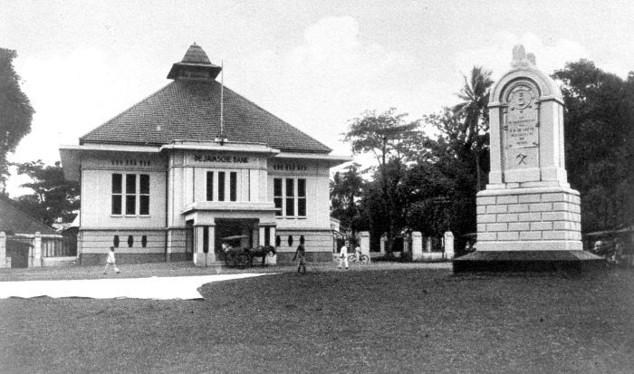
Museum Bank Indonesia Padang
Museum · 1.7 km
no.66 Jalan Batang Arau,Kec Padang Barat, Padang
Old Bank Indonesia Building, Padang
Museum · 1.8 km
Building in Indonesia
29 more on the map.
Parks, trails and playgrounds13





1 more on the map.
Restaurants and cafes93

Sogogi Padang
Restaurant · Korean, Steak House · 2.5 km
alai parak kopi Jalan Taman Siswa, padang
Mo-Sa 10:00-19:00
Mie Gacoan
Restaurant · Noodle · 4.0 km
Mie Gacoan Terpedas Nomor 1 se-Indonesia
Jl. Khatib Sulaiman
Mo-Su 09:00-23:00
Soerabi Bandung Enhaii
Restaurant · Indonesian · 2.3 km
Jl. Batang Kampar No. 3A-B
Mo-Su 08:00-23:00


81 more on the map.
History
Padang has been a trade centre since the 16th century, having been controlled by the Pagaruyung Kingdom and the Aceh Sultanate. During the 16th and 17th centuries, pepper was cultivated and traded with India, Portugal, the United Kingdom, and the Netherlands. In 1663, the city came under the authority of the Dutch and a trading post was built in 1680. The city came under the British Empire twice, firstly from 1781 to 1784 during the Fourth Anglo-Dutch War and again from 1795 to 1819 during the Napoleonic Wars. In 1819 the city was transferred back to the Netherlands. Up to circa 1780 the most important trade product was gold originating from gold mines in the region. When the mines were exhausted, the focus turned to other products such as coffee, salts, and textiles.
From the History section of Padang on Wikipedia, under CC BY-SA 4.0.
Where to stay54
Edotel Hotel Bundo Kanduang
Motel and hotel · 0.8 km
Jalan Bundo Kanduang, Kota Padang
Churches and places of worship136
Mushala Pemuda KNPI Sumbar
Place of worship · 2.3 km
1 Jallan Batang Antokan No. 1, Rimbo Kaluang, Komplek GOR. H.Agus Salim, Padang
Shopping23
Gas and EV charging7
Schools, colleges and libraries100
Dinas Keasipan dan Perpustakaan Sumatera Barat
Library
no.4 Jalan Diponegoro ,Belakang Tangsi ,Padang Barat., Padang
Dinas Kearsipan dan Perpustakaan
Library · 0.6 km
no.3 jalan kapuas,kampuang jao,padang barat, Padang
Perpustakaan Daerah Kota Padang
Library · 2.4 km
Rimbo Kaluang,Kec Padang Barat, Padang
Healthcare37
Map of Padang
250 places. The map loads OpenStreetMap tiles when you open it.
Getting there and nearby towns
Minangkabau International Airport (PDG) is the nearest airport with scheduled flights listed in OpenStreetMap, 20 km away.
- Solok 38 km northeast, about 38 min by car
- Pariaman 45 km northwest, about 45 min by car
- Padangpanjang 55 km north, about 55 min by car
- Bukittinggi 71 km north, about 1 h 15 min by car
- Sijunjung 75 km east, about 1 h 15 min by car
- Payakumbuh 87 km north, about 1 h 30 min by car
Drive times are estimates from straight-line distance, not routes.
Local news
Headlines from INDB.
Reviews, tips and questions
Loading what members have shared...
Sources and licences
- GeoNames (CC BY 4.0): population, coordinates, regions and time zone
- OpenStreetMap contributors (ODbL 1.0): places, airports, map data
- Wikidata (CC0 1.0): elevation, founding date, time zone, website, landmarks and historic places
- Wikimedia Commons (see each image): photos
- Wikipedia (CC BY-SA 4.0): overview and history text
Photo credits
- Kota Padang Indah, Zhilal Darma, CC BY-SA 4.0
- Rektorat Universitas Andalas Sep 2021, Rhmtdns, CC BY-SA 4.0
- Quiet Water of Padang Beach, Bali, Christine Anggeline, CC BY-SA 4.0
- Rektorat UNP oleh Denas, Rahmatdenas, CC BY-SA 4.0
- Politeknik Negeri Padang 20 Juni 2026, Ahsanuz Zikri, CC BY-SA 4.0
- Museum Adityawarman 20211213, Rhmtdns, CC BY-SA 4.0
- COLLECTIE TROPENMUSEUM Kantoor van de Javasche Bank en het monument voor W.H. de Greve TMnr 10015479, Unknown author Unknown author, CC BY-SA 3.0
- Makam Syekh Bayang 20220413 173107, Rahmatdenas, CC BY-SA 4.0
- Masjid Agung Nurul Iman 2020, Rahmat Irfan Denas, CC BY-SA 4.0
- Stadion Agus Salim, https://web.archive.org/web/20161017100116/http://www.panoramio.com/user/5496889?with_photo_id=47350524, CC BY 3.0
- Hotel Axana, Rahmat Irfan Denas, CC BY-SA 3.0
- Masjid Muhammadiyah Padang 2019 (2), Alfatajri, CC BY-SA 4.0
- Masjid Muhammadan Agustus 2020, Rhmtdns, CC BY-SA 4.0
- Masjid Raya Andalas, Rahmatdenas, CC BY-SA 3.0
- Pendar cahaya ruang salat Masjid Raya Sumbar, Uni Riska, CC BY-SA 4.0
- SMA Negeri 1 Padang, Merekayangpeduli, CC BY-SA 4.0
- SMA Negeri 3 Padang 2016 Foto Kemdikbud, Unknown author Unknown author, Public domain
- Padang dan Gunung Padang Nov 2019, Uni Riska, CC BY-SA 4.0
- Rumah Kelahiran Bagindo Azizchan, Rhmtdns, CC BY-SA 4.0
- Gallery Distro, SayangAyang, CC BY-SA 4.0
- Masjid Al Hakim oleh Denas, Rahmat Irfan Denas, CC BY-SA 4.0


Page built November 3, 2026. Spotted a mistake? Tell us or suggest a place.