


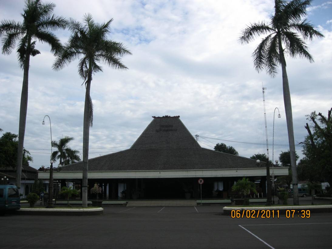

Pasuruan, Indonesia
Pasuruan is a town of 213,469 people in East Java, Indonesia, founded in June 17, 1686.
Why visit Pasuruan
Townapedia lists 7 museums and landmarks, 16 parks and trails, 24 places to eat, 5 places to stay and 1 attraction in and around town.
Highlights include New Star Cineplex Pasuruan, Taman Lansia and Taman Sekargadung.
Weather in Pasuruan
Forecast from MET Norway (CC BY 4.0). Full forecast
About Pasuruan
Pasuruan (Dutch: Pasoeroean) is a city in East Java Province of Java, Indonesia. It had a population of 186,262 at the 2010 Census and 208,006 at the 2020 Census; the official estimate as of mid 2025 was 213,838 (comprising 107,013 males and 106,825 females).
From the Wikipedia article Pasuruan (this version), under CC BY-SA 4.0.
Things to do1

New Star Cineplex Pasuruan
Cinema and theater · 0.7 km
Blok B-1 Komp. BCA Lama Pasuruan Jl. Soekarno Hatta No.1, Pasuruan
Museums and landmarks7

Gedung Yayasan Pendidikan Pancasila
Monument and historic site · 1.0 km
12 Jalan Hasanuddin, Pasuruan
Rumah Singa Pasuruan
Monument and historic site · 0.8 km
13 Jalan Hasanuddin, Pasuruan
Parks, trails and playgrounds16

Taman Lansia
Park · 2.5 km
Taman kota pasuruan
Jl. Ki Hajar Dewantara, Pasuruan
Mo-Fr 08:00-17:00
Taman Sekargadung
Park · 2.8 km
Taman Kota dan Hutan Kota yang berada di Kota Pasuruan
02 Jl. Sekarsono, Pasuruan
Mo-Su 08:00-22:00
Taman KPP PRatama Pasuruan
Park · 0.8 km
29 Jalan Panglima Sudirman, Pasuruan
Mo-Fr 08:00-17:00
Taman Pemandian Katak Riang
Park · 4.2 km
21 Jl. Raya Pleret, Pasuruan
Mo-Su 07:00-17:00


4 more on the map.
Restaurants and cafes24

Valencia Bakery, Cafe & Resto
Restaurant · Asian, Italian
11 Jalan Hayam Wuruk, Kota Pasuruan
Mo-Su 09:00-22:00
D'Fahira Resto
Restaurant · Asian, Italian · 0.9 km
41 Jalan Soekarno-Hatta
Mo-Su 10:00-21:00

12 more on the map.
Where to stay5
Churches and places of worship77
Masjid Darul Arqom
Place of worship · Sunni
202 Jalan Kyai Haji Wahid Hasyim, Kota Pasuruan
Shopping15
Gas and EV charging9
Schools, colleges and libraries36
Healthcare14
Apotek Sumber Rejeki
Clinic and pharmacy · 2.2 km
Jalan Dokter Wahidin Sudirohusodo, Pasuruan
Map of Pasuruan
204 places. The map loads OpenStreetMap tiles when you open it.
Getting there and nearby towns
Juanda International Airport (SUB) is the nearest airport with scheduled flights listed in OpenStreetMap, 32 km away.
- Bangil 11 km northwest, about 11 min by car
- Pandaan 24 km west, about 24 min by car
- Tanggulangin 28 km northwest, about 28 min by car
- Sidoarjo 30 km northwest, about 30 min by car
- Lawang 32 km southwest, about 32 min by car
- Buduran 32 km northwest, about 32 min by car
- Prigen 32 km west, about 32 min by car
- Tulangan Utara 34 km northwest, about 34 min by car
- Probolinggo 36 km east, about 36 min by car
- Surabaya 47 km north, about 47 min by car
Drive times are estimates from straight-line distance, not routes.
Local news
Headlines from INDB.
Reviews, tips and questions
Loading what members have shared...
Sources and licences
- GeoNames (CC BY 4.0): population, coordinates, regions and time zone
- OpenStreetMap contributors (ODbL 1.0): places, airports, map data
- Wikidata (CC0 1.0): elevation, founding date, time zone, website
- Wikimedia Commons (see each image): photos
- Wikipedia (CC BY-SA 4.0): overview and history text
Photo credits
- Stasiun Pasuruan 2020, Rizal Febri Ardiansyah, CC BY-SA 4.0
- Jalan Diponegoro, Kebonsari, Purworejo, Kota Pasuruan - panoramio, sugeng widodo, CC BY-SA 3.0
- Alun2PasuruanMalamHari - panoramio, sugeng widodo, CC BY-SA 3.0
- Masjid Jami' Al-Anwar Pasuruan - panoramio, Vebra, CC BY 3.0
- Taman di dalam alun2 kota Pasuruan - panoramio, sugeng widodo, CC BY-SA 3.0
- Pendopo Kabupaten Pasuruan, view from south - panoramio, sugeng widodo, CC BY-SA 3.0
- Pendopo Kabupaten Pasuruan, view from south east - panoramio, sugeng widodo, CC BY-SA 3.0
- Rawon Saminah, the best rawon in pasuruan - panoramio, KevinSieto, CC BY 3.0
- Masjid Jamik Al-Anwar di kota Pasuruan - panoramio, sugeng widodo, CC BY-SA 3.0
- Musholla Baitul Fithroh, Pendopo Kabupaten Pasuruan - panoramio, sugeng widodo, CC BY-SA 3.0
- Pasuruan pelabuhan - panoramio, Supra Syitno, CC BY-SA 3.0
- Jalan Yuwono, Perum Tembok Indah, Kota Pasuruan - panoramio, sugeng widodo, CC BY-SA 3.0
- Jalan dalam lingkungan Perumahan Tembok Indah, Tembokrejo, Purworejo, Kota Pasuruan - panoramio, sugeng widodo, CC BY-SA 3.0
- Masjid An-Nur, Perumahan Tembok Indah, Tembokrejo, Purworejo, Kota Pasuruan - panoramio, sugeng widodo, CC BY-SA 3.0
- Info Takmir Masjid An-Nur, Perum Tembok Indah, Kota Pasuruan - panoramio, sugeng widodo, CC BY-SA 3.0
- Masjid An-Nur, Perumahan Tembok Indah, Kota Pasuruan - panoramio, sugeng widodo, CC BY-SA 3.0
- SDN Tembokrejo II, Kota Pasuruan - panoramio, sugeng widodo, CC BY-SA 3.0
- Menara Masjid An-Nur, Perumahan Tembok Indah, Kota Pasuruan - panoramio, sugeng widodo, CC BY-SA 3.0
- Jalur Pantura di Kraton, Pasuruan saat banjir (kali welang meluap 5 Pebruari 2015) - panoramio, sugeng widodo, CC BY-SA 3.0
- Cangkruk Malam Alun-alun - panoramio, Vebra, CC BY 3.0
- Jl. Alun-Alun Utara - panoramio, Vebra, CC BY 3.0
- Jamur Ekor Kalkun, Nurchasanah.94, CC BY-SA 4.0
- Pagi yang penuh berkah, Ummufikriyah, CC BY-SA 4.0
- Bunga Sepatu Varigata Merah, Nurchasanah.94, CC BY-SA 4.0
- Pasar Meubel Bukir-2, Indonesiagood, CC BY 4.0
- Pasar Meubel Bukir-3, Indonesiagood, CC BY 4.0
- Pasar Meubel Bukir-4, Indonesiagood, CC BY 4.0
- Pasar Meubel Bukir-5, Indonesiagood, CC BY 4.0
- Pasar Meubel Bukir-6, Indonesiagood, CC BY 4.0
- Pasar Meubel Bukir-1, Indonesiagood, CC BY 4.0
- Kupang lont 220717-190234 krat, Wibowo Djatmiko ( Wie146 ), CC BY-SA 4.0
- Kupang lont 220717-191237 krat, Wibowo Djatmiko ( Wie146 ), CC BY-SA 4.0
- Kupang lont 220717-190253 krat, Wibowo Djatmiko ( Wie146 ), CC BY-SA 4.0
- Speed Boats - panoramio, Dj Onces Saputra, CC BY 3.0
- ISS022-E-85538 - View of Java, Earth Science and Remote Sensing Unit , Lyndon B. Johnson Space Center, Public domain


Page built November 3, 2026. Spotted a mistake? Tell us or suggest a place.